
< more recent | July 2021 | older >
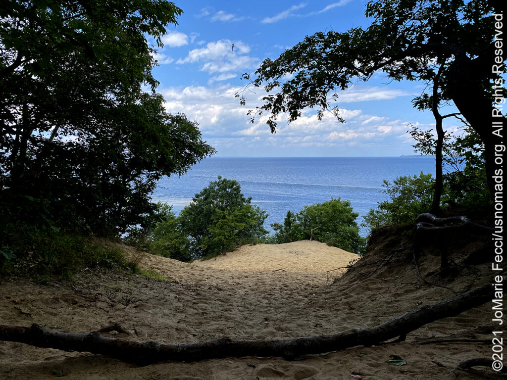
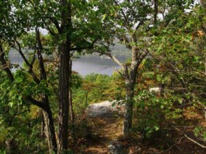
30 July 2021: Beautiful day to be outdoors today. Took some time to work on map and compass skills on a permanent orienteering course that is set up at Sunken Meadow State Park on Long Island. A nice walk in the woods and plenty of interesting artifacts to discover before reaching a gorgeous beach overlook along the cliff line. Got all the CPs without any difficulty and enjoyed the hike …
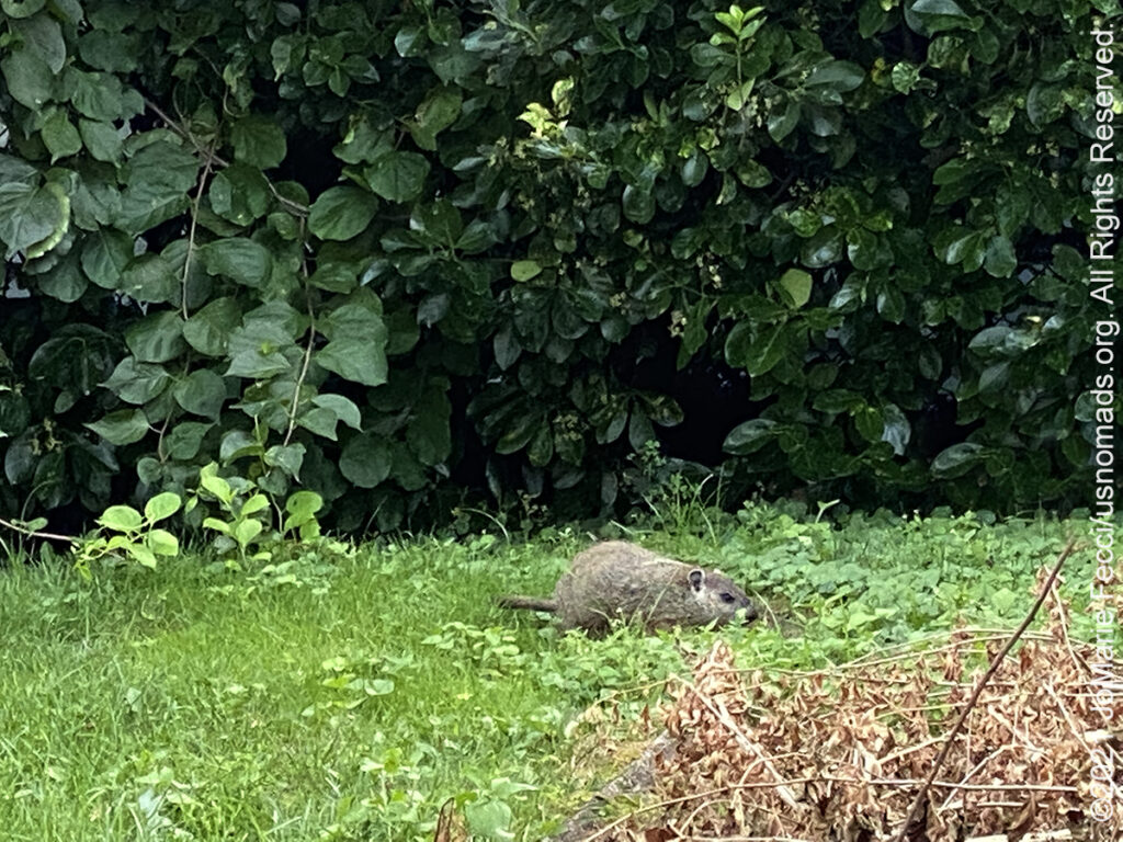
27 July 2021: First time ever seeing a groundhog in the backyard here on Long Island — knew it was a groundhog thanks to following “The Chunks” on social media. Couldn’t get a clearer photo of it, but definitely looks like a groundhog …
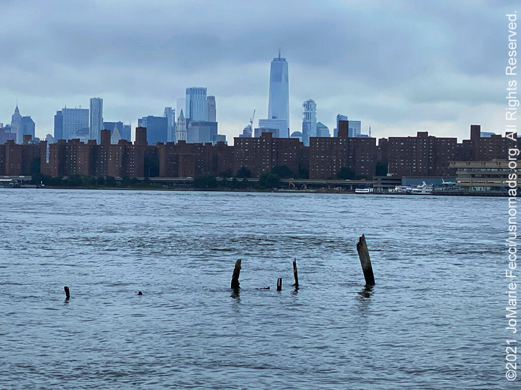
25 July 2021: Was helping with a friend’s move today in Long Island City, Queens, and found this incredible view of Manhattan from across the East River. Never saw the city from this angle before so it was an interesting discovery…
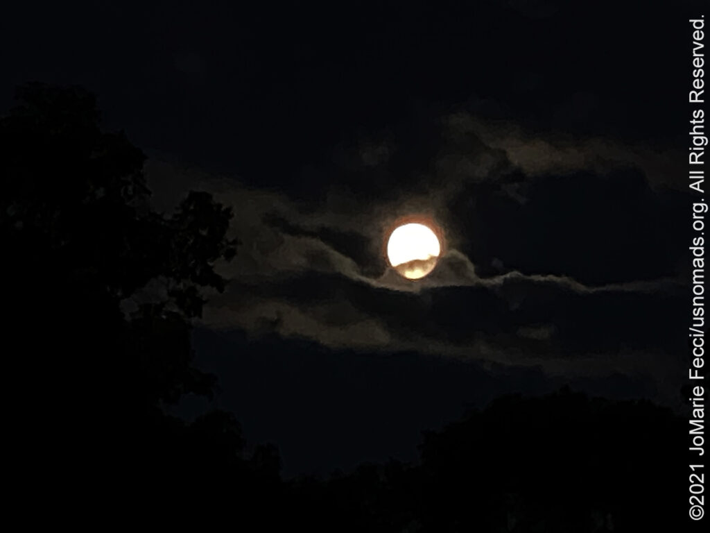
21 July 2021: Looked like a full moon through the clouds this evening — a little bit of beauty and some mysterious feeling thanks to the clouds, but it seemed so close to the treeline, just perfect …
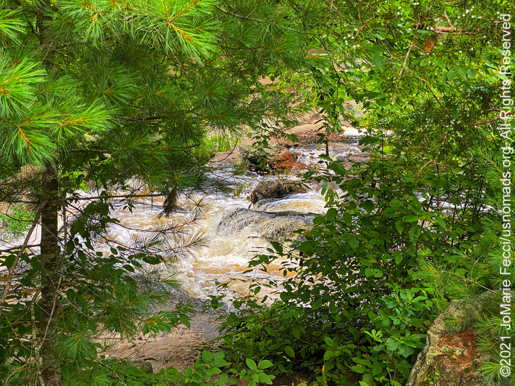
15 July 2021: A waterfall in a quiet corner of the Devil’s Hopyard State Park in Connecticut made for a nice calm morning destination while exploring after navigation practice this weekend …
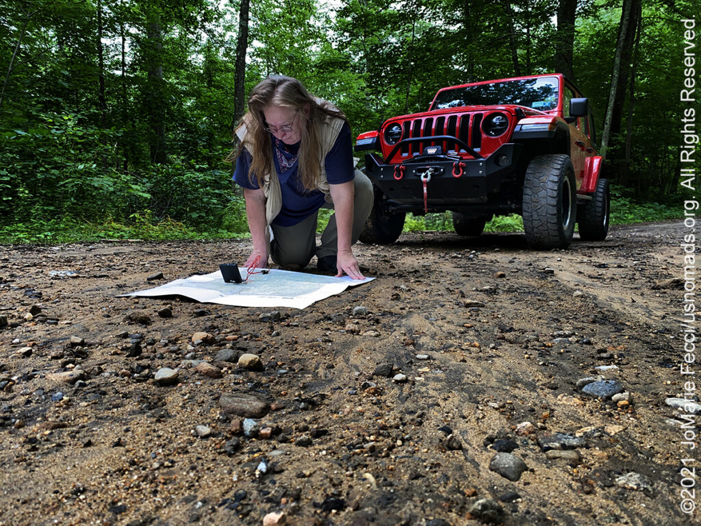
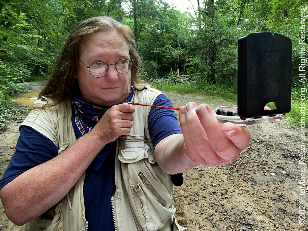
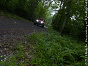
12 July 2021: Taking some time to go over navigation routes while doing some training in the Cockaponset State Forest today to practice driving and navigating Rebelle Rally style — that is to say, without using GPS …
11 July 2021: Out in the woods at Hurd Park checking out the permanent orienteering course there and getting some map and compass practice in while enjoying the weekend in the forest …
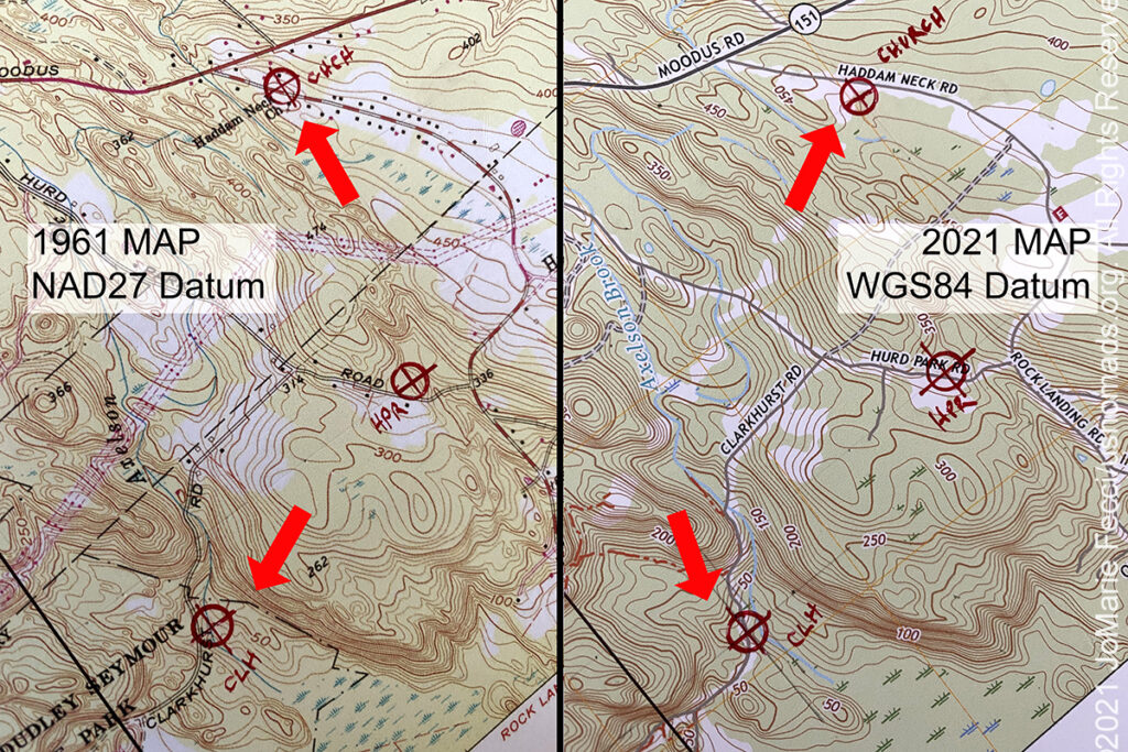
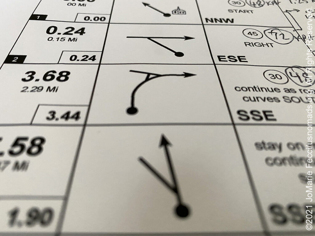
10 July 2021: A cool illustration of the importance of map datums while preparing a navigation exercise–after setting “checkpoints” using Google Maps, I accidentally printed an older set of maps (long story) and after plotting the CPs on the correct (2021) set of maps, I decided to plot the same CPs on the old maps (1961) just to see if there was a difference — well WOW, super illustration of the “map datum” issue! The map on the left used the NAD27 datum, the one on the right used the WGS84 (which is what Google maps uses and what GPS defaults to) — check out the top set of arrows, the “Church” plots are on opposite sides of the street…and the bottom set of arrows look at how the wrong datum has us “across” the stream instead of next to the road …
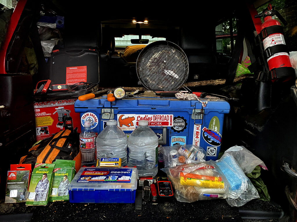
09 July 2021: As part of the Ladies Offroad Network Challenge this year we needed to display the “Emergency” supplies we carry in our vehicles. Lots of tools and gadgets here, but doesn’t include all the extra food and water that is always in the Jeep too (a 3-Day supply minimum whenever we are heading out into the backcountry)…
07 July 2021: Interesting experience building Roadbooks for an upcoming navigation simulation exercise. Definitely getting a better understanding of the concept behind these after having to create one from scratch …
THIS MONTH:
![]()
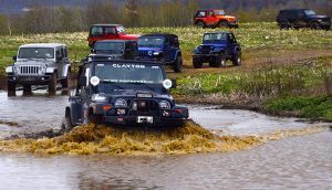
Taking part in the 6th Annual 2021 Ladies Offroad Challenge which runs from May through July. This year’s challenge continues the fun and exciting format from 2019. Participants take on a series of 11 Challenges that have different deadlines spanning over 10 weeks. These offroad based challenges will tap into each persons skills, tools, heart and mind. They are built to be fun and everyone should find at least one challenge activity that pushes them outside their comfort zone. Participants have different ways to earn a spot in a “Top Ten Weekend” where 10 ladies join Charlene Bower for a 4-day epic weekend experience…
COMING UP SOON:

Every Day Is a Clean Up Day in 2021. Ladies Offroad Network has partnered with TreadLightly! to create a year-long program that encourages members to pick up trash on the trails whenever they are out off-roading. Participants simply pick up the trash, weigh it, take a photo, and log the location and time it took, then upload the details. At the end of the year there will be a series of prizes based on pounds of trash removed from the trails as well as participation in other TreadLightly! initiatives. This is a great way to do some good on a local level and make a larger impact via the national program…

Looking ahead to a return to Paris as soon as possible to reconnect with friends and some favorite places in the city of light. Plans are finally in place for a post-pandemic journey to Paris in August, as Europe is ready to re-open to international travelers once again…
Overlanding trip across the country from east to west as we return to the deserts of the southwestern USA for some training, exploring and events happening this fall. The focus is simple: taking the slow road and enjoying the journey…

Joining Team 127 in this year’s Rebelle Rally from 7-16 October 2021. The Rebelle covers more than 2,000 kilometers of stunning terrain across the Nevada and California desert. Blending the love of driving with the ultimate challenge of precise navigation, the Rebelle pushes participants to test their skills over 8 days of competition. It is designed as the ultimate competition combining multiple navigation rally skills including headings, hidden checkpoints, time, and distance using maps, compass, and roadbook…
COCKAPONSET STATE FOREST
Cockaponset State Forest is the second largest forest in the Connecticut state forest system, encompassing over 17,000 acres of land. The forest is disjointed, and comprises land in the towns of Haddam, Chester, Deep River, Killingworth, Durham, Guilford, Madison, Clinton, Westbrook, Middletown and Middlefield. The forest was named after a Native American chief buried in Haddam. Acquisition of forest parcels began in 1926 and two Civilian Conservation Corps camps were active in the forest in the 1930s constructing roads and planting trees. A portion of the forest is known as the Chester Cedar Swamp was declared a National Natural Landmark in May 1973. Along with Pachaug-Great Meadow Swamp, it is one of the finest remaining examples of an Atlantic white cedar forest. The Connecticut Department of Energy and Environmental Protection (CT DEEP) manages a 20-mile trail system based around Pattaconk Reservoir Recreation Area near Chester. Some trails have been designated for footpath only, while others are open to horses and mountain bikes. The centerpiece for this area is the scenic Pattaconk Lake which is used for swimming, fishing, and paddling. Even though the CT DEEP has maps detailing only 20 miles of trails, there are over 100 miles of trails within the greater Cockaponset State Forest. According to the headquarters at Chatfield Hollow State Park, many of these unmarked trails have an undesignated status, which means that the CT DEEP has either not yet decided their use or are within an area earmarked for logging in the future. These undesignated trails are currently open to most users willing to respect low-impact travel. Pine Ledge is a popular rock climbing destination within Cockaponset State Forest located about a half mile west of Deep River, Connecticut. The rocky cliff is as high as 60 feet at its southern end and extends for about a half mile north. The larger cliff faces are primarily used with top-roping techniques and there are several large bouldering rocks. The locals have also adopted the name, “Pine Ledge,” to describe the surrounding section of Cockaponset State Forest where the Pine Ledge cliff resides. At this time, the access roads are somewhat rugged and may become thick with mud after a heavy rain or during the spring melt. Even though the use of all-terrain-vehicles has not been officially designated, the greater Pine Ledge area has become very popular among local riders. Jeeps and 4X4 off-road vehicles have also utilized some of the old abandoned access roads as trails. There are foot paths through dense mountain laurel throughout the Pine Ledge rock climbing area as access to the more remote cliff edges…
HURD STATE PARK
Hurd State Park is a public recreation area lying adjacent to George Dudley Seymour State Park on the east bank of the Connecticut River in the town of East Hampton, Connecticut. In addition to offering hiking, picnicking, and mountain biking, it is one of four Connecticut state parks that offer primitive camping for boaters on the Connecticut River. Four public camps along the Connecticut River at Hurd, Gillette Castle, River Highlands and Selden Neck State Parks offer primitive, riverside sites with fireplaces and pit toilets for individuals traveling on the river. The park was established in 1914, only one year after the establishment of a State Park Commission, when the state purchased 150 acres of the present Hurd Park as part of an initiative to obtain land for public use along the Connecticut River. Situated in the town of East Hampton on the east bank of the river, the park has grown to almost 1000 acres and is especially popular with small boat owners. Many of these boaters recognize the park by its landmark “split rock” towering above the trees. In the granite ledges of the split rock are veins of feldspar which was once mined extensively in Connecticut. Shortly after its acquisition, Hurd became the focus of legal action to determine the ownership of mining privileges at the park. The resulting court decision fortunately favored the State and averted the possible desolation of some 130 acres of land. The park is named after the Hurd family, which came to the Middle Haddam region from Massachusetts in 1710 and settled on the level bench of land high above the river…

MORE NOTES FROM THE ROAD:
June – LI & VA
16-31 May – Long Island
8-15 May – Return to NY
1-7 May – Southeast Utah
23-30 April – LON Bogi’s & 5+
16-22 April – LON Navigation
8-15 April – Sedona
1-7 April – Nevada
16-31 March – New York
8-15 March – Death Valley
1-7 March – Arizona
22-28 Februay – Alabama Hills
15-21 Februay – Mojave Road
8-14 Februay – Death Valley
1-7 Februay – Glamis
15-31 January – Roadtrip Southwest
1-14 January – Long Island
22-31 December – Holiday Roadtrip
15-21 December – Holiday Roadtrip
7-14 December – Holiday Roadtrip
1-6 December – Long Island
15-30 November – Long Island
1-14 November – Long Island
28-31 October – Roadtrip East
22-27 October – Moab
15-21 October – Moab
8-14 October – Moab
1-7 October – Roadtrip West
16-30 September – Roadtrip West
1-15 September – Long Island
16-31 August – Long Island
1-15 August – Summer Roadtrip
22-31 July – Summer Roadtrip
14-21 July – Summer Roadtrip
1-13 July – Long Island
Archive
SPECIAL REPORT

All about exploring ghost towns and abandoned places in the USA and beyond, with tips, and information on the many different types of sites to be found across the globe, including detailed guides for eight specific sites… [read]
RE-OPENING
Report from the first trail run with the Off Road Consulting group at Rausch Creek Off Road Park as the post-pandemic phased re-openings begin in Pennsylvania and some of our favorite local trails re-open to the public after the two-month shutdown… [read]
REFLECTIONS

EGYPT: CAIRO REFLECTIONS
A quick overview of impressions from a stop in Cairo during our recent scouting mission in Egypt and Sudan … [read]
SPECIAL REPORT

A look into south-eastern Algeria on the border with Libya and Niger: overlanding with the Tuareg in one of the most remote corners of the Sahara … [read]