
< more recent | 16-22 April 2021 | older >

22 April 2021: The sky was unsettled this morning and the weather did not look great, with winds picking up and colder temperatures in the forecast. Ignoring the forecast we spent the day exploring the Vermilion Cliffs National Monument along House Rock Road, checking out a few areas and ultimately deciding to set up camp at the small State Line campground which has only eight sites, and is tucked into an area that is somewhat protected from the wind …

21 April 2021: Continued the drive north from Cottonwood to Flagstaff, then crossing into the Navajo Nation before finally arriving to Marble Canyon on the edge of the Vermilion Cliffs where we stopped for the night…

20 April 2021: After saying goodbyes to the great group at the Ladies Offroad Network navigational training event, we left the Phoenix area behind and headed back to the Cottonwood, the first stop on a north-bound route with just a vague destination in mind — the main idea is to find an escape from the crowds that seem to be everywhere in the backcountry south of Flagstaff…
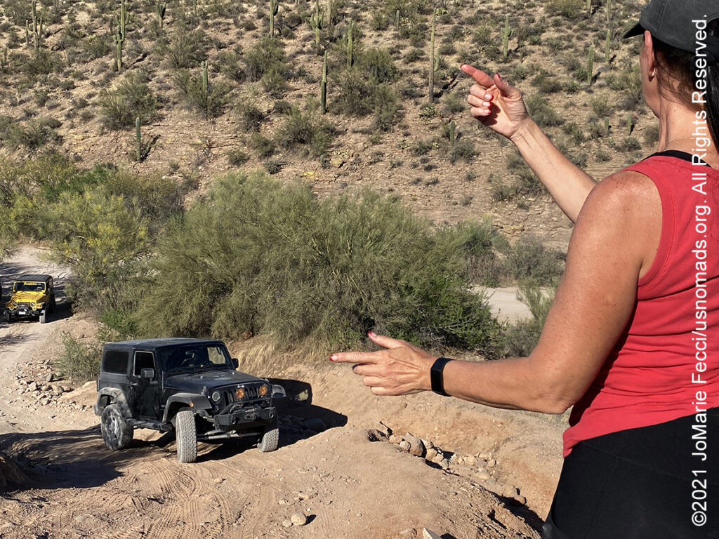
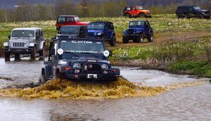
19 April 2021: The final day of the LON navigation training had the group out on the trails in search of specific GPS coordinates in a vehicle-based version of an “easter egg hunt.” Teams had to use the satellite views on their app-based navigational aids “off-line” for extremely precise geo-location out in backcountry desert terrain with few landmarks. After wrapping up the navigation exercise we hit a few more trails to work on spotting skills as a group before returning to base camp for a final evening of fun …

18 April 2021: The LON navigation training moved into the field for a long day today as the group was tasked with researching and planning a route to a location that was previously unknown to us. We had to find the location on a map and build a route using online mapping tools. There were a number of specific details that needed to be included in the route we chose, and once the plan was complete we alternated as teams “in charge” of leading the trail. It was a great opportunity to see how different app-based navigational tools performed in an area that did not necessarily have cell coverage. The exercise also threw us a few navigational “curveballs” forcing us to adapt and change plans en route, which made for a very realistic training scenario…
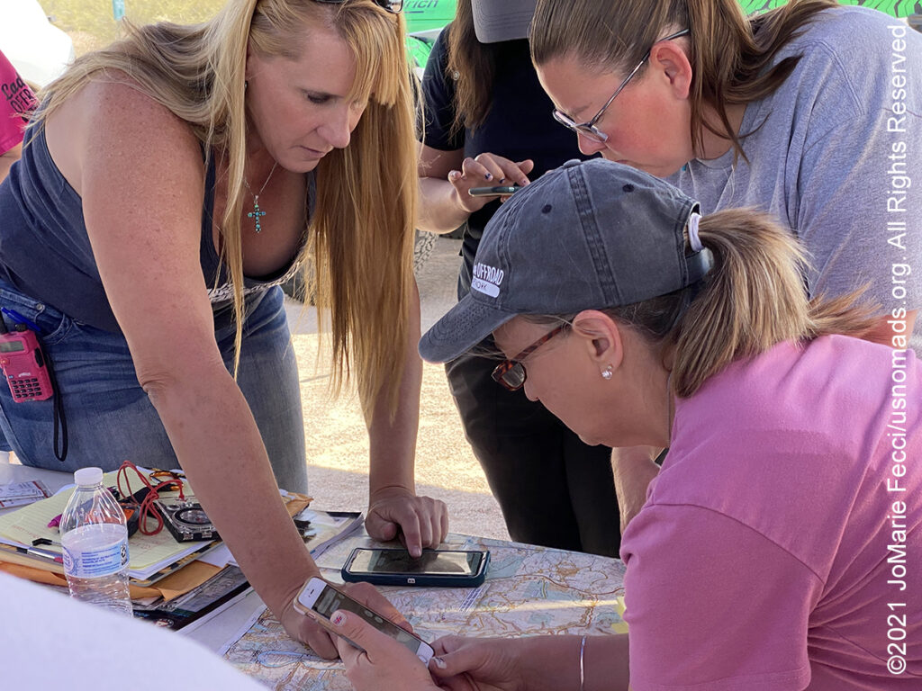
17 April 2021: Today was the start of a multi-day Ladies Offroad Network Navigation training event with LON founder, Charlene Bower. The morning began with an introduction to map and compass skills followed by a practical focus on using GPS and phone-based navigation apps in the field. Then in the afternoon the group got to do a short time-senstive exercise in route planning and “driving while navigating” to various rendezvous points …
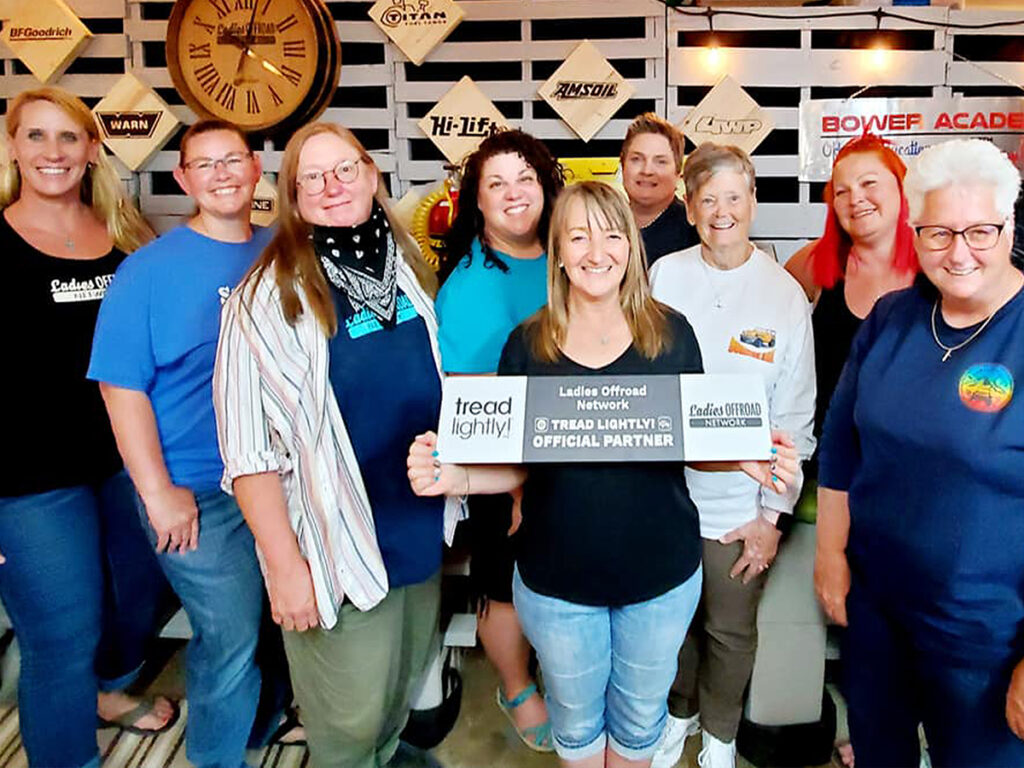
16 April 2021: Proud to have been among the first group of Ladies Offroad Network TreadLightly! “Tread Trainers” certified, after the group completed the requisite training today. The Tread Trainer certification is part of the on-going partnership between Ladies Offroad Network and the TreadLightly! organization intended to encourage land stewardship among the network members and across their larger communities…
THIS MONTH:

Navigation and Tread Trainer principles are the focus of the next Ladies Offroad Network camping adventure in Arizona. The group will be spending five days working on navigation skills covering everything from paper maps to GPS and the various navigation apps currently in use, then they will head out to test their knowledge on Arizona trails…
COMING UP SOON:
![]()
Joining in on a Ladies Offroad Network camping adventure in Arizona: Five days of fun learning out on the trail and in camp with Charlene Bower and a small group of adventure-minded ladies. The event consists of three core days of trail runs and training, and two days with additional optional activities designed around the event theme…

Every Day Is a Clean Up Day in 2021. Ladies Offroad Network has partnered with TreadLightly! to create a year-long program that encourages members to pick up trash on the trails whenever they are out off-roading. Participants simply pick up the trash, weigh it, take a photo, and log the location and time it took, then upload the details. At the end of the year there will be a series of prizes based on pounds of trash removed from the trails as well as participation in other TreadLightly! initiatives. This is a great way to do some good on a local level and make a larger impact via the national program…

Looking ahead to a return to Paris as soon as possible to reconnect with friends and some favorite places in the city of light. Timing is still uncertain due to the pandemic, but we hope the trip is back on the calendar for early 2021…
VERMILION CLIFFS
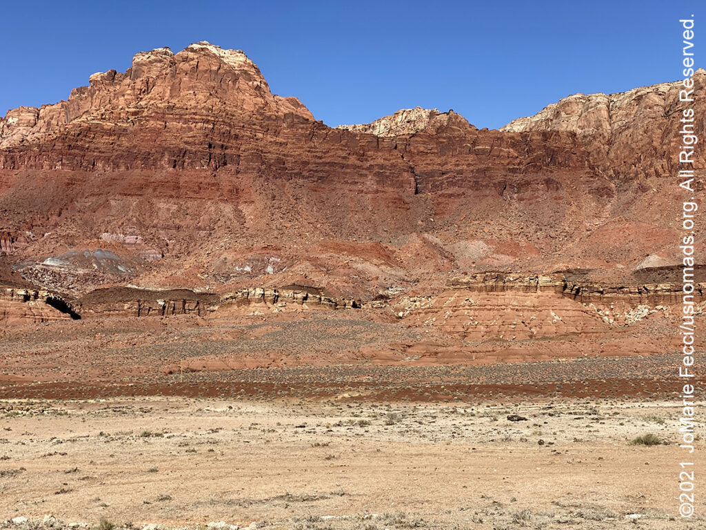
The Vermilion Cliffs National Monument is located in northern Arizona just south of the Utah state line. The 293,689 acre national monument, administered by the U.S. Bureau of Land Management, protects the Paria Plateau, Vermilion Cliffs, Coyote Buttes, and Paria Canyon. The Vermilion Cliffs themselves run along the southern and eastern edges of the monument. Steep eroded escarpments consisting primarily of sandstone, siltstone, limestone, and shale the Vermilion Cliffs rise as much as 3,000 feet (910 m) above their bases. The escarpment runs for over 30 miles and is one of the most spectacular and extensive cliff faces in the US – unusually colorful because of the especially variegated Chinle Formation that forms the lower strata. These sedimentary rocks have been deeply eroded for millions of years, exposing hundreds of layers of richly colored rock strata. Mesas, buttes, and large tablelands are interspersed with steep canyons, where some small streams provide enough moisture to support a sampling of wildlife. The first explorers into the region were Spanish missionaries and explorers from the 1776 Domínguez–Escalante expedition. Later, Mormon explorers searched the region during the 1860s, some of them settling on land that is now within the monument. They built one of the first ferry crossings on the Colorado River in 1871. That same year, John Wesley Powell ventured through this region during his scientific explorations of the Colorado River plateau. Today, the region surrounding the monument is relatively unspoiled with virtually no permanent inhabitants remaining and limited road access. In addition to the cliffs, the monument contains many other diverse landscapes, including the Paria Plateau, Coyote Buttes, and Paria Canyon. The monument borders Kaibab National Forest to the west and Glen Canyon National Recreation Area to the east. The monument includes the Paria Canyon-Vermilion Cliffs Wilderness. Elevations range from 3,100 to 7,100 feet. The monument is also home to a growing number of endangered California condors. Each year, condors hatched and raised in a captive breeding program are released in the monument. A visit to the monument, requires careful planning and awareness of potential hazards. There are no paved roads within the monument. Most roads need a high clearance, four-wheel-drive vehicle due to deep sand. While House Rock Valley Road (BLM 1065) is a maintained dirt road, it may be impassable when wet. There are two developed campgrounds outside the monument — Stateline and White House — and dispersed camping is allowed in previously disturbed sites outside the wilderness area. Permits are required to hike in Coyote Buttes North (The Wave), Coyote Buttes South, and for overnight trips within Paria Canyon. There are no visitor centers in the monument….
TREAD TRAINERS

Tread Lightly! has more than 2,000 Tread Trainers nationwide. The Tread Trainer program is designed to train participants in innovative, practical methods of spreading outdoor ethics to the public with a curriculum specifically focused on motorized and mechanized recreation. The program was created to address the growing pressures on our public lands that come with increased usage. With more people recreating on public lands resources can quickly become overused. Lack of government funding to repair dilapidated facilities and perform regular maintenance can lead to closures, which puts an even higher burden on surrounding recreation areas. In order to combat these problems, Tread Lightly! developed the train-the-trainer program that provides the tools and education needed to produce responsible stewards – people who will care for the land they use. When recreationists understand the consequences of their actions and behaviors, they are more likely to act in responsible ways. The Tread Trainer program provides the education needed to bring different types of recreationists together for the betterment of the common areas they enjoy. Once a participant becomes active in the Tread Trainer program he or she is equipped with the knowledge to recreate responsibly; present the Tread Lightly! message to other educators, clubs, employees, visitors, enthusiasts or community members, or train additional Tread Lightly! instructors…
Nesconset | Paris | Belgrade | Akron | St. Louis | Clinton | Grants | Yuma | Borrego Springs | Laughlin | Baker | Barstow | Ridgecrest | Lone Pine | Death Valley | Beatty | Sedona | Phoenix

MORE NOTES FROM THE ROAD:
8-15 April – Sedona
1-7 April – Nevada
16-31 March – New York
8-15 March – Death Valley
1-7 March – Arizona
22-28 Februay – Alabama Hills
15-21 Februay – Mojave Road
8-14 Februay – Death Valley
1-7 Februay – Glamis
15-31 January – Roadtrip Southwest
1-14 January – Long Island
22-31 December – Holiday Roadtrip
15-21 December – Holiday Roadtrip
7-14 December – Holiday Roadtrip
1-6 December – Long Island
15-30 November – Long Island
1-14 November – Long Island
28-31 October – Roadtrip East
22-27 October – Moab
15-21 October – Moab
8-14 October – Moab
1-7 October – Roadtrip West
16-30 September – Roadtrip West
1-15 September – Long Island
16-31 August – Long Island
1-15 August – Summer Roadtrip
22-31 July – Summer Roadtrip
14-21 July – Summer Roadtrip
1-13 July – Long Island
16-30 June – Long Island
1-15 June – Bald Eagle
16-31 May – Central PA
1-15 May – Re-opening Trails
April – Lockdown NY
Archive
EVENTS

LADIES OFFROAD NETWORK NONCON 2020
Recap from the Ladies Offroad Network camping and wheeling event, dubbed the “NonCon” as in “not the convention,” that came together after the official convention was cancelled due to the pandemic… [read]
RE-OPENING
Report from the first trail run with the Off Road Consulting group at Rausch Creek Off Road Park as the post-pandemic phased re-openings begin in Pennsylvania and some of our favorite local trails re-open to the public after the two-month shutdown… [read]
REFLECTIONS

EGYPT: CAIRO REFLECTIONS
A quick overview of impressions from a stop in Cairo during our recent scouting mission in Egypt and Sudan … [read]
SPECIAL REPORT

A look into south-eastern Algeria on the border with Libya and Niger: overlanding with the Tuareg in one of the most remote corners of the Sahara … [read]