
< more recent | 8-15 April 2021 | older >
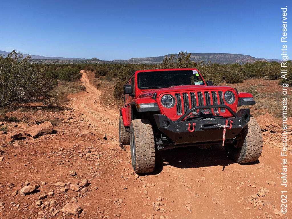
15 April 2021: Broke camp this morning and had enough time to drive one more Jeep trail before heading south, so picked Diamondback Gulch, another of the more popular Sedona trails and an old favorite. Enjoyed the trail and made only a few photos stops, then turned back towards the highway for the drive south to Mesa for the Ladies Offroad Network navigation event …
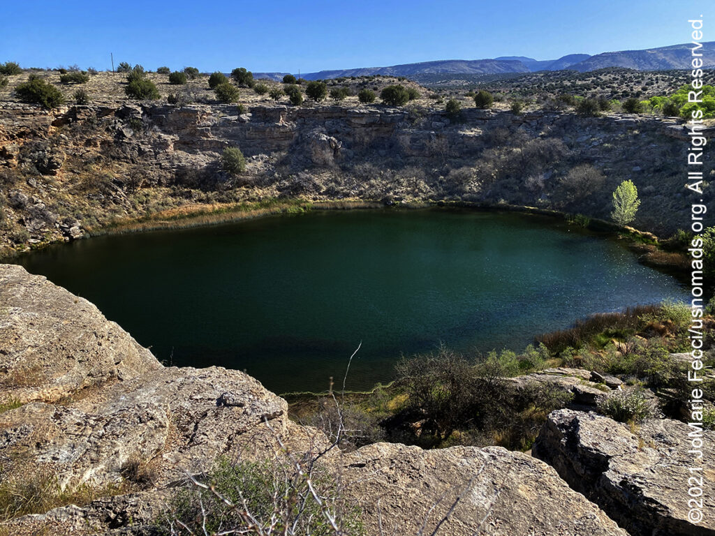
14 April 2021: Decided to do some exploring on the “east side” of I-17 today, starting with the Montezuma Well National Monument site for more cliff dwellings and then going in search of a trail vaguely remembered from a navigation training some years earlier. Looking at the map it was possible to find part of the route we used then, and locate the specific trail which is an easy dirt road that goes up along a very scenic route along a canyon somewhat parallel to the I-17 and before connecting with the road to Stoneman Lake at the end …
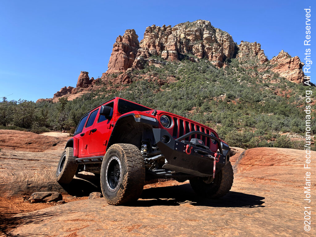
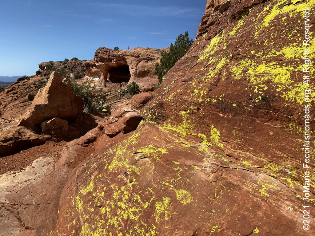
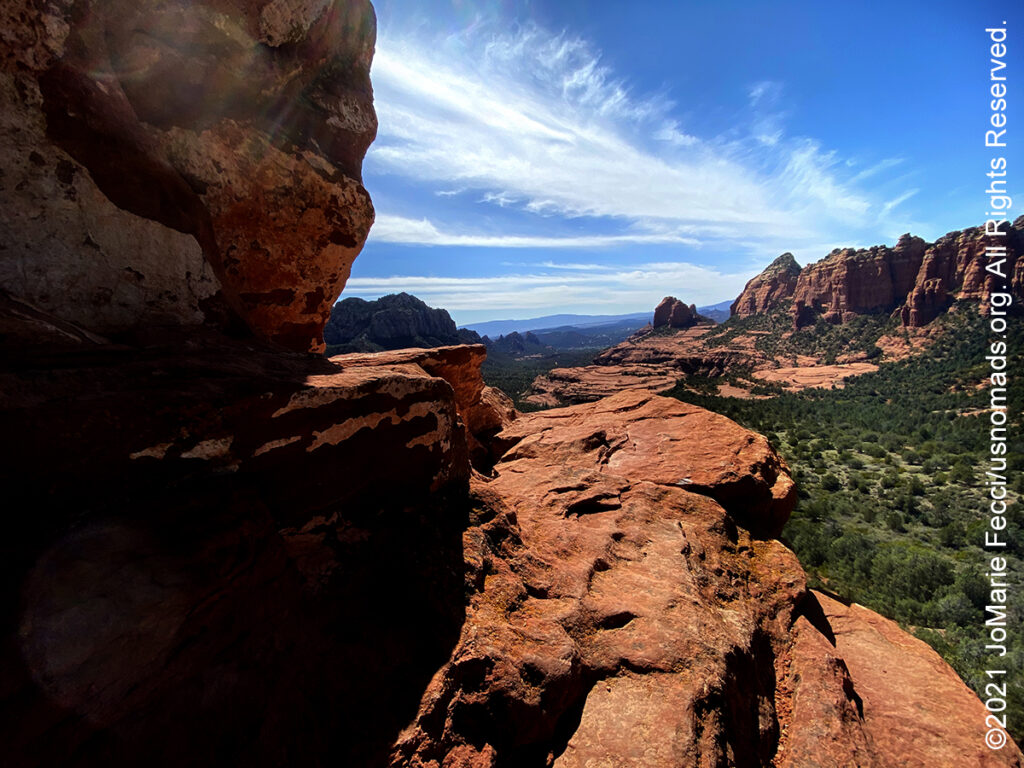
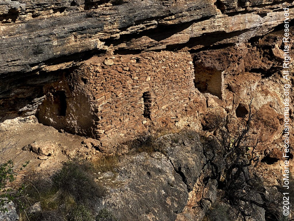
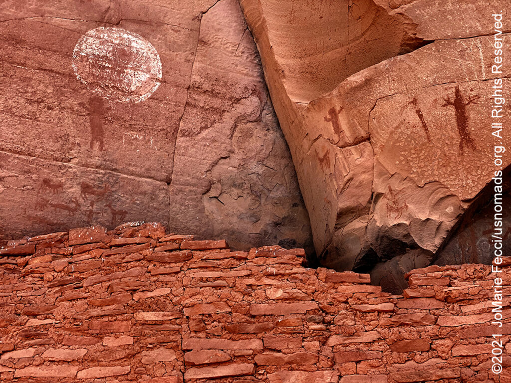
13 April 2021: With an early start we beat the tour Jeeps to Broken Arrow first thing in the morning and even was able to enjoy some solitude on Submarine Rock before the crowds began to arrive. Finished the trail early enough that there was time to do another one, and chose Outlaw with a stop to hike around the Honaki Cliff Dwelling ruins before. The light was right for viewing the ruins today and it was possible to see some pictographs that we hadn’t been able to see in previous visits, so that was extra cool. The Jeep trail was pretty crowded and there were few opportunities to stop for photos during that part of the days drive …
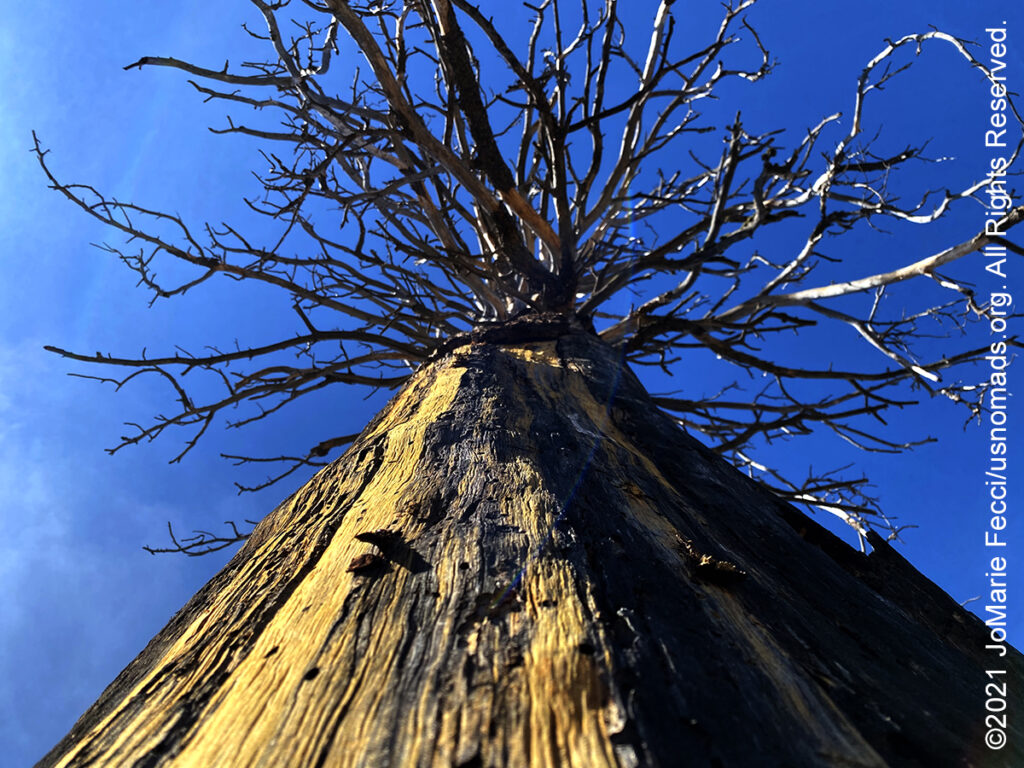
12 April 2021: Even on a Monday morning the Sedona area trails were crowded, so we chose one of the less visited routes, heading to a hiking trail for “Robbers Roost.” The hike itself was really fun and a bit challenging even though in terms of distance it was not “far.” There was some climbing involved and a very narrow ledge high up on the sandstone, but the reward was great upon reaching the “roost”…
11 April 2021: Up early and continued the route north all the way to Williams, which was also crowded with tourists heading to the Grand Canyon. Quickly leaving yet another crowded town, we turned back south and made a leisurely drive through the forest back towards Jerome, ending the day at the Dead Horse Ranch State Park in Cottonwood. Set up the big tent as that will be “basecamp” for the next few days…
10 April 2021: Made a strategic decision to spend the weekend away from the crowds in Sedona, and headed towards Jerome after coming down from Schnebly. Picking up the Jerome-Perkinsville Road, which is just a dirt forest road, we headed north towards Williams, then detoured along a smaller trail to the Sycamore Canyon Wilderness for some exploration. Set up camp not far from the wilderness boundary and didn’t see another person after leaving Perkinsville …
9 April 2021: Drove up Schnebly Hill Road, which had just re-opened all the way to the top. Had the amazing experience of getting to camp right on the edge of the rim, and was able to enjoy a beautiful campfire too (there were not yet any fire restrictions in place). Watching the sunset over Sedona from on top of the rim was a special treat and I was really glad it was not too windy…
8 April 2021: Took care of some administrative things today and got settled in to the general Sedona-area for the week. It is quite crowded here with a real sense that “Sedona is full.” Cottonwood is a little bit “better” …
THIS MONTH:

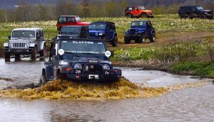
Navigation and Tread Trainer principles are the focus of the next Ladies Offroad Network camping adventure in Arizona. The group will be spending five days working on navigation skills covering everything from paper maps to GPS and the various navigation apps currently in use, then they will head out to test their knowledge on Arizona trails…
COMING UP SOON:
![]()
Joining in on a Ladies Offroad Network camping adventure in Arizona: Five days of fun learning out on the trail and in camp with Charlene Bower and a small group of adventure-minded ladies. The event consists of three core days of trail runs and training, and two days with additional optional activities designed around the event theme…

Every Day Is a Clean Up Day in 2021. Ladies Offroad Network has partnered with TreadLightly! to create a year-long program that encourages members to pick up trash on the trails whenever they are out off-roading. Participants simply pick up the trash, weigh it, take a photo, and log the location and time it took, then upload the details. At the end of the year there will be a series of prizes based on pounds of trash removed from the trails as well as participation in other TreadLightly! initiatives. This is a great way to do some good on a local level and make a larger impact via the national program…

Looking ahead to a return to Paris as soon as possible to reconnect with friends and some favorite places in the city of light. Timing is still uncertain due to the pandemic, but we hope the trip is back on the calendar for early 2021…
MONTEZUMA’S WELL
Montezuma Well is a sub-unit of Montezuma Castle National Monument. As with Montezuma Castle, the label “Montezuma” is a misnomer: the Aztec emperor Montezuma had no connection to the site or the early indigenous peoples that occupied the area. When European-Americans first observed these long-abandoned sites in the 1860s, they named them for the famous Aztec emperor Montezuma in the mistaken belief that he had been connected to their construction. The “well” is actually a natural limestone sinkhole through which some 1,500,000 US gallons of water emerge each day from an underground spring. The Well has a diameter of 386 feet from rim to rim and contains a near-constant volume of spring water even in times of severe drought. The land around the well has been home to many prehistoric groups of people since as early as 11,000 CE. The ruins of several prehistoric dwellings are scattered in and around the rim of the Well. The inhabitants belonged to the indigenous group archaeologists refer to as the Sinagua. The Sinagua intensively farmed the land surrounding the Well using its constant outflow as a reliable source of irrigation. Beginning about 700 CE, the Well’s natural drainage into the immediately adjacent Wet Beaver Creek was diverted into a man-made canal running parallel to the creek. Estimated to have been nearly seven miles in length, the canal drained into a network of smaller lateral canals downstream, supplying perhaps as much as 60 acres of farmland with water. The first Anglo-Americans to settle at Montezuma Well were Wales and Jennie Arnold in 1870. They operated a mail station and used the prehistoric irrigation canal to water their land. The land then passed through a series of ranchers, farmers, and business people until the Back family converted Montezuma Well into a tourist attraction for the first time. The Backs charged for tours, displayed artifacts found at nearby archeological sites, and later operated campgrounds, picnic areas, and a resort. Eventually the Backs agreed to sell the land to the US government and Congress approved the legislation in 1943, with Montezuma Well becoming part of the National Park Service in 1947. The Montezuma Well site is still considered sacred by many local tribes–the Yavapai people believe it is the place through which they emerged into the world…
THE SINAGUA PEOPLE
The Sinagua were a pre-Columbian culture that occupied a large area in central Arizona from the Little Colorado River, near Flagstaff, to the Verde River, near Sedona, including the Verde Valley, area around San Francisco Mountain, and significant portions of the Mogollon Rim country, between approximately 500 CE and 1425 CE. The name “Sinagua” comes from the Spanish “sin agua,” meaning “without water.” Despite the name, the Sinagua actually had plenty of water. The group was named by Harold S. Colton in 1939, after the San Francisco Peaks, where Colton first identified the culture. (The peaks were called “sierra sin agua” by early Spanish explorers because they lacked rivers and streams.) The Sinagua were living in the Verde Valley as early as 650 CE, and their earliest houses were pithouses, made by digging partially into the ground, inserting log posts, and covering the structure with plant material. Beginning around 1050 CE, they began building pueblos and cliff dwellings in naturally occurring caves in the cliffs. Cliff dwellings often had multiple levels, and were accessed using wooden ladders. The Sinagua lived in pueblos and cliff dwellings until around 1400 CE when they began to migrated away over time. Although we do not know the exact reason, possible explanations include environmental change, overpopulation, social conflict, or religious reasons. Some Hopi clans believe that the Sinagua were their ancestors. Some Yavapai-Apache say that not all Sinagua left, but instead integrated with the Yavapai and Apache…
JEROME-PERKINSVILLE ROAD
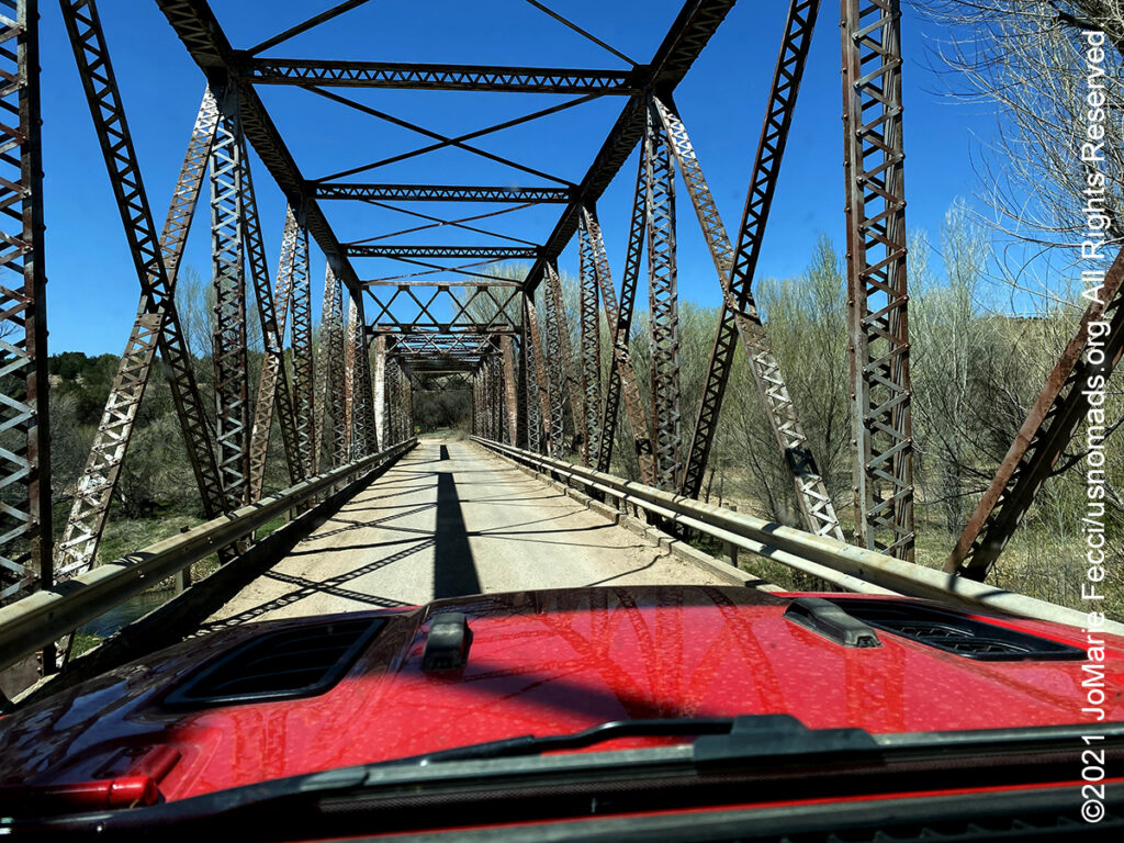
The Jerome-Perkinsville Road starts from within the old mining town of Jerome along Highway 89A heading north to Perkinsville and then continues on to Williams. It is a 47-mile journey one-way. Along the route there are amazing views of the Red Rock Country and the rolling desert hills just east of Chino Valley. As it goes north from Jerome the road follows the edge of the Woodchute Mountain Wilderness Area before reaching Perkinsville and crossing the Verde River. It begins as a narrow winding dirt and gravel road carved out of the hills that follow the old United Verde & Pacific Railway bed and the whole valley spreads out below. Approaching Perkinsville the landscape becomes a dry series of hills leading to the one-lane bridge that crosses the Verde River. Perkinsville itself is more a ranch than an actual town and continuing north the route begins to climb again. The juniper, oak and mesquite transition to Pines as the road meanders through the Kaibab National Forest before finally turning back into pavement and arriving to the colorful historic district of restored saloons and bordellos in Williams which was once a rough-and-tumble ranching, lumber and railway center…
Nesconset | Paris | Belgrade | Akron | St. Louis | Clinton | Grants | Yuma | Borrego Springs | Laughlin | Baker | Barstow | Ridgecrest | Lone Pine | Death Valley | Beatty | Sedona | Phoenix

MORE NOTES FROM THE ROAD:
1-7 April – Nevada
16-31 March – New York
8-15 March – Death Valley
1-7 March – Arizona
22-28 Februay – Alabama Hills
15-21 Februay – Mojave Road
8-14 Februay – Death Valley
1-7 Februay – Glamis
15-31 January – Roadtrip Southwest
1-14 January – Long Island
22-31 December – Holiday Roadtrip
15-21 December – Holiday Roadtrip
7-14 December – Holiday Roadtrip
1-6 December – Long Island
15-30 November – Long Island
1-14 November – Long Island
28-31 October – Roadtrip East
22-27 October – Moab
15-21 October – Moab
8-14 October – Moab
1-7 October – Roadtrip West
16-30 September – Roadtrip West
1-15 September – Long Island
16-31 August – Long Island
1-15 August – Summer Roadtrip
22-31 July – Summer Roadtrip
14-21 July – Summer Roadtrip
1-13 July – Long Island
16-30 June – Long Island
1-15 June – Bald Eagle
16-31 May – Central PA
1-15 May – Re-opening Trails
April – Lockdown NY
Archive
EVENTS
LADIES OFFROAD NETWORK NONCON 2020
Recap from the Ladies Offroad Network camping and wheeling event, dubbed the “NonCon” as in “not the convention,” that came together after the official convention was cancelled due to the pandemic… [read]
RE-OPENING
Report from the first trail run with the Off Road Consulting group at Rausch Creek Off Road Park as the post-pandemic phased re-openings begin in Pennsylvania and some of our favorite local trails re-open to the public after the two-month shutdown… [read]
REFLECTIONS

EGYPT: CAIRO REFLECTIONS
A quick overview of impressions from a stop in Cairo during our recent scouting mission in Egypt and Sudan … [read]
SPECIAL REPORT

A look into south-eastern Algeria on the border with Libya and Niger: overlanding with the Tuareg in one of the most remote corners of the Sahara … [read]