
< more recent | 22-31 July 2020 | older >

31 July 2020: Today was the first day out on the trails for the Ladies Offroad Network “NonCon,” an informal camping and wheeling “non-event” that was cobbled together when the annual convention had to be cancelled due to the pandemic. Attendees joined LON founder Charlene Bower out in the woods for some offroading fun, starting with today’s trail run. [Check out the full recap: THE LON NONCON 2020] …
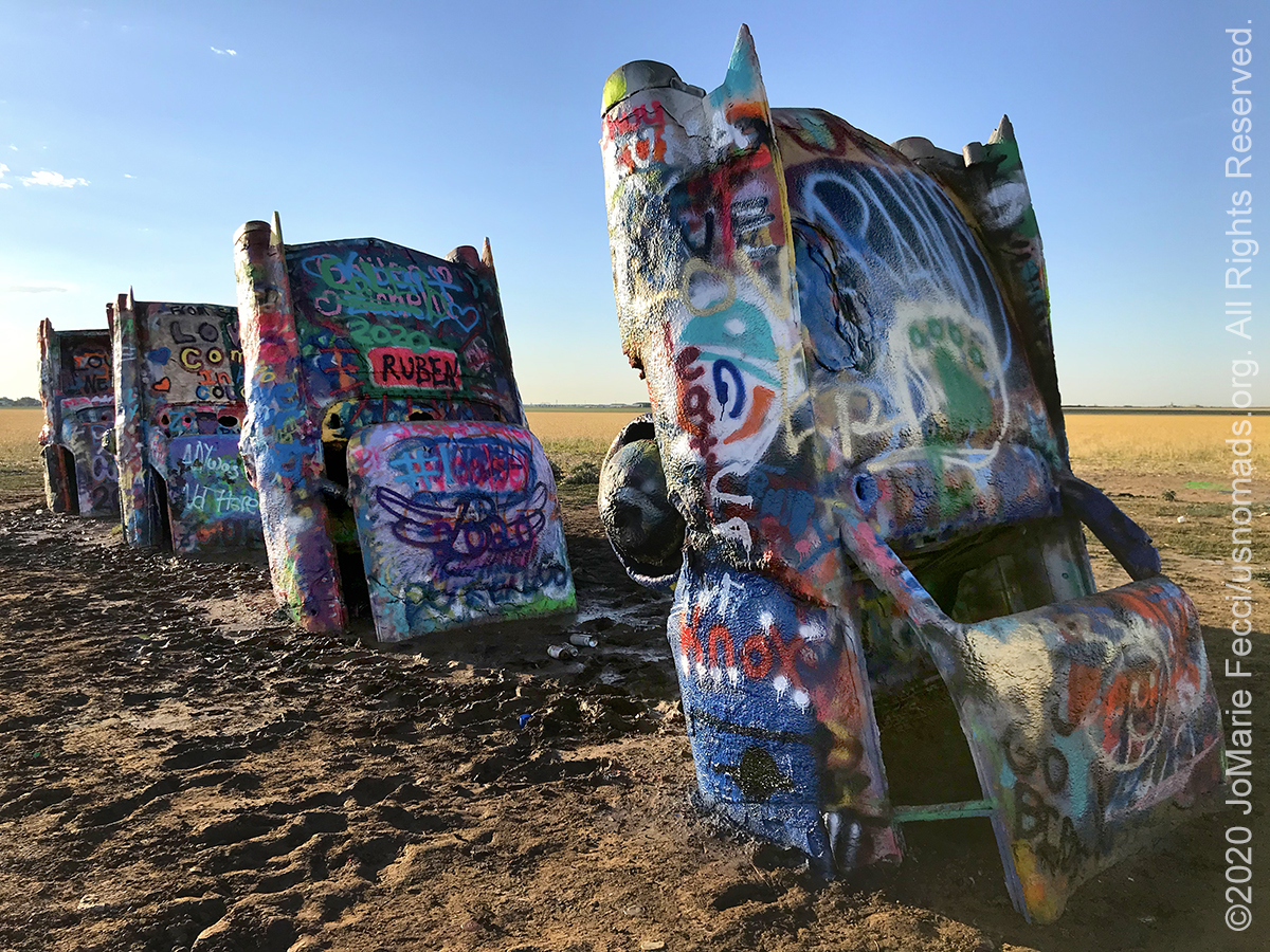
30 July 2020: Stopped at Cadillac Ranch on the way out of Amarillo, then continued the westward journey across New Mexico and into Arizona, with another short diversion to visit the painted desert briefly along the way. Got into Flagstaff in time to pick up some maps before heading out to camp …
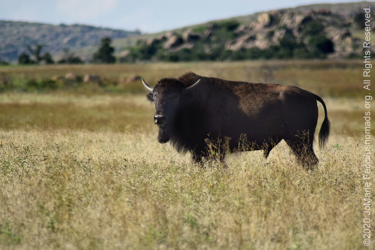
29 July 2020: At some indiscernible moment during the day we crossed from “east” to “west” and the landscape changed, beginning to resemble the iconic western vistas. The exact point somewhere in Oklahoma was missed as we encountered torrential rain and low clouds that reduced visibility to almost zero as we were driving. By the time the rain stopped we were definitely in the “west” where we took a short breat at the Witchita Mountains Wildlife Refuge to see the Prairie Dog Town and had a surprise encounter with some buffalo too …
28 July 2020: Took a last trail run on the backside of the Nemo tunnel before departing Catoosa WMA to start a marathon drive to Arizona to attend an event that promsies to be exciting and that just came up at the last minute. We need to detour from the east coast roadtrip to cross the country in roughly three days in order to arrive in Flagstaff on time …

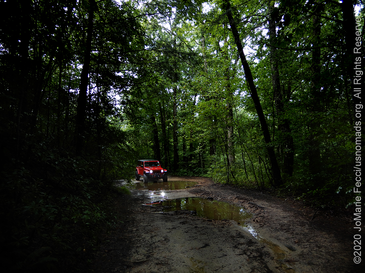
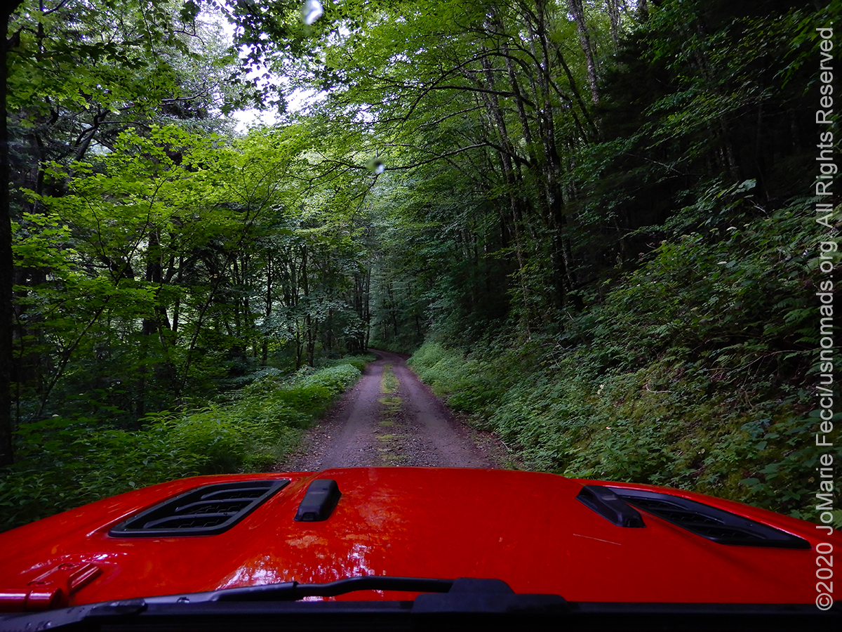
27 July 2020: Explored a unique Jeep trail that goes through an abandoned train tunnel — Nemo Tunnel #24 — not far from an old iron bridge, all part of the Nemo crossing on land managed by the national parks service as part of the Obed Wild and Scenic River. The bridge is located just above the Obed-Emory confluence and was the first iron structure to cross the river. The train tunnel was abandoned when a more modern tunnel was constructed nearby allowing for taller modern trains to fit through …
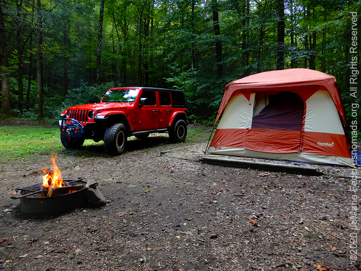
26 July 2020: Crossed the Smoky Mountains via the Newfound Gap road to Gatlinburg, then headed straight back into the woods of the Catoosa Wildlife Management Area where we set up camp for a couple of nights…
25 July 2020: Did some exploring in the Smoky Mountains, succeeding in finding some of the lesser travelled areas of one of America’s most visited National Parks. Spent some time in the Catalooche Valley and on the Heintooga Ridge loop, enjoying the trails despite intermittent rain…
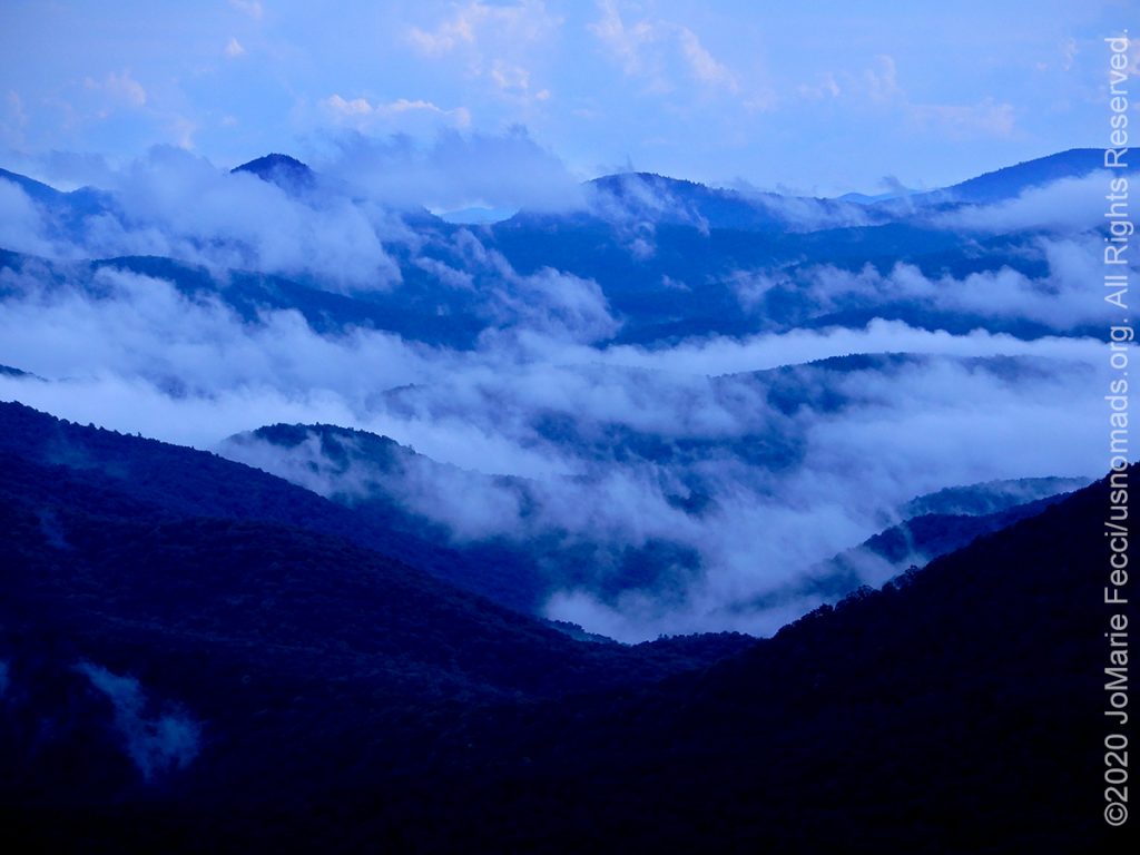
24 July 2020: Left the Uwharries and made our way westward picking up the Blue Ridge Parkway into the Great Smoky Mountains National Park. The drive up and along the mountain tops was a real treat as the unsettled weather created great cloud formations between the mountain ridges making it look truly “smoky”…

23 July 2020: Back to the OHV area today to sample two more trails, Slab Pile and Rocky Mountain, which made for a fun afternoon. Again, the trails were mostly empty — probably a combination of the heat and the fact that it is midweek…
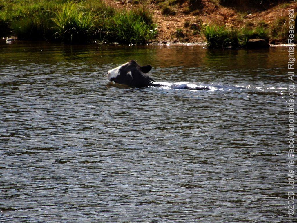
22 July 2020: It was so hot out today that even the cows went swimming–seriously. On the way back from the trail we spotted a group of cows that had gone beyond simply wading in the water hole to actually swimming in it…

22 July 2020: Got out to the OHV area today and spent some time playing around Wolf Den where I was the only Jeep, and in fact the only traffic I encountered on the trail was a couple of ATVs. It was a great day out, though quite hot, which maybe why the trails were so quiet…
THIS MONTH:

Time for an impromptu summer road trip post-pandemic style. Given the current situation, this means planning a journey to keep away from the crowds–so into the wilderness we go. Heading down the east coast on the coastal route then turning inland and looping back up via the mountains with some fun camping and wheeling along the way…
COMING UP SOON:
![]()
The 5th Annual 2020 Ladies Offroad Challenge starts on May 4th. Ladies will participate in a series of challenge tasks that are built to educate and encourage stepping into some unknown territories. The Challenge goes on over ten weeks with participants striving to “Do the Best They Can” at each of the tasks. Ten Participants from the Challenge will be invited to the very special Top 10 Weekend hosted by Charlene Bower…

Looking ahead to a return to Paris as soon as possible to reconnect with friends and some favorite places in the city of light. Timing is still uncertain due to the pandemic, but the trip is back on the calendar for late summer/early fall…
CATOOSA WMA
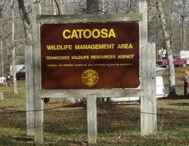
Catoosa Wildlife Management Area is a large game-management area on the Upper Cumberland Plateau in Morgan, Cumberland and Fentress counties in Tennessee. It comprises 96,000 acres of wild land administered by the Tennessee Wildlife Resources Agency. The Management Area is funded by hunters and fishermen, and is popular with all outdoors enthusiasts, including backpackers, and whitewater rafters. It has many trails for hiking, of which the most notable is the Cumberland Trail. It also has gravel roads and dirt track four-wheel drive roads for motorized exploration. Off-road vehicles and horses are permitted, but only on certain roads and trails. Overnight camping is allowed on designated areas by permission of the area manager. Catoosa ranges from gentle rolling hills to some of the most rugged and extreme terrain in the country. Many rivers and streams have cut deep canyons into the Cumberland Plateau and Cumberland Mountains of the Management area allowing for beautiful vistas. The Catoosa WMA lies within the Emory River drainage, which is divided by a number of major stream drainages, including the Obed River, Daddy’s Creek, Clear Creek, and Otter Creek. The Emory River meets the Obed River in the southeast corner of the area. Over 98 percent of the WMA is forested and the wildlife populations have been restored. Man’s first use of the plateau was as hunting grounds. Artifacts found in caves and rock shelters suggest Mississippian and later Cherokee hunters camped here but never established permanent dwellings. The hunting grounds were visited seasonally by the Cherokees, Choctaws, Chickasaws, and Shawnees, and were the subject of repeated conflicts. Ecologists believe the prairie-like environment arose from lightning-caused wildfire and grazing by megafauna. This natural community was maintained by periodic burning by the Native Americans. The plateau reforested when early European settlers began practicing fire suppression. The white settlers visited the high country occasionally to mine coal and harvest timber before major industry came to the area with the first lumber mill in the 1870s. By 1911, two coal and lumber companies had formed a syndicate that exploited the region until the main bridges on their rail lines were destroyed by a flood in 1929. As the companies cleared the woodland they leased these lands to small farms for arable and animal farming. The Great Depression prevented the industrial companies from reinvesting in the repair of their railroads and businesses began to fail. In 1940 the Crossville Exchange Club appointed a committee to encourage the state to purchase some of the abandoned land for a wildlife management area. The Conservation Commission bought 63,000 acres from the Tennessee Mineral and Lumber Company in 1942. In 1949 the Tennessee Game and Fish Commission, now the Tennessee Wildlife Resources Agency (TWRA), established a tentative purchase boundary encompassing some 90,000 acres within which they began to eliminate interior holdings through a land acquisition program…
SMOKY MOUNTAINS
The Great Smoky Mountains are a mountain range rising along the Tennessee–North Carolina border in the southeastern United States. They are a subrange of the Appalachian Mountains, and form part of the Blue Ridge Physiographic Province. The Smokies are best known as the home of the Great Smoky Mountains National Park, which protects most of the range. The park was established in 1934, and, with over 11 million visits per year, it is the most visited national park in the United States. The range is home to an estimated 187,000 acres of old growth forest, constituting the largest such stand east of the Mississippi River. The cove hardwood forests in the range’s lower elevations are among the most diverse ecosystems in North America. The Great Smokies are also home to the densest black bear population in the Eastern United States. The U.S. National Park Service preserves and maintains 78 structures within the national park that were once part of the numerous small Appalachian communities scattered throughout the range’s river valleys and coves. The park contains five historic districts and nine individual listings on the National Register of Historic Places, it is also designated a UNESCO World Heritage Site. The Smokies rise prominently above the surrounding low terrain and because of their prominence, receive heavy annual amounts of precipitation. Flash flooding and landslides can often occur after heavy rain. The name “Smoky” comes from the natural fog that often hangs over the range and presents as large smoke plumes from a distance. This fog is caused by the vegetation exhaling volatile organic compounds …
THE BLUE RIDGE PARKWAY
The Blue Ridge Parkway is America’s longest linear park, running for 469 miles through Virginia and North Carolina, linking Shenandoah National Park to Great Smoky Mountains National Park. It runs mostly along the spine of the Blue Ridge, a major mountain chain that is part of the Appalachian Mountains. Its southern terminus is at U.S. 441 on the boundary between Great Smoky Mountains National Park and the Cherokee Indian Reservation in North Carolina, from which it travels north to Shenandoah National Park in Virginia. The roadway continues through Shenandoah as Skyline Drive, a similar scenic road which is managed by a different National Park Service unit. The parkway is one of the most visited units of the National Park System. Begun during the administration of President Franklin D. Roosevelt, the project was originally called the Appalachian Scenic Highway. The parkway’s construction created jobs in the region, but also displaced many residents and created new rules and regulations for landowners, including requirements related to how farmers could transport crops. The project took over 52 years to complete …
THE UWHARRIES
 ”
”
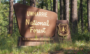
The Uwharrie Mountains in North Carolina span the counties of Randolph, Montgomery, Stanly, and Davidson and were once a coastal mountain range before the eastern seabed rose up, leaving them over 150 miles from the coast. They formed approximately 500 million years ago and it is speculated that they once rose to 20,000 feet, before eroding to a maximum of just over 1,100 ft. today. The Uwharries lie within a southeastern mixed forest ecoregion and give their name to the Uwharrie National Forest. Once entirely cleared for timber and farmland, the mountains were designated a U.S. National Forest in 1961 by President John F. Kennedy. The woodlands have since returned, providing a haven for a diversity of wildlife, recreational facilities, and numerous Native American archeological sites. The Uwharrie National Forest is the smallest of the four National Forests in North Carolina, with a total area of 50,645 acres and it is managed together with the other three North Carolina National Forests (Croatan, Nantahala, and Pisgah) from common headquarters in Asheville, North Carolina. The western border of the forest is made by the Yadkin River and Great Pee Dee River while the northern border follows the northernmost range of the Uwharries near Asheboro. To the east, the forest is bordered by the Montgomery County seat of Troy. An interesting fact about the forest’s history: in 1799, the discovery of gold at the nearby Reed Gold Mine in Cabarrus County led to America’s first gold rush, and gold was found in the Uwharrie Mountains in the 19th century. A mini gold rush occurred during the Great Depression. Panning for gold in the forest’s streams and rivers remains a popular activity. Boating and fishing are available at Badin Lake, while the 20-mile (32.19 km) Uwharrie National Recreation Trail runs through the forest. Other trails and paths provide opportunities for hiking, mountain biking, camping, and horseback riding. Off-road vehicles have their own trail system. The Badin Lake OHV Trail Complex is open for motorized recreation for dirtbikes, ATVs, UTVs, side-by-sides, and full-sized 4-wheel drive vehicles with the purchase of a day or annual pass/permit to be displayed on the vehicle. The trail system is open from April 1st to December 15th annually. It has 6 trailheads to access the 16 miles of trails. Additionally, it is within 1 to 2 miles of developed campgrounds – Arrowhead Campground, Badin Lake Campground, and Badin Lake Group Camp where flush toilets, vault toilets and showers are available for campers. The trails range from easy to extremely difficult. Currently there are 8 trails with plans for more trails in the future…
Nesconset | Paris | Belgrade | Albermarle | Gatlinburg | Catoosa | Knoxville | Memphis | Little Rock | Oklahoma City | Amarillo | Albuquerque | Flagstaff | Sedona | Harrisonburg | Stroudsburg

MORE NOTES FROM THE ROAD:
14-21 July – Summer Roadtrip
1-13 July – Long Island
16-30 June – Long Island
1-15 June – Bald Eagle
16-31 May – Central PA
1-15 May – Re-opening Trails
April – Lockdown NY
16-31 March – Lockdown NY
9-15 March – Roadtrip Home
1-8 March – Moab
23-29 February – Vegas to Anza Borrego
15-22 February – Southwest Roadtrip
8-14 February – Southwest Roadtrip
1-7 February – Glamis to Vegas
27-31 January – Yuma to Glamis
15-26 January – Nevada to Arizona
1-14 January – Starting the New Year
24-31 December – Holidays on the Road
16-23 December – Cross-Country Drive
9-15 December – New York
1-8 December – Paris
16-30 November – Paris & Rennes
1-15 November – New York
14-31 October – Arizona
8-13 October – LON TOP TEN
1-7 October – Girl Gang Garage
16-30 September – Women’s Wheeling
1-15 September – Long Island
9-31 August – Serbia
1-8 August – #LONCON2019
Archive
REFLECTIONS

A quick overview of impressions from a stop in Cairo during our recent scouting mission in Egypt and Sudan … [read]
SPECIAL REPORT

A look into south-eastern Algeria on the border with Libya and Niger: overlanding with the Tuareg in one of the most remote corners of the Sahara … [read]