
< more recent | 15-21 February 2021 | older >
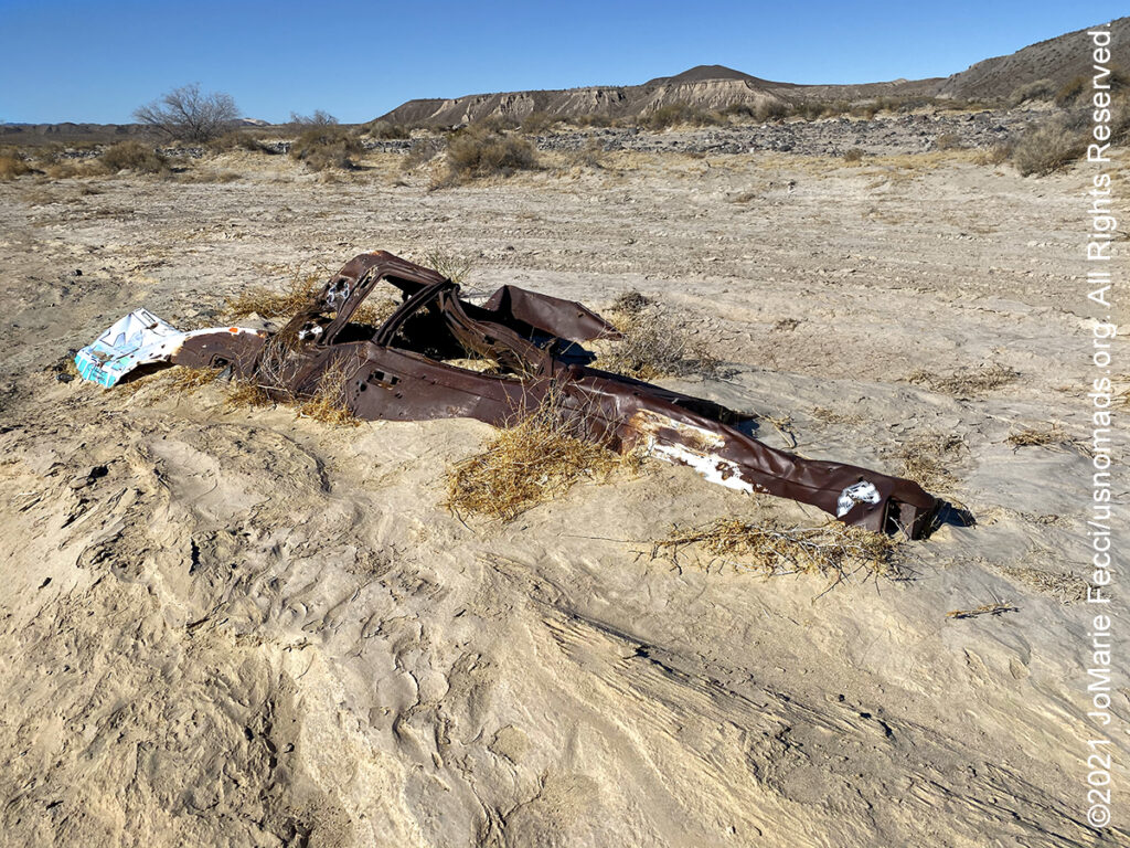
21 February 2021: Picked up the last bit of the Mojave road this morning, and it was interesting because according to the GPS we were driving in the middle of a river, but in reality everything was bone dry. The Mojave Road itself ends near Yermo, and took some time to pick up trash for the LON/TreadLightly initiative before leaving dirt. Made a stop at a strange ghost-town-like site covered in graffiti that sits back from the highway between Yermo and Barstow, then made another stop to drive the scenic loop at Rainbow Basin…
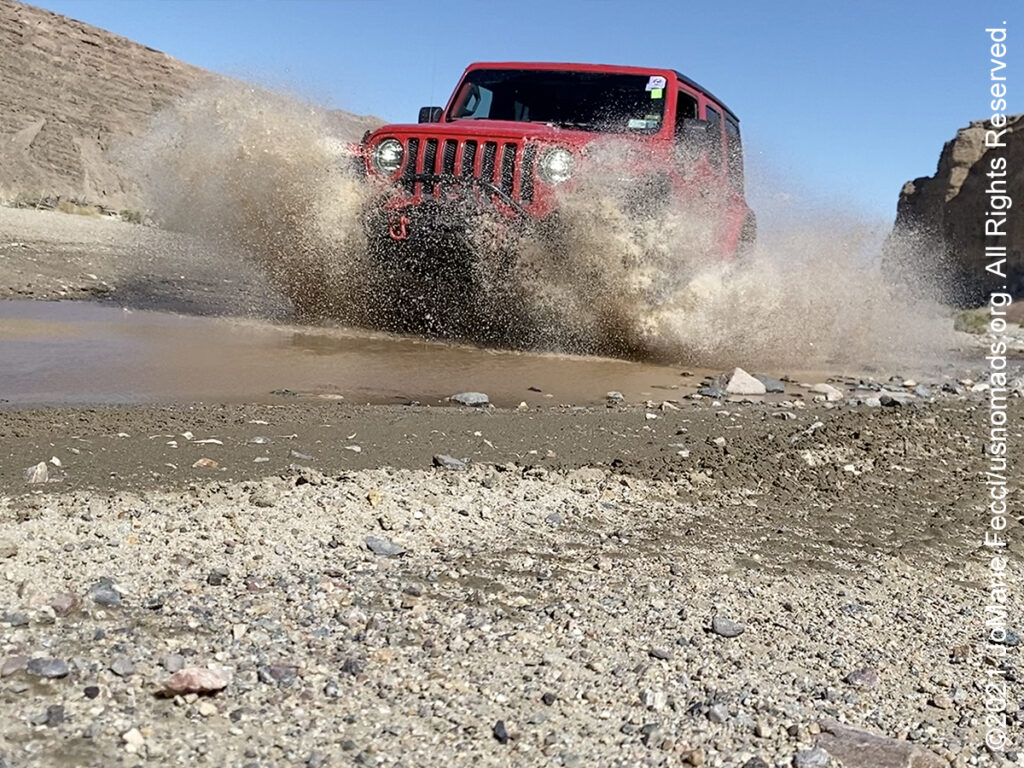
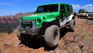
20 February 2021: The winds were much stronger this morning, and we got to the lakebed for some photos early in the morning before it was blowing too bad. However, the “soft sand” segment of the route ended up being right in the windiest part of the day, feeling a bit like a real desert sandstorm during moments. The guide book said it was a dangerous stretch of sand, so we made the decision to keep moving fast so as not to get stuck, and ended up getting through the section without any photos. From there it was on to the river and the “exit” through Afton Canyon which was an amazingly beautiful location. Set up camp at the Afton campground and didn’t bother to set up the tent, preparing directly to sleep in the Jeep because of the wind…
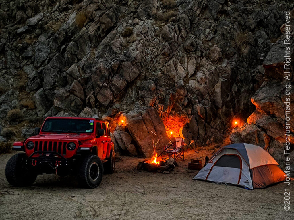
19 February 2021: This morning the Jeep said it was 19°F and the wind continued. The desert was cold. Still, the Jeep was warm and the driving was good, following the old trail westward through the surreal desert landscape. Stopped to camp next to the rocky hills of 17-Mile Point, tucking the Jeep and tent in between the rocks for protection from the wind. It was a beautiful campsite and a little bit warmer than last night …
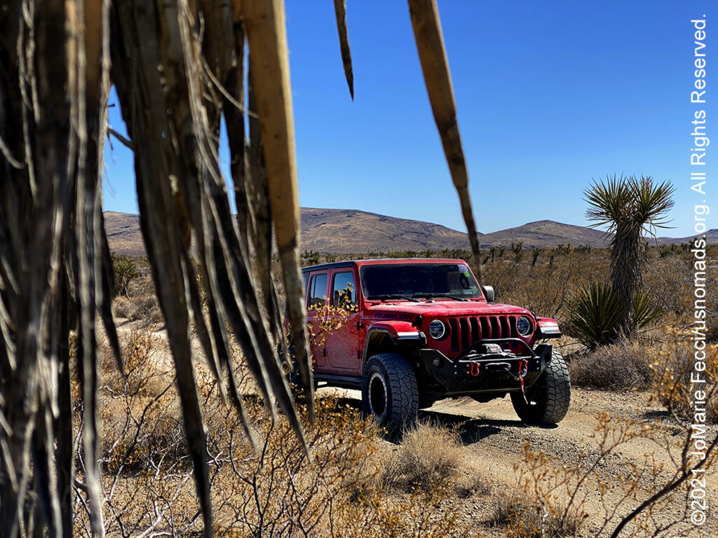
18 February 2021: The wind and cold continued today, accompanying us on the Mojave road as far as the “Rock House”, an old homestead build by a WWI veteran who had been gassed at the front and came searching for the healing dry air of the desert. Set up camp under a juniper tree and settled in for a very cold night …
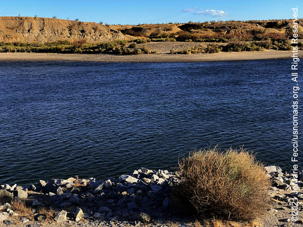
17 February 2021: A windy and cold day in Laughlin today, and the sharp brightness of winter sun on the Colorado River at the “beginning” of the famed Mojave Road. The trail starts at an unmarked location within the Fort Mojave Indian reservation lands near the place known as Beale’s crossing …

16 February 2021: Always a bit odd when “civilization” is defined by the surreal ambiance of the Las Vegas strip, but made a brief stop there this afternoon anyway. Tomorrow it is back to the trail for a long loop and it will be awhile before the next hotel…
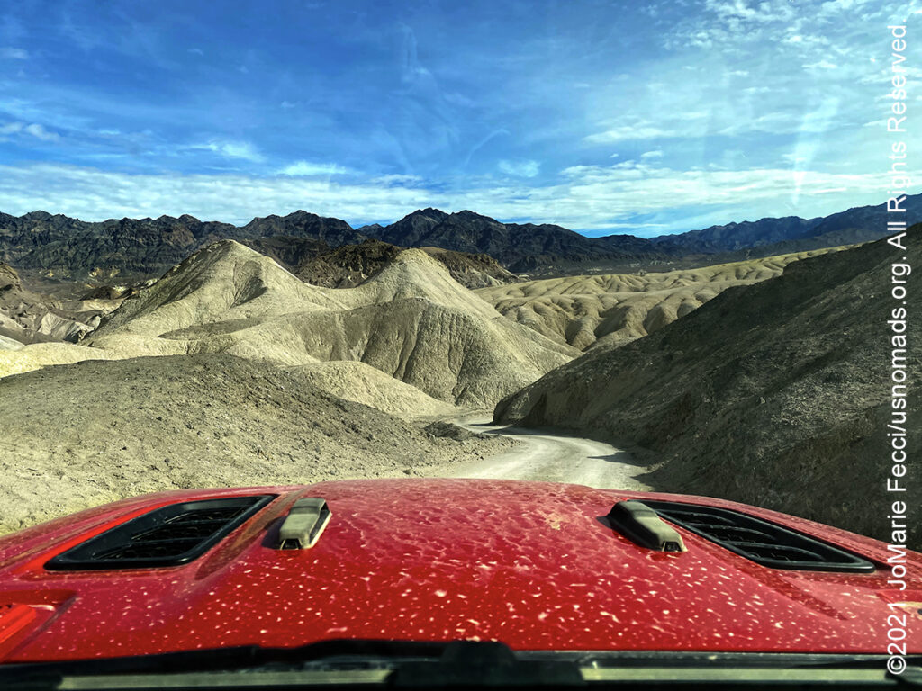
15 February 2021: Took some time leaving Death Valley this morning to exit via a loop around 20 Mule Team Canyon, a favorite scenic trail through what seems like petrified sand dunes that has a wonderful view over the badlands beyond. Then continued on into Nevada to take care of some Jeep maintenance and administrative matters before getting back to the journey at hand …
THIS MONTH:

Trail Guiding for the California 4-Wheel Drive Association’s inaugural Death Valley Experience 2021 fundraiser event running from March 10-14, 2021. Each day will feature a choice of runs to some famous, some infamous and some secretive points of interest within Death Valley National Park. The runs will depart from Furnace Creek and from Stovepipe Wells. Some of the points of interest we will visit during Death Valley Experience 2021 include Zabriskie Point (famous), Barker Ranch (infamous) and the Racetrack (learn the secret of the moving rocks). Other points of interest include Dante’s View, 20 Mule Team Canyon, Artists’ Drive, Chloride Cliffs, Aguereberry Point, Skidoo, Titus Canyon, and Darwin Falls. All of the trail runs are suitable for novice drivers and SUVs with high clearance and 4-wheel drive…
COMING UP SOON:
![]()
Joining in on a Ladies Offroad Network camping adventure in Arizona: Five days of fun learning out on the trail and in camp with Charlene Bower and a small group of adventure-minded ladies. The event consists of three core days of trail runs and training, and two days with additional optional activities designed around the event theme…

Every Day Is a Clean Up Day in 2021. Ladies Offroad Network has partnered with TreadLightly! to create a year-long program that encourages members to pick up trash on the trails whenever they are out off-roading. Participants simply pick up the trash, weigh it, take a photo, and log the location and time it took, then upload the details. At the end of the year there will be a series of prizes based on pounds of trash removed from the trails as well as participation in other TreadLightly! initiatives. This is a great way to do some good on a local level and make a larger impact via the national program…

Looking ahead to a return to Paris as soon as possible to reconnect with friends and some favorite places in the city of light. Timing is still uncertain due to the pandemic, but we hope the trip is back on the calendar for early 2021…
THE MOJAVE ROAD
The Mojave Road, The Mojave Road is an east-west route, roughly 150 miles long, that traverses the desert between the Colorado River and the Mojave River near Wilmington, Los Angeles, CA. Most of the Mojave Road is within the boundaries of the Mojave National Preserve. Also known as Old Government Road or the Mohave Trail, it is a historic route stretching 147 miles from Beale’s Crossing (the river crossing site on the west bank of the Colorado River, opposite old Fort Mohave, roughly 10 miles southwest of Bullhead City, Arizona), to Fork of the Road location along the north bank of the Mojave River where the old Mojave Road split off from the route of the Old Spanish Trail/Mormon Road. A traditional thoroughfare of desert-dwelling Native Americans, the Mohave Trail much later served Spanish missionaries, explorers, and foreign colonizers and settlers from the 18th to 19th centuries who called it the Mojave Trail. The route ran between watering holes across the Mojave Desert from the Colorado River to the Mojave River then following it to the Cajon Pass, the gap between the San Bernardino Mountains and San Gabriel Mountains, into Southern California ending at Drum Barracks. The watering holes recur at intervals of about 60 miles to 70 miles. Over time military forts were established along the route to protect the water sources and provide assistance for travelers. The land had been taken from Mexico by the US in 1848 following the Mexican–American War and the Mohave Trail became part of a long wagon road bringing settlers into Southern California. Soon hostilities began between the Mohaves and the settlers, triggering the Mohave War, and Army posts were established at Fort Mojave, at Beale’s Crossing, and at Camp Cady. The army protected the settlers and travelers from the attacks of the resident Paiute, Mojave, and Chemehuevi Native Americans until 1871. This also opened the way for large mining development in the Mojave Desert region of San Bernardino County and agricultural development in the Victor Valley area. The route became an “off-road” destination after it was popularized by Dennis Casebier in the 1980s. The Mojave Road Guide by Dennis Casebier provides mile-by-mile descriptions of the road and is still the best resource for planning a Mojave Road trip…
THE MOJAVE DESERT
The Mojave Desert is an arid rain-shadow desert and the driest desert in North America. It occupies 47,877 square miles of California and Nevada with small areas that extend into Utah and Arizona. Its boundaries are generally noted by the presence of Joshua trees, which are native only to the Mojave Desert and are considered an indicator species. The Mojave Desert is bordered by the Great Basin Desert to its north and the Sonoran Desert to its south and east. Topographical boundaries include the Tehachapi Mountains and the Sierra Pelona Ridge to the west, the Sierra Nevada and the Inyo Mountains to the northwest, and the San Gabriel Mountains and San Bernardino Mountains to the south. The mountain boundaries are distinct because they are outlined by the two largest faults in California – the San Andreas and Garlock faults. The Mojave Desert displays typical basin and range topography. Large parts of the Mojave Desert are often referred to as the “high desert”, in contrast to the “low desert”, the Sonoran Desert to the south. Most of the Mojave Desert is above 2,000 ft (610 m), with only Death Valley and the Colorado River basin in the east (including the neighboring Las Vegas Valley) being lower. The Mojave Desert, however, is generally lower than the even higher Great Basin Desert to the north. The spelling Mojave originates from the Spanish language while the spelling Mohave comes from modern English. Both are used today, although the Mojave Tribal Nation officially uses the spelling Mojave; the word is a shortened form of Hamakhaave, their endonym in their native language, which means “beside the water”…
Nesconset | Paris | Belgrade | Akron | St. Louis | Clinton | Grants | Yuma | Borrego Springs | Laughlin | Baker | Barstow | Ridgecrest | Lone Pine | Death Valley | Beatty | Sedona | Phoenix

MORE NOTES FROM THE ROAD:
8-14 Februay – Death Valley
1-7 Februay – Glamis
15-31 January – Roadtrip Southwest
1-14 January – Long Island
22-31 December – Holiday Roadtrip
15-21 December – Holiday Roadtrip
7-14 December – Holiday Roadtrip
1-6 December – Long Island
15-30 November – Long Island
1-14 November – Long Island
28-31 October – Roadtrip East
22-27 October – Moab
15-21 October – Moab
8-14 October – Moab
1-7 October – Roadtrip West
16-30 September – Roadtrip West
1-15 September – Long Island
16-31 August – Long Island
1-15 August – Summer Roadtrip
22-31 July – Summer Roadtrip
14-21 July – Summer Roadtrip
1-13 July – Long Island
16-30 June – Long Island
1-15 June – Bald Eagle
16-31 May – Central PA
1-15 May – Re-opening Trails
April – Lockdown NY
16-31 March – Lockdown NY
9-15 March – Roadtrip Home
1-8 March – Moab
23-29 February – Vegas to Anza Borrego
15-22 February – Southwest Roadtrip
8-14 February – Southwest Roadtrip
1-7 February – Glamis to Vegas
Archive
EVENTS
LADIES OFFROAD NETWORK NONCON 2020
Recap from the Ladies Offroad Network camping and wheeling event, dubbed the “NonCon” as in “not the convention,” that came together after the official convention was cancelled due to the pandemic… [read]
RE-OPENING
Report from the first trail run with the Off Road Consulting group at Rausch Creek Off Road Park as the post-pandemic phased re-openings begin in Pennsylvania and some of our favorite local trails re-open to the public after the two-month shutdown… [read]
SPECIAL REPORT

A look into south-eastern Algeria on the border with Libya and Niger: overlanding with the Tuareg in one of the most remote corners of the Sahara … [read]