
< more recent | 8-14 October 2020 | older >
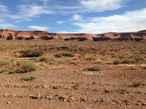
14 October 2020: Broke camp at Devils Kitchen in the morning and began the route to the next campsite at Bobby Jo meandering past some petroglyphs in a valley between the rock walls before heading into the heart of an area full of rock spires. A day of amazing landscapes and one little challenging bit of trail to keep it interesting …
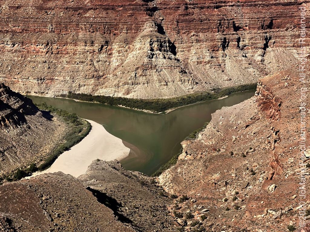
13 October 2020: Took some time to explore in the direction of the Confluence Overlook, which sits above the place where the Green and Colorado rivers meet. It was a fun drive to a hiking trailhead from where it was possible to climb up onto the top of the plateau and follow the trail to the edge of the canyon wall, where far below the rivers joined each other. The hike was a nice walk with a little scrambling. Back at camp in time for sunset and stayed up late watching the stars …
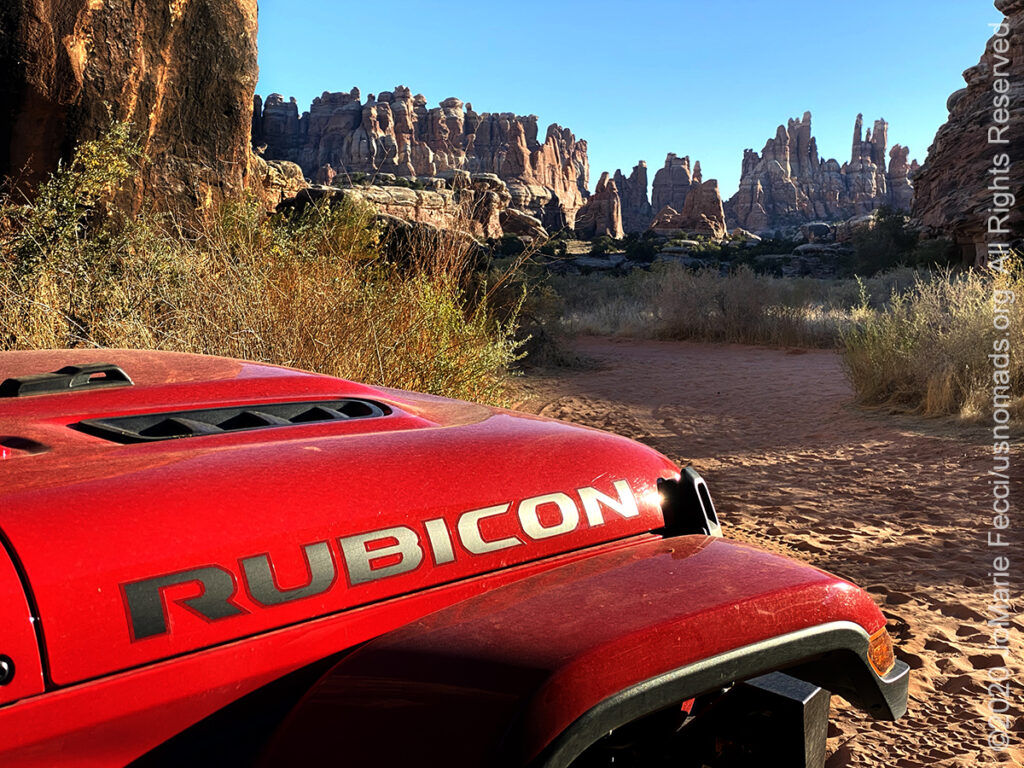
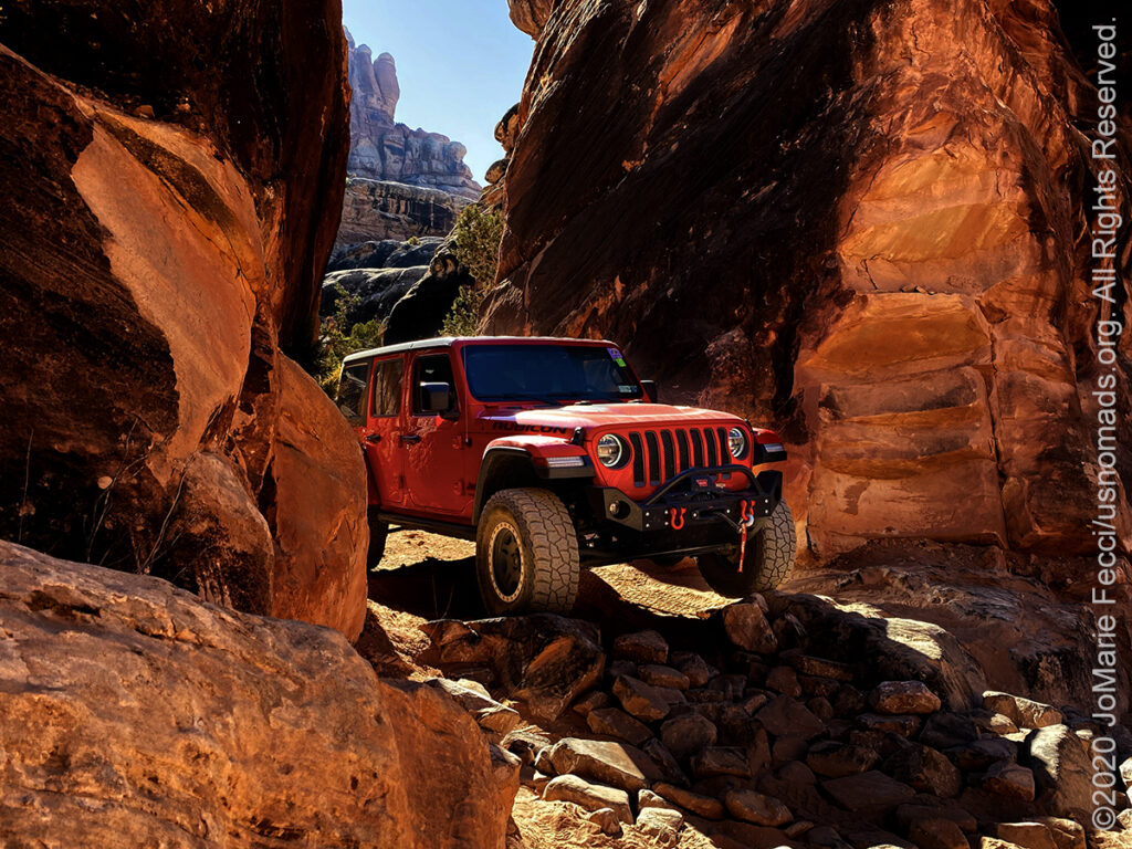
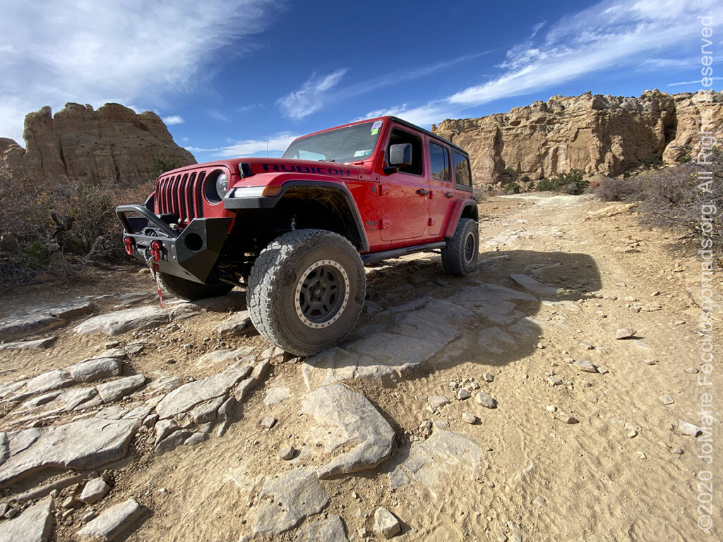
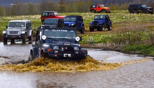
12 October 2020: Headed south of Moab and into the Needles District of Canyonlands National Park for the next several days. First time driving the famed “Elephant Hill” trail which was fun. On the way down had to rescue someone who was high-centered on a rock and alone without appropriate recovery gear. Set up camp for two nights at Devils Kitchen, tucked in between some rocks and enjoyed the sunset …
11 October 2020: Broke camp this morning and said “goodbye” to the San Rafael Swell and this playful region of the desert to return to town and resupply before the next segment of the journey into the Canyonlands…
10 October 2020: Set off on a route heading west-northwest to check out a few different rock art sites and generally explore a bit further, just enjoying the moment and the beauty of the desert. Plotted a course that included a drive through a culvert that runs under the I-70, a stop at an arch and an old log cabin in addition to some pictograph sites…
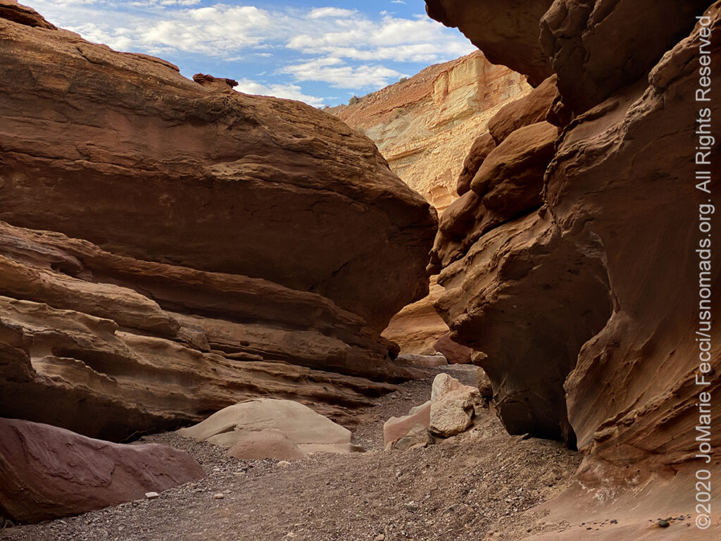
9 October 2020: Started off the day with a drive and a hike — really enjoyed exploring the Little Wildhorse Canyon trail, which includes an awesome narrow slot and just the right amount of scrambling to be fun but not “hard.” There is so much incredible beauty “hidden” out in this part of the desert, it is a bit like a fun navigational scavenger hunt …
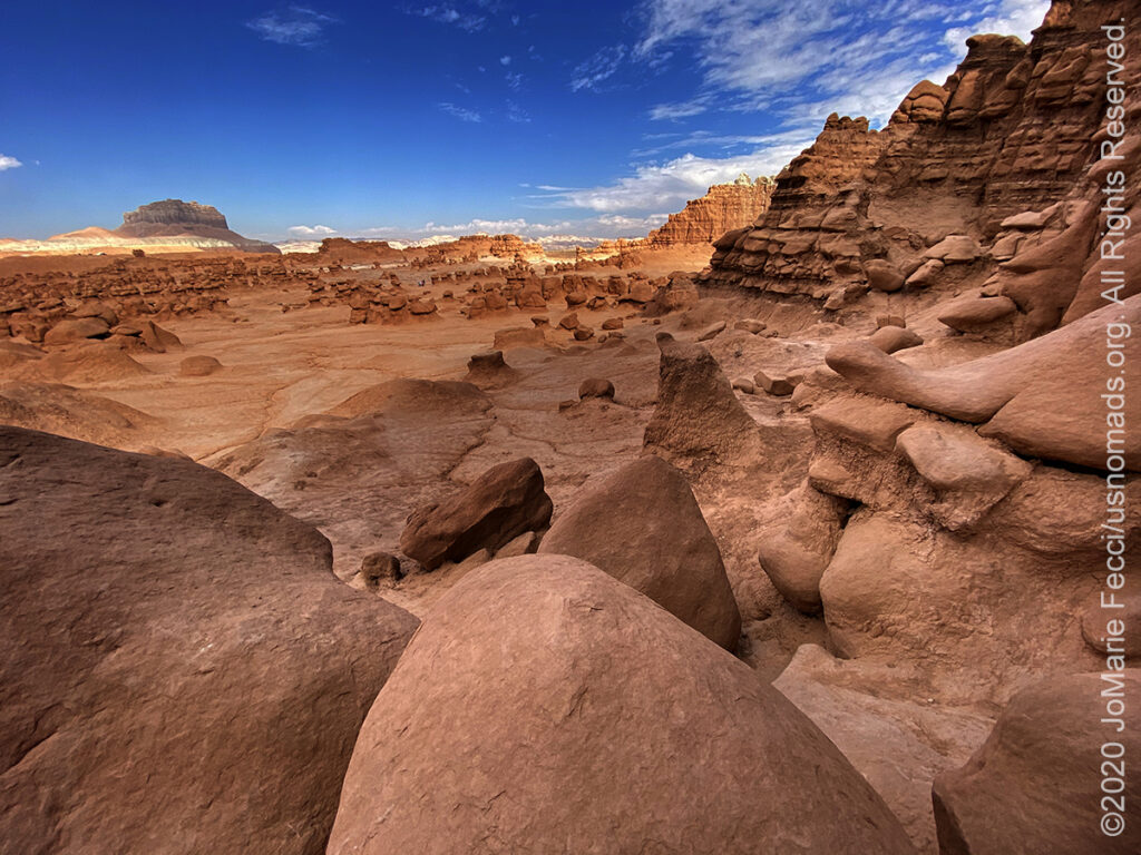
8 October 2020: Took some time to wander around the incredible landscape of Goblin Valley, heading off on foot among the “goblins”…
THIS MONTH:

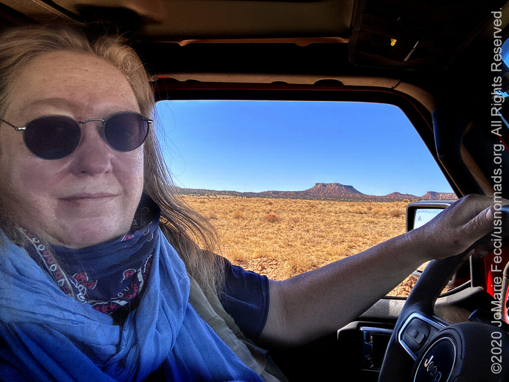
Hitting the road again to begin the next big U.S.A. Roadtrip to the west. For this journey we will be spending some time en route exploring a few of the wild places in between New York and Moab. We are making the long drive west into its own overland adventure with camping, hiking and off-road fun. The focus of this trip is to appreciate America’s wilderness and get to know some of the lesser known public lands along the way…
COMING UP SOON:
A new Moab adventure is in the works for October, details to come soon…

The 5th Annual 2020 Ladies Offroad Challenge started on May 4th. Ladies will participate in a series of challenge tasks that are built to educate and encourage stepping into some unknown territories. The Challenge goes on through October this year with participants striving to “Do the Best They Can” at each of the tasks. Ten Participants from the Challenge will be invited to the very special Top 10 Weekend hosted by Charlene Bower…

Looking ahead to a return to Paris as soon as possible to reconnect with friends and some favorite places in the city of light. Timing is still uncertain due to the pandemic, but we hope the trip is back on the calendar for late fall/early winter…
ABOUT THE SAN RAFAEL DESERT
Much of the area around the San Rafael Swell is remote and aside from Interstate (1-70), is mostly undeveloped with only old uranium mines, dirt roads and some simple recreation facilities. The BLM advises visitors to bring maps, as many roads are not signed. Motorized vehicle usage is limited or prohibited in certain areas (see the Emergency Road Closures for current information). Additionally, the BLM reminds those traveling in the desert of some basic safety precautions: Never camp or park your vehicle in a wash or stream bed and avoid hiking in narrow canyons when rain is a possibility. A dry wash can flash flood in a matter of minutes even if you don’t see a cloud in the sky. Many roads within the Swell cross soil types that are extremely muddy after storms and during periods when snow is melting. At such times, these roads become virtually impassable. Obtain a long-range weather forecast before traveling into the area. There are very few sources of potable water in the San Rafael Swell, so make sure to carry at least one gallon of water per person per day. Exercise extreme caution when exploring around old mines. Besides the danger of being caught in a collapsing tunnel or falling into a hidden shaft, heavy concentrations of radioactive radon gas are known to accumulate at the entrances to old uranium mines in this area. Note that no permits are required for individuals and small groups for non-commercial use. For more information contact the Bureau of Land Management’s Price Field Office at 435-636-3600.
GEOLOGY OF THE SAN RAFAEL SWELL
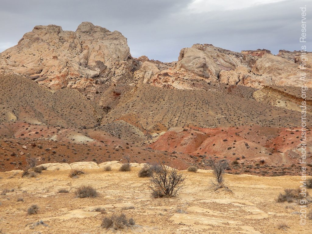
The story of the San Rafael Swell’s unique geology begins roughly 250 million years ago in the Permian period, when it was a seashore. Layers of sandstone were deposited as beach dunes piled up, forming Coconino Sandstone, a rough irregular stone with cross-hatching and variable hardness that forms small fins and ledges as it erodes. The Coconino was covered by a layer of limestone when the ocean overtook the shore. This Kaibab Limestone is a thin layer very resistant to erosion that forms the base of many of the flat open areas in the upper San Rafael.
As the ocean moved back and forth over the area, more layers of soft mud, mudstone, and sandstone were deposited. Then, in the late Triassic Period (roughly 200 million years ago), western Utah rose up out of the ocean, high above sea level, while the eastern side remained flat. The breakpoint was along a weak spot in the crust known as the “Wasatch Line.” During this transition a variable layer of sandstone and mudstone formed, called the Chinle Formation (the Chinle Formation is the site of uranium and radium deposits). As eastern Utah dried out it formed a desert of shifting sand dunes. First came the Wingate Sandstone, which forms towering cliffs, followed by Kayenta Sandstone, which created erosion-resistant layers protecting the Wingate cliffs below it, and finally, at the start of the Jurassic Period desert dunes formed Navajo Sandstone. But the dunes soon gave way to a wet floodplain, as a narrow finger of ocean intruded north-to-south creating the Carmel Formation along the border between the western highlands and the eastern plain. Interestingly, many of the later Jurassic period rock layers that are familiar in the Moab area, are NOT found in the eastern San Rafael.Geologists theorize that a pool of upwelling magma that didn’t quite make it to the surface pushed the rock layers of the San Rafael upwards like a giant blister. The steep eastern slope of the uplifted area is exposed on the east flank of the San Rafael Swell, and is called the San Rafael Reef. This upsloping Navajo Sandstone forms an impressive shark-tooth line of steep sandstone. The western slope of the Swell is more gradual, eroding into canyons, spires, and castles. When the Great Basin fell and stretched away from the Colorado Plateau (this plateau includes the San Rafael and Moab areas) during the Tertiary period about 65 million years ago, erosion began to wash the rock layers away. Once the Cretaceous Period deposits were eroded, the original uplifted region broke the surface again. As the “blister” broke, the reef edge was exposed. Some highlands were protected by hard underlying rock layers, forming large flat areas. Deep gorges were cut through the harder rock as water drained from the uplifted areas. Where a small bit of hard rock was spared in a higher layer, castles and spires were left standing across a dynamic and varied landscape of open vistas, cliffs and deep gorges that define the San Rafael today. (For more details see the full explanation by UtahMountainBiking.com)
Nesconset | Paris | Belgrade | Howard | Toledo | Silver Lake | Chesterton | Prairie City | Grand Island | Halsey | Gering | Buford | Hayden | Grand Junction | Moab
MORE NOTES FROM THE ROAD:
1-7 October – Roadtrip West
16-30 September – Roadtrip West
1-15 September – Long Island
16-31 August – Long Island
1-15 August – Summer Roadtrip
22-31 July – Summer Roadtrip
14-21 July – Summer Roadtrip
1-13 July – Long Island
16-30 June – Long Island
1-15 June – Bald Eagle
16-31 May – Central PA
1-15 May – Re-opening Trails
April – Lockdown NY
16-31 March – Lockdown NY
9-15 March – Roadtrip Home
1-8 March – Moab
23-29 February – Vegas to Anza Borrego
15-22 February – Southwest Roadtrip
8-14 February – Southwest Roadtrip
1-7 February – Glamis to Vegas
27-31 January – Yuma to Glamis
15-26 January – Nevada to Arizona
1-14 January – Starting the New Year
24-31 December – Holidays on the Road
16-23 December – Cross-Country Drive
9-15 December – New York
1-8 December – Paris
16-30 November – Paris & Rennes
1-15 November – New York
Archive
EVENTS
LADIES OFFROAD NETWORK NONCON 2020
Recap from the Ladies Offroad Network camping and wheeling event, dubbed the “NonCon” as in “not the convention,” that came together after the official convention was cancelled due to the pandemic… [read]
RE-OPENING
Report from the first trail run with the Off Road Consulting group at Rausch Creek Off Road Park as the post-pandemic phased re-openings begin in Pennsylvania and some of our favorite local trails re-open to the public after the two-month shutdown… [read]
REFLECTIONS

EGYPT: CAIRO REFLECTIONS
A quick overview of impressions from a stop in Cairo during our recent scouting mission in Egypt and Sudan … [read]
SPECIAL REPORT

A look into south-eastern Algeria on the border with Libya and Niger: overlanding with the Tuareg in one of the most remote corners of the Sahara … [read]