
< more recent | 25-31 October 2021 | older >
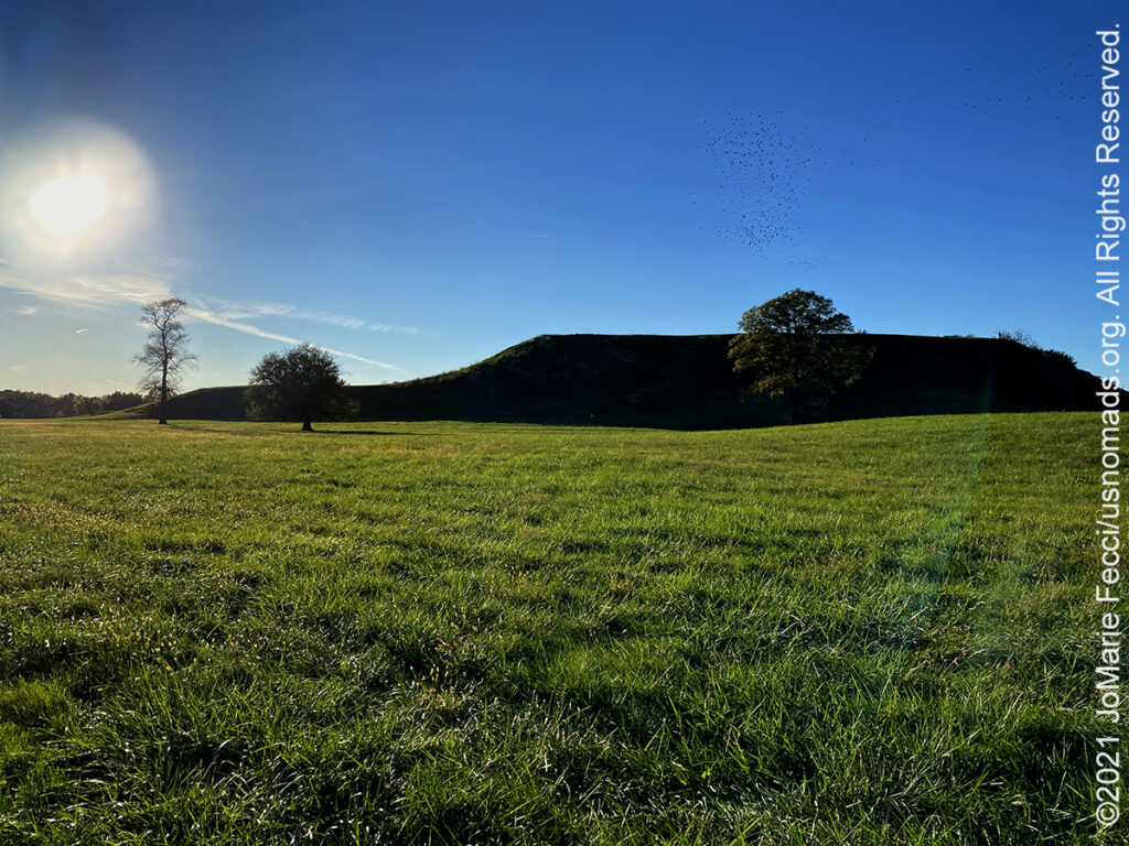
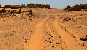
31 October 2021: Stopped for a brief visit at the Cahokia Mounds State Historic Site which preserves the dramatic earthworks of an indigenous culture that once flourished along the Mississippi River. On first glance the nicely manicured grass landscape resembles a golf course with carefully designed hills and dips, but approaching closer the enormity of the site reveals itself to be a city of earthenwork step pyramids surrounded by lesser structures, all incongruously covered in a layer of bright green grass. The fact that the site exists just on the edge of the city of St. Louis is itself an interesting detail, hinting at how long this area has been an important civilization center. There was a great deal of information about artifacts and archaeology available at the Visitor Center, but the most impactful part of the visit was walking the ancient alleyways and climbing up to the top of a pyramid I had never known existed until today…
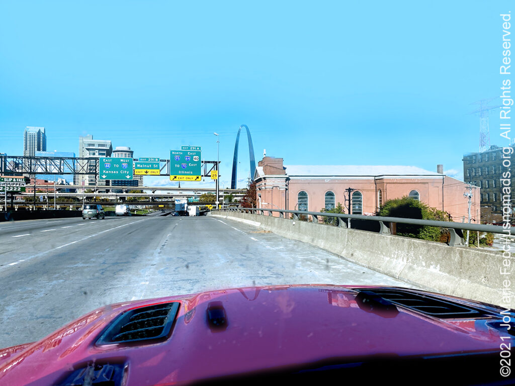
31 October 2021: The skies were slightly overcast as we left Joplin MO, saying goodbye to Route 66, and picking up the Interstate for speed, with a goal of making up as much mileage as possible in the drive-day. The landscapes scrolling through the windshield soon changed from farms to eastern woodlands that were beginning to show signs of fall color and I am not sure when the midwest gave way to the east, but I think that it was about the time the St. Louis Archway came into view and a familiar eastern-style urban city appeared with red brick buildings and the steel frames of the elevated subways. After crossing the Mississippi I stopped at the Caholia Mounds site for a walk and a bit of history, before continuing as far east as Terre Haute IN…
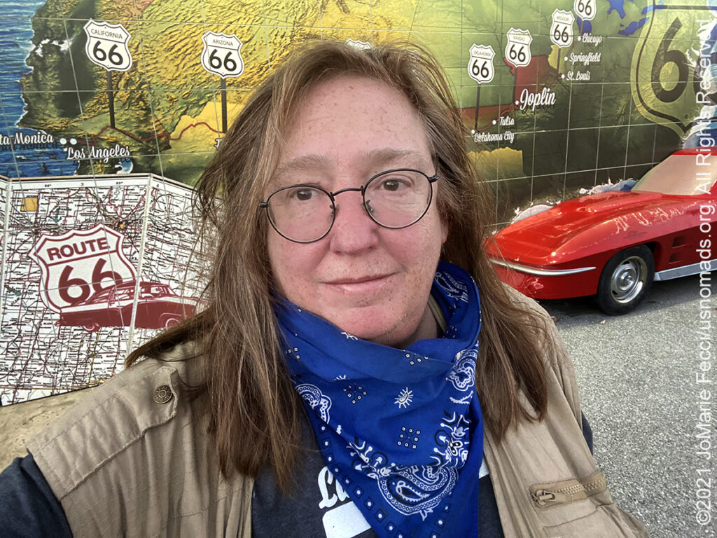
30 October 2021: Took a little time to explore a strip of Route 66 in the city of Joplin, pausing for dinner at a local hot spot, then wandering along the main street which IS historic route 66 for several blocks. There were a few roadtrip themed murals and a park set up just for mother road travellers to take selfies, so I obliged with a quick selfie of my own…
30 October 2021: Broke camp slowly this morning, then made a last visit to the Prairie Dogs before leaving the Witchita Mountains National Wildlife Reserve and turning north towards home. Somewhere around Oklahoma City the landscape transitioned from “western” to “eastern” with more greens and less earthtones, but the change was hidden somewhat because the area had many large farms that seemed to disguise the “divide.” Crossed the whole state of Oklahoma and into Missouri where I stopped for the night in the town of Joplin…
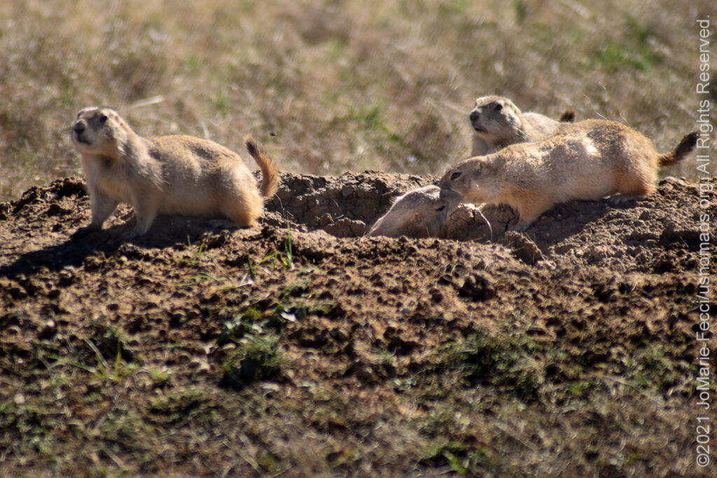
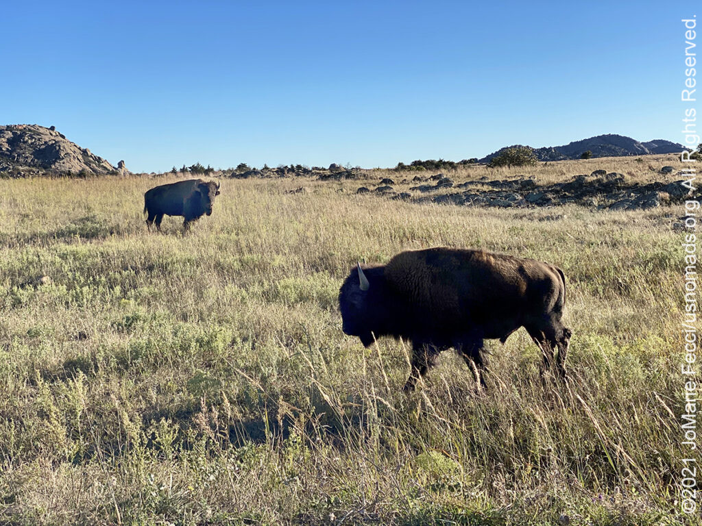
29 October 2021: Entering the Witchita Mountains National Wildlife Refuge from the west, I came upon some buffaloes grazing freely along the side of the road and was happy to see them. I made some photos as they moved slowly, then crossed the road and stood in my way until a vehicle coming in the other direction disturbed them. Beyond the buffalo I came to the Prairie Dog Town, my favorite spot in the refuge. I made a long stop there and got out and sat on a rock for a while just observing the curiosity of the little animals, as they first ran and hid in their holes, then slowly popped back up to explore once they knew it was safe. I made some photos with them then headed to the campground where I had finally secured a tent campsite (the tent camping had been blocked since covid started even though RV camping had been permitted during the last several months — tent camping was only opened back up recently, and I was able to book a site online prior to arriving, as there was no “walk up” camping allowed). My site was in a great spot near a river with lots of space an plenty of privacy and I set up, got a fire started and enjoyed the evening under the stars listening to a coyote chorus…
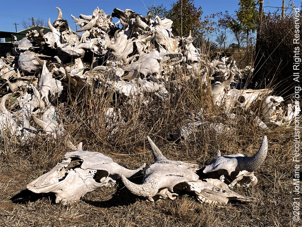
29 October 2021: Leaving Amarillo in the morning I headed southeast into the heart of ranching country. Along the way I passed through the town of Goodnight, named for a famous Texas rancher, Charles Goodnight, who had discovered the Palo Duro Canyon and who founded the “Goodnight Loving” cattle trail. I stopped at the Charles and Mary Ann Goodnight Ranch State Historic Site to see if there was something interesting to learn, and in fact I learned that Goodnight was also responsible for saving the Buffalo! He and his wife put together a herd during the time when the buffalo were disappearing in America, and they protected and nurtured the herd, eventually leading to herds in places like Yellowstone National Park and the Witchita Mountains National Wildlife Refuge. As I left the ranch site, I came across a bizarre pile of cow heads that I can only imagine were left there to “bleach” so they can be sold as souvenirs eventually. But the pile of skulls was odd and I made some photos before continuing my journey. I stopped again in Hollis OK, which is something of an “almost ghost” town that I had visited previously. It was interesting to see that this time there was some kind of activity around the harvest of massive bales of cotton, and I realized for the first time that cotton crops were a “thing” in this region. I saw many more fields of cotton on my way to the Witchita Mountains NWR and I couldn’t help thinking of the song “Summertime”, with the lyric “… summertime and the living is easy, fish are jumping and the cotton is high…” In fact the song lyric stayed in my head all the way into the refugee, until I saw the first buffalo, and them my mental song book switched to “Buffalo Soldiers”…
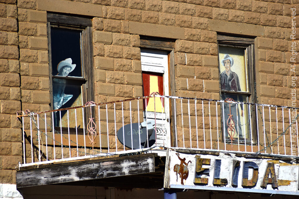
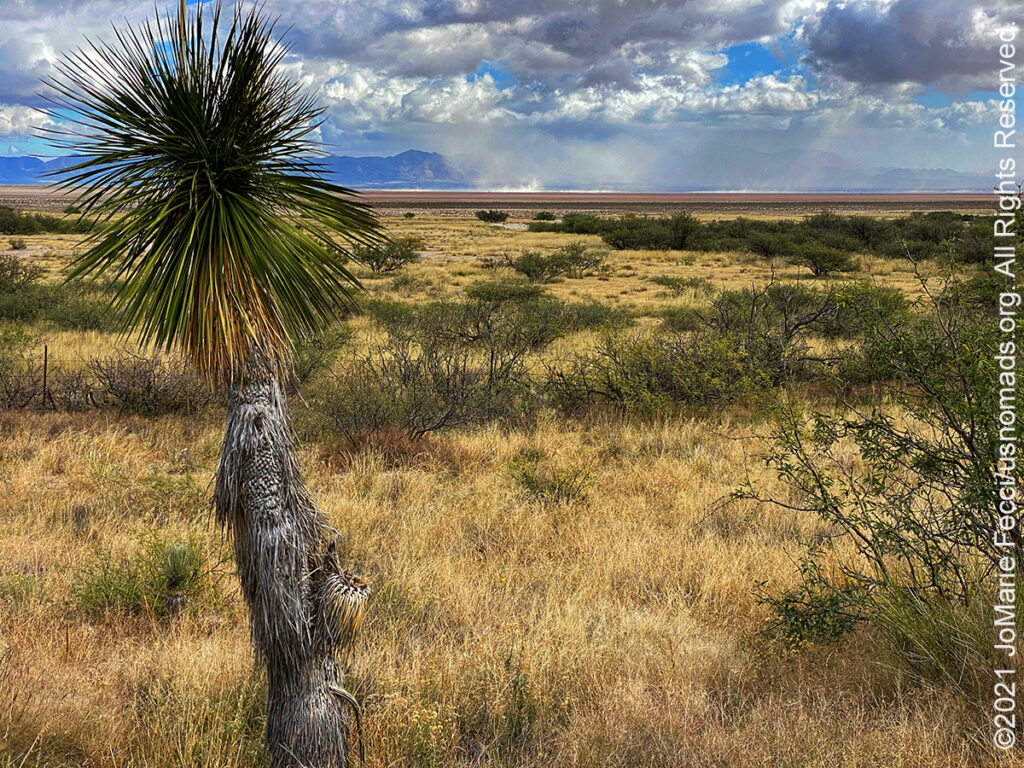
28 October 2021: Driving into the town of Elida NM was like stepping into the twilight zone. A modern town hall and up-to-date children’s playground in a well manicured park were surrounded by abandoned buildings and boarded up storefronts and there were no people anywhere. It was a strange mix and an eerie ghosttown ambiance that wasn’t exactly a “ghost” town, but was in the final stages on the verge of becoming one. In one of the abandoned storefronts there was a note pinned to the door thanking someone for her work on behalf of revitalizing the downtown, and it was dated 2010 — so it looks like maybe around 2010 they had a last ditch effort to revive their town center, which accounts for the relatively nice looking building facades though they are all shuttered and empty. The government buildings at the center of the town square looked like they were definitely still in use, even though there was only one car in the parking lot. The park playground was well maintained even if it was empty, as if they town was still trying its best. After wandering around for a while looking for answers I got back on the road, still completely clueless as to what happened to the town… …
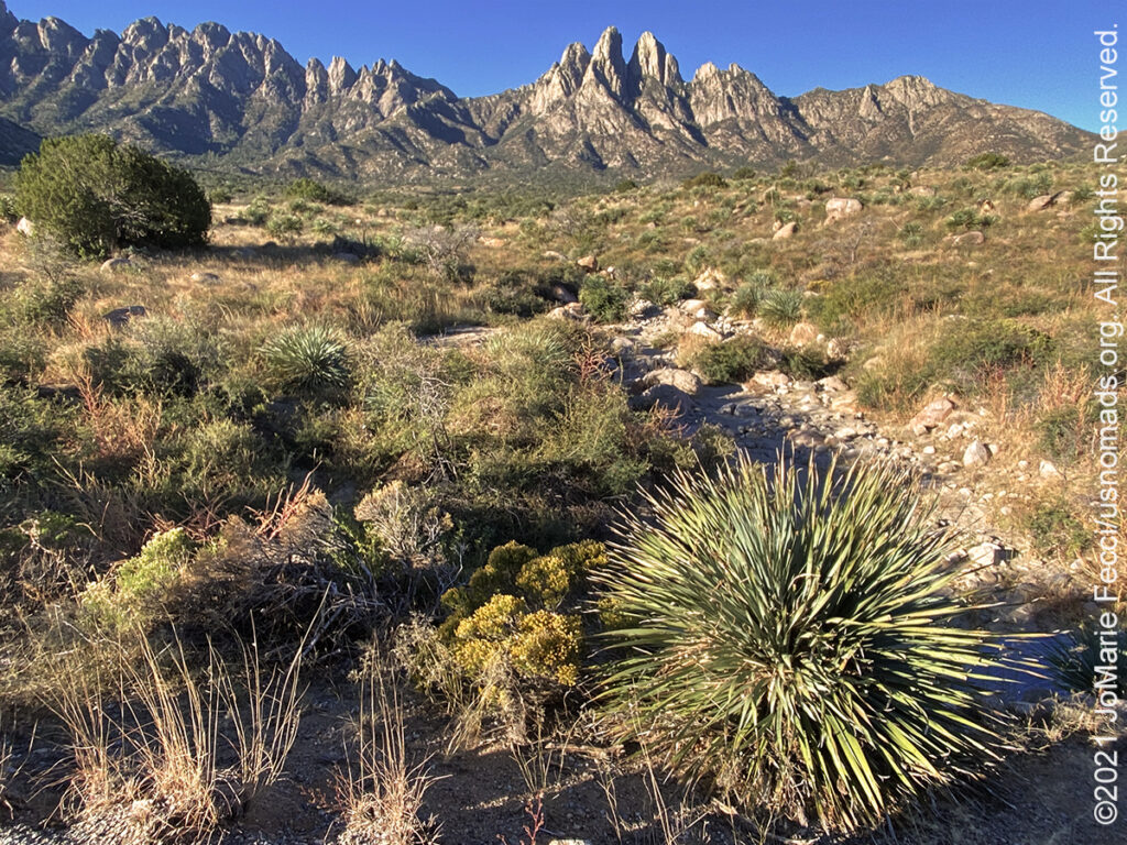
28 October 2021: Broke camp at Aguirre Springs in the morning, glad that the wind had died down a little bit. The overlook at my campsite was beautiful and the sun on my back warmed my soul as I packed up the Jeep and began the journey down the winding mountain road on the edge of the artillery range fence. The White Sands Missle Base could be seen down below, a densely packed collage of buildings in the great emptiness of the surrounding desert. A few planes were flying above and there was also some kind of drone at one point, but I saw no actual firing range activity as I made the drive back to White Sands, where I paused again to visit the edge of the dune field before driving on to Alomogordo and turning towards Texas. After an unplanned stop to explore the “almost ghost” I continued the rest of the way to Amarillo arriving just after sunset at the Big Texan Steakhouse where I planned to have dinner and stay in their “motel” for the night …
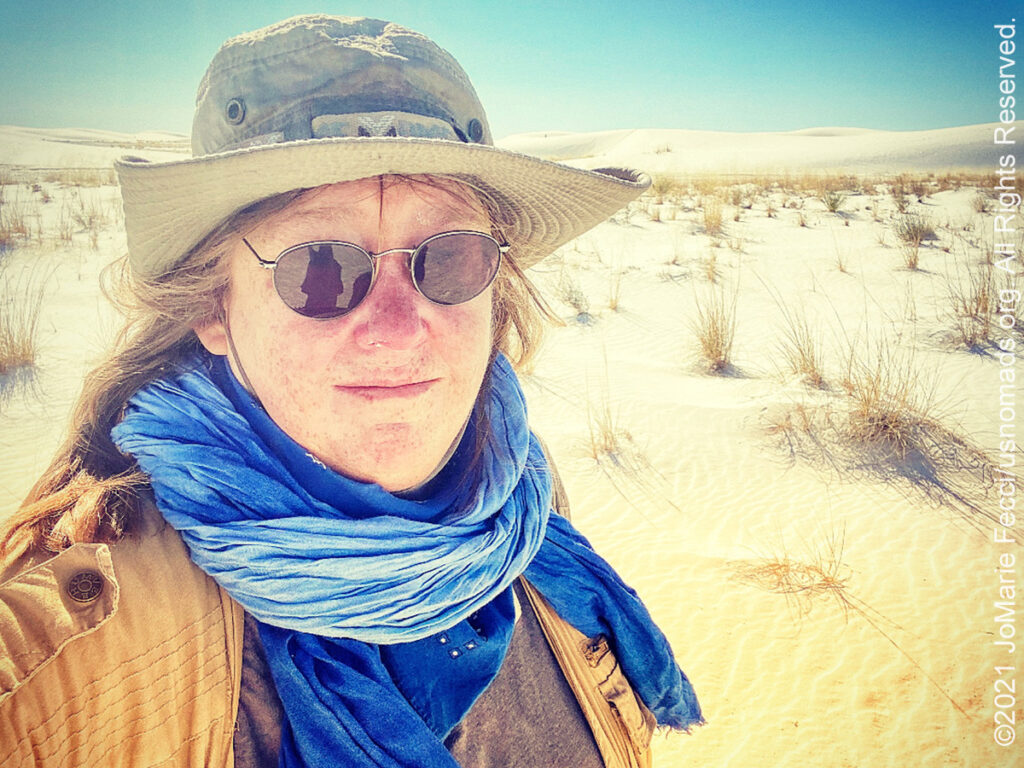
27 October 2021: I made my way out to the White Sands National Park first thing in the morning, hoping to catch some of the beautiful morning light on the dunes. The park sit in the middle of the White Sands Missile Range, an area of vast empty desert between two sets of mountains and the towns of Las Cruces and Alamogordo. Signage everywhere made it clear that it was the middle of an active military base, and then crossing the invisible line of the park boundary it was public land and open to exploration. Coming from Las Cruces, the dunes did not look very imposing on the approach from the highway, and they were partly covered in heavy vegetation making them seem more like beach sand dunes than desert sand dunes on first glance. The park was just opening when I got there, and I headed for the furthest spot along the dunes drive, which is a loop out into the taller dunes. Here I found my desert landscape and set off on foot for a brief wander to make photos. I surprised myself, continuing to wander deeper into the dunefield, climbing up to the very top of the tall dunes, eventually taking off my shoes to walk barefoot in the sand. I approached the dunes looking for “lines” as if I was driving them, climbing up from the least steep park and walking along the ridges and crests, then finding the easiest way down into the corridors between them. In this way I made progress deeper into the dunes, closer to what looked like a perfect pyramid shaped dune surrounded by other dunes with the mountains in the distance. I stopped when I was able to make a good photograph of it, and eventually returned back the way I’d came using distant mountains as guides pointing the way back to my Jeep. In the afternoon I drove back towards Las Cruces to Aguirre Springs to find a camp site on an overlook on top of a mountain, and it was perfect, if a bit windy …
26 October 2021: The drive from Tucson to Las Cruces was a slow transition from the sonoran desert to the chihuahuan desert, with the saguaros gradually disappearing, and a subtle change in the visual appearance of the desert landscape. As I drove the wind began to pick up and by the time I reached Las Cruces it was blowing between 50 and 70 mph, and I made a quick decision to not attempt to camp or go to the dunes, but rather to shelter in a hotel in town until the wind eases up, as it is forecast to do tomorrow …
<
25 October 2021: I left the Ladies Offroad Network HQ late in the morning after getting new tires for the Jeep and headed south from Phoenix towards Tucson. Arriving in the late afternoon I headed to the western district of the Saguaro National Park. It was my first time visiting this side of the park, and I had planned to go check out some petroglyphs, but when I got there the sun was already beginning to set, so I just enjoyed the sunset and made some photographs, leaving the petroglyph visit for another time …
THIS MONTH:

On the road heading back east, taking the slow road from Arizona to New York with a few fun detours along the way…
COMING UP SOON:

Every Day Is a Clean Up Day in 2021. Ladies Offroad Network has partnered with TreadLightly! to create a year-long program that encourages members to pick up trash on the trails whenever they are out off-roading. Participants simply pick up the trash, weigh it, take a photo, and log the location and time it took, then upload the details. At the end of the year there will be a series of prizes based on pounds of trash removed from the trails as well as participation in other TreadLightly! initiatives. This is a great way to do some good on a local level and make a larger impact via the national program…

Return to Paris for a few weeks to connect with friends and favorite places, with a bit of urban exploration in between. Looking forward to familiar locales and fun times in the city of light once again…
![]()
Advanced sand dune training with Barlow Adventures at the Imperial Sand Dunes in southern California. This three day driving and navigation program focuses on moving safely and effectively through large dunefields. Skills-building exercises are intended to improve pace, line choice and vehicle control, as well as developing precision map and compass navigation technique…

Trail Guiding for the California 4-Wheel Drive Association’s second annual Death Valley Experience fundraiser event running in March. Each day will feature a choice of runs to some famous, some infamous and some secretive points of interest within Death Valley National Park. The runs will depart from Furnace Creek and from Stovepipe Wells. Some of the points of interest we will visit during Death Valley Experience 2021 include Zabriskie Point (famous), Barker Ranch (infamous) and the Racetrack (learn the secret of the moving rocks). Other points of interest include Dante’s View, 20 Mule Team Canyon, Artists’ Drive, Chloride Cliffs, Aguereberry Point, Skidoo, Titus Canyon, and Darwin Falls. All of the trail runs are suitable for novice drivers and SUVs with high clearance and 4-wheel drive…
![]()
Stay tuned for a new kind of exciting adventure coming up in Summer 2022. Details will be released early next year…
ABOUT THE 100TH MERIDIAN
The meridian 100° west of the Prime Meridian of Greenwich is a line of longitude that extends from the North Pole across the Arctic Ocean, North America, the Pacific Ocean, the Southern Ocean, and Antarctica to the South Pole. In the United States, this meridian roughly marks the boundary between the semi-arid climate in the west and the humid continental and humid subtropical climates in the east and is used as shorthand to refer to that arid-humid boundary. It forms the eastern border of the Texas panhandle with Oklahoma and Dodge City, Kansas lies exactly at the intersection of the Arkansas River and the 100th meridian. Historically the meridian has often been taken as a rough boundary between the eastern and western United States, and the 100th meridian has traditionally been considered “where the great plains begin.” In 1878 John Wesley Powell first advanced the idea that the climatic boundary between the United States’ humid East and arid West lay along this line. While the 100th meridian is still considered a climatic boundary line today, that will likely change in the coming decades as the 51-centimeter rainfall line is gradually moving east due to climate change, according to recent research…
ABOUT PRAIRIE DOGS
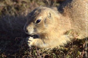
Prairie dogs are a type of ground squirrel native to the grasslands of North America. The five species are: black-tailed, white-tailed, Gunnison’s, Utah, and Mexican prairie dogs. In the United States, they range primarily to the west of the Mississippi River, mainly at altitudes ranging from 2,000 to 10,000 ft above sea level. Prairie dogs are considered a keystone species with their mounds often being used by other species. Their mound-building encourages grass development and renewal of topsoil, with rich mineral, and nutrient renewal in the soil which can be crucial for soil quality and agriculture. They are extremely important in the foodchain, being important to the diet of many animals such as the black-footed ferret, swift fox, golden eagle, red tailed hawk, American badger, and coyote. Other species, such as the golden-mantled ground squirrel, mountain plover, and the burrowing owl, also rely on prairie dog burrows for nesting areas. Grazing species, such as plains bison, pronghorn, and mule deer have shown a proclivity for grazing on the same land used by prairie dogs. Prairie dogs have some of the most complex systems of communication and social structures in the animal kingdom. The prairie dog habitat has been affected by direct removal by farmers, as well as the more obvious encroachment of urban development, which has greatly reduced their populations. The removal of prairie dogs “causes undesirable spread of brush”, the costs of which to livestock range and soil quality often outweighs the benefits of removal. The prairie dog is protected in many areas to maintain local populations and ensure natural ecosystems and that they are not harmed. Highly social, prairie dogs live in large colonies or “towns.” A prairie dog town may contain 15–26 family groups. The family group is the most basic units of its society. Members of a family group inhabit the same territory. Members of a family group interact through oral contact or “kissing” and grooming one another. They do not perform these behaviors with prairie dogs from other family groups…
THE GOODNIGHT RANCH
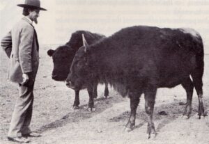
The Charles and Mary Ann Goodnight Ranch State Historic Site offers some insights into the Texas ranching heritage, focusing on the role Goodnight played in the establishment of the cattle business in the Texas panhandle. Charles Goodnight is known as the father of the Texas Panhandle. He helped established the Goodnight-Loving Trail, invented the chuck wagon, founded the JA Ranch in Palo Duro Canyon, and thanks to wife, saved the Southern Plains bison. Goodnight established the first cattle ranch here in 1877 near Palo Duro Canyon. Ten years later, he created the Goodnight-Thayer Cattle Company and built a spacious Victorian-style two-story ranch house which now hosts the museum. The museum contains a wealth of information about the rancher and his family, but also documents the history of the preservation of a near-extinct bison herd that would become the forebearers of many of the managed herds in the USA today. The Goodnight Bison Herd is the only southern bison herd to survive intact from the days of annihilation. Millions of bison roamed the central plains of North America until they were almost entirely wiped out by commercial hunters in the 1870s. Charles and Mary Ann helped save the animals from extinction by raising some orphaned buffalo calves on their land, then breeding them to recover a large herd of 200. The Goodnights donated some of their buffalos to other buffalo conservation herds including the ones at Yellowstone National Park and the New York Zoological Park. Goodnight buffalo have also been placed in Canada, Germany, Nevada, New Hampshire, Kansas, Oklahoma, Texas, Montana, New Mexico and New York …
WHITE SANDS NATIONAL PARK
White Sands National Park rises up from the heart of the Tularosa Basin. Great wave-like dunes of gypsum sand engulf 275 square miles of desert. The glistening white sand dunefield is one of the world’s great natural wonders, and White Sands National Park preserves a major portion of the world’s largest gypsum dunefield, protecting the plants and animals that live there. This gypsum dunefield has a depth of about 30 feet, dunes as tall as 60 feet, and about 4.5 billion short tons of gypsum sand. The Park is completely surrounded by the White Sands Missile Range. It is the most visited NPS site in New Mexico, with about 600,000 visitors each year. The park features a drive from the visitor center to the heart of the dunes, picnic areas, backcountry campground in the dunefield, marked hiking trails, and sledding on the dunes. The landscape was created approximately 12,000 years ago, when the land within the Tularosa Basin featured large lakes, streams, grasslands, and Ice Age mammals. As the climate warmed, rain and snowmelt dissolved gypsum from the surrounding mountains and carried it into the basin. Further warming and drying caused the lakes to evaporate and form selenite crystals. Strong winds then broke up crystals and transported them eastward. A similar process continues to produce gypsum sand today …
SAGUARO NATIONAL PARK
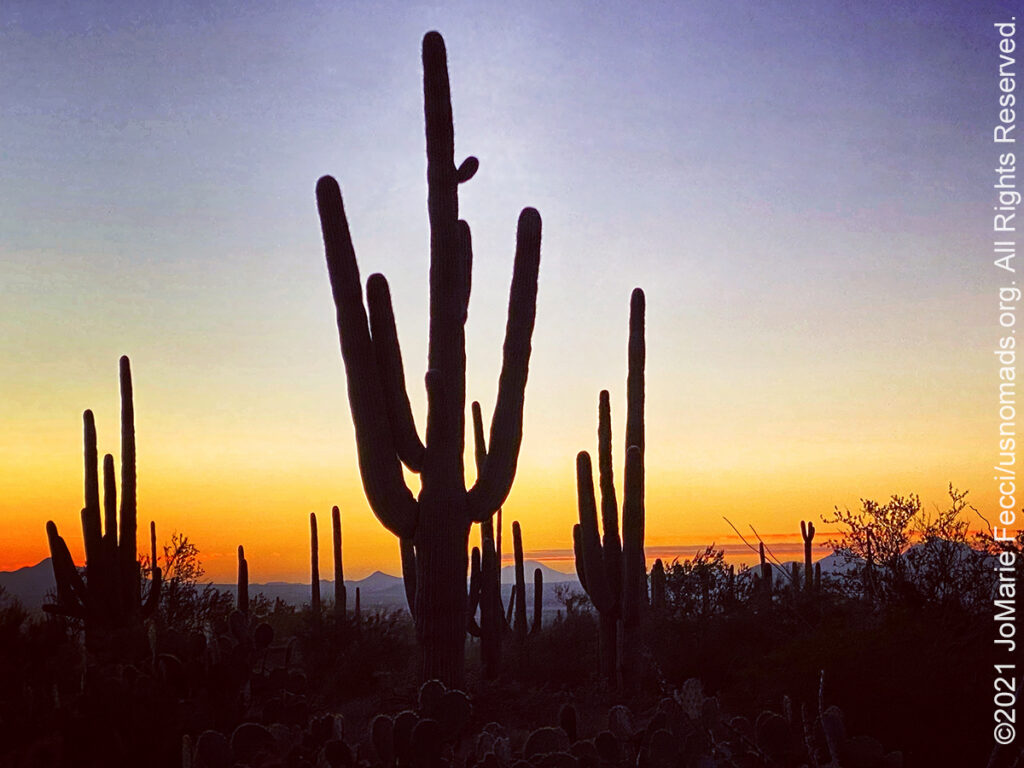
The Saguaro National Park near Tucson AZ includes 92,000 acres across two separate areas–the Tucson Mountain District about 10 miles west of the city and the Rincon Mountain District about 10 miles to the east. The park’s mission is to preserve Sonoran Desert landscapes, fauna, and flora, including the giant saguaro cactus that is the universal symbol of the American west. These majestic plants are only found in a small portion of the United States, and thrive in the area around the modern city of Tucson. Popular activities in the park include hiking on its 165 miles of trails and sightseeing along paved roads near its two visitor centers. Both districts allow bicycling and horseback riding on selected roads and trails. The Rincon Mountain District offers limited wilderness camping, but there is no overnight camping in the Tucson Mountain District. The two districts have very different landscapes, though both feature the namesake cactus. The volcanic rocks on the surface of the Tucson Mountain District differ greatly from the surface rocks of the Rincon Mountain District; over the past 30 million years, crustal stretching displaced rocks from beneath the Tucson Mountains of the Tucson Mountain District to form the Rincon Mountains of the Rincon Mountain District. Uplifted, domed, and eroded, the Rincon Mountains are significantly higher and wetter than the Tucson Mountains. The Rincons, as one of the Madrean Sky Islands between the southern Rocky Mountains and the Sierra Madre Oriental in Mexico, support high biodiversity and are home to many plants and animals that do not live in the Tucson Mountain District. The earliest known residents of the land in and around what later became Saguaro National Park were the Hohokam, who lived there in villages between 200 and 1450 A.D. Petroglyphs and bits of broken pottery are among Hohokam artifacts found in the park …

MORE NOTES FROM THE ROAD:
17-24 October – LON Top Ten
7-16 October – Rebelle Rally
1-6 October – Rebelle Training
24-30 September – Rebelle Training
16-23 September – Roadtrip West
1-15 September – CT Training
August – Paris
July – LI & CT
June – LI & VA
16-31 May – Long Island
8-15 May – Return to NY
1-7 May – Southeast Utah
23-30 April – LON Bogi’s & 5+
16-22 April – LON Navigation
8-15 April – Sedona
1-7 April – Nevada
16-31 March – New York
8-15 March – Death Valley
1-7 March – Arizona
22-28 Februay – Alabama Hills
15-21 Februay – Mojave Road
8-14 Februay – Death Valley
1-7 Februay – Glamis
15-31 January – Roadtrip Southwest
1-14 January – Long Island
22-31 December – Holiday Roadtrip
15-21 December – Holiday Roadtrip
7-14 December – Holiday Roadtrip
1-6 December – Long Island
15-30 November – Long Island
1-14 November – Long Island
28-31 October – Roadtrip East
Archive
SPECIAL REPORT
All about exploring ghost towns and abandoned places in the USA and beyond, with tips, and information on the many different types of sites to be found across the globe, including detailed guides for eight specific sites… [read]
RE-OPENING
Report from the first trail run with the Off Road Consulting group at Rausch Creek Off Road Park as the post-pandemic phased re-openings begin in Pennsylvania and some of our favorite local trails re-open to the public after the two-month shutdown… [read]
REFLECTIONS

EGYPT: CAIRO REFLECTIONS
A quick overview of impressions from a stop in Cairo during our recent scouting mission in Egypt and Sudan … [read]
SPECIAL REPORT

A look into south-eastern Algeria on the border with Libya and Niger: overlanding with the Tuareg in one of the most remote corners of the Sahara … [read]