
< more recent | 16-30 June 2022 | older >
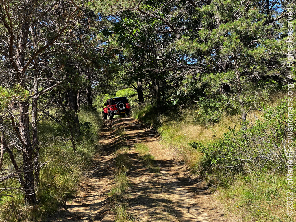
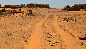
30 June 2022: The Over Sand Vehicle route was closed at Cape Cod National Seashore due to nesting birds so we were not able to really get out on the beach sand as we had hoped. Instead we explored a few quiet dirt roads behind the wilderness area and took a walk on some accessible dunes…
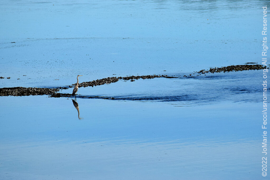
29 June 2022: Left Maine today and made a very long drive under a very hot sun all the way to Cape Cod National Seashore. We hardly had time to stop anywhere en route, but did manage to make a photo stop while in the wetlands before getting on the highway …
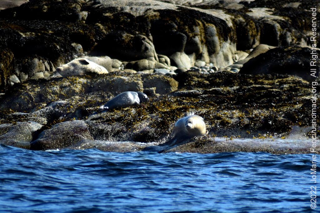
28 June 2022: We got out into the harbor on a boat today and had a chance to explore the area from a different perspective. We learned a lot about the lobster trapping culture and how the local lobstermen are working to prevent over-harvesting. And we got to see some of the seals that live in this ecosystem from a distance…
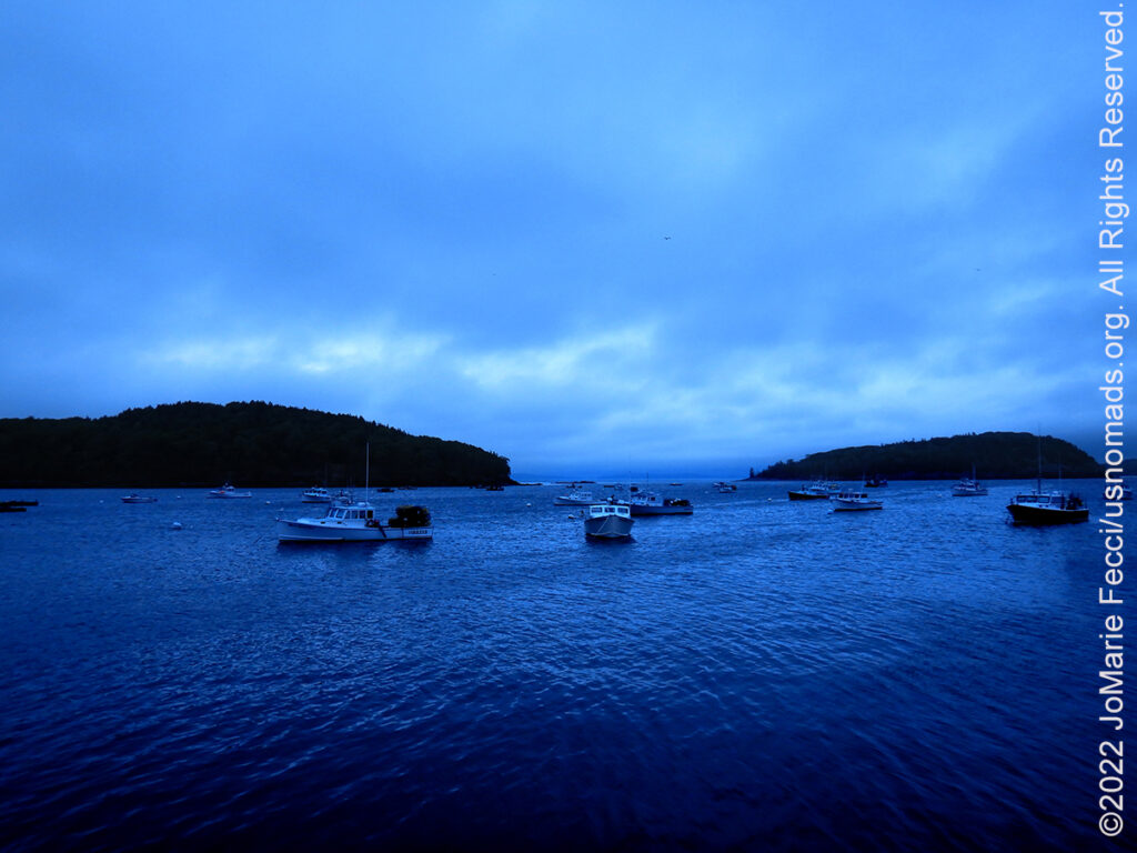
27 June 2022: It was a very stormy day today, and we had to adapt our plans to the situation. When it stopped coming down heavily, we were able to get out a little bit, and the unsettled weather made for interesting light…
26 June 2022: We set up our camp at the Schoodic Woods campground on the less-crowded side of the park, then set out to explore the Schoodic Peninsula and caught an amazing sunset on the rocky coast before coming back to camp and getting the fire going for dinner…
25 June 2022: Left the Covered Bridge campground this morning and started a long drive day heading east towards Bar Harbor Maine and the Acadia National Park. …
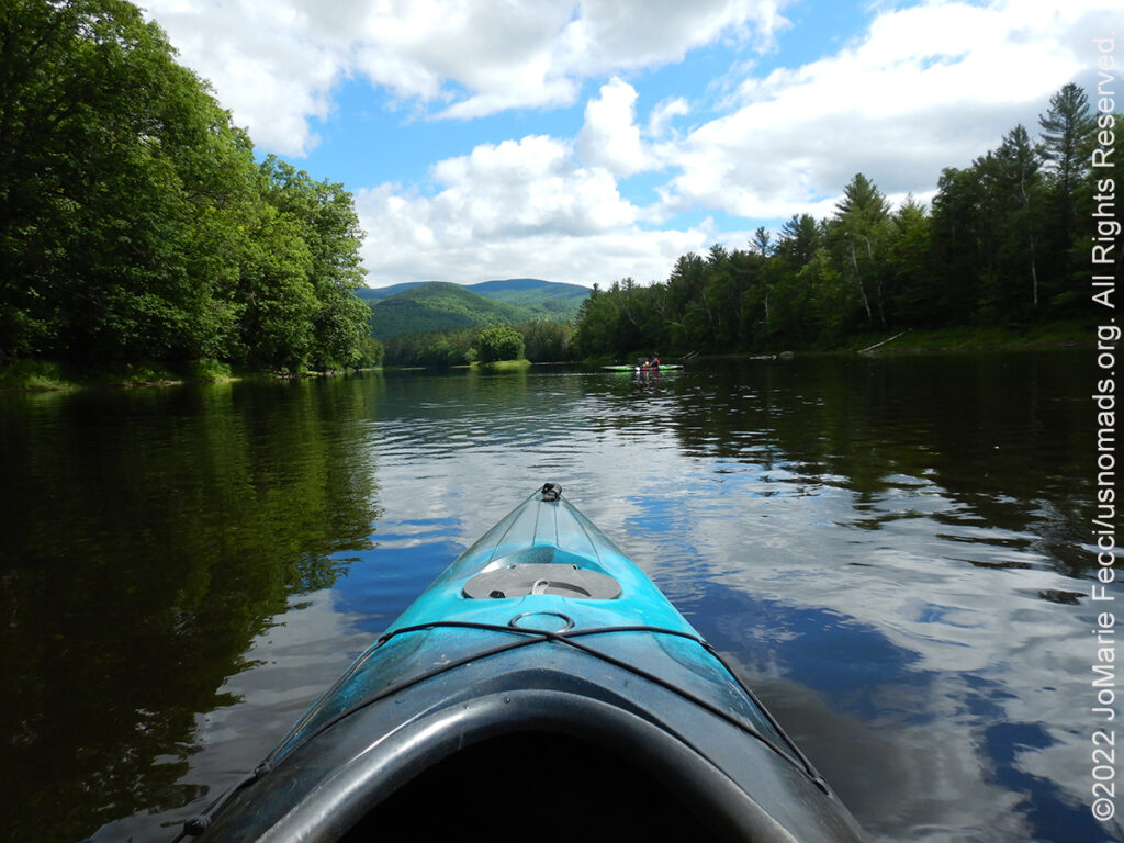
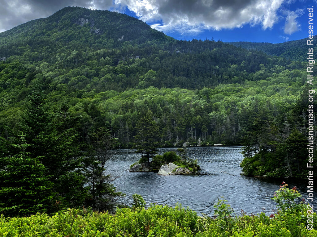
24 June 2022: Busy day outdoors today, but still haven’t seen a moose! In the morning we did some mellow kayaking along the Androscoggin River, then drove up to the summit of Mount Washington, stopping to explore the incredible landscapes in between…
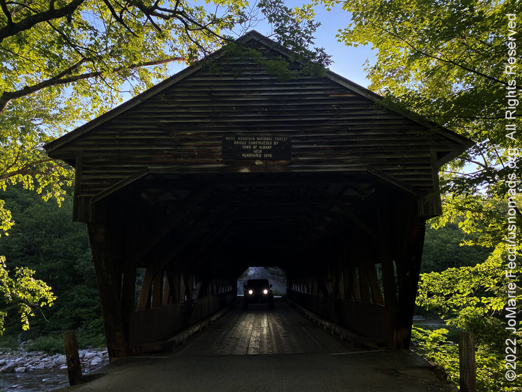
23 June 2022: Left Vermont and picked up the Kancamagus Scenic Byway to the White Mountain National Forest making a number of photo stops and taking time for some short hikes along the way. We arrived to camp at the Covered Bridge campground late in the afternoon…
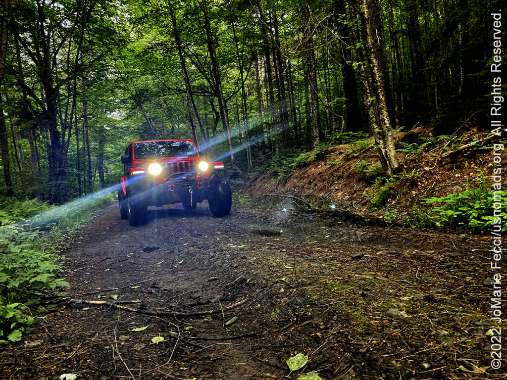
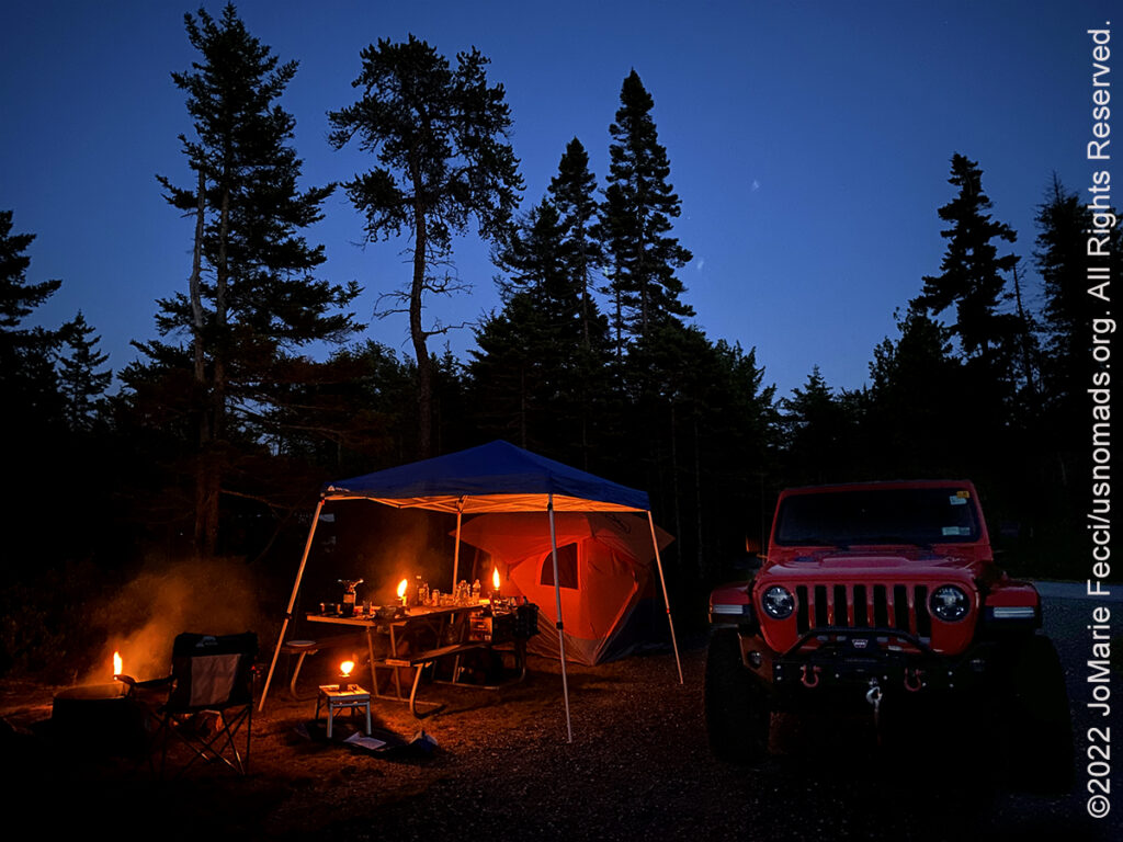
22 June 2022: Explored some of the Class IV roads in the Stockbridge area and went looking to see if we could spot any wildlife in the Lew Newall Wildlife Management Area (we really want to find a moose), but didn’t see anything larger than a squirrel. We were able to glean some firewood from a recently logged area of the forest though, and so we had a really nice campfire in the evening…
21 June 2022: Setting off for our Northeast Loop today, left Long Island by ferry and made the drive up to Vermont where we set up camp at Chittenden Brook campground in the Green Mountains National Forest. It was damp but not raining, and a little bit chilly, but we quickly got a fire going and settled in for the night …
THIS MONTH:
![]()
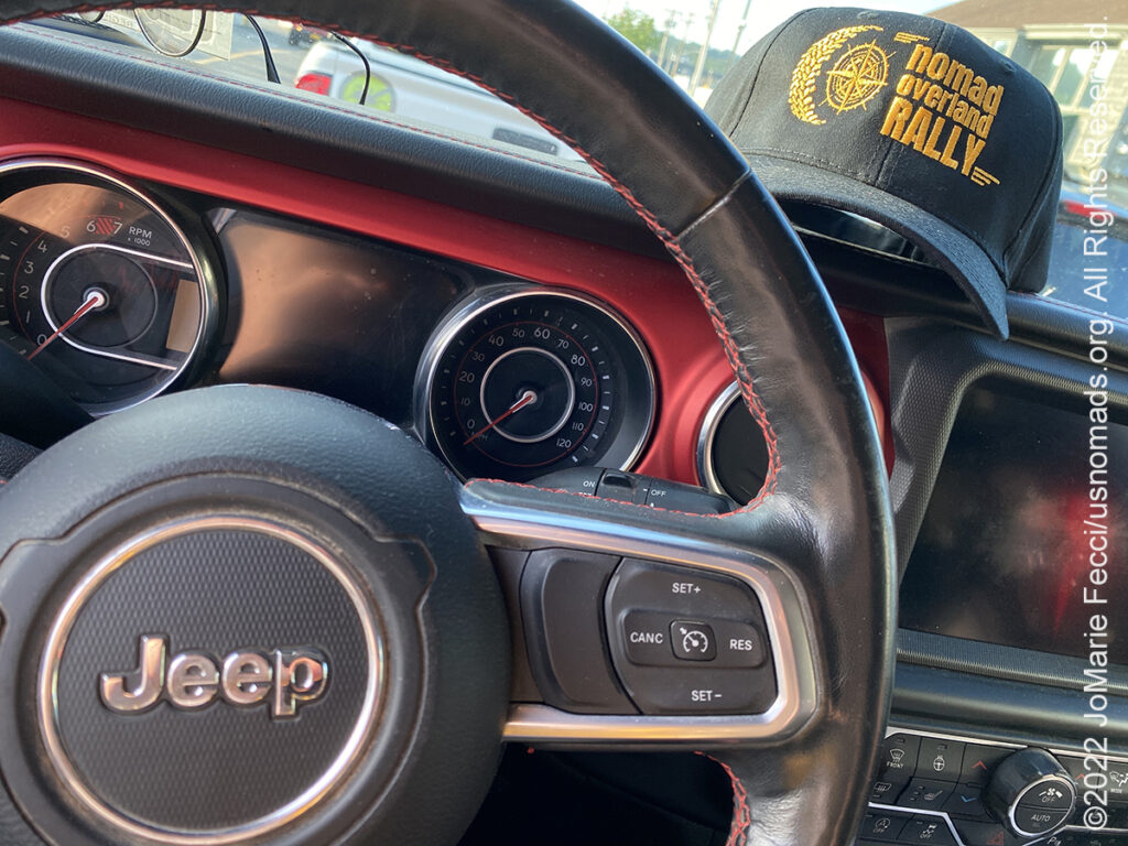
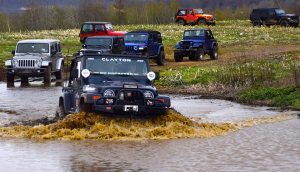
USnomads.org is very proud to be presenting a brand new kind of rally experience for 2022 — the Nomad Overland Virtual Adventure Rally a ten week event that participants can do from anywhere within the continental U.S.A. Competitors design their own routes as part of the rally, then drive it in a points-based online competition that includes optional activity tasks, quests and weekly challenges. The rally will run from 6 June – 14 August and is open to any driver within the United States who has an off-road capable vehicle — stock or modified. Late Registration is still open. For more information see the Rally website …

A Northeastern Overland Roadtrip looping from Long Island NY to the Green Mountain National Forest in Vermont to the White Mountain National Forest in New Hampshire to Acadia National Park in Maine to Cape Cod National Seashore in Massachusetts and back to Long Island …
COMING UP SOON:

Heading to a small village in Serbia to help out with the annual plum harvest and spend some time exploring the countryside with friends …
![]()
Attending the Ladies Offroad Network Convention in Moab, UT. The 6th annual convention will be held October 12-15, 2022, with lots of hands-on opportunities to gain all types of offroading skills, learn and engage with other offroad ladies as they share their stories, and laugh the whole way. The convention is an action-packed, interactive 4-day weekend educating, motivating, and guiding offroad ladies…
ABOUT MOUNT WASHINGTON
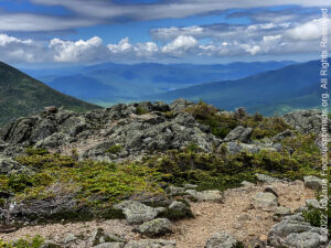
Mount Washington, at 6,288 ft, is the highest peak in the Northeastern United States and the most topographically prominent mountain east of the Mississippi River. The mountain, located in the Presidential Range of the White Mountains, is notorious for its erratic weather and is home to the Mount Washington Observatory, a weather research station.
Before European settlers arrived in the region, the mountain was known by various indigenous peoples as Kodaak Wadjo (“the top is so hidden” or “summit of the highest mountain”) or Agiochook or Agiocochook (“the place of the Great Spirit” or “the place of the Concealed One”). The Algonquians called the summit Waumbik, “white rocks”. The Abenaki people inhabiting the region at the time of European contact believed that the tops of mountains were the dwelling place of the gods, and so among other reasons did not climb them out of religious deference to their sanctity. The first European to mention the mountain was Giovanni da Verrazzano. Viewing it from the Atlantic Ocean in 1524, he described what he saw as “high interior mountains”. Darby Field claimed to have made the first ascent of Mount Washington in 1642. Field climbed the mountain in June of that year to demonstrate to the Abenaki chief Passaconaway that the Europeans bargaining for tribal land were not subject to the gods believed to inhabit the summit, a primarily political move that facilitated colonists’ northern expansion. Field again summited Agiocochook in October 1642 on an early surveying expedition that created maps of land as far as Maine, which allowed people from the Massachusetts colony to identify arable coastal areas. A geology party, headed by Manasseh Cutler, named the mountain in 1784. The Crawford Path, the oldest continuously maintained hiking path in the United States, was laid out in 1819 from Crawford Notch to the summit and has been in use ever since. The summit station of Mount Washington has an alpine climate or tundra climate, although it receives an extremely high amount of precipitation, atypical for most regions with such cold weather. However, elevations just beneath treeline have a subarctic climate which eventually transitions to a humid continental climate near the mountain’s base and the surrounding lower elevations. The mountain’s notoriously erratic weather is partly due to the convergence of several storm tracks, mainly from the Atlantic to the south, the Gulf region and the Pacific Northwest. The vertical rise of the Presidential Range, combined with its north–south orientation, makes it a significant barrier to westerly winds. Low-pressure areas are more favorable to develop along the coastline in the winter due to the relative temperature differences between the northeastern United States and the Atlantic Ocean. With these factors combined, hurricane-force wind gusts are observed from the summit of the mountain on average of 110 days per year. These extreme winds also contribute to the mountain’s very short treeline, with elevations as low as 4,400 feet being too hostile to support any plant life more than a few inches in height. The first regular meteorological observations on Mount Washington were conducted by the U.S. Signal Service, a precursor of the National Weather Service, from 1870 to 1892 and the Mount Washington Observatory was built on the summit in 1932. The Mount Washington station was the first of its kind in the world, setting an example followed in many other countries. The primary summit building was designed to withstand 300 mph winds; other structures are chained to the mountain…
ABOUT CLASS IV ROADS
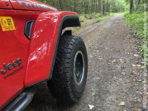
Vermont has miles of Class IV roads (unmaintained roads) and trails that can be easily accessed by any legally registered 4×4. Legal road maps (including class 4 roads and legal trails) by township can be downloaded for free from the Vermont Agency of Transportation Policy & Planning Division. Vermont’s Class IV Roads are defined as: “A Vermont Class IV road (or highway) is a road that is not maintained by the town or state, and can be in any state of disrepair.” While these roads are not maintained, any legally registered vehicle may travel on them unless otherwise posted. “Class IV” roads can include many different surface types – gravel, dirt and even brick. The Vermont Class 4 road system is truly an amazing resource in New England. These roads offer access to old historic sites, beautiful waterfalls, and awe-inspiring vistas. Depending on the condition of the road, they can also offer a challenge to 4×4 enthusiasts. Many of these “roads” have been left unmaintained for so long that Mother Nature has reclaimed her grasp on them. Often when traveling these roads, one will encounter fallen trees, large boulders, or impassible water crossings. To travel these roads, one must be prepared with the proper equipment, proper knowledge, and a deep level of respect for the access we have to these ancient roads. A good resource for finding Class IV roads is the website https://vermontroads.net/, you can also go directly to the Vermont Transportation Agency’s Map Library to download maps of the area you are looking to explore, and visually identify potentially interesting trails. …

MORE NOTES FROM THE ROAD:
1-15 June – Long Island
May – Nomad Rally Prep
16-30 April – Long Island
7-15 April – Heading Back to NY
1-6 April – Heading Back to NY
27-31 March – Death Valley- DVE
21-26 March – LON Skills Camp
15-20 March – Death Valley
8-14 March – Nevada
1-7 March – Glamis Training
16-28 February – Roadtrip Southwest
1-15 February – Long Island
8-31 January – Long Island
1-7 January – Florida to NY
28-31 December – Okefenokee NWR
24-27 December – Ocala National Forest
19-23 December – Heading South
10-18 December – Long Island
1-9 December – Paris
16-30 November – Paris
1-15 November – Roadtrip East
25-31 October – Roadtrip East
17-24 October – LON Top Ten
7-16 October – Rebelle Rally
1-6 October – Rebelle Training
24-30 September – Rebelle Training
16-23 September – Roadtrip West
1-15 September – CT Training
August – Paris
July – LI & CT
Archive
SPECIAL REPORT
All about exploring ghost towns and abandoned places in the USA and beyond, with tips, and information on the many different types of sites to be found across the globe, including detailed guides for eight specific sites… [read]
RE-OPENING
Report from the first trail run with the Off Road Consulting group at Rausch Creek Off Road Park as the post-pandemic phased re-openings begin in Pennsylvania and some of our favorite local trails re-open to the public after the two-month shutdown… [read]
REFLECTIONS

EGYPT: CAIRO REFLECTIONS
A quick overview of impressions from a stop in Cairo during our recent scouting mission in Egypt and Sudan … [read]
SPECIAL REPORT

A look into south-eastern Algeria on the border with Libya and Niger: overlanding with the Tuareg in one of the most remote corners of the Sahara … [read]