
The Time-Traveler’s Return: Crossing the International Date Line
The journey from the humid basin of Chengdu back to the familiar skyline of New York City is more than a flight; it is a profound exercise in temporal distortion…
As I gear up for my expedition into the heart of the Tibetan Plateau, I’ve realized that the greatest challenge isn’t just the altitude — it’s the fact that the landscape I’m about to enter effectively doesn’t exist on any modern paper map. Planning my route through this high-altitude wilderness required a detour into history, using sixty year old maps to get a sense of the actual terrain I will be driving through. But using declassified 1950s military maps and trying to plot coordinates pulled from modern GPS data is a recipe for being several hundred meters off, and I had to find a creative way to “bridge the gap” while route planning.
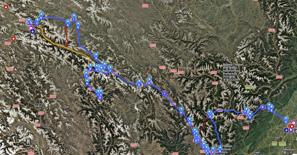 First let me explain that my reliance on vintage maps was due to the lack of any publicly available (in the U.S.) high-resolution topographic paper maps of this specific region of China. The most common resource available is the National Geographic “Trails Illustrated” map of the entire country; but while it’s a great map for general orientation, the scale is far too small for expedition work. My entire thousand-mile zone of travel is shrunk down to a mere few inches, making a massive mountain range appear as a tiny smudge.
To get the level of terrain detail I need, I had to go to the declassified archives of the Perry-Castañeda Map Library where I found 1:500,000 tactical aviation maps from the mid-20th century. They are beautiful old maps with a level of detail that actually even included locations of “nomad camps,” but they are technically “broken” when used with modern GPS. The primary issue is the datum shift.
A map datum is essentially the mathematical model cartographers use to translate the shape of the earth onto a flat piece of paper. The Earth isn’t exactly a perfectly smooth sphere — it’s a sphere with mountains sticking out, and depressions like valleys and canyons. Imagine trying to wrap a piece of gift wrap around a rough jagged rock — depending on where you start taping the paper and how much you stretch it, the patterns on the wrap will sit in different places. Modern GPS uses a “best fit” model for the entire globe (WGS 84), while these Cold War-era maps were built on an older regional datum, most likely the Pulkovo 1942. Because the “starting points” of these two models are different, a single physical spot on the ground will have two different sets of coordinates depending on which “tape job” you are looking at.
 When I plot a coordinate pulled from high-resolution satellite imagery onto these vintage maps, the point is often “off” by several hundred meters. In a landscape defined by sheer cliffs and deep river gorges, a 300-meter discrepancy isn’t just a minor annoyance; it is a recipe for disaster. To navigate safely, I am forced to perform a sort of cartographic forensic analysis.
First, I use Google Maps for general route planning and the major “highway” sections, though sometimes the actual road paths it shows are inaccurate once we move into the back country (and in one case, Google Maps was actually missing a major paved highway that I had to manually draw in). Then I go to satellite view to set my “waypoints” where I can “see” the actual terrain features, and grab the coordinates. Next I plot the coordinates on the paper maps, and then compare them to the satellite view to make the “adjustment” to the “exact” spot visually. Now I have the route on paper with the contour lines, that show the hidden dips and ridges obscured by shadow on the satellite imagery.
The process forced me to return to the fundamentals of terrain association—identifying landmarks like peaks and river confluences rather than trusting a single coordinate point. It is a humbling reminder that despite our “all-seeing” satellites, up on the plateau, the gap between the coordinates and what’s on the ground is where the real exploration begins.
The journey from the humid basin of Chengdu back to the familiar skyline of New York City is more than a flight; it is a profound exercise in temporal distortion…

The lowlands of Chengdu find their soul in the explosive, colorful, and lightning-fast world of Sichuan Opera…

After the spiritual stillness of Yushu, Chengdu greets you with a vibrant, sensory-rich landing…

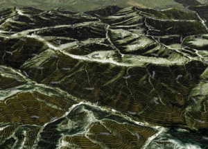
The transition from the Tibetan Plateau to the Sichuan Basin is one of the most dramatic environmental shifts on the planet…