
[rev_slider fgaz-pt2]
A smiling teen waved to our Jeep as we drove slowly down the street in Erfoud. We waved back, and some of his friends waved too. This was our last send off. We were on our way into the desert to find the “bivouac,” the mobile camp that would become our base for the next several days. As we passed the local population busy about their day, I wondered what they really thought of us, the Rally, and all these brightly decorated trucks passing through. Some people, like the boy and his friends, waved and smiled, others paid no attention. The Rally schedule was tight, and left us no time to chat with anyone apart from those involved with the event, so we had no idea if they were glad for the economic boost, if they resented our presence, or if they just thought westerners were “strange.”
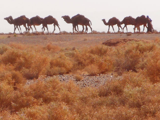
When we got to the end of the paved road, we turned into the desert. In the distance, a group of camels walked slowly across the sand, as if to confirm that we were finally here. There was no trail, just criss-crossing tracks everywhere. We knew the general direction of the location we were headed to, and we didn’t really need to know more as all the other Gazelles were headed there too. A mad dash of brightly colored cars sparkling in the desert sun moved forward kicking up plumes of dust in a tangled ribbon across this tiny corner of the Sahara. And we were one of them.
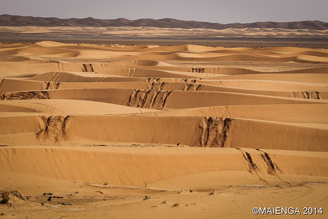
We followed the herd across the sand, not sure what we were going to see when we got “there.” I imagined a group of tents something like the bedouin “bivouacs” prepared for tourists that I had seen before. The desert had seemed flat from the road, but now we realized there were lots of dips and small hills that blocked our view, and as we came up over one of those rises, the dust cleared in the distance, and we saw the massive installation that would serve as our base.
It was very well organized, separated by function, and a space was roped off for us to set up our tents. We unpacked and tossed our 2-second tent on the ground, and it popped right up as expected. Securing it with stakes and the weight of our gear, we realized that everyone had the same exact tent, and I recalled that one of the papers they sent us had mentioned marking your tent in some way so you could tell which one it was.
Finally the big moment arrived, and the vehicles lined up in a complex grid that was arranged by group letter and position number. The sheer logistical feat was impressive, as they somehow arranged it so the 160 teams would not all end up in a massive traffic jam rolling across the desert towards the same objective. The system sorted teams into manageable groups of 10 or 15 vehicles per checkpoint, then fanned the checkpoints out across the desert in the same general area, and at the same distance, so teams would be moving somewhat parallel to each other over equivalent terrain. The starts were then timed to create separation, with two minute intervals between vehicles that were headed to the same CP so teams in the same group wouldn’t be “on top” of each other.
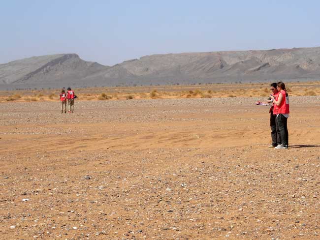
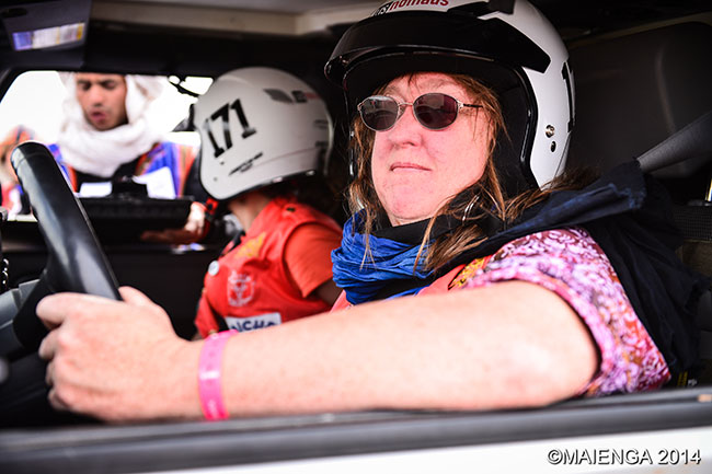
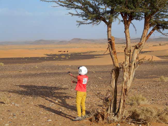
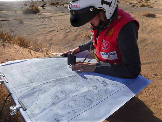
As we tried to figure out the system, making sure we were in the correct line, we could feel the excitement mounting. Some girls were nervously checking their cars, others had walked along the edge of the camp and had their maps and compasses out, sighting distant points. I recalled Emily Miller telling us in training that we should look around the bivouac, and get to know what is north, south, east, and west of it visually.
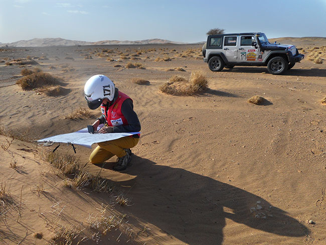
We decided it might be a good idea for us to go see what was “north.” Finding a spot at a polite distance from other teams, we set down our map and used the compass to orient it to the ground. Then we looked “north” at the prominent ridge line beyond the bivouac. “North” was aligned with a dip in the ridge that looked as if someone had taken a “bite” out of it.
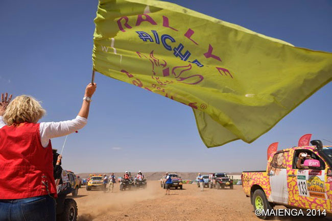
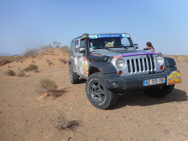
Vehicles had begun moving, and we headed back to the Jeep, put our helmets on and inched closer to the starting line. Rally officials walked through the crowd of trucks offering words of encouragement. Their familiar faces were reassuring, like coaches giving a final pep talk to the teams. We were nervous and excited at the same time. And then Rally director Dominique Serra waved the flag and we were off.
The day’s course was something of a mini rally day, with 3 checkpoints, but only two hours to find them. According to the organizers, this 45-km looped course would pose no major difficulties, as the terrain was relatively flat and navigation should be straightforward with easy to identify features. This “Prologue” was intended to give us an initiation to the terrain and the rally process. It doesn’t count in the rankings, but is used to establish “groups” based on skill level, so that the top teams are in the same group from the start of the actual competition.
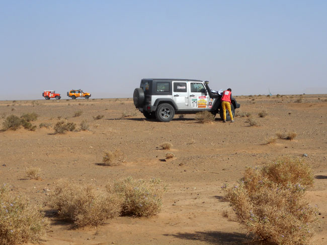
As we headed off into the desert for real, we were a little unsure of what to do. Niki got out and took a heading, and then I drove towards the point she said was “it.” We were monitoring our distance, just as we had done during training. The driving seemed easier than I had expected, though there were small dunes just passed the edge of camp. They proved fairly easy to drive and I was feeling very confident.
It was a beautiful day, the sky was blue, the sun was shining, and it wasn’t too hot. We were smiling as we drove across the expanse of desert landscape beyond the small dunes. This area was more rocky, but not “rock-crawling” rocky, just bumpy and rough. Every now and then we stopped so Niki could get out to check our heading. Seeing other Gazelles in the distance, all doing the same thing as us, gave us a sense of comfort — we can’t all be going in the wrong direction!
Continuing on the general heading, we were getting close to the distance measure, and we start looking for the flag.
We should see our CP, but we don’t. We are on line with the heading and we have driven the distance measured. It should be here. Yet all we could see was desert landscape. A slightly uncomfortable realization set in — this is going to be even harder than we expected!
We had done everything “right” and were feeling at a bit of a loss for ideas. What do we do once we are where we “should” be and we don’t find the checkpoint? That wasn’t in the training. Looking at the map again, we double check our plot, and it is correct. Then we look around us and start trying to match up the landscape with the map. It is hard to tell what in the terrain is what on paper. We are unsure if the land feature we see in front of us is this or that black blob on the topo map.
We guess. We “guess” that the land feature is the one that should be our “backstop” — meaning that our CP should be before we reach it. We “guess” that maybe our distance is too short since we did zig-zag a bit in the small dunes. We “guess” maybe we need to keep going in the same direction. But truthfully we have no idea.
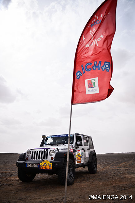
Getting back in the Jeep we are silent, each in her own thoughts, as we drive forward. I am wondering how far we should keep driving before we start to circle back around, and what good would circling back around do anyway. I am scanning the horizon looking for something “red.” Then like a mirage, it appears off to our ten o’clock — a red banner in a grove of trees, the sun shining through it’s translucent fabric.
Excitedly I tell Niki that I think I see it. As we get closer, we both see it. There are lots of Gazelle vehicles there too. Niki is concerned that it is so far off to our left instead of in the direction of our heading — but in our direction we see nothing, so we follow the path of hope.
Disappointment crushes hope when the checkpoint official shakes his head. No. It is not our checkpoint.
We get back in the Jeep, silently, and continue driving forward, all the way to the “backstop,” and then around behind it, “just in case.” Now we are far from where we should have found it. We both agree this is too far. Deciding it is time to “backtrack,” we picked up our own tracks, and tried looking at the terrain from this reverse perspective. As we were passing the “wrong” checkpoint, we noticed another Gazelle vehicle going over a small hill next to the area we had been in before. We decided to go take a look.
As we drove up the rocky ridge, I could see more vehicle “tracks” and I thought to myself that so many teams wouldn’t drive up this random hill for no reason. Hope returned. And this time it was rewarded. From the top we could see the flag, encircled by Gazelle vehicles, hidden from view in the bottom of a oued.
Relieved at finding the first CP, we realized we hadn’t done so poorly when we saw our friends from the more experienced US teams there too. We weren’t that far “behind” the curve. But we were a bit frustrated by our total lack of accuracy. We hadn’t been “lost,” as we knew roughly where we were on the map, but we hadn’t been able to find the exact location of the CP directly either.
Losing some confidence, Niki told me she felt like she didn’t understand what she was supposed to be doing. Yet from what I could tell, she was doing everything more or less correctly. We decided to try to be more methodical for the next CP.
Together we reviewed the map, orienting it to the land as we tried to determine how the features we saw around us were indicated on the map. Then, I thought maybe we needed to be more truly “straight” in our headings. Rather than just using the compass to go towards a heading via dead reckoning, I showed her how to sight a terrain feature on both the forward and back azimuth, using the alignment of the two to stay “straight.” This technique seemed like it could really help us to get back in line when we had to “offset” around a mountain or hill that we could not see over.
We took the straight heading for CP2, first to the edge of a ridge line, then around a hill, where we lined ourselves up again. This was slow going because we kept having to stop to check the heading and alignment after every “obstacle.”
But it worked! We came straight onto our second checkpoint.
The two-hour time limit was pressing upon us, as we left CP2, encouraged with how much better the technique had worked this time. Using the same process, we made our way towards the third checkpoint. According to our map, it should be on the other side of a real “road.” Niki picked a distant point on our heading and I drove straight toward it.
We were making good progress and keeping it straight until we ran into a field of dunes. Not very big ones, but big enough to cause some trouble. As we entered the soft sand my priority shifted from driving straight to not getting stuck. I needed to be careful as we moved quickly along the crests in the general direction of our heading. Niki was doing her best to keep an eye on our “point” as we dipped and crested, and I worked on making forward progress.
Coming up around the crest of one of the larger dunes, another vehicle was stuck in the spot I was headed to. I quickly turned down and looped around the bowl trying to figure out how to get around. I backtracked and swung behind the big dune I had just crested, looking for another line forward and out of these dunes. We worked our way along, using a combination of “easier” lines along the edges between the dunes, straight over the smaller ones, and following the tracks of previous vehicles that had gotten through.
As we finally exited the dunes, I was reassured by the fact that we hadn’t gotten stuck. But we are running out of time.
Niki picked up her visual waypoint, and we lined back up with our heading, and I start driving faster. The terrain became rocky again, and the Jeep was bumping up and down, rattling over the rocks. Other teams going the same way pass us, and I started going even faster.
Banging along across the flat rocky plain, we were straight on. As I sped up to chase the vehicle that was now ahead of us, Niki reminded me to be careful for the Jeep. It wasn’t even the first day of the real competition and we’d better not break it! I eased back off the throttle a little, then seeing a flag far off in the distance, I picked up the pace again. It was exactly where it should be on the other side of the road and we were both smiling as we pulled up to it with a little bit of time to spare.
The feeling is celebratory when Niki handed the CP monitor our log sheet for the final stamp of the day. He looked at it, then handed it back to her shaking his head. It was not our CP.
We had been so sure. We couldn’t believe this was not our CP. And we had only twenty minutes before the checkpoints would close. We knew from the map that ours was just this side of the road, so we decided to look for it by paralleling the road. We randomly chose a side and started driving. Daylight was beginning to fade. Time ran out.
Our frustration at being so close yet so far from that final CP, gave way to concern about the setting sun. We needed to get back to the bivouac, but we didn’t know where it was from here.
The only thing we had to identify it was the visual “bite” in the ridge line we had noted in the morning. But we couldn’t see that from this location.
Realizing we have no concrete idea how to find the base camp, we headed back in the direction we came from. The sun was gone and we soon found ourselves in a tiny village with just a few houses in the middle of nowhere. This complicated navigation, because we had to get around the homes and cultivated land, while trying to keep some sense of heading. Frustration was turning to mild panic, as Niki was unsure of where we were on the map or which way we should go, and I didn’t want to drive blindly into the dunes in the dark.
I suggested heading back towards the power lines and the main road, while there was still some ambient light to see them by. We knew that road went to Erfoud, and from Erfoud we had precise directions for how to get to the bivouac.
Niki agreed and we made for the power lines as fast as we prudently could.
Before we reached the road, we saw headlights moving in the general direction of the bivouac. Other Gazelles! We turned to intercept the lights and this time I drove really fast. Their brightly colored trucks were a welcome sight, and we fell in behind them with a sense of relief.
Driving in convoy through the darkness, we entered the small dunes which seemed much more complicated in the dark. They are tight together and we couldn’t see anything further than what was directly in front of us. We were glad to follow a “leader.” Behind us other teams struggled with the soft sand, and when we noted that the headlights of the team behind us were no longer visible, we stopped to wait for them to catch up. However, “trail etiquette” does not seem to apply in the Rally, and the teams ahead of us kept going.
By the time the stragglers caught up, the “leader” was far gone, and we inherited the role. So here I was leading a group through a tangle of small dunes and camel grass in the dark on my first day in the desert. Unsure of where to go or even the right direction, I followed the tracks in front of me, until I came to a thick mess of bush. I went to scout ahead on foot, and out of nowhere a young kid comes up to the Jeep with his bicycle offering to help lead us out! And he wants to be paid for it!
Accepting local help was against the rules, and besides, we had to figure this out for ourselves. It is only the first day, we couldn’t give up that easily. We politely declined the boy’s offer and I walked through the bush for several meters until I found where the tracks picked up. Back in the Jeep we continued on in the darkness. It seemed to take forever to pick our way out of there, but we did it without getting stuck or getting the teams behind us stuck. And now clear of the sandy hills and thick vegetation, we could see the lights of what looked like a small city ahead of us — the bivouac at last…
MORE ON TRAINING: Pathfinding Across Terra Incognita | Lessons from the Rubicon | Scouting the Sahara in Morocco | US Nomads Go to Jeep School | Following the Clues on a Map | Navigating the Desert the Bedouin Way | Route Finding with Orienteering
NOTE: This is the first in a series of essays chronicling our personal experiences in the incredible adventure known as the Rallye Aicha des Gazelles. We took on the challenge in March 2014 to hone our skills in desert driving and navigation as preparation for an independent trans-Saharan expedition and are not professional rally racers. The opinions and descriptions presented here are based on our own experience of the event, and may not be typical. However, we can say without hesitation to anyone considering participating in the Gazelle Rally in the future: DO IT! (For a more general description of the rally, videos, and more, see our RALLY RECAP)
The Rallye Aicha des Gazelles au Maroc, which takes place each March, is one of the toughest motorsport events in the world. For nine days 150 all-female teams race off-road across the Moroccan Sahara competing to see who can reach the most checkpoints with the least mileage using only a map and a compass.
The event takes place in the south-eastern part of Morocco, near the border with Algeria. Teams start near the town of Erfoud and make their way west to the beach at Essaouira.