Day 5: IA to NE — Where the Prairie Meets the Sky
The Great Plains don’t announce their arrival. There is no mountain pass, no dramatic shift in elevation, no billboard declaring that you’ve crossed into a different kind of country…

The river outlasted the bridge. Along the Kankakee River in Illinois, old stone or concrete pylons stood in the water, the structure they once supported long gone. Trees had taken root on the weathered remnants, suggesting they had been abandoned for decades. Whatever story the bridge might have told had largely disappeared, leaving only these quiet markers of a crossing that no longer existed. I found myself wondering how long they had stood there, slowly being reclaimed by the river and the vegetation along its banks.
The Kankakee River has a history that reaches far beyond the towns and farmland along its banks. Before drainage and agricultural development transformed much of the surrounding landscape, the river flowed through the vast Grand Kankakee Marsh, one of the great wetland systems of North America. Much of that original marsh is gone, but stretches of the river in Illinois retain their natural, meandering course, with wooded banks and wetlands offering glimpses of the landscape that once dominated this region. Today, the river is part of a designated National Water Trail, a reminder that waterways remain more than lines on a map: they are corridors through the landscape, carrying their own histories long after the roads and bridges that cross them have disappeared.
Continuing along the “slow road,” this part of Illinois looked deceptively simple. Cornfields stretch to the horizon, the terrain barely seems to rise or fall, and the landscape offers few clues to what lies beneath its familiar surface.
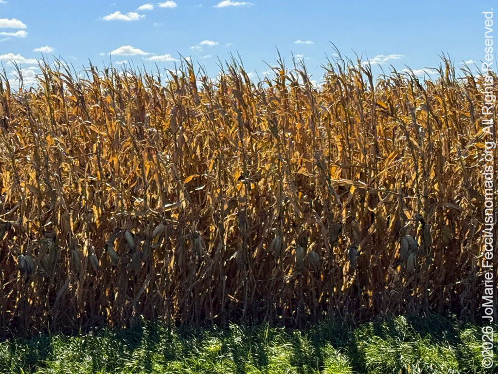 Somewhere in the cornfields, I began to suspect that Siri had lost the plot. The road turned right, then left, then right again, threading through miles of fields that looked almost identical in every direction. After enough turns, I began to lose my sense of direction entirely. North, south, east, west—it all became a little theoretical when every road looked much like the last and the horizon offered no useful clues.
I had somehow found myself navigating a corn maze for adults, with no admission fee, no exit map, and a phone that seemed perfectly confident it knew where it was taking me.
Eventually, the zig-zagging route brought me out of the cornfields, right at the edge of Starved Rock State Park.
The Midwest can disguise its complexity behind an illusion of simplicity. From the interstate, the landscape appears flat and uniform, an endless patchwork of fields beneath a wide sky. Yet even here, the land carries the marks of ancient glaciers, shifting waterways, and centuries of human activity.
Continental ice sheets once ground their way across this region, reshaping the terrain and depositing the mineral-rich glacial till that helped create some of the most productive agricultural soil on Earth. Then, without warning, the flat prairie breaks open.
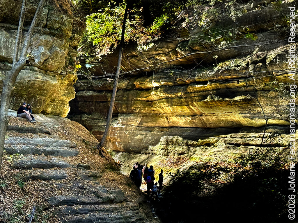 At Starved Rock, the landscape changes dramatically. The Illinois River has cut into the terrain, exposing towering sandstone bluffs and narrow canyons where moss and ferns cling to damp, shaded walls. After miles of fields and winding country roads, stepping into one of these canyons feels like crossing into an entirely different region.
The river explains why this spot matters. Long before asphalt spanned Illinois, waterways were the primary corridors through the wilderness. Starved Rock carries that human timeline in dense layers. Indigenous peoples lived along the Illinois River for centuries; French explorers pushed canoes up this current in the 1600s; Fort St. Louis once stood atop the bluff overlooking the water. Even the park’s name preserves the memory of native conflict. According to local legend, during an 18th-century clash following the assassination of Ottawa Chief Pontiac, a band of Peoria sought refuge atop the 125-foot sandstone bluff. Trapped on the rock and surrounded by Ottawa and Potawatomi warriors below, they were besieged without food or water until they perished—giving the dramatic outcrop its haunting name.
That history leaves a quiet, somber weight in the air. Deep inside the canyon, the steep stone walls swallow the passage of time so completely that ascending back toward the rim makes the rumble of truck traffic feel strangely out of place—a fleeting, temporary layer slapped over centuries of human drama and deep geologic time.
Leaving Starved Rock behind, the Jeep climbs out of the valley and points west once again. But the mental shift has already taken root. Looking out over the prairie, the interstate reveals itself as merely modern traffic following the same ancient impulse that guided early traders and riverboats across this continent: finding a way through.
 The route eventually brings the Mississippi River into view. Crossing that wide, brown ribbon of water near the Quad Cities into Iowa isn’t just traversing a state line—it is the moment the eastern half of the country officially falls behind, and the vast interior takes over.
Instead of just driving high above the water at speed, I pull off onto Rock Island Arsenal to stand right on the riverbank at Lock & Dam 15. The upper Mississippi isn’t a passive force of nature out here; it is a massive, engineered industrial engine.
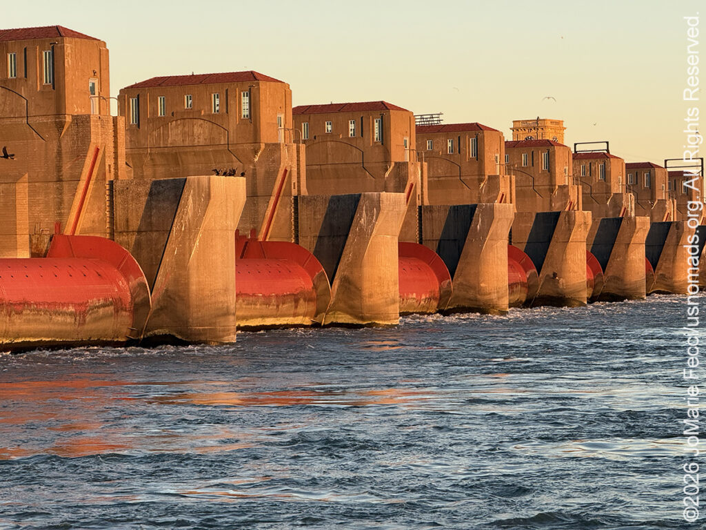
Standing on the edge of the locks, the sheer scale of river transport takes hold. Beside me sits the 1896 Government Bridge—a double-deck, swing-span iron monster that still rotates 360 degrees to let river traffic pass. In front of me, the world’s largest roller dam holds back a swollen river channel while massive 15-barge commercial grain tows navigate into the lock chamber. Churning muddy water, heavy steel roller gates, rusted iron trusses, and thousands of tons of grain slide past with inches to spare—the raw, mechanical muscle of the continent’s main economic spine in action, where the agricultural wealth of the Midwest meets 19th-century river infrastructure.
By late afternoon, I cross the remaining river span into Davenport and push west toward Newton, Iowa. An invisible boundary has been crossed—the dense, tree-lined corn belt of the Central Midwest is beginning to give way, and the country ahead is no longer just “farther west,” but the true entryway to the Great Plains. Out here, the trees thin out, the rain grows sparse, and the cornfields will soon hand the landscape over to wheat, cattle, and endless sky.
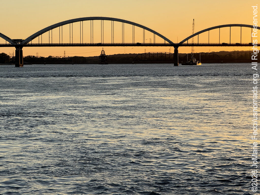 There is something imposing about standing on the banks of the Mississippi and realizing that the river before you isn’t just water—it is the living, beating economic pulse of a nation.
The Mississippi has always defined North America’s central threshold. For centuries, it stood as a formidable barrier to westward movement and a wild, unpredictable highway for frontier commerce. But at Lock & Dam 15, sitting squarely on Rock Island between Illinois and Iowa, that raw natural force collides head-on with human engineering.
Built in the 1930s by the U.S. Army Corps of Engineers, Lock & Dam 15 is a mechanical marvel. It features the world’s longest roller dam—a massive series of steel cylinders anchored across the river, adjusted to tame a current that once made navigation treacherous. Running beside it is the 1896 Government Bridge, a double-deck swing span that can rotate a full 360 degrees on a central pier to let towering river traffic pass through.
Watching a 15-barge tow boat enter the lock chamber is a study in precise, heavy-industry muscle. Thousands of tons of grain, steel, and timber float through with mere inches of clearance, held in check by rusted iron, heavy steel gates, and the churning fury of controlled river currents.
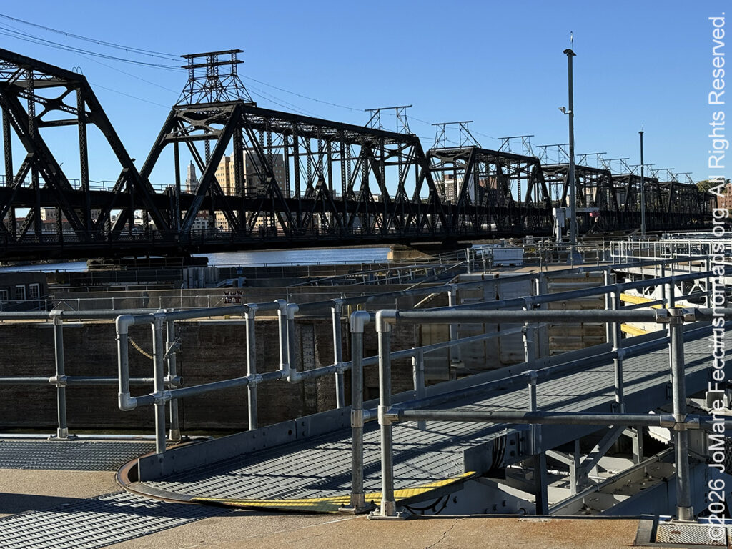 It is a striking collision of timelines. Long before iron bridges and concrete lock chambers spanned the water, Native nations and early European explorers paddled these same eddies, reading the currents by eye and muscle. Today, the modern world drives high above on interstate bridges, while down on the locks, the old river trade endures—using 19th-century mechanical principles and 20th-century steel to move 21st-century commerce.
Standing on the water’s edge, the river ceases to be just a line on a map. You can smell the damp, river-bottom silt, feel the vibration of heavy diesel engines echoing off iron trusses, and watch the brown current sweep south toward the Gulf.
That makes Lock & Dam 15 a powerful place to pause as the journey pushes west.
A cross-country drive is measured in highway miles and state lines. The river beneath the bridge is measured in geography, history, and raw industrial scale. And right here, on a quiet island in the middle of the current, you realize you have left the East behind for good.
The Great Plains don’t announce their arrival. There is no mountain pass, no dramatic shift in elevation, no billboard declaring that you’ve crossed into a different kind of country…
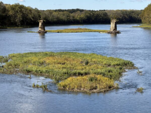
The river outlasted the bridge. Along the Kankakee River in Illinois, old stone or concrete pylons stood in the water, the structure they once supported long gone…

Long before sunrise, the quiet hum of the Jeep’s engine cut through the pre-dawn darkness of Toledo…
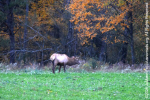
Dawn changes the character of a place. In Benezette, the valley is quiet again…