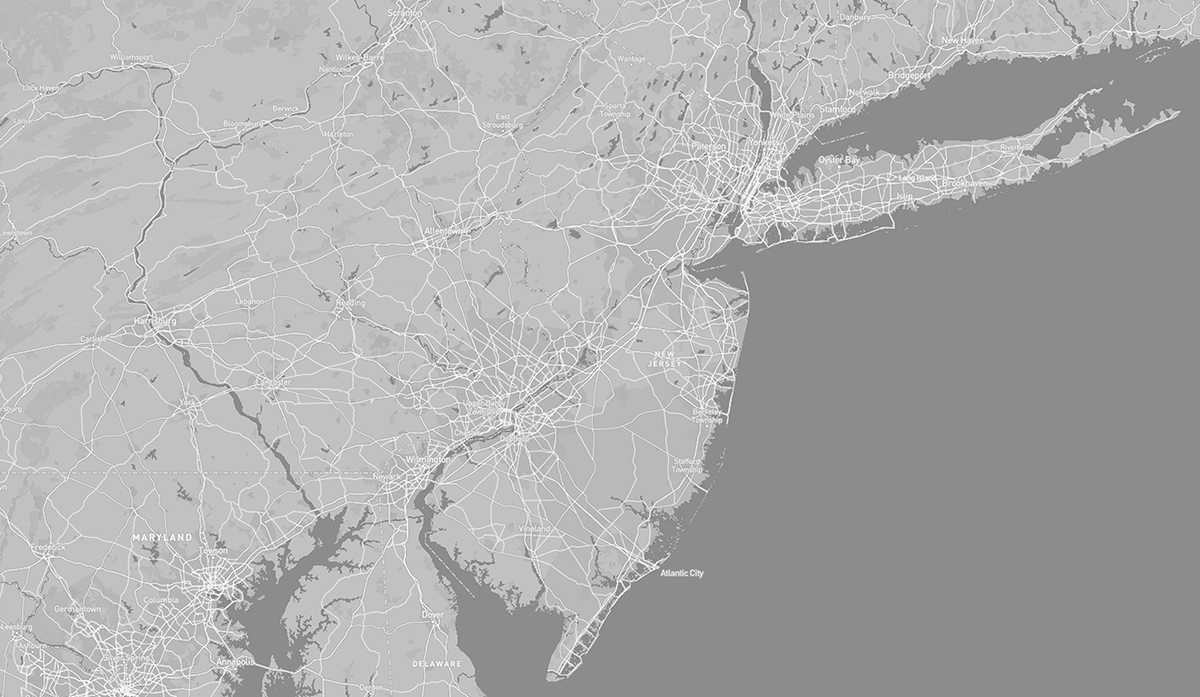
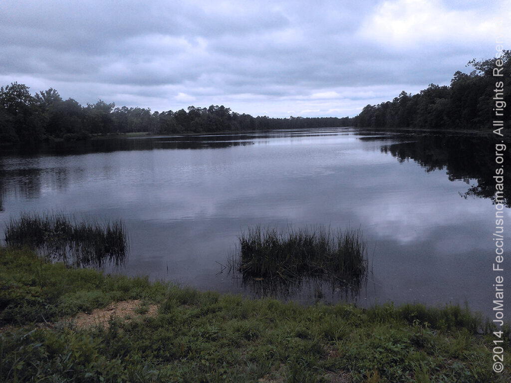
Though we are based relatively close to New Jersey we haven’t done a lot of exploring there — but there are a few places that we’ve checked out while “en route” south or west from NY.
Overview: While much of New Jersey seems a continuation of the New York City metro area and its suburban bedroom communities–or the Jersey Shore beachfront scene–there are some bits of wilder open spaces and rural areas beyond the well known locations. Traveling south or west from the urban sprawl you begin to find them.
TOPOGRAPHY: New Jersey is situated within both the Mid-Atlantic and Northeastern regions of the United States. Despite its heavily urban character and a long history of industrialization, forests cover roughly 45 percent of New Jersey’s land area. The state can be divided into five distinct areas based on natural geography and population concentration. Northeastern New Jersey, often referred to as the Gateway Region, lies closest to New York City and is the most urban in character. The northwestern part of the state, often referred to as the Skylands Region, is more wooded, rural, and mountainous. The Jersey Shore, along the Atlantic Coast has its own unique characteristics owing to its location by the ocean. The Delaware Valley includes the southwestern counties of the state, which reside within the Delaware Valley surrounding Philadelphia. The New Jersey Pine Barrens is situated in the southern interior of the state and covered extensively by mixed pine and oak forest.
High Point in Montague Township is the state’s highest elevation at 1,803 feet above sea level. The Palisades are a line of steep cliffs on the west side of the Hudson River in Bergen and Hudson Counties. Major New Jersey rivers include the Hudson, Delaware, Raritan, Passaic, Hackensack, Rahway, Musconetcong, Mullica, Rancocas, Manasquan, Maurice, and Toms rivers. Due to New Jersey’s peninsular geography, both sunrise and sunset are visible over water from different points on the Jersey Shore.
HISTORY: New Jersey was first inhabited by Paleo-Indians as early as 13,000 B.C.E., with the Lenape being the dominant Indigenous group when Europeans arrived in the early 17th century. Dutch and Swedish colonists founded the first European settlements in the state, with the British later seizing control of the region and establishing the Province of New Jersey. The colony’s fertile lands and relative religious tolerance drew a large and diverse population. New Jersey was among the Thirteen Colonies that supported the American Revolution, hosting several pivotal battles and military commands in the American Revolutionary War. New Jersey remained in the Union during the American Civil War and provided troops, resources, and military leaders in support of the Union Army. After the war, the state emerged as a major manufacturing center and a leading destination for immigrants, helping drive the Industrial Revolution in the U.S. New Jersey’s central location in the Northeast megalopolis helped fuel its rapid growth and suburbanization in the second half of the 20th century.
While no federally recognized tribes are located in New Jersey, the state currently recognizes three Native American Tribes: the Nanticoke Lenni-Lenape the Powhatan Renape Nation and the Ramapough Lenape Indian Nation (also known as Ramapough Mountain Indians).
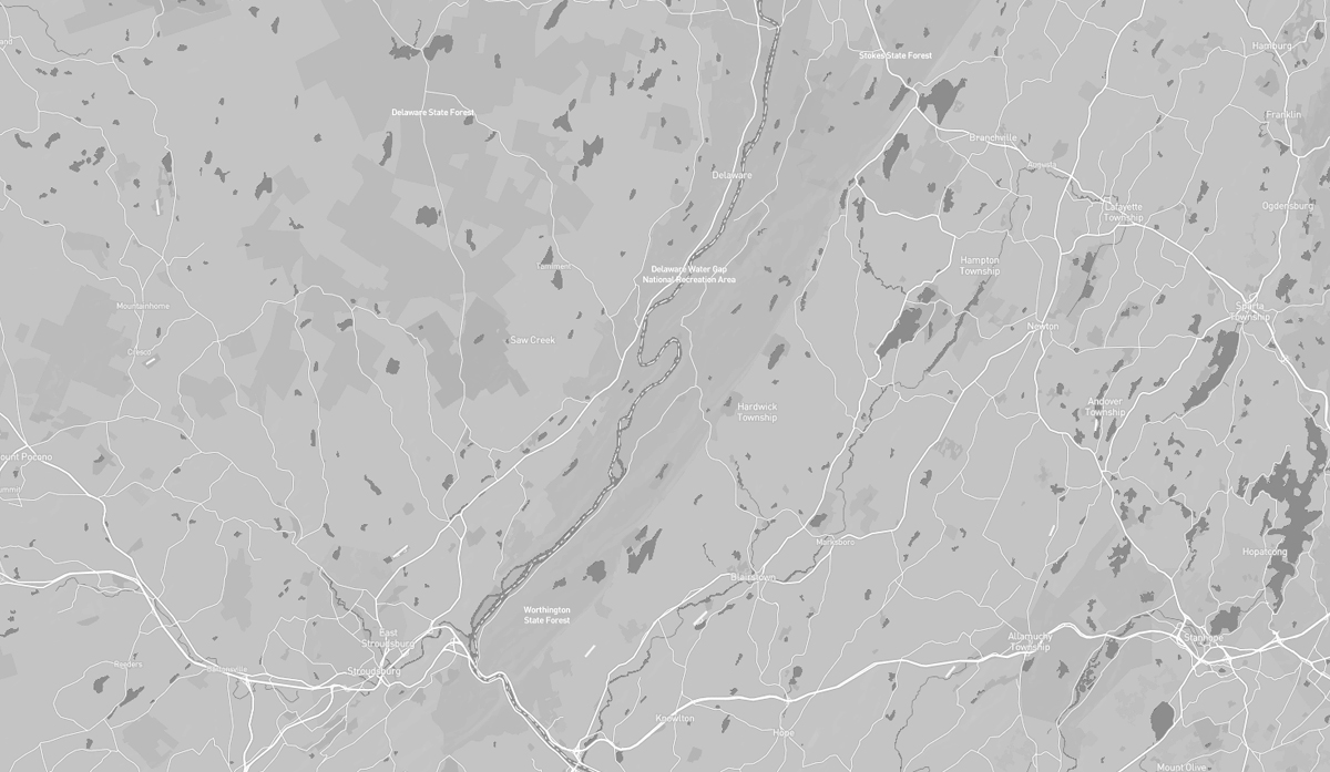
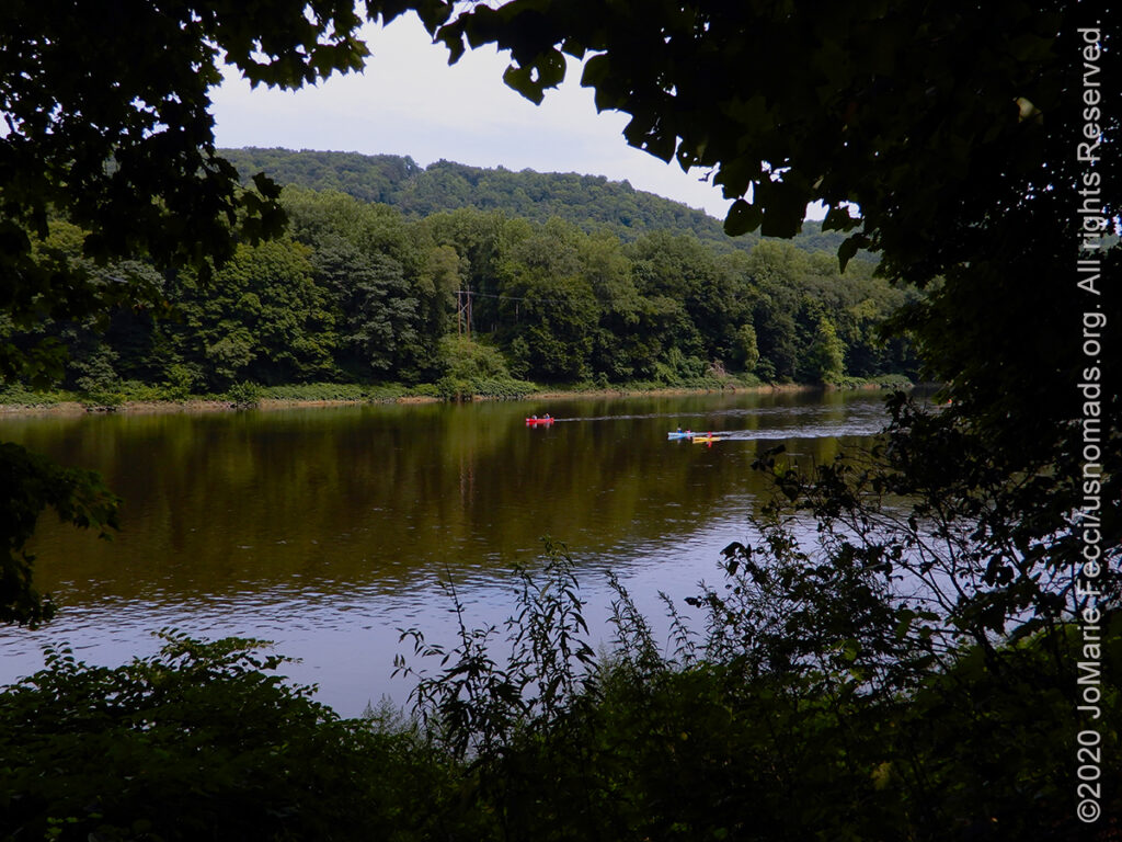
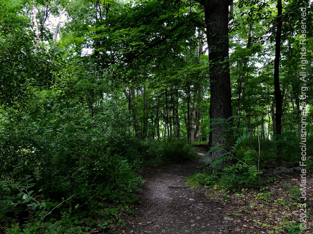
The Delaware Gap refers to the place where the Delaware River cuts through a large ridge of the Appalachian Mountains on the border between New Jersey and Pennsylvania. The river and mountains define the natural landscape there, and much of the area is protected by the Delaware Gap National Recreation Area and State Forests on both the NJ and PA sides of the border. The Appalachian Trail hike goes through here, but there are also many less strenuous hiking trails on the various public land units, with camping and kayaking opportunities, as well as an easy dirt road to base your exploration around.
The Delaware Water Gap is about 980 feet across at river level and 4,600 feet wide at the top. The river through the gap is 290 feet above sea level. The ridge of the Appalachians that the Delaware River crosses is called the Blue Mountains in Pennsylvania and the Kittatinny Ridge in Warren County, New Jersey. This is the first major ridge of the Appalachian mountains. New Jersey’s mountain is Mount Tammany, named after the Lenni-Lenape Chief Tamanend. The Pennsylvania mountain is Mount Minsi, named after the Native American tribe of the area. The summit of Tammany is 1,540 ft (470 m) above sea level.
A northern deciduous forest cloaks the slopes of the Delaware Water Gap. Hardwood species comprising the forest include various oaks, hickories, maples, ash, elm, cherry, walnut, birch, sycamore, and beech. Coniferous species include Eastern White Pine, Pitch Pine, Eastern Red Cedar, and Eastern Hemlock.
Black bear, white-tailed deer, gray squirrels, red squirrels, raccoons, gray fox, fisher, and chipmunks are some of the forest species of the area.
A water gap is a geological feature where a river cuts through a mountain ridge. The Delaware Water Gap formed 500 million years ago when quartz pebbles from mountains in the area were deposited in a shallow sea. The Martinsburg Shale on the eastern side of what was to be Kittatinny Mountain was uplifted 450 million years ago when a chain of volcanic islands collided with proto-North America. These islands slid over the North American plate, and deposited rock on top of the plate, forming the Highlands and Kittatinny Valley.
About 400 million years ago, a small continent collided with proto-North America. The heat from the pressure melted the quartzite, which allowed it to bend the quartz pebbles. This layer was then uplifted and cracked over thousands of years. During this period, the Delaware River slowly cut its path down through the shattered and cracked quartzite. If the quartzite had not been cracked, the river would not have been able to cut its path through the mountain to form the gap.
HIGHLIGHTS: Hiking,
Historical structures,
Kayaking, Camping,
Dirt roads
HIGHLIGHTS: Paddling,
Camping
HIGHLIGHTS: Hiking
trail, Mine site,
Waterfalls
HIGHLIGHTS: Hiking,
Scenic driving, Camping,
Kayaking
HIGHLIGHTS: Historic
Structures, Ruins, Dirt
Road, Hiking Trail
Access, River access
The Delaware Gap National Recreation Area provides a unique opportunity to experience tranquil landscapes, rich human history, and striking scenery along 40 miles of the longest free-flowing river east of the Mississippi. The park offers year-round recreation including hiking, paddling, fishing, and hunting. The gap is a popular place to rock-climb in New Jersey. The climbs are 150 to 300 ft. and there are about one hundred climbs on the New Jersey side. Camping is available in the adjacent Worthington State Forest.
The Delaware Water Gap National Recreation Area came about as a result of the failure of a controversial plan to build a dam on the Delaware River at Tocks Island to control water levels for flood control and hydroelectric power generation. The dam would have created a 37-mile lake for use as a reservoir. Starting in 1960, the present-day area of the Recreation Area was acquired for the Army Corps of Engineers through eminent domain. Between 3,000 and 5,000 dwellings were demolished, including historical sites, and about 15,000 people were displaced by the project. Because of massive environmental opposition, dwindling funds, and an unacceptable geological assessment of the dam’s safety, the government transferred the property to the National Park Service in 1978. The National Park Service found itself as the caretaker of the previously endangered territory, and with the help of the federal government and surrounding communities, developed recreational facilities and worked to preserve the remaining historical structures. By 2020, American Rivers, an environmental advocacy group, named the Delaware River as the River of the Year citing 75 years of progress in reducing pollution and restoring wildlife.
There are two visitor centers, one in New Jersey near the Delaware River bridge and the other in Dingman’s Ferry, Pennsylvania. The New Jersey side of the gap is also protected within Worthington State Forest, a forest wholly contained within the recreation area.
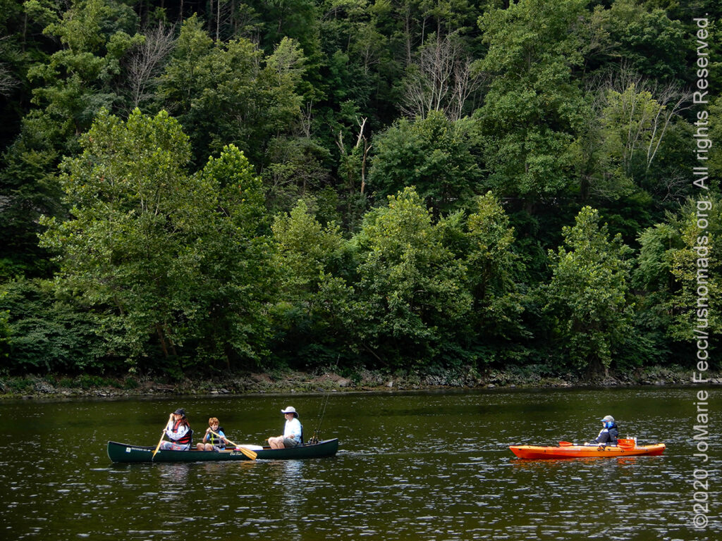
The Delaware River is the longest free-flowing (undammed) river in the Eastern United States. It runs from Hancock NY south for for 282 miles, passing along the borders PA and NJ, before finally emptying into the Delaware Bay. There are a numerous places along the river for recreational kayaking, rafting or tubing. In the zone covered by the Delaware Gap NRA it is possible to organize a multi-day kayak/camping trip. There is a set 3-day itinerary with rentals that leaves from Dingman’s Ferry on the PA side and goes down river for 27 miles.
And there are plenty of opportunities for shorter paddling activities. This part of the Delaware River is relatively unspoiled as it travels through the rural landscape. Lots of quiet pools and a few short riffles make this section ideal for beginning paddlers and those seeking a relaxing trip. During summer weekends a free shuttle service is provided by the Monroe County Transit Authority for those who want to bring their own kayak. Or you can rent from one of the approved outfitters.
Paddling the river gives you a chance to experience the landscape from a different perspective, and appreciate it’s timeless beauty.
Though now largely a scenic river traveled by recreational paddlers, the Delaware River has played key roles in the nation’s evolution at different periods of history. At the time of the arrival of the Europeans in the early 17th century, the area near the Delaware River was inhabited by the Native American Lenape people. They called the Delaware River “Lenape Wihittuck”, which means “the rapid stream of the Lenape”. The Delaware River played a key factor in the economic and social development of the Mid-Atlantic region. In the seventeenth century it provided the conduit for colonial settlement. In the eighteenth century, major cities like Philadelphia and Trenton were established along the Delaware and their continued commercial success was dependent on access to the river for trade and power. The Delaware is perhaps most famous for the Revolutionary War event that every American school kid knows, when George Washington made a surprise attack after crossing the river in the night and achieved an important victory that was considered a key turning point of the war (FYI, the crossing was NOT at the Delaware Water Gap, but further south near Trenton).
The Worthington State Forest is adjacent to the Delaware Gap NRA, and is the first area you reach if you turn north from Interstate 80 and travel along Old Mine Road. It includes an excellent campground right on the river.
The forest has some of the most rugged terrain and splendid views in northern New Jersey. There are 22 miles of hiking trails that lead to some cool places, including Sunfish Pond – one of New Jersey’s Seven Natural Wonders. If you’re feeling energetic you can climb to the top of Mount Tammany and discover a spectacular 360-degree view. Or you can just relax along the river, and finish your day off by the campfire against the backdrop of the Delaware River and Kittatinny Mountains.
Worthington is an excellent place to launch canoes, kayaks and SUPs for a trip on the river. If you do not have your own boat there are many local outfitters that rent canoes and kayaks for river trips. There are 5 miles of canoe/kayak trails on this section of the Delaware River.
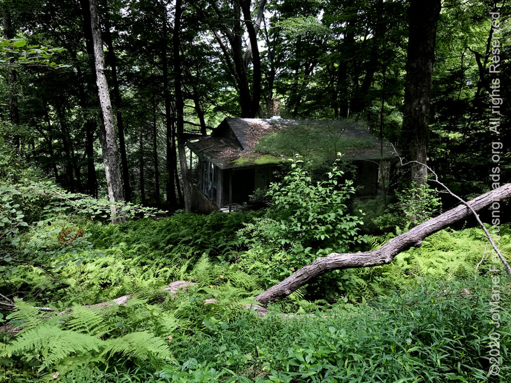
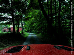
Old Mine Road is one of the oldest continually used roads in the United States. The 250-year old route is made up of several roads that form the Delaware Water Gap NRA’s main north-to-south passageway in New Jersey. Parts are paved while other sections are dirt and gravel, but the drive is easy for any kind of car. The road passes many interesting historic structures in various states of ruin/repair, as well as points where you can stop and access the river or hiking trails. It starts out passing through a portion of the Worthington State Forest, where there is some good camping right by the river.
It is said that Old Mine Road, constructed in the mid-1700s, connected the Hudson River and Philadelphia to the Pahaquarry Mines and provided an important conduit for New Jersey farmers taking crops to area markets. However, the origins of the road are shrouded in mystery. The popular story that it was used to haul copper from the mines to port cities dozens of miles away, seems unlikely, as there is no evidence of activity at the required scale. The more likely explanation is that old Lenape – and later, colonial – trails gradually widened with use. This provided clearer paths for people wanting to reach different locations.
Over time, the road evolved and shifted as more people poured into the Delaware River Valley and built their lives alongside it. By the dawn of the 20th century, the New Jersey side of the Gap was a picturesque landscape of farms and villages along bumpy roads tucked between the mountain ridges. Tourism was booming, and many hotels and guesthouses welcomed visitors in their new cars. Some of those still standing today include Mountain Side House/Coppermine Inn at Turtle Beach, Delaware View House at Walpack Bend, and the Ferncliff Hotel in the center of Peters Valley.
The Pahaquarry Copper Mine is an abandoned mine located on the west side of Kittatinny Mountain. Active mining was attempted for brief periods during the mid-eighteenth, mid-nineteenth, and early twentieth centuries but was never successful despite developments in mining technology and improving mineral extraction methods. The copper ore deposit found at Pahaquarry is the grayish mineral chalcocite (copper sulfide) embedded in a hard gray sandstone band of the Bloomsburg Red Beds. The similar color and low ore yield make visual identification difficult. Between 1903 and 1906, an average yield of 3.25% copper was reported and in 1943, the United States Geological Survey reported yields of 0.11% to 0.38% copper and recommended that no more work be done at Pahaquarry.
Today, the site within the Delaware Water Gap National Recreation Area, incorporates the mining ruins, hiking trails, and nearby waterfalls. It was added to the National Register of Historic Places in 1980 as a contributing property to the Old Mine Road Historic District.
There are several legends associated with this mine that have been discredited by historians and archaeologists. One legend claims that the Lenape worked the mine even before European settlers arrived. However, archeological and scientific testing show that the copper artifacts from the area originated from major native copper mines in Isle Royale and the Keweenaw Peninsula Michigan. Another legend claims that early Dutch settlers of New Netherland in the 1650s discovered and worked the mine building the Old Mine Road to transport the ore. The legend of the Dutch miners has also been refuted by recent research. The earliest evidence of mining at Pahaquarry is 1740 with a brief venture funded by John Reading, Jr. The next attempt began with the formation of the Alleghany Mining Company in 1847 by a group of men from Flemington, New Jersey. New mining activity began, but quickly ended in 1848, due to the poor quality of the ore. The last mining attempt began in 1901 when the Montgomery Gold Leaf Mining Company, founded by the brothers, Henry and Oliver Deshler of Belvidere, New Jersey, purchased the assets of the Alleghany Mining Company. After unsuccessful operations, the company reorganized as the Pahaquarry Copper Company in 1904. During the next years, a large ore processing mill, adjoining buildings and infrastructure were constructed at the area. New ore was not dug until 1911, and stopped after three months, producing perhaps only three ingots of refined copper. The last of the mining equipment was removed in 1928, ending copper mining in the area.
Paved roads, apart from Old Mine Road. Street-legal vehicles only.
Camping at campgrounds only (no dispersed camping)
Gas, food and water are all easily accessible.
The New Jersey Pine Barrens stretch across more than seven counties and the region remains mostly rural and undisturbed despite its proximity to the sprawling metropolitan cities of Philadelphia and New York City. The Pinelands Reserve contains three state forests (Wharton, Brendan T. Byrne, Penn, and Bass River) and two National Wild and Scenic Rivers (the Maurice and the Great Egg Harbor).
The Barrens formed in the southernmost and newest land area in New Jersey 1.8 to 65 million years ago, during the Tertiary era. Around 10,000 years ago, the ancestors of the Lenape people first inhabited the Pine Barrens. During the 17th century, the area that is now New Jersey was explored and settled by the Swedish and Dutch, who developed whaling and fishing settlements mainly along the Delaware River. The first shipbuilding operations began in the Pine Barrens in 1688, utilizing the cedar, oak, and pitch trees, as well as local tar and turpentine. The first sawmills and gristmills opened around 1700, leading to the first European settlements in the Pinelands. During the colonial era, the Pine Barrens was the location of various industries. Charcoal operations began in 1740, and the first iron furnace opened in 1765. Bog iron was mined from bogs, streams, and waterways, and was worked in about 35 furnaces including Batsto, Lake Atsion and several other locations. Iron from these early furnaces was instrumental in supplying the American military with weapons and camp tools during the American Revolution and the War of 1812.
The first Indian reservation in the Americas was founded in 1758 in what is now Indian Mills in Shamong Township. Cultivated cranberry bogs begin in the 1830s, and in 1832, the first paper mill opened in the region. In 1854, the first railroad across the Pinelands opened, connecting Camden and the newly-established Atlantic City. In 1869, the bog iron industry ended in the Pine Barrens, after the discovery that iron ore could be mined more cheaply in Pennsylvania. Other industries such as paper mills, sawmills, and gristmills rose and fell throughout the years, however over time the forest reclaimed almost all traces of the Pine Barrens’ industrial past. Ghost towns —-remnants of villages built around these former industries—-can still be found at various locations.
The New Jersey Pine Barrens, also known as the Pinelands or simply the Pines, is the largest remaining example of the Atlantic coastal pine barrens ecosystem (the other two large contiguous examples of this ecosystem are the Long Island Central Pine Barrens and the Massachusetts Coastal Pine Barrens). The name pine barrens refers to the area’s sandy, acidic, nutrient-poor soil. Although European settlers could not cultivate their familiar crops there, the unique ecology of the Pine Barrens supports a diverse spectrum of plant life, including orchids and carnivorous plants. The area is also notable for its populations of rare pygmy pitch pines and other plant species that depend on the frequent fires of the Pine Barrens to reproduce. The sand that composes much of the area’s soil is referred to by the locals as sugar sand.
Despite rapid urbanization of surrounding areas, the Pine Barrens remained largely untouched because its sandy soil was unsuitable for growing most crops.
In 1969, the Pine Barrens averaged a density of 15 inhabitants per square mile compared with 1,000 inhabitants per square mile in the lands bordering it. With rising environmental concerns at the time, people became alerted to the possible destruction of the Pine Barrens by urban sprawl.
Congress created the New Jersey Pinelands National Reserve, the country's first National Reserve, to protect the area under the National Parks and Recreation Act of 1978.
HIGHLIGHTS: Hiking, Camping,
Sandy 4WD Trails, Paddling,
Historic locations
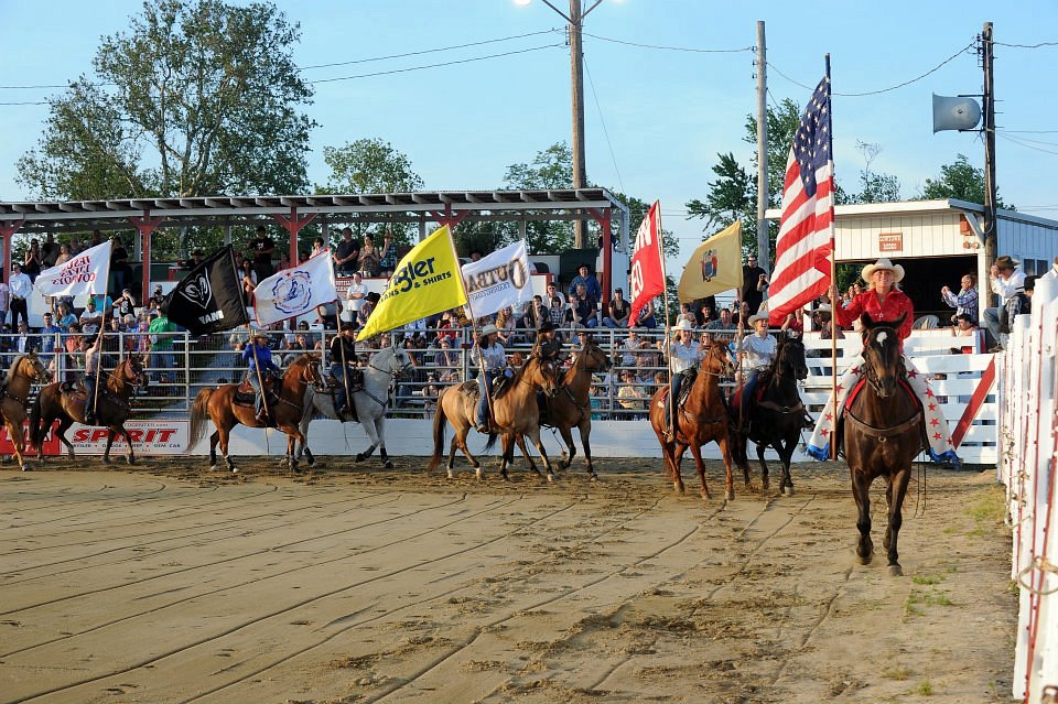
HIGHLIGHTS: Weekly Rodeo
HIGHLIGHTS: Scenic dirt
road, Wildlife observation,
Marshland, Hiking
Wharton State Forest is the largest state forest in New Jersey, encompassing approximately 122,880 acres of the Pinelands northeast of Hammonton. The entire forest is located within the Atlantic coastal pine barrens ecoregion as well as the New Jersey Pinelands National Reserve.
The land that is now the Wharton State Forest had been acquired by Philadelphia industrialist Joseph Wharton in the 1870s. Wharton purchased property and abandoned towns in the Pine Barrens, with the idea that he could tap the groundwater underneath to provide a source of clean drinking water for Philadelphia; however, the New Jersey Legislature quashed the plan by passing a law that banned the export of water from the state. The state bought the vast tract from Wharton’s heirs in the 1950s and established the Wharton State Forest on December 30, 1954. To prevent additional development, local residents and farmers worked to preserve the Pine Barrens, eventually leading to the formation of the Pinelands National Reserve in 1978.
Nestled in the heart of the Pinelands National Reserve, Wharton State Forest offers a chance to experience the unique Pine Barrens ecosystem with a variety of natural and historic activities. Visitors may enjoy scenic hiking trails, canoeing or kayaking, exploring historic Batsto Village, swimming and picnicking at Atsion Recreation Area during the summer, fishing, bicycling, bird watching, camping, and more.
The forest includes extensive hiking trails and over 250 miles of unpaved roads, making it the major public lands destination for off-roading in the state. The sand forest roads are open to street-legal vehicles and motorcycles that are properly registered, insured and driven by a licensed operator. ATV’s are not permitted. Canoeing and kayaking can be enjoyed on Mullica, Batsto, Wading and Oswego Rivers.
Wildlife that can be seen in the forest include bald eagles, red-tailed hawks, marsh hawks, ospreys, great blue herons, swans, screech owls, great-horned owls, bluebirds, hummingbirds, purple martins, goldfinch, turkeys, beavers, river otters, fox and deer.
It also has ten campgrounds, ranging from family camping at Atsion Recreation Area, with showers and a guarded beach, to wilderness camping that can be reached only by hiking or canoe/kayak. The Atsion campground, which is open April – October, has 50 tent and trailer sites with fire rings and picnic tables. Potable water, flush toilets and showers are within walking distance. The smaller Godfrey Bridge campground, which is open all year, has 34 tent and trailer sites (21 feet or less), water, picnic tables, fire rings and pit toilets. Primitive campsites with hand pumps for water and pit toilets are located at Bodine Field, Hawkins Bridge, Batona, Mullica River and Goshen Pond. Sites at Buttonwood Hill and Lower Forge have no water. Mullica River and Lower Forge can only be accessed by hiking, canoeing or horseback; all other areas are accessible by motor vehicles.
The hiking trails pass through dry upland and low wetland landscapes typical of the region. The terrain is relatively flat with some low hills; the soil is sandy and the climate varies from hot and humid in summer to below freezing in winter. Ticks, chiggers, biting flies and mosquitoes can be common, so be prepared. The fire-prone uplands of the region consist mostly of pine-oak and oak-pine forests often with a dense shrub layer. About one quarter of the New Jersey Pinelands is comprised of wetlands. Atlantic white cedar and red maple swamps, wetland savannas and bogs occur along slowmoving tannin-stained rivers and creeks. Wetlands provide habitat for the majority of the rare and endangered plants and animals of the pine barrens ecosystem.
A nice easy hike is the Tom’s Pond Trail, a 1.1 mile loop that begins in a dry pine-oak forest with a lush growth of huckleberry and other upland shrubs typical of the region. The trail gradually descends to an Atlantic white cedar swamp along the Mullica River. After crossing to the west side of the river, the trail is generally dry with abundant pitch pine and short leaf pine. This portion of the trail travels through dry pine woods with huckleberry, low blueberry and particularly abundant growths of teaberry and lichens. (To the right just beyond the west end of the foot bridge an alternate loop that closely follows the Mullica River is often dry enough to take back to the main portion of the trail.) The scrubby pitch pine borders Atlantic white cedar growing along a small creek. Beneath the cedar, carnivorous plants and other typical bog plants thrive.
There are also a few different hiking trail options near the historic Batsto Village, which itself is an interesting interpretive site — a former bog iron and glass manufacturing that operated here from 1766 to 1867. In the 1800s, the area’s rich natural resources made South Jersey an important center of industry and various various bog iron and paper industries developed in the New Jersey Pine Barrens. Batsto produced iron products for the Revolutionary War, and more than 30 of its 19th century buildings survive, including the fully furnished Batsto Mansion.
A few other interesting “sites” within the forest include the Atsion mansion and the Carranza Memorial. The Atsion mansion, once a residence and cranberry packing facility, had been vacant since 1882 before being restored to the current historically accurate interpretation of the building which is open to visitors. The Carranza Memorial in Tabernacle marks the spot where Captain Emilio Carranza Rodríguez was killed while returning from a historic goodwill flight from Mexico City to the United States. Carranza became a national hero when, in the summer of 1928, he was selected to undertake a goodwill flight from Mexico City to New York City in response to the previous year’s flight from New York City to Mexico City undertaken by American aviator Charles Lindbergh. Carranza began his American visit by landing in Washington, D.C. on June 12 where he was congratulated by President Calvin Coolidge. He then flew to New York City and was honored by the city’s mayor. Carranza departed New York on July 12. Shortly after taking off, he encountered thunderstorms while flying over the NJ Pinelands. His plane, named the Excelsior, came apart and he crashed into the woods. His body was recovered the next day. A 12-foot monument in Wharton State Forest marks the site of his crash. The monument, installed with funds donated by Mexican schoolchildren, depicts a falling eagle of Aztec design. Every July, on the Saturday nearest the anniversary of his crash (second Saturday in July) at 1:00 p.m. he is honored at the monument site by members of the American Legion Mount Holly Post 11 accompanied by an entourage from the Mexican consulates in New York City and Philadelphia.
Something really fun and not typical of this part of the US is the Cowtown Rodeo in Pilesgrove, New Jersey, eight miles east of the Delaware Memorial Bridge. The Rodeo runs weekly on Saturdays during the summer.
Cowtown Rodeo was started in 1929 by Howard Harris Sr. and his son, Howard “Stoney” Harris Jr. Stoney held the first rodeo in Woodstown NJ, in conjunction with the Salem County Fair, at the original auction grounds on North Main Street.
The rodeo was held annually during the County Fair until 1938. World War II caused the rodeo to be put on hold until 1955 when Howard “Baldy” Harris, Stoney’s son, came back from the University of Idaho carrying the 1954 National Intercollegiate All Around Rodeo Championship saddle. The Family worked together in establishing what is now known as the “oldest weekly professional rodeo in the United States.”
The rodeo outgrew the original arena and in 1967 built the present 4,000 seat arena.
Cowtown Rodeo is unique in the fact that they not only have produced rodeos all over the East Coast, from Rutland, Vermont to Raleigh, North Carolina, but also raise most of their bucking stock. The bucking horses you see today are the grandsons and granddaughters of those you might have seen in the early 1970’s. In 1984 & 1985.
The rodeo season is every Saturday Night, Memorial Day weekend through the end of September. Gates open at 6:00 pm and the action starts at 7:30 pm.
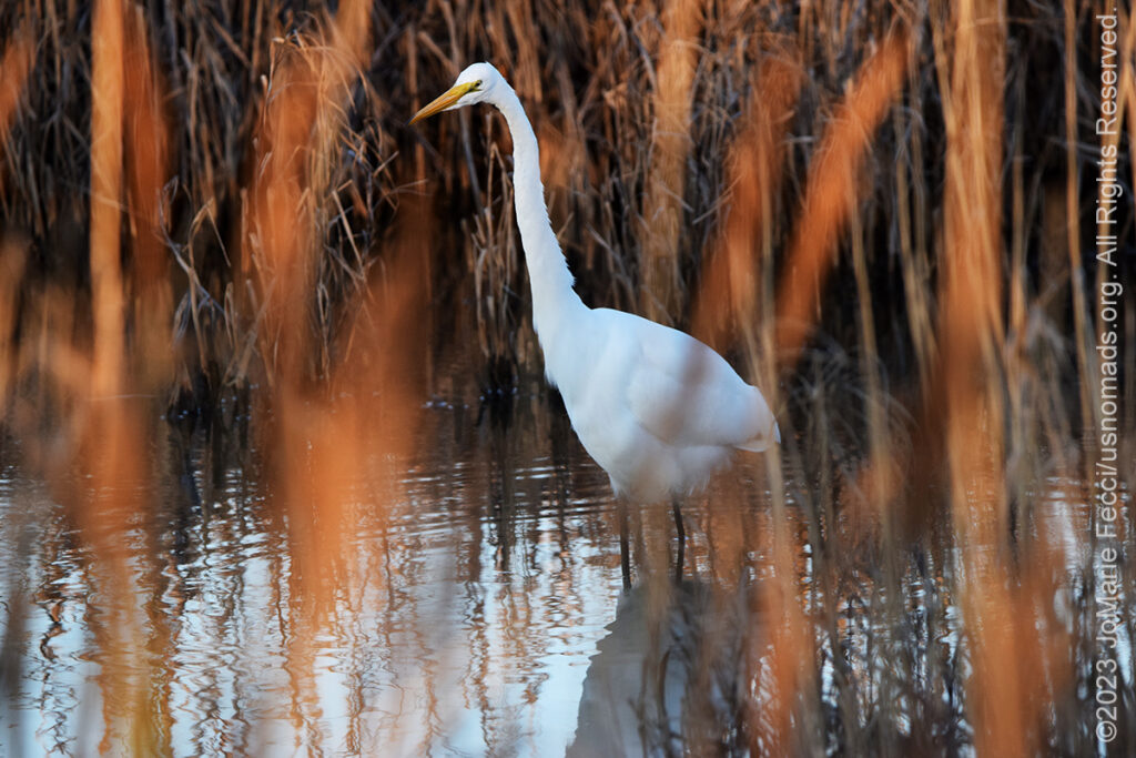
The Edwin Forsyth National Wildlife Refuge includes more than 47,000 acres of southern New Jersey coastal habitats and represents the fragile estuary ecosystems which are sustained by fresh water flowing from the interior Pine Barrens forests into the coastal marshes and bays. More than 82 percent of Forsythe refuge is wetlands, of which 78 percent is salt marsh, interspersed with shallow coves and bays.
The Refuge is located on one of the Atlantic Flyway’s most active flight paths. The Refuge includes walking trails through increasingly rare coastal pine forest habitats and a self-guided drive. The Wildlife Drive features two wildlife observational towers, a boardwalk extending over the salt marsh with views of the Atlantic City skyline, and links to a network of trails, providing opportunities for hiking, wildlife observation, photography, and more.
Motorized access in the Wharton State Forest is open to street-legal vehicles only.
Developed and primitive campsites are available in the forest (no dispersed camping)
Gas, food and water are all easily accessible.
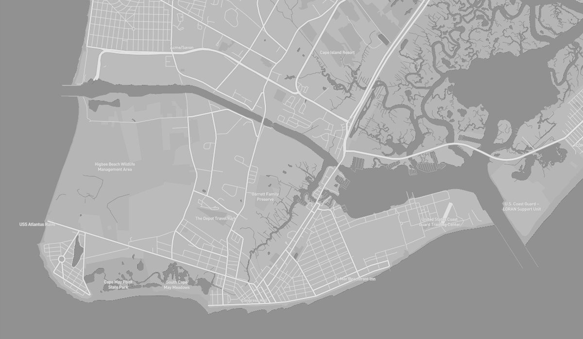
Cape May is a seaside resort town located at the southern tip of Cape May Peninsula where the Delaware Bay meets the Atlantic Ocean. It is one of the country’s oldest vacation resort destinations. And while we are not particularly interested in the beach resort aspect of the town, we have found some interesting historical and wilderness sites, as well as the ferry to Delaware, which makes for a great north-south coastal route to the Delmarva Peninsula.
The area was originally settled by the Kechemeche who were part of the Lenape tribe and the Kechemeche first encountered European colonialists around 1600. The city was named for the Dutch captain Cornelius Jacobsen Mey, who explored and charted the area between 1611–1614. Cape May began hosting vacationers from Philadelphia in the mid-18th century. The entire city of Cape May is designated the Cape May Historic District, a National Historic Landmark due to its concentration of Victorian architecture (its the only city in the U.S. to be wholly designated as a national historic district).
Because of the World War II submarine threat off the East Coast of the United States, especially off the shore of Cape May and at the mouth of the Delaware Bay, numerous United States Navy facilities were located here in order to protect American coastal shipping. Cape May Naval facilities also provided significant help in reducing the number of ships and crew members lost at sea.
Cape May consists of a peninsula and barrier island system that is roughly coterminous with Cape May County and runs southwards from the New Jersey mainland, separating Delaware Bay from the Atlantic Ocean. The southernmost point in New Jersey lies on the cape. It is at approximately the same latitude as Washington, D.C., and Arlington County, Virginia. It is generally low-lying, with its highest point, at the intersection of Washington and Jackson Streets, at only 14 ft above sea level. Cape Island, which contains the “tip” know as Cape May Point, is a man-made island separated from the mainland by the Cape May Canal, Cape Island Creek and Cape May Harbor. The canal connects the Harbor to the Delaware Bay.
The Cape May peninsula is part of the Atlantic Coastal Plain, one of eight distinct topographic divisions of the continental USA. The Coastal Plain is differentiated from the Continental Shelf based on the portion of the land mass above and below sea level.
The lands adjacent to the Atlantic coastline are made up of sandy beaches, marshlands, bays, and barrier islands. It is the flattest of the U.S. physiographic divisions and stretches over 2,200 miles in length from Cape Cod to the Mexican border (and southward an additional 1,000 miles to the Yucatán Peninsula).
It is an area of nearly continuous barrier islands interrupted by inlets and extensive wetlands and marshes.
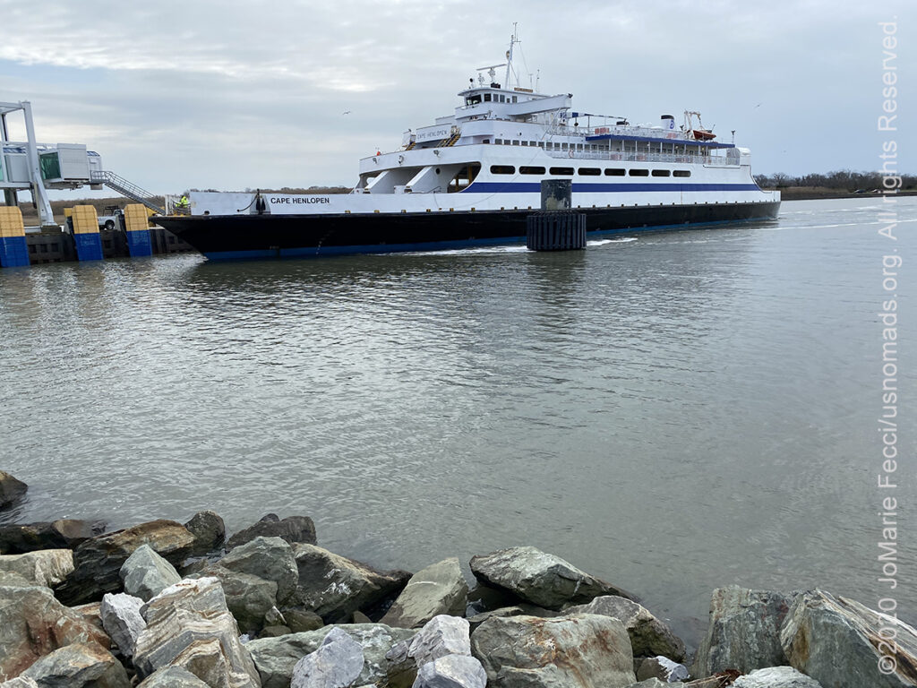
HIGHLIGHTS: Ferry to
Delaware
HIGHLIGHTS: Historic
Structure, Beach, Sunken
Ship ruins
HIGHLIGHTS: Lighthouse,
Beach
HIGHLIGHTS: Historic
Structure, Beach
HIGHLIGHTS: Hiking,
Wildlife Observation
The Cape May–Lewes Ferry is a ferry system in the United States that traverses a 17-mile crossing of the Delaware Bay connecting North Cape May, New Jersey with Lewes, Delaware. The ferry constitutes a portion of U.S. Route 9 and is the final crossing of the Delaware River-Delaware Bay waterway before it meets the Atlantic Ocean. As the ferry is a part of US 9, it is included as part of the U.S. Highway System. The only other U.S. Route to use a ferry is U.S. Route 10, which uses the SS Badger across Lake Michigan. Routewise, taking the ferry avoids going around the Delaware Bay and avoids highways and bridges such as the New Jersey Turnpike, Delaware Memorial Bridge, US 13, and DE 1.
The ferry carries vehicles and foot passengers, and the one-way journey takes approximately 85 minutes. Along the way there are views of three lighthouses: the Cape May Light in New Jersey, and the Harbor of Refuge Light and Delaware Breakwater East End Light near Lewes.
The ferry crossing dates back to the 1920, when the idea was to use a World War I military ship to transport passengers and cars across the Delaware Bay, but the project was abandoned after a few months. It wasn’t until almost 50 years later that ferry service actually began on July 1, 1964. The ferry utilized a fleet of five steamers purchased from Virginia, before replacing them with more modern ships in the 1970s.
The ferry was conceived with transportation as its primary use, providing a connection between the south Jersey Shore towns and the Delaware Beaches and Ocean City, Maryland, on the Delmarva Peninsula. It was only later on that the he Delaware River and Bay Authority (DRBA) recognized the ferry’s potential as a tourist attraction. And while it continues to provide transportation between Delaware and New Jersey, the experience has also been optimized to draw in tourists.
Cape May National Wildlife Refuge is located throughout the tip of South New Jersey and along the Atlantic Flyway. Encompassing pristine beach, bayshore, saltmarsh, and upland forest habitats it is world famous for its spectacular migratory bird populations as well as become a crucial area for the rehabilitation of multiple threatened and endangered species.
Established in 1989, Cape May NWR provides critical habitat to a wide variety of migratory birds and other wildlife. It supports 317 bird species, 42 mammal species, 55 reptile and amphibian species, and numerous fish, shellfish and other invertebrates. Its value for the protection of migratory birds and their habitat will continue to grow as wildlife habitat along the Jersey Shore is developed into roads, shopping centers and housing developments. Cape May Peninsula’s unique configuration and location concentrate songbirds, raptors and woodcock as they funnel south to Cape May Point during their fall migration. Faced with 12 miles of water to cross at the Delaware Bay migrants linger in the area to rest and feed until favorable winds allow them to cross the Bay or head north along the Bay’s eastern shore.
Cape May NWR is focused on restoring crucial marsh habitat throughout South Jersey.
The site houses three separate divisions each with various trails and sights for the public to enjoy. There are four hiking trails throughout the refuge. These include Cedar Swamp Trail in the Great Cedar Swamp Division; Woodcock Trail and Songbird Trail in the Delaware Bay Division; and Dune Trail at the Two Mile Beach Unit. The Two Mile Beach Unit also has a semi-enclosed photo blind is located on the Marsh Trail as well as open air observation platforms along the Dune Trail.
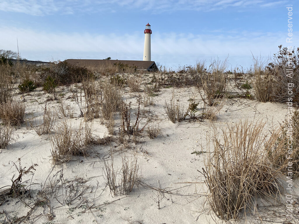
The Cape May Lighthouse, at the tip of Cape May, was built in 1859. There are 199 steps to the top of the Lighthouse and the walls were designed to withstand winds several times above hurricane force. The view from the top extends to Cape May City and Wildwood to the north, Cape May Point to the south, and, on a clear day, Cape Henlopen, Delaware, to the west. Within immediate view are Cape May Cove and Battery 223, a harbor defense battery originally built during World War II.
This is the third fully documented lighthouse to be built at Cape May Point. The first was built in 1823 and the second in 1847. The exact locations of the first two lighthouses are now underwater due to erosion.
The lighthouse was automated in 1946, and continues operation to this day. It is now owned by the state of New Jersey, and in addition to it’s role as an active aid to maritime navigation, the lighthouse is open to the public with interpretive exhibits that give visitors some insight into the maritime history of the area.
Cape May Lighthouse was added to the National Register of Historic Places on November 12, 1973.
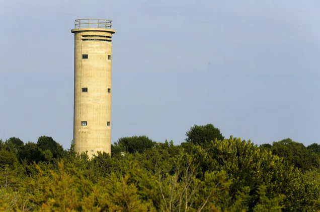
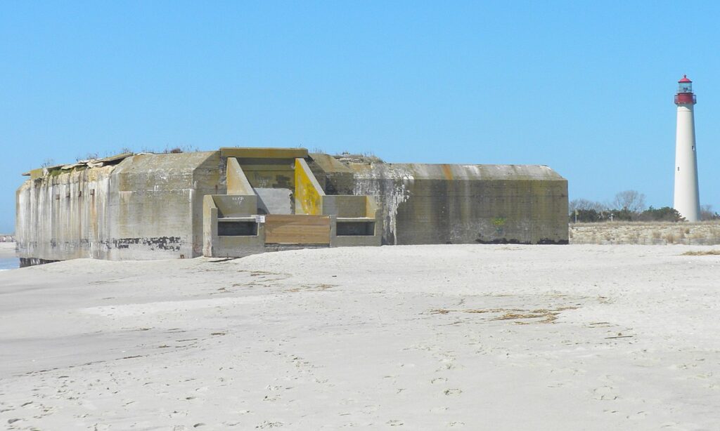
Battery 223 has been part of the coastal landscape in Cape May Point since it was completed in 1943. When the harbor defense battery was erected it was 900 feet from the ocean. Today, because of beach erosion, it’s right on the beach.
The bunker/gun emplacement boasts 20 rooms, six-foot-thick reinforced concrete walls, and a blast-proof roof strong enough to withstand a direct hit from a battleship artillery shell or an attack by a dive-bombing airplane.
In the years before the entry of the U.S. into World War II, the belief that America’s shore defenses were inadequate resulted in the 1940 Modernization of the Coastal Defense program. Battery 223 was part of the effort to address the advances of offensive and defensive technology in the 1930s. Standardized and mass-produced fortifications were built on both the east and west coasts.
Battery 223 was one of three 200-series fortifications built for Fort Miles, headquartered in Cape Henlopen, Delaware. Designed to host a 6-inch battery and survive a direct hit from battleships and aircraft, the structure was built with six-foot thick reinforced concrete walls and a thick blast proof roof; the entire building was covered with earth. The 6-inch guns had a nine-mile range.
In addition to the three 200-series batteries, Fort Miles also had a 16-inch and a 12-inch battery, both at Cape Henlopen. The 16-inch guns had a range of 26 miles. In all, assets of Fort Miles extended along 200 miles of shoreline, including a network of 20 fire control towers.
Battery 223’s guns were never fired at an enemy, though there were drills and live fire tests. As the war turned in favor of the Allies, lessening the need for coastal defense, and continuing advances in warfare technology rendered fixed coastal defenses obsolete, the Modernization of the Coastal Defense program was never completed. Battery 223 was decommissioned in 1944. It became part of the Cape May Point State Park in 1962.
Paved Roads only
Camping at campgrounds only (no dispersed camping)
Gas, food and water are all easily accessible.