Our home base is on Long Island, NY, and these are a few of our favorite places close to home.
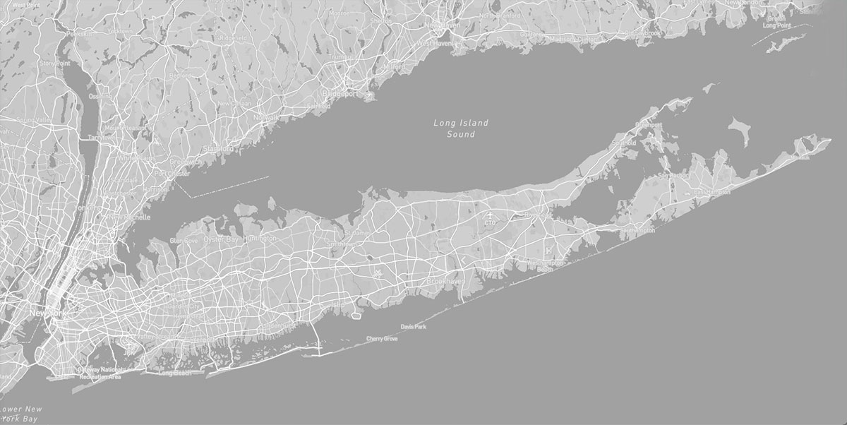
Overview: The whole island is essentially part of the New York City metro area, characterized by sprawling suburbs and shopping centers — however, there are some interesting outdoor locations to explore, where you can experience something of the raw natural beauty of coastal beaches, pine barrens and a little bit of obscure military history. This area is all paved roads apart from a few short fishing access dirt roads — however if you are in the region, it is definitely worth spending some time enjoying the outdoors here.
TOPOGRAPHY: Long Island is the largest island adjoining the contiguous United States, extending approximately 118 miles east-northeast from the mouth of the Hudson River. It is separated from the mainland on the north by the Long Island Sound and bounded by the Atlantic Ocean on the south and east. Twenty miles at its widest point, Long Island is composed of low plateaus on the north, longitudinal ridges of glacial moraine through the central parts of the island, and gently sloping plains to the south. The landscape reflects the island’s geological formation from glacial movement and coastal erosion. High topography and rocky beaches characterize much of the north shore of Long Island, while the sandy outwash plain and beaches represent the lower topography of the south shore. Glacial retreat left its mark throughout the interior of the island as well, with relatively flat plains, lakes and ponds that were formed from the maximum retreat of the Wisconsin ice sheet more than 18,000 years ago.
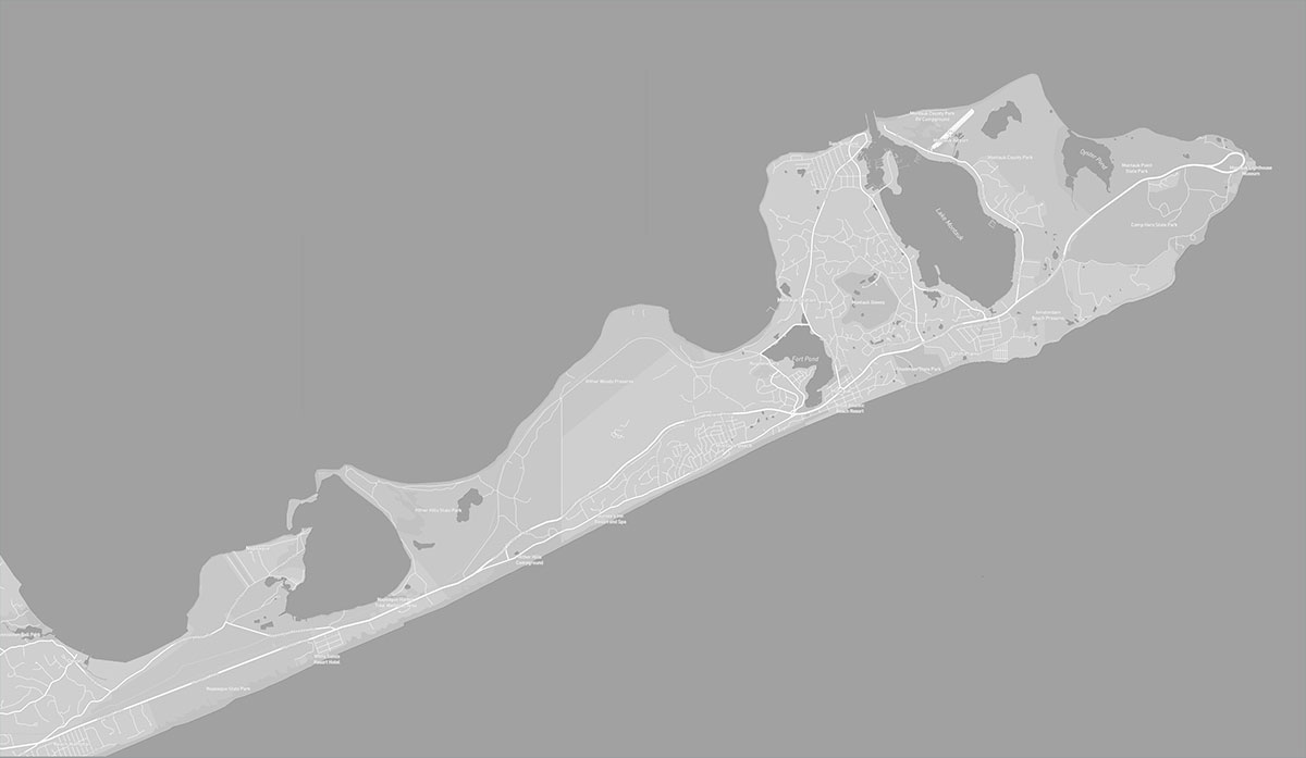
The East End of the island is made up of two forks. The North Fork is approximately 28 miles long, the southern – terminating at Montauk Point – is about 44 miles in length. Peconic and Gardiners Bays separate the two forks.
HISTORY: The island’s indigenous inhabitants fell into two linguistic groups with the Montauk (who spoke a language of the Mohegan-Montauk-Narragansett language group) at the eastern half of the island, and the Delaware or Lenape (who spoke an Algonquian language called the Munsee dialect) in the west. In 1524 they encountered Giovanni da Verrazzano, the first European to explore the Atlantic coast of North America from Florida to New Brunswick. Then came the Dutch and the English who stayed.
The Shinnecock were one of the first indigenous tribes to come into contact with the European settlers (the place of “first contact” now called “Conscience Point” is one of our waypoints). The Shinnecock people were master whalers, expert fisherman, hunters and farmers, sustaining themselves from the lands and waters around them, and they help the settlers learn to live off the lands. During the early stages of European settlement life continued as usual for the Shinnecock, but as colonization progressed, clashes over land became more frequent. Initially the English settlers purchased and paid for the land they occupied, but by 1662 there were complaints of European occupation of lands they hadn’t paid for. By 1686 the situation had changed and the colonizers began systematically pushing the indigenous peoples out of their homelands. This was also the beginning of the push to “assimilate” indigenous people by force — the Shinnecock were forced into the English way of life, forced to have English names and wear European-style clothing, forced into Christianity and the Church. Though many Shinnecock people taught their traditions underground, it proved very detrimental to their traditional way of life.
Today there are only two recognized tribes on Long Island: The Shinnecock Nation and the Unkechaug Nation. The Shinnecock Nation has a Reservation in Southampton and the Unkechaugi band of Poospatuck have a reservation in Mastic.
Long Island’s “East End” consists of two “forks” — the North Fork and the South Fork, with each offering a different kind of ambiance. (While there is a lot of tourism and social activity out there, it is still possible to get out into the woods and onto some of the wilder beaches if you time it right and avoid the peak summer seasonal crowds). There is a cluster of State Parks on the east end of the South Fork that taken together provide some great opportunities for exploring.
As you wander some of these more remote trails, you can get a feeling for what this area was like before the arrival of European settlers.
Long Island’s landscape once consisted of prairie which gradually gave way to a transition zone of scrub oak, heath plants and scattered pitch pines as one moved from west to east. Little remains of these unique areas, but on the eastern most part of the island, where pines grew taller and denser, a good portion of the natural landscape was protected. These “Pine Barrens” once stretched for 250,000 acres from west of the Connetquot River to Hampton Bays.
The sandy soil — glacial outwash of the last Ice Age — is so porous that many traditional crops fared poorly without extensive soil amendments. Native plants, however, adapted themselves to near desert-like conditions and frequent brush fires. Pitch pines, scrub oaks and the understory “heath plants”—-blueberry, huckleberry, wintergreen and so on—-contain pitches and resins that actually promote their own burning. However, these plants store much of their energy in large underground roots, so that when a brush fire blackens the earth they re-sprout in great abundance, while competing, non-native species do not.
Post-World War II development changed the island’s landscape forever. The Pine Barrens, too, dwindled to about 100,000 acres — saved by the 1993 Pine Barrens Protection Act.
Some of our favorite places on the South Fork of the East End include the Shadmoor Cliffs, Napeague Bay, Camp Hero Radio Tower and the Walking Dunes hike.
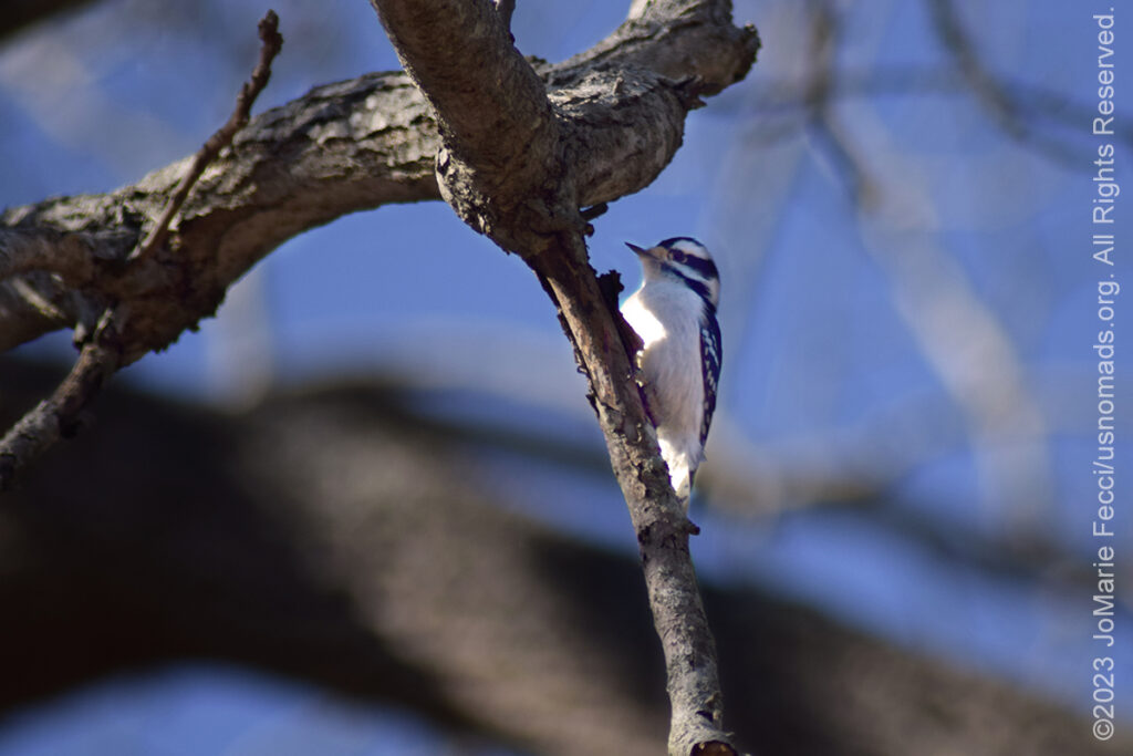
The Long Island Pine Barrens is a large area of publicly protected pine barrens in Suffolk County covering more than 100,000 acres. It is Long Island’s largest natural area and its last remaining wilderness. The region contains a remnant of the Atlantic coastal pine barrens ecoregion, whose forests might once have covered a quarter million acres on Long Island. Formed by a unique set of geological conditions over the past 15,000 years, the Pine Barrens is one of the Northeast’s greatest natural treasures. Dry upland areas are dominated by the pitch pine that gives the region its name, though in many areas black, scarlet and white oak share the tree canopy. The Long Island Pine Barrens also contains a diverse range of wetland communities, including marshes, heath bogs, red maple swamps and rare Atlantic white cedar swamps. Animals in the Long Island Pine Barrens include over 100 bird species, and the region boasts the greatest diversity of plant and animal species anywhere in the state of New York.
This sometimes scrubby tree survives in near desert-like conditions by sending huge taproots and lateral roots far into sandy soil. It's plate-like bark, full of insulating air pockets, allows the tree to survive fires as hot as 2,000 degrees if the crown remains intact.
Pitch pines are also self-pruning, dropping their lower branches as a way of keeping their feet out of a fire.
Soft, light, and durable, but too coarse-grained for fine woodwork, old virgin stands of pitch pine often ended up as railroad ties and joists in log houses. Much pitch pine was burned to create charcoal. At the turn of the 20th Century, pitch pine was a staple of the box-manufacturing industry. Pitch pines were also a source of turpentine.
The “humble” pitch pine, then, has played an important role in the lives of those who have lived in its shadow.
HIGHLIGHTS: Montauk Lighthouse,
Shoreline hiking trails
HIGHLIGHTS: Abandoned military
sites, Old radar tower,
coastal bluffs
HIGHLIGHTS: Bluff Overlooks
Bluff Hiking Trails,
Abandoned Military Sites
HIGHLIGHTS: Beachside
Campground,
Coastal Hikes
HIGHLIGHTS: Walking Dunes
Hike, Napeague Bay,
Coastal Wilderness,
Promised Land Ruins
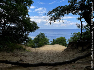
At the very tip of the South Fork is the Montauk Point State Park with it’s iconic lighthouse. The lighthouse is one of the oldest in the nation, authorized by the Second Congress under George Washington in 1792.
This park is heavily developed with a restaurant and gift shop near the area of the lighthouse, but it is possible to get away from the crowds on one of the easy walking trails along the rocky shoreline with stunning views of the Atlantic Ocean where it meets the Block Island Sound. The view is unique, because, when the water is calm, visitors can clearly see the “race” of converging tides from the Atlantic and Block Island Sound.
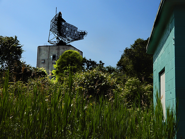
Camp Hero State Park is adjacent to Montauk Point State Park and is less developed. Though it has no campground, it offers the opportunity to explore the heights of the bluffs as well as the ruins of a World War II – era military installation.
This area of Long Island was heavily fortified during World War I and World War II and the gun emplacements and concrete observation bunkers are still visible.
The site known as Camp Hero, or the Montauk Air Force Station, was originally commissioned by the U.S. Army in 1942. Camp Hero was originally a coastal defense station that was disguised as a fishing village, and its location was chosen to prevent a potential invasion of New York from the sea.
Three gun batteries were built at Camp Hero, replacing most of the other heavy guns in the Harbor Defenses of Long Island Sound. Two batteries, Batteries 112 and 113 (officially named Battery Dunn), held two 16-inch guns each and Battery 216 held two 6-inch guns. All three batteries consisted mainly of a large concrete bunker covered with earth, containing ammunition magazines and fire control equipment.
Camp Hero remained largely undeveloped through the 1980s and 1990s. Camp Hero State Park was opened to the public on September 18, 2002. There are plans to create a museum and an interpretive center that will focus on World War II and Cold War history inside the radar tower.
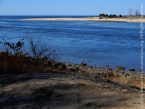
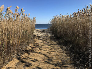
Napeague is located on a very narrow, low-lying strip between the Atlantic Ocean to the south and Gardiners Bay to the north that was flooded in the Great Hurricane of 1938. It derives its name from the Montaukett name for “land overflowed by the sea”. At the end of the last ice age, Napeague was submerged under the sea. (At that time, Montauk was an island.) In the intervening several thousand years, ocean currents, or littoral drift, filled in this space with sand, giving rise to Napeague.
Napeague State Park is a largely undeveloped park that stretches across the entire narrow width of the South Fork between Amagansett and Montauk. The hamlet of Napeague is located on the park’s edge. The beaches on the north side of the park follow the countours of the Napeague Bay. There is virtually no infrastructure or permitted camping at the park, which is administered by Hither Hills.
Its most distinguishing natural feature is a pristine Atlantic Ocean beach that is often closed during the summer because the of nesting piping plovers.
An interesting historical ruin on the north side of the park is the ruins of an abandoned Smith Meal fish factory called “Promised Land.”
We chose to camp at the Hither Hills State Park campground, which has beach access by foot, just across the dunes. We were very lucky to get a campsite even though it was early summer, as this campground is usually solidly booked for the peak season will in advance. The 153 site developed campground accepts tents, motor homes, pop-ups and trailers.
From a base at Hither Hills it is easy to explore two lesser visited parks right nearby — Napeague and Shadmoor Preserve
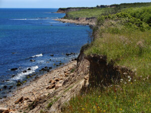
The Shadmoor Preserve features striking, panoramic views of the Atlantic. With spectacular fluted sand and clay bluffs that plunge dramatically down to the Atlantic, Shadmoor’s trails have been enjoyed since the time of the Montauketts. At one time, the area was inhabited by farmers who purchased the land from the Native Americans to use as common pasture for their livestock. Shadmoor was still a grassland at the turn of the 20th century when it became Camp Wycoff, where Teddy Roosevelt’s Rough Riders, returning from the Spanish American War of 1898, were quarantined as they battled malaria and other tropical diseases.
Over the years, most of the grassland has grown into a dense maritime heathland dotted with wetlands, including several small ponds that are important habitat for both migrating and nesting birds.
During World War II, Shadmoor was part of the coastal defense system for New York City and was used as a coastal artillery fire control station. Two historic bunkers remain there today.
The park preserves more than 2,400 feet of beach and 100-foot bluffs along the Atlantic. This expanse of preserved oceanfront makes it a refuge for birds and other wildlife, and one of the few remaining habitats for a number of endangered wildflowers. Shadmoor derives its name from the thick shadbush found growing atop the bluffs.
Today it is possible to hike along the bluffs with their spectacular coastline views via 3 miles of trails, but beyond that the park is largely undeveloped, and has no infrastructure.
There are really no publicly accessible jeep trails or even dirt roads here, though it is possible to get a permit for beach driving with very specific limitations.
Camping at campgrounds only (no dispersed camping)
Gas, food and water are all easily accessible.
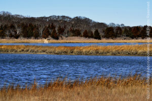
The Peconic Bay separates the North and South Forks of Long Island, and there are some really great spots to experience the wetlands environment here. A series of protected areas preserve the Peconic Estuary.
The Peconic Estuary and its watershed have been identified as one of The Nature Conservancy’s “Last Great Places” in the western hemisphere. A body of water between two forks, the Peconic Estuary is a shallow, well-mixed estuary located between the North and South ends of Long Island, New York. Approximately 128,000 acres of the watershed drain into the 155,000-acre estuary connected to the Atlantic Ocean.
The Peconic Estuary exhibits a rich mosaic of coastal and underwater habitats that support diverse communities and 140 globally and locally rare species. The distinctive ecology of the Peconic Estuary can be attributed to its unique fresh groundwater source and the restriction of water flow out of the estuary by Shelter Island.
The estuary provides feeding habitat as well as spawning and nursery grounds to a wide variety of aquatic and terrestrial species.
Meadows of eelgrass, found along the edges of the eastern end of the estuary establish one of the most important underwater habitats within the Peconic. These meadows provide food and shelter for many marine organisms and are an important component of the nutrient cycle.
Shellfish, such as bay scallops and hard clams, and fish, such as bay anchovies, Atlantic silversides, summer flounders and weakfish, are among the many aquatic species that utilize the Peconic Estuary.
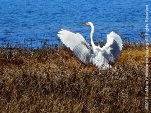
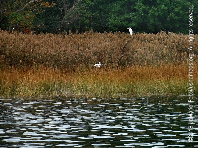
HIGHLIGHTS: Wild Birds
Nature Trail Hike, Jessups Neck
HIGHLIGHTS: Historic site,
Short marshland nature trail
HIGHLIGHTS: Scenic dirt
road, Wildlife observation,
Marshland
HIGHLIGHTS: Kayaking, Wildlife
The Wild Birds Nature Trail is a 1.2-mile loop path on relatively flat land through the forest and onto the beach. There is an observation deck near one of the refuge’s ponds, where green frogs and painted turtles can sometimes be spotted. Once at the beach the trail continues along Jessup’s peninsula for another two miles.
The Conscience Point Historic Site and Nature Walk is at the end of Conscience Point Road in Southampton, at the edge of the Conscience Point National Wildlife Refuge (which is not open to the public). The Historic Site is managed by the Southampton History Museum.
Conscience Point is the approximate landing place of the first English colonists who arrived here in June of 1640. The Shinnecock Indians lived around the harbor for many centuries before the arrival of the English who subsequently settled in the vicinity of the present Southampton Village.
Conscience Point received it’s name after a weary traveler, leaving the boat for the first time in months, reportedly looked heavenward and said, ”For conscience’s sake, we’ve hit land!”
Both the early settlers and the Native Americans benefited from the productivity of the marsh-bordered land and harbor.
At the site is a commemorative plaque and some interpretive signs and a short walking trail along the marsh edge with the beautiful North Sea harbor on the other side. The short nature walk follows a straight path to the rock marker that commemorates the arrival of the Europeans.
The Village of Southampton, which was settled as Southampton Town in 1640 and incorporated in 1894, began with a small group of English Puritans who set sail from Lynn, Massachusetts and landed at what is now known as Conscience Point. It was to become the first permanent English settlement in the State of New York and was named after the British Earl of Southampton.
The early settlers established their “plantation” at the head of Old Town Pond, where it is believed they constructed their first homes. The Native American Shinnecock tribe sold additional land to the settlers adjoining their original grant of “eight miles square” and also shared their knowledge of planting corn and fertilizing with fish, growing crops, trapping game, and digging clams and scallops from the nearby bays. During the 18th and 19th centuries, fishing, farming (especially Long Island Potatoes and our local sweet corn) and duck-raising were the predominant industries.
With the end of the Revolutionary War and withdrawal of British forces in 1783, the community was slow to recover. The Whaling Industry, which began off-shore on a small scale in the late 17th century, grew immensely with long-distance whaling in the 19th century and helped the community regain its prosperity. With the extension of the Long Island Rail Road through Southampton to Sag Harbor in 1872, wealthy New Yorkers seeking escape from the ever-growing city sought the serenity and recreational opportunities of our countryside and the beauty of our pristine beaches. This new national phenomenon – the summer vacation – led to a building boom during the early part of the 20th century when large estates were designed and built here, transforming the Village of Southampton into the resort community it is today.
Scallop Pond Preserve, managed by the Nature Conservancy, is one of the most pristine salt marshes left on eastern Long Island and part of the Sebonac Creek estuary. The marshes and tidal flats are flooded twice daily by the tide and serve as a major spawning ground for shellfish and finfish, including scallops, winter flounder, summer flounder, menhaden, weakfish and scup. The preserve is also an important stopover point for migratory birds. In fact, it’s an important habitat for birds year round—144 different bird species have been recorded here.
Scallop Pond Preserve is an assemblage of six tracts, and although it is one of Long Island’s least developed coastal wetlands, it has a long history of human use. The Sebonac Creek estuary was an important source of food for Native Americans and European colonists. By the 1790s, much of the forest in this area had been cut for houses and shipbuilding, and by the 1830s the estuary was being fished for menhaden.
By the 1880s, records show an annual harvest of oysters, scallops, quahogs, soft shell clams and eels. Sport-hunting became widespread by 1900, and it wasn’t uncommon for a hunter to kill upwards of 300 scaups in a single day. These practices led to the quick extinction of birds such as the passenger pigeon, heath hen, Eskimo curlew and Labrador duck.
Scallop Pond Preserve offers a one-mile stroll through beautiful salt marshes and near ponds. Trails are open for hiking and observing nature from dawn to dusk. Visitors are reminded not to walk in the fragile marsh habitat.
Please note when traveling to the preserve that the sand-and-dirt road that comes off of Scotts Road into Scallop Pond Preserve is called “K Road” on most maps. It is located directly across from Scallop Pond Road. K Road is the road you will use to enter the preserve. This road can be difficult to drive on due to large, seasonal potholes and puddles; it is often easier to park along the 90-degree bend at the beginning of K Road and walk on K Road down to the pond and marshes. This half-mile sand road is a wonderful, sometimes muddy walk. It is great for birdwatching and offers excellent views of the site’s expansive marshlands. Late afternoon and sunset are especially beautiful times to watch the light move across the marsh grasses.
This preserve provides valuable nesting and feeding areas for a variety of birds, from American black duck and other waterfowl to shorebirds such as least and common terns and piping plover. The pond is rich in wading birds, including American bittern, green heron, snowy egret and black-crowned night heron. Spring and fall bring neotropical migrants stopping to rest on their marathon journeys. The best place to observe birds is at the end of the dirt road off Scott Road.
From this vantage point, it is also possible to look back on the tranquil wetlands and the labyrinth of tributaries that flood during each high tides. The vegetation that thrives here must be uniquely adapted to this cycle and is comprised predominantly of salt marsh cordgrass, salt hay and salt grass. At the back of the marsh, saltwort, sea lavender, and salt marsh fleabane grow. Groundsel bush and marsh elder dominate the drier edges of the habitat, giving way to species such as bayberry and beach plum in the upland areas.
The Peconic River originates in the bogs and wetlands of central Long Island and flows eastward to the Peconic Bay. It is the longest river on Long Island and is almost entirely within the Pine Barrens wilderness.
It is fresh water until about the center of Riverhead where it becomes an estuary. The river is shallow and slow-moving, making it ideal for kayaking.
The Peconic River Blueway Paddling Trail is a scenic and adventurous 9.5 mile paddle. The upper portion of the river is narrow and winding but broadens as you paddle eastward. This beautiful trail allows you to see the diverse wildlife and habitats of the Peconic and there are several launch sites which means you can lengthen or shorten the trip according to your preference. It is important to note that there are four dams on the River and you will have to walk your kayak across the street to continue at each one.
Rental kayaks and shuttle service is available locally.
There are really no publicly accessible jeep trails or even dirt roads here, apart from small fishing access routes.
Camping at campgrounds only (no dispersed camping)
Gas, food and water are all easily accessible.
The Nissequogue River is home to one of the largest coastal wetlands on the North Shore of Long Island. The river runs for nine miles from the freshwater Hauppauge Springs to Smithtown Bay in the Long Island Sound. Comprised of open meadows, wooded hillsides, tidal mudflats, bluffs, and both salt and freshwater marshes, this area supports habitat which sustains a wide variety of flora and fauna. The Nissequogue River has been designated as a “Scenic and Recreational River” by the New York State Department of Environmental Conservation.
Nissequogue and Head of the Harbor, are side-by-side villages on the north shore of central Long Island with a woodsy waterfront ambiance characterized by narrow winding roads with many dead-ends and private drives that discourage visitors. The Gilded Age can seem alive and well here. Majestic 19th-century houses with fireplaces big enough to stand in try to hide modestly behind hedges. Relatives of their 1800s builders occasionally live inside. But what’s left of some once-grand estates are only mysterious stone walls. Scattered throughout the villages are 1960s colonials, 1980s contemporaries and a split-level ranch or two.
The Nissequogue River is a riverine habitat and is the only major river on Long Island that drains into Long Island Sound. It is a tidal estuary that ebbs and flows with the tides, making it an ideal choice for a well-timed kayak trip that allows you to paddle with the tides both out and back for a great roundtrip. The coastal area includes the river corridor, adjacent marshlands and sand beaches along Long Island Sound. The region provides wintering grounds for waterfowl, a foraging area and roost for species of herons and egrets with more than more than 100 wading birds concentrating there during some part of the year. It also serves as a migration route for songbirds.
Estuaries and their surrounding wetlands are bodies of water usually found where rivers meet the sea. Estuaries are home to unique plant and animal communities that have adapted to brackish water—a mixture of fresh water draining from the land and salty seawater.
Estuaries are transitional areas that straddle the land and the sea, and the daily tides are a major influence on these dynamic environments. Water continually circulates into and out of an estuary.
While strongly affected by tides and tidal cycles, many estuaries are protected from the full force of ocean waves, winds, and storms by reefs, barrier islands, or fingers of land, mud, or sand that surround them.
HIGHLIGHTS: Hike through field,
woodland and beach ecosystems,
Wildlife
HIGHLIGHTS: Sandy beach,
Pine barrens hike, Marshland
HIGHLIGHTS: Kayaking, Wildlife
observation, Tidal Basin
HIGHLIGHTS: Bluffs,
Hiking, Beach access
HIGHLIGHTS: Hiking, Beaches,
Orienteering
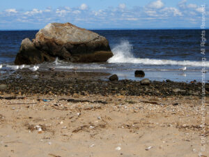
Kayaking the calm winding waters of the Nissequogue River is an easy and fun way to explore this unique ecosystem from within. There are two put-in/take-out stops at either end of the 6 mile “trail” and which one you will use will depend on the direction of the tide. On an “incoming” high tide, paddlers put in near the Kings Park Bluffs at the Nissequogue River State Park and travel “south” towards the Paul T. Given County Park in Smithtown. On the “out-going” tide, the trip is reversed. You can also make a round trip out of it by using both incoming and outgoing tides.
Personally I prefer to paddle this route south to north, because it offers more of a sense of “discovery” starting in the forested narrow channel of water, ducking down to go under the “bridge” (which is really the overpass of Route 25A) and making your way between the tall maze-like marsh weeds, looking for wildlife as you paddle. There are herons and egrets as well as other birds of the wetlands habitat.
As you make your way towards the Long Island Sound, the river widens and you begin to encounter bigger boats and more people. You must pay attention to traffic at this point, and make your way to the take out point just before the river joins the Sound.
Rental kayaks and canoes are available with shuttle service back to your vehicle (departure times and locations change daily due to the tides).
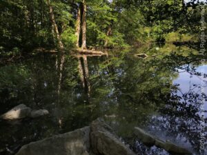
At the David Weld Sanctuary, managed by the Nature Conservancy, you can wander down a trail that leads from cedar-dotted fields to a boulder-strewn beach, passing through an impressive array of habitats and glacial handiwork.
Hiking trails cross an old field dotted with red cedars, loop around a red maple swamp, pass colossal tulip trees, climb a 50-foot bluff overlooking the Long Island Sound and lead eventually to a kettle hole, a 60-foot-deep depression formed when a massive block of glacial ice melted in place.
There are also 1,800 feet of beachfront and a number of enormous boulders scattered throughout the woods and along the shore.
The David Weld Sanctuary has just enough elevation change to make the trails interesting but nothing too daunting for a leisurely hike.
Thanks to sculpting by glaciers during the last Ice Age, the sanctuary’s landscape supports a remarkable diversity of trees, shrubs, vines, ferns and wildflowers, as well as a variety of birds and small mammals. In spring, the giant tulip trees display magnificent blooms. Look for their long, straight trunks, which were once used for masts on ships. Their large, greenish-yellow blooms are full of nectar sipped by orioles and hummingbirds. You may also see eastern tiger swallowtail butterflies fluttering about since tulip tree leaves are one of their caterpillars’ favorite foods.
In summer as you walk along the bluff, observe the burrow holes in the top two or so feet of sediment. These were created by bank swallows that patrol the coastline. Take the side trail to the beach for a closer look at the large boulders exposed along the shore, especially during low tide. Autumn brings two simultaneous spectacles: The woodlands become a kaleidoscope of red, burgundy, orange and yellow foliage as the deciduous trees prepare to shed their leaves, while waves of shorebirds, songbirds and other migrants stop to feed and rest on their long journeys south. In winter, if you’re lucky, you can see a common loon swimming offshore, as well as huge rafts of brant, American black duck, and other waterfowl.
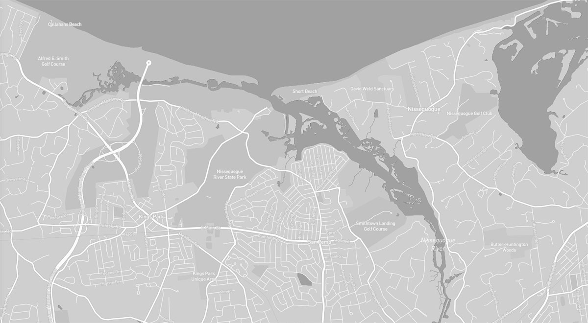
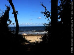
Short Beach is a narrow strip of rocky sand on the Long Island Sound adjacent to the outlet of the Nissequogue River. It is a “town” beach administered by the Town of Smithtown with access by permit only to town residents during the summer months. And while it has all the typical “town beach” amenities in summer, during the “off” seasons it almost transforms back into a “wild” beach. With the pine barrens coming right up to the sand bluffs and the marshland on the other side it can almost seem rugged.
It is a great place to go for an unstructured walk between scrub pines on the bluffs and then down along the shore to where big boulders beckon farther east. Just be aware of the tide times if you walk far to the east, because some very narrow sections are impassable during high tide and you could get stuck there until the tide goes back out.
Walking west leads to the estuary, and depending on the tides it is possible to walk between “ponds” and observe herons and egrets searching for food among the reeds.
In summer town residents can get a camping permit (for weekends only, and only during the period from Memorial Day weekend through September 16)
Nissequogue River State Park is a 521-acre state park located on the banks and bluffs of the river. The north end of the park overlooks the beautiful waters of the Long Island Sound. The Greenbelt Trail, for walking and hiking, parallels the Nissequogue River and provides scenic views of the river and the Sound from the top of the bluffs. There are also stunning views of the Nissequogue River on the east end of the park, hundreds of acres of mature woodlands, open fields, recreational facilities, scenic trails and a marina.
A bird conservation area has been established at the park, with the primary purpose of protecting overwintering locations for waterfowl and migratory birds. The conservation area particularly aims to protect feeding and roosting habitat for wading birds.
There are some great hikes along the “coastal” portion of the park with “high” and “low” options depending on how much elevation gain you are in the mood for and good chances of seeing wildlife at the right time of day.
Sunken Meadow State Park includes three miles of beaches and six miles of hiking trails, as well as a myriad of recreation facilities. In the summertime the beaches are chock-a-block with people, but in the off seasons this is a beautiful landscape to explore.
The park has a wide range of topography that sustains a variety of flora and fauna. The three miles of beach meets tall, glacier-formed bluffs at the west end of the shoreline. A man-made dam separates the park’s brackish creek and marshes from the tidal flats. South of the flats are acres of undeveloped and heavily-wooded rolling hills. The hiking trails go through marshland and woodlands, and along some of the bluffs high above the sound.
There is a permanent Orienteering Course set up in the park and the variety of terrain includes some elevation changes unusual for Long Island’s normally flat topography.
Paved Roads only
Camping at campgrounds only (no dispersed camping)
Gas, food and water are all easily accessible.
The Lloyd Harbor area blends the eras of colonial manor, Gold Coast estate, small rural residential community, and modern suburb to preserve something of the natural beauty of the unique landscape around Llyod’s neck — a narrow strip of land that forms the natural harbor. The “neck” of land called Caumsett (meaning “place by sharp rock”) by the Matinecock Indians. The Matinecock sold 3,000 acres of what is now called Lloyd Neck to English settlers for a variety of items, including three coats, three shirts, wampum, six knives, and two pairs of shoes. The property changed hands several times during the next two decades, acquiring the name Horse Neck because Huntington farmers grazed horses there. In 1676, James Lloyd acquired the neck, developed the land to create an estate with tenant farmers which was then taken over by his son Henry.
During the Revolutionary War, members of the Lloyd family found themselves on opposing sides, and the farms of two Lloyd patriots were confiscated by the British. Joseph, a patriot, fled to Connecticut and a fort (Fort Franklin, now known as Fort Hill) was built by the British in 1778 on the western end of Lloyd Neck overlooking the entrance to Cold Spring Harbor. Another fortification was built on the east side of Lloyd Neck near a large rock. This rock is called Target Rock because British warships were said to have used it for target practice. The last Lloyd to own the estate was Henry Lloyd IV, who acquired it in 1841 and built a dock near the Causeway in 1852 as a stop for Oyster Bay-to-New York steamboats. In the early 1880s, steamboats brought tourists to a beach recreation complex at the end of the Causeway called Columbia Grove.
The 1900s ushered the era of the Long Island Gold Coast, and various wealthy families began to buy land and build seaside mansions and estates. Marshall Field came to Lloyd Neck in 1921 after searching Long Island’s North Shore for a tract of land suitable for the country home he envisioned. Field had been educated in England and yearned to replicate the life of an English gentleman with a grand manor house and self-sufficient estate. The 1,500-acre estate was carefully planned as a well integrated rural estate village with farm houses, servants quarters, 18 major structural units, dairy farm, extensive gardens, racehorses, and sports and hunting. Today many of these estates have been adapted for other uses including public parks and wildlife refuges. Marshall Field III’s estate is now Caumsett State Historic Park.
Lloyd Neck, a peninsula that extends into Long Island Sound, is made up of open meadows, beaches, hardwood forest, dunes, saltwater marsh, and a freshwater pond near the Sound. It includes the largest and most diverse coastal forest on the North Shore of Long Island, and the Caumsett State Historic Park Preserve is home to native Long Island grasslands, one of the most rapidly disappearing habitats in the region. The passive use of the preserve and environmentally diverse habitat makes this site a treasure on the North Shore of Long Island.
Lloyd Harbor is one of several relatively large, shallow, coastal wetland ecosystems on Long Island's north shore. Consequently, the harbor is an important fish and wildlife habitat throughout the year.
Most of Lloyd Harbor is less than 8 feet deep at mean low water, and has a tidal range of approximately 7 feet. The bay is bordered by sparse residential development and undeveloped wooded slopes,
including lands of Caumsett State Park. The harbor is utilized to some extent for recreational
boating and commercial shellfishing.
HIGHLIGHTS: Hiking trails,
Historical Sites, Beach,
Wildlife
HIGHLIGHTS: Wildlife, Hiking
Caumsett State Historic Park Preserve, situated on a scenic peninsula extending into Long Island Sound, offers miles of trails over acres of woodland, meadows, rock shoreline and salt marsh. The park, which was acquired by New York State in 1961, has beautiful gardens and excellent fishing. It also preserves a number of historical structures from it’s time as a luxurious Gold Coast Estate.
Marshall Field III purchased 1,750 acres of Lloyd Neck in 1921 to build a large estate. He named the land after its Matinecock Indian name, Caumsett, which means “place by a sharp rock” and created a self-sufficient English-style estate that was a combination country club, hunting preserve, and home, complete with its own water and electrical supply.
According to the Caumset Foundation: The making of Caumsett was a phenomenal operation, especially for the early 20th century. When Field purchased the land it was a track of overgrown woodlands and meadows and derelict and abandoned farms. Woods were cleared, roads were built and a central water system with fire hydrants installed. Electrical and telephone lines were placed underground.
Starting in 1922, the main house, polo stable, the Summer and Winter cottages and the farm group were constructed. The landscaping was done with equal speed, as full sized trees were barged in and planted. Mature shrubs were planted, and hillsides of mountain laurel were transplanted.
Caumsett had no shortage of staff. Household staff, field workers and dairy men manned the estate. Many hands were required to fire the coal furnaces, tend to the coal stoves and make ice and deliver it for the iceboxes. There were two ice making plants on the estate. In the warm months tending the fridges was a major job. The icebox room in the main house had such a tremendous melt output, that a babbling brook was created and flowed copiously during the warm months.
A strict European “order” concerning servants was expected. There was a pecking order among the servant classes. There was no social interaction.
Sporting activities were central to estate life with frequent polo matches and other equestrian activities. The pheasant shoots were legendary, with hired beaters flushing out the birds into the swale for an easy shoot. Some described it as a slaughter rather than hunt. Fox hunting was also in vogue, as the Fields not only had foxes, but kennels full of hunting dogs.
The master’s bath house had an outdoor court, paved with red Egyptian clay that had to be tended to on a regular basis. The most amazing part of this facility was the salt water swimming pool, which had beautiful views to the west and east. The bathhouse itself was a cedar shingled Cape Cod style house with a large front porch. Inside there were changing rooms and a lounge. There was also a kitchen where food could be prepared for lunch on the terrace.
In the early 30s, the Fields s put on grand parties including a famous “circus” party given in 1932 which was probably the most extravagant. There was a china smashing booth and freak show. Some described the party as a mess, and in light of the grim Depression years, an unconscionable display of decadence.
In 1936, Fields hosted a “coming out” party for their daughter Barbara. It was far tamer than the circus event. The affair was very elegant, and held in the boxwood garden to the west of the house. The lawn was covered by a huge crepe canopy, with flood lights shining onto the gardens. Two thousand Japanese lanterns were hung from the trees encircling the freshwater pond.
Bettine Field, on the other hand, had her coming out party down at the master’s bath house. Unlike her sister, she went for the less formal approach and served beer and hot dogs from a Swankie Frankie truck which stayed for the duration.
As the 1930s progressed, the social life at Caumsett became less ostentatious as the Fields become very conscious of these extravagances in a country reeling from an economic disaster. During the depression, Field reduced salaries, but fired no one. Fortunately, for those living on the estate, life was relatively secure. Most had a home on the place, dairy rations and vegetables from the kitchen garden.
Caumsett is a precious remnant of that brief time when America had mansions and spacious estates. So much of Long Island’s Gold Coast has been lost, never to return. Caumsett gives us a peek into that brief and magical time.
Wetlands like the brackish pond provide important habitat to Long Island’s wildlife. Here, the tide from Huntington Bay floods the pond daily and mixes with the freshwater from the surrounding watershed. The result—a pond with salinity lower than that of the Bay, teeming with life from plants to birds, turtles, mammals, and fish.
Microscopic plants and animals inhabit the pond and serve as food for other invertebrates and small fish. Black ducks and other puddle ducks feed on the invertebrates and aquatic plants. Herons and egrets silently stalk the water’s edge preying on fish.
A ring of smooth cordgrass lines the pond. It’s roots are adapted to filter out excess salt from absorbed water, which is then secreted through leaf pores. As the land becomes drier, cordgrass gives way to hightide bush, a woody plant which produces distinctive white flowers in early autumn. Red cedar and other trees border the upland edge of the pond. The sun loving cedar bears bluish berries, providing food for robins, catbirds, mockingbirds, thrushes and others.
Today the refuge land serves as crucial habitat for a variety of plants and animals. So why the name Target Rock? If you take the path all the way to the beach overlooking Huntington Bay, you will see a large, 14-foot-tall rock in the water. Supposedly, the British Navy used the rock for target practice during the War of 1812. If you look closely, you may even see some blemishes from the bullets.
Paved Roads only
Camping at campgrounds only (no dispersed camping)
Gas, food and water are all easily accessible.
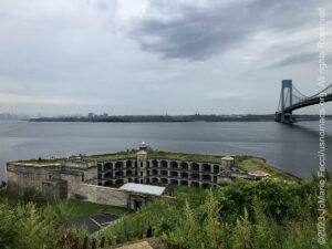
A hidden ruin right in the heart of the New York Metro area, Fort Wadsworth sits silently under the Verrazano Bridge on the Staten Island shore guarding the entrance to the New York City waterways. It’s part of the Gateway National Recreation Area that covers a number of locations in the heart of a very urban zone where we don’t really expect to find public lands and wilderness. But it is here, and rather interesting to explore on the historical level as well as the habitat and ecosystem level, as we can only begin to re-imagine what the wild environment might have been like on these “gateway” islands. Breezy Point on the western end of Rockaway Peninsula together with the eastern highlands of New Jersey act as the ‘gates’ to New York Harbor, thus becoming know as the ‘Gateway to Freedom’ to many immigrants arriving in the New World. Today the Gateway National Recreation Area runs along the metropolitan shoreline of New York and New Jersey and manages over 28 miles of open to near open-ocean shoreline at the entrance of New York Harbor.
Trying to imagine what this area was like before Western Contact is nearly impossible, but thanks to the work of the Wildlife Conservation Society researchers as described in a NY Times article, we can get a sense of it. The researchers geolocated old maps onto the modern city of Manhattan to get a sense of what was here before the first Dutch colonists sailed through the Narrows into New York Harbor. They found Times Square was a forest with a beaver pond and the Jacob K. Javits Federal Building, at Foley Square, was the site of an ancient mound of oyster middens. Whales were a meaningful part of the local economy and ecosystem. It had vast forests of timber. There were otter, beavers, mink, oysters, brook trout, bears and there are even historical records indicating that wolves lived on Manhattan until the 1720s.
The New York City metro area and Long Island itself are actually barrier islands — though their modern urban character stands in stark contradiction to what we typically think of as the rugged and wild strips of coastal land that protect the shores of the mainland United States from the full force of the Oceans. Rockaway Peninsula and the other barriers of Long Island’s South Shore began forming seaward of their present location about 8,000 years ago as glacial-fluvial sediments were reworked by waves and currents. Historically, Rockaway built westward in response to the dominant longshore transport current until the jetty at Breezy Point, installed in the 1930s, prevented further progradation to the west.
There are many types of wetlands in New York City, ranging from tranquil swamp forest to surf-pounded coastal shoreline. Nearly half of present day New York City was once either saltwater or freshwater wetland, but as the city expanded, many wetlands were filled in and lost. New York City also has a diversity of forests and woodlands. Although the words forest and woodland are often used interchangeably, they actually mean different things. A woodland is open with space between the treetops that allows enough sun to penetrate to sustain a rich understory of shrubs, vines, and herbaceous plants. A forest's thick canopy, on the other hand, permits little light to filter to the ground below. A forest is made up of four different layers: the canopy layer, the shrub layer, the understory, and the ground layer.
HIGHLIGHTS: Historical Sites,
Scenic views
HIGHLIGHTS: Wildlife, Beaches,
Hiking, Historical Structures
Fort Wadsworth, part of the Gateway National Recreation Area on Staten Island, is one of the oldest military installations in the nation. The site occupies 226 acres on the northeastern shore of Staten Island, overlooking the Narrows of New York Harbor. Rich in history and natural beauty, Fort Wadsworth affords the opportunity to observe an important part of our nation’s history, while offering magnificent views of New York Harbor and the Verrazano Bridge.
Historic structures include Battery Weed, directly on the harbor, and Fort Tompkins on the bluff above. Both were built in the mid-19th Century and are open to the public on guided tours only. There are several smaller early 20th Century coastal artillery batteries and an overlook with panoramic views of the Upper Bay, Brooklyn and Manhattan. The National Park Service currently maintains a visitors’ center on site and offers ranger-led tours of the facilities.
The fort dates to the Revolutionay War period when Staten Island, as well as the rest of New York City, was occupied by the British between 1776 and 1783. British forces fortified the area now known as Fort Wadsworth in 1779. After the American Revolution the protection of New York, which had been so easily invaded, became a priority for the new American government. New York State began planning for construction of masonry and earthen fortifications to help defend the Narrows in the early 1800s.
Fortifications at Fort Wadsworth included what is now known as Battery Weed and Fort Tompkins. Other coastal fortifications built during this time period included Fort Lafayette in Brooklyn, Castle Williams and Fort Jay on Governors Island, Fort Wood on Liberty Island, and Fort Gibson on Ellis Island. This system of forts came to be known as the Second American System of coastal defense and existed to protect New York harbor from foreign interference.
Battery Weed was rebuilt 1847-1862. It was originally called Fort Richmond, and renamed Fort Wadsworth in 1865 to honor Brevet Major General James Wadsworth, who was killed during the Civil War. The new Fort Wadsworth also used granite and brick to replace the original sandstone. New weaponry developed during the Civil War made these masonry forts and the smoothbore cannons they used obsolete. Fort Wadsworth was updated with disappearing gun batteries and expanded greatly during the time of the Spanish American War. The batteries contained guns that were designed to attack enemy warships and allow American vessels the time necessary to reach and engage the enemy.
In 1907 electric lights, motorized ammunition hoists, searchlights and telephone communications were added to the existing fortifications. Observation posts were also added, so that the target’s direction, bearing and speed could be sent to soldiers in plotting rooms. The soldiers in the plotting rooms used the information to triangulate on and target moving enemy ships and then relayed to the artillery gun crews what elevation and direction to fire their guns.
During World War II, operational control of the Fort was under Coast Artillery and the main defenses were anti-aircraft guns. From 1955 to 1960 Fort Wadsworth was the headquarters of the 52ND Anti-Aircraft (AAA) Brigade. The unit oversaw the Nike Missile firing batteries of the New York Defenses until moved to a new missile master facility in Highlands, N.J.
After the Army vacated the site in 1979 the U.S. Navy made it the headquarters of Naval Station New York. In 1994 the U.S. Navy turned Fort Wadsworth over to the National Park Service.
Spanning 27,000 acres from New Jersey to New York City, the park is the “gateway” from the ocean into New York Harbor and offers green spaces and beaches alongside historic structures and cultural landscapes. Gateway National Recreation Area was established in 1972 to offer a national park service experience to an urban audience. Gateway is made up of historic sites and natural areas. It is the 4th most visited National Park Service unit with more than 9.2 million annual visitors.
Gateway is separated into three administrative units: Jamaica Bay, Staten Island and Sandy Hook.
The Jamaica Bay unit is one of the largest expanses of open spaces in the region, consisting of 19,000 acres of land, bay and ocean waters within Brooklyn and Queens. Specific locations include: Jamaica Bay Wildlife Refuge, Jacob Riis Park, Fort Tilden, Plumb Beach, Floyd Bennett Field, Canarsie Pier, Bergen Beach, Spring Creek, Frank Charles Memorial Park, Hamilton Beach, Breezy Point Tip, and Shirley Chisolm State Park.
The Staten Island unit manages 2,974 acres of land and bay waters. Specific locations include: Fort Wadsworth, Great Kills Park, Miller Field, and Swinburne and Hoffman Island.
The Sandy Hook unit handles 4,688 acres of land, bay and ocean waters in Monmouth County, NJ. Specific locations include: Fort Hancock, a former U.S. Army fort. More than 100 buildings and fortifications remain. Coastal defense features include historic batteries, and Nike missile radar and launch sites. This unit is home to the oldest operating lighthouse in the U.S.
Paved Roads only
Camping at campgrounds only (no dispersed camping)
Gas, food and water are all easily accessible.