
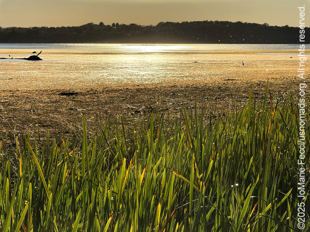
Today I left the “mainland” and crossed Lake Champlain to begin exploring the “Champlain Islands,” a series of small islands in the middle of the lake, nestled between Vermont’s Green Mountains and the Adirondacks of New York. Set off by geography and by their own unique sense of time and place, the Champlain Islands are truly a world apart. Leaving the Winooski River Delta and the greater Burlington area, I passed through the otherworldly wetlands landscape of the Sand Bar National Waterfowl Management Area. One of the most ecologically significant wetland complexes in the region, the Sand Bar WMA consists of a large delta and marsh complex that serves as a critical habitat for migratory birds and aquatic species. Most of its 1,560 acres are a refuge with no public access. However, the upland portion northeast of US-2 is open for visitors and I pulled into a small parking area and walked out into the landscape.
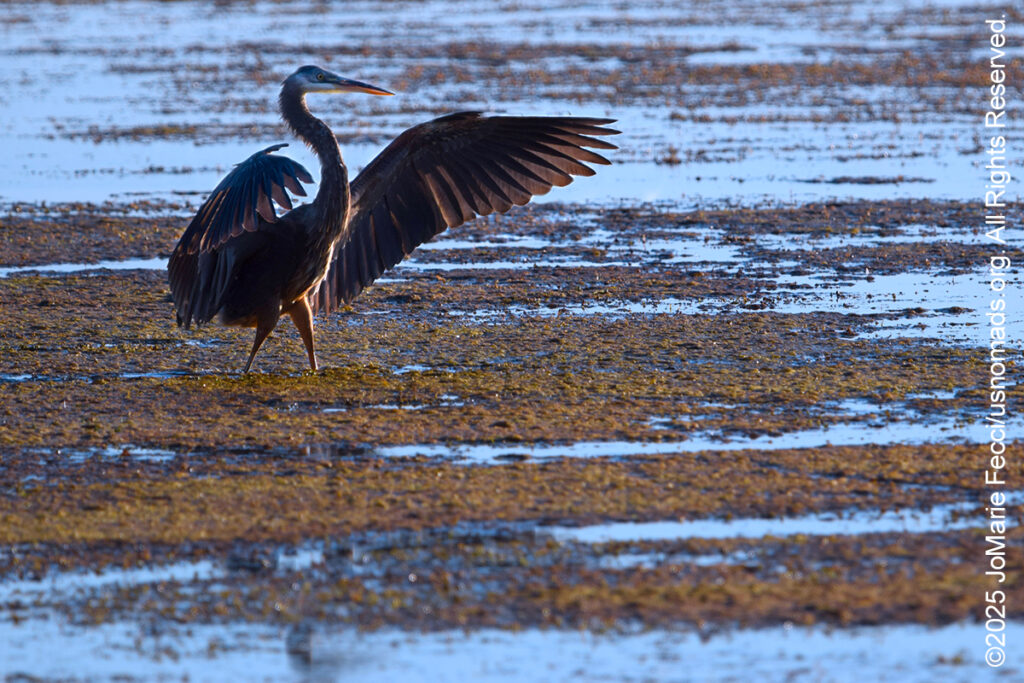
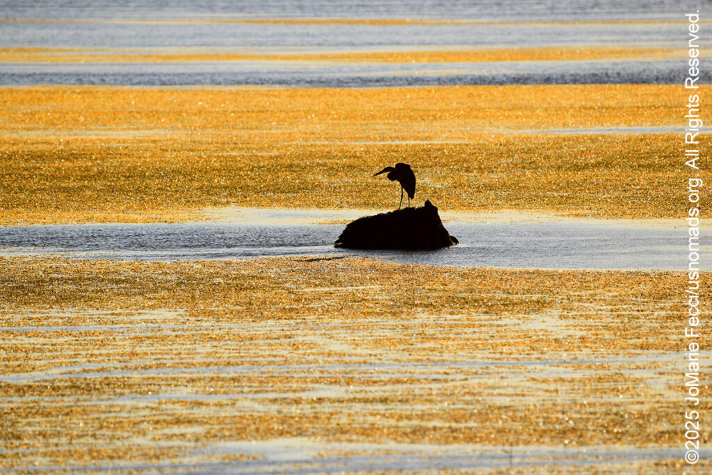
A raking light spilled across the water creating a vibrant collage of golden yellow and blue. I felt compelled to take a closer look around and let my eyes absorb the richness of nature’s handiwork. Wading birds were everywhere and the land itself didn’t seem to know whether it was a beach or a marsh or a lake — instead it was all three at once. As I walked along the muddy mass of weeds that seemed to delineate the “edge” of the marsh, the birds were busy pulling sustenance from the water. There was a swirl of motion with some coming and others going and at one point a great blue heron seemed to be flying right at me. I really felt like I could stay here for hours, but I needed to get to the Grande Isle State Park to set up my basecamp for the next few days, so I tore myself away from the wetlands and continued the drive.
I was following the route of the Lake Champlain Byway, along US Route 2, which connects the islands via a series of causeways. The entire scenic byway is 184 miles long from south to north and it actually begins on US Route 7 in Addison county, but the island section runs for about 30 miles through five historic villages and ends near the Canadian border.
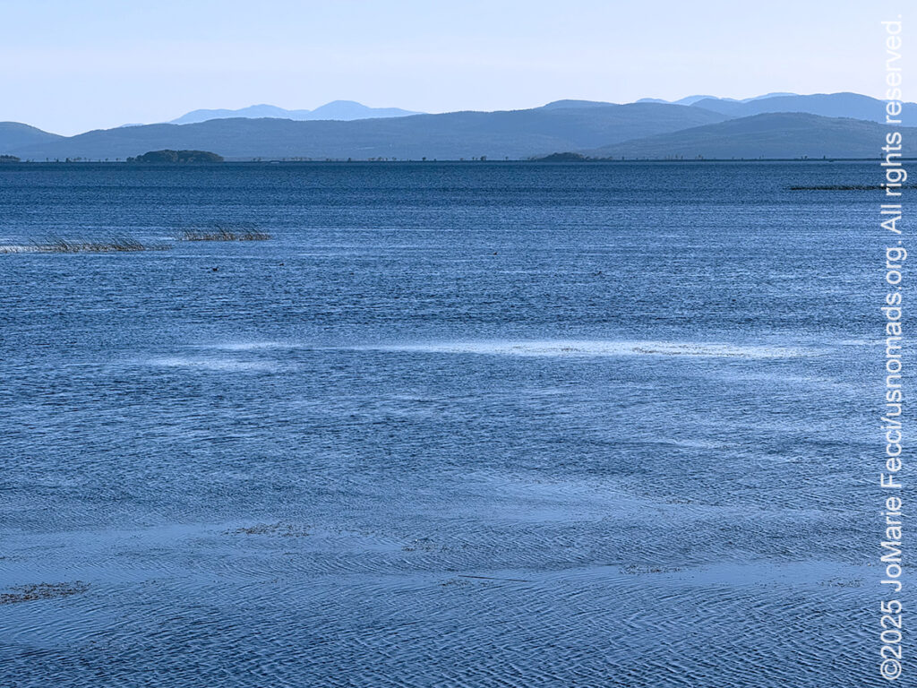
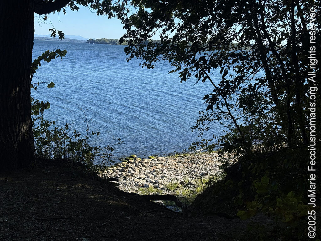
The first view after leaving the wetlands was a dramatic vista of open water and far off mountains. The land seemed to float between mountain horizons and the glimmering expanse of the lake. I was driving along the first causeway, a narrow strip of road that connects the largest island, “Grande Isle” to the mainland. The causeway sits relatively low as it crosses the lake with the resulting impression that you are driving on the water. A strong wind was blowing some “spray” off the lake, amplifying the effect, and I had a vague feeling that I should “hurry.”
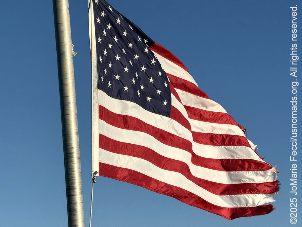
Despite my irrational sense of urgency to get across the water, I paused when I saw a pull-off area near the midpoint of the causeway. A tattered American flag flew high above a historical plaque that read, “Historic Lake Islands: These islands were first seen by a European in 1609 when Samuel de Champlain explored the Lake which bears his name and claimed them for the King of France. Ceded in 1763 to Britain, they became part of the Royal Colony of New York. After 1776, several American Revolutionary heroes received Land Grants here, and two islands were so named, In 1793, this area joined the Free and Independent Republic of Vermont. Here is history and legend of the famous Allen family, the Green Mountain Boys, Rogers Rangers and many others.”
So there is definitely some interesting history to explore here in addition to the wetlands landscapes that first drew my attention. I will start delving into the history tomorrow, for now I need to stay focused on getting camp established before sunset. My campsite is at the Grand Isle State Park, on the first and biggest of the islands. As I reach the “shore” after crossing the lake, I notice the island’s rural character. It is a narrow swath of farms and meadowland, just 24 miles long and 3 miles wide, with fertile fields that overlook vistas of breathtaking sunrises and sunsets. The island contains two towns — Grand Isle (on the northern half) and South Hero (on the southern half) — surrounded by open water. To the east is the Inland Sea, on the south and west the broad lake of Lake Champlain and on the north is the “gut” at the drawbridge to North Hero.
Despite it’s incredible beauty, the island doesn’t seem to be “overrun” by tourists — though that could be because it is not really “beach season.” Still, there doesn’t seem to be any of the excessive tourism infrastructure that mars some other picturesque beach towns in other parts of the country. It seems authentically “local” with full-time residents and working farms.
Grand Isle State Park is unobtrusively tucked into the woodlands along a quiet bluff on land that used to be a private summer resort. The park was created in 1959 and originally included a hotel-like building, cabins and a recreation hall. The only one left today’ is the park’s nature center. Park development during the 1960’s was spurred by a successful effort to attract visitors to the area by providing quality camping opportunities and the original 59-acre park expanded to 226-acres with additional land acquisitions over the years. Today, the park includes 4,150 feet of Lake Champlain shoreline and Grand Isle has the most-visited campground in the state park system.
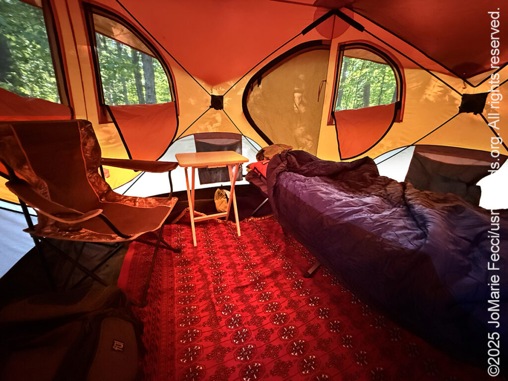
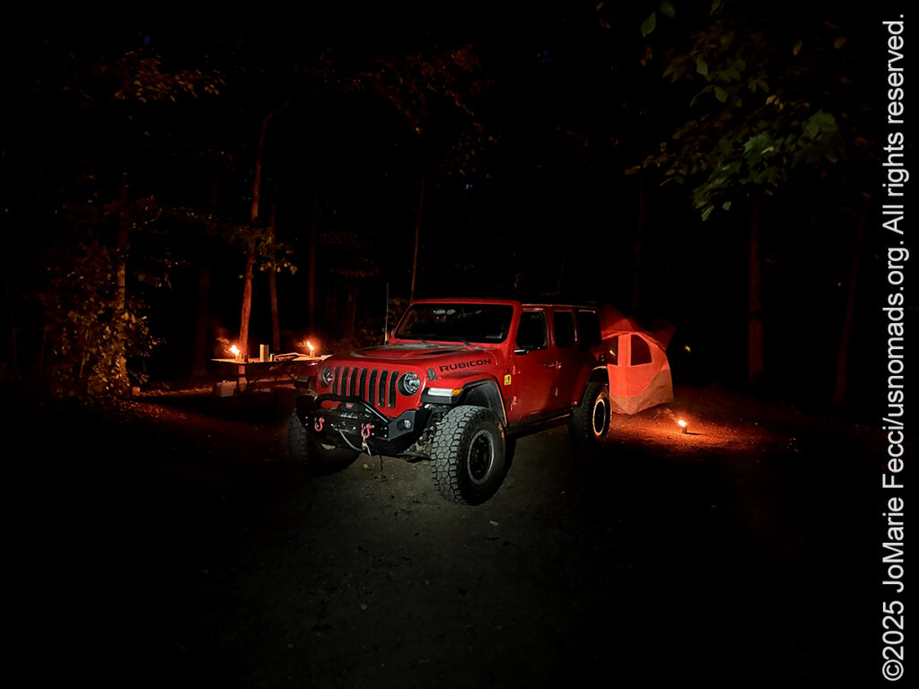
I pulled in to my campsite and began to set up my large Gazelle tent and configure the space into a new base camp. Despite the fact that the park has over 100 campsites, there is good separation between them nestled beneath tall maples interspersed with pine that creates a sense of privacy.
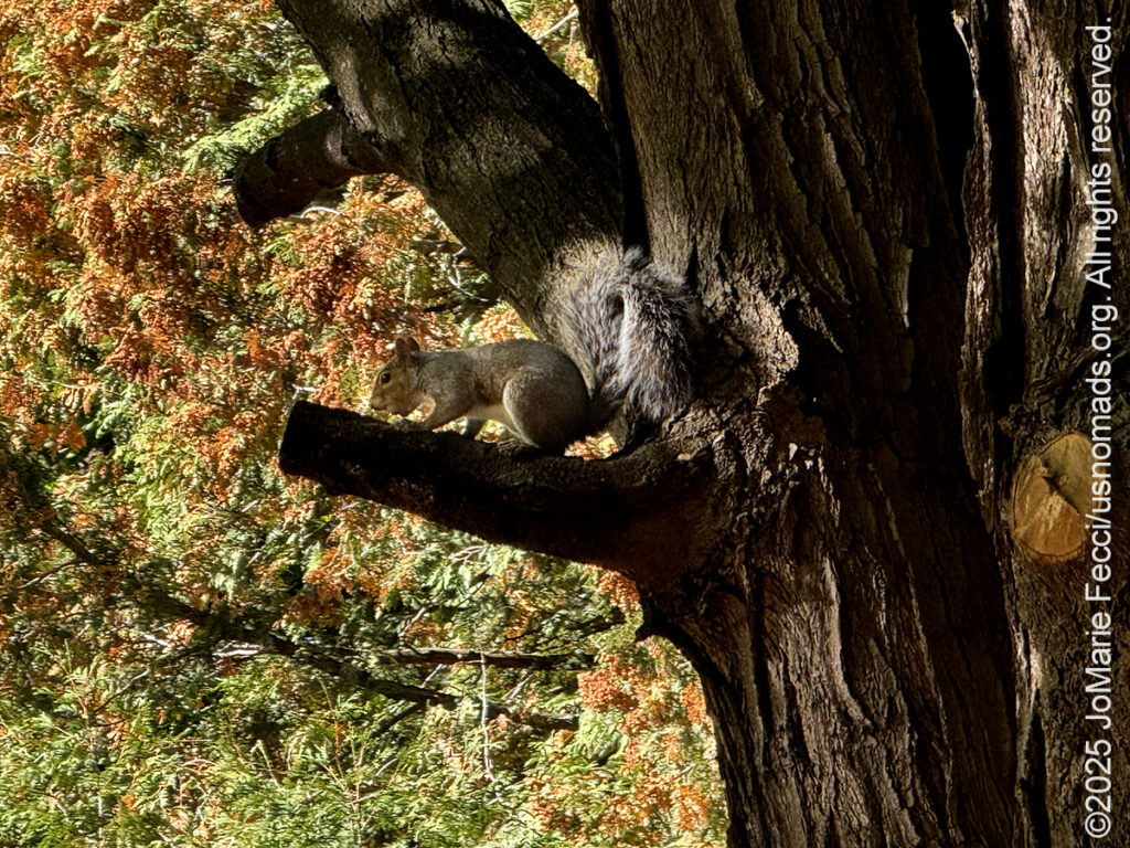
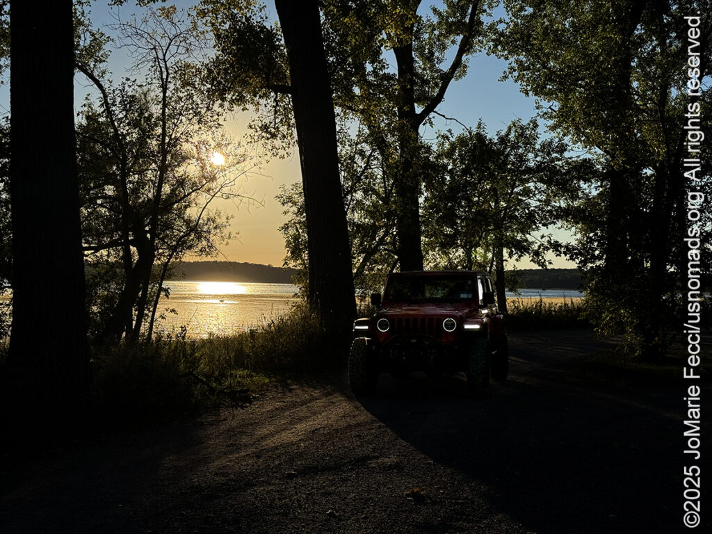
After getting the tent up I went for a walk along the edge of the bluff where the lake meets the shore. The water seemed calm now and I paused to watch a grey squirrel who was gathering acorns on the edge of the treeline. He scampered up one of the pines and sat on a low branch, watching me watch him until I continued on my walk around the perimeter of my “loop.” Back at my site, I started the campfire as the sun slipped below the trees. It had been another good day on the road and tomorrow would be very busy, so I made it an early night.
ABOUT THE JOURNEY
JoMarie Fecci, of USnomads.org, set off on a fun overlanding adventure exploring around the state of Vermont for a few weeks in September. Driving and camping out of her 2019 JL Rubicon, she was able to check out several different regions and enjoy some local cultural and historic sites while en route to “Beaver Camp” at the Bonnyvale Environmental Education Center in Brattleboro. The 2nd Annual “Beaver Camp” is a workshop event dedicated to resolving human-wildlife conflicts with workable solutions that allow the beavers to continue their important role as a keystone species restoring and conserving wetland ecosystems.
WHERE WE ARE
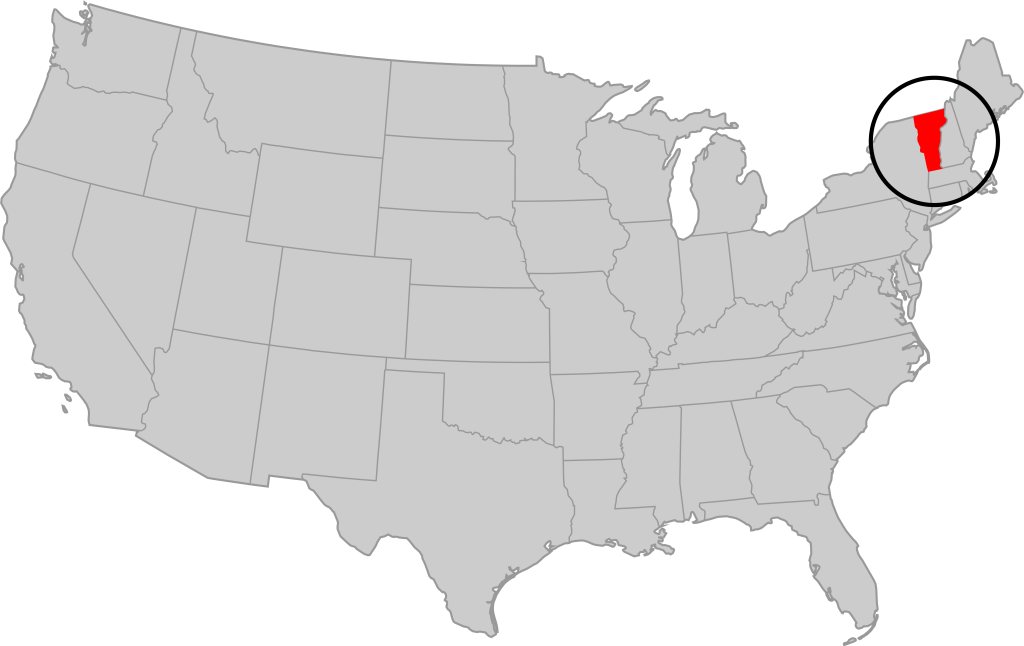
Vermont is part of the “New England” region of the United States. It borders Massachusetts to the south, New Hampshire to the east, New York to the west, and the Canadian province of Quebec to the north. The geography of the state is marked by the Green Mountains, which run north–south up the middle of the state, separating Lake Champlain and other valley terrain on the west from the Connecticut River Valley that defines much of its eastern border. A majority of its terrain is forested with hardwoods and conifers. The Algonquian-speaking Abenaki and Iroquoian-speaking Mohawk were active in the area at the time of European encounter, but the history of the indigenous peoples here goes back about 12,000 years. The first humans to inhabit what is now Vermont arrived as the glaciers of the last ice age receded. Small groups of hunter-gatherers followed herds of caribou, elk, and mastodon through the grasslands of the Champlain Valley. At that time much of region was mixed tundra. The oldest human artifacts are 11,000 year old projectile points found along the eastern shore of the saltwater Champlain Sea. This time is known as the Paleo-Indian period. By about 8,000 years ago, the Champlain Sea had become the freshwater Lake Champlain and the climate was more temperate, bringing increased diversity of flora and fauna. By about 4,300 years ago, the forests were as they are today. Large mammals underwent extinction or migrated north, and the human population became reliant on smaller game and plants. Most of the state’s territory was occupied by the Abenaki, south-western parts were inhabited by the Mohicans and south-eastern borderlands by the Pocumtuc and the Pennacook. In 1609, Samuel de Champlain led the first European expedition to Lake Champlain. He named the lake after himself and made the first known map of the area. The French maintained a military presence around Lake Champlain, since it was an important waterway, but they did very little colonization. In 1666, they built Fort Sainte Anne on Isle La Motte to defend Canada from the Iroquois. It was abandoned by 1670. The English also made unsuccessful attempts to colonize the area in the 1600s. In 1724, they built Fort Dummer near what is now Brattleboro, but it remained a small and isolated outpost, often under attack by the Abenaki. Vermont became the 14th state of the United States on March 4, 1791. From north to south, Vermont is 159 miles long. Its greatest width, from east to west, is 89 miles at the Canada–U.S. border; the narrowest width is 37 miles near the Massachusetts border. There are fifteen U.S. federal border crossings between Vermont and Canada. Several mountains have timberlines with delicate year-round alpine ecosystems. The state has warm, humid summers and cold, snowy winters. The topography and climate make sections of Vermont subject to large-scale flooding, and extreme rain and flooding events are expected to intensify with climate change.