
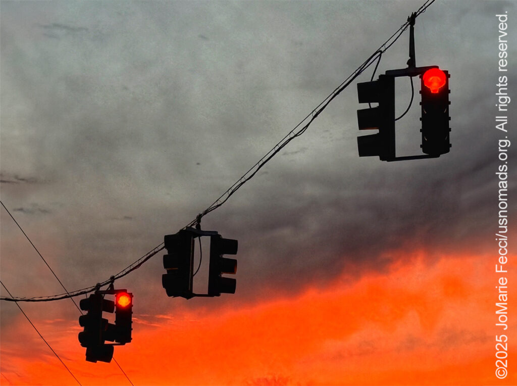
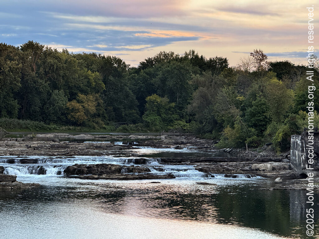
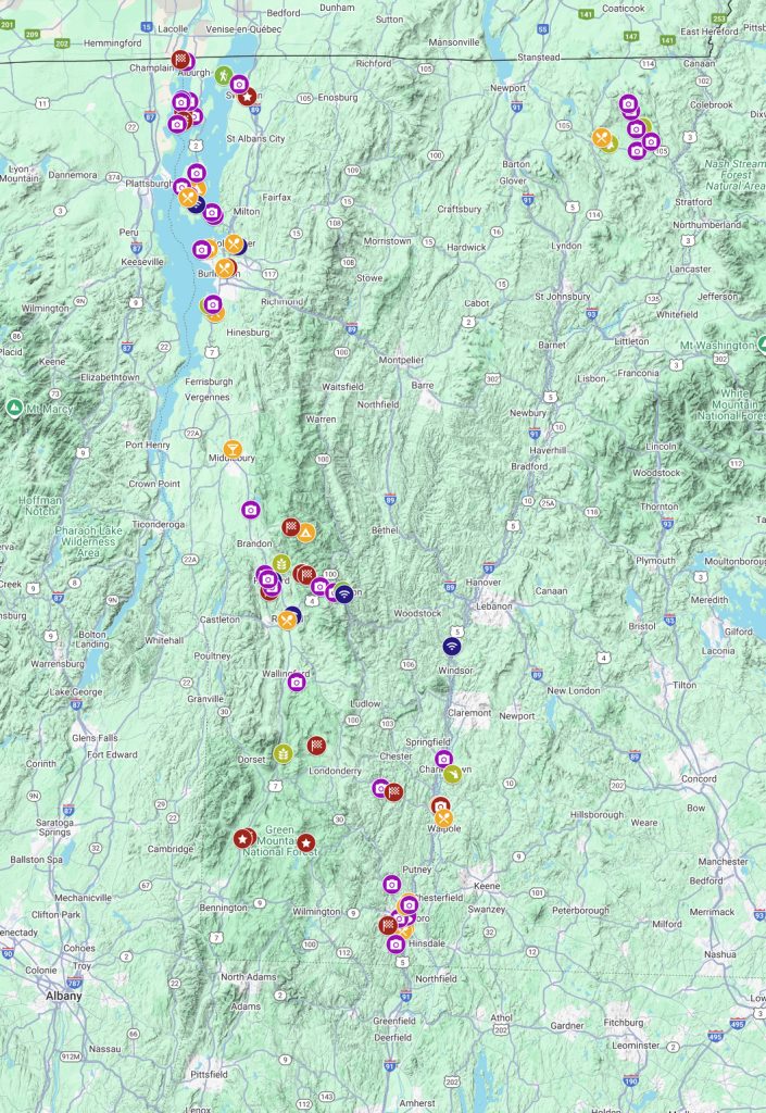
The morning was a bustle of activity as I loaded the Jeep and left Chittenden Brook campground and the Green Mountain National Forest behind. I headed North towards Burlington and the old industrial center of Winooski. It was only 65 miles away, but the drive took me “out of the woods” and into “civlization” — that is to say, an urban environment, and one with a very interesting history. Winooski is an Abenaki name meaning “land of the wild onion” and the city is sometimes referred to as “Onion City,” but what it is really known for is it’s foundational role in New England’s textile industry. The town sits on the banks of the Winooski River, centered around a prominent cascading waterfall that was harnessed in the 19th century to power the early textile mills.
The Winooski River is a tributary of Lake Champlain, flowing from the southeast into Burlington Bay roughly 45 miles from the Canada-US border. Although not Vermont’s longest river, it is one of the state’s most significant, forming a major valley way from the lake through the Green Mountains towards the Connecticut River Valley. And it was at the “heart” of the region’s industrialization thanks to its two sets of falls. The first textile mills appeared on the banks of the Winooski River in the late 1700s after Ira Allen, one of the towns founders built a dam across the upper falls in 1789. Allen used the power generated by the dam to run two saw mills. Other mills soon sprung up to provide products like flour, paper and linseed oil for the local market.
But with the opening of the Champlain Canal in 1823 the Winooski River was connected via a new maritime route from Lake Champlain to the Hudson River to New York City and ports beyond, creating opportunities for larger industrial development. The Burlington-area soon became a major international inland port and industrial center. The first of the big textile mills, the Burlington Woolen Mill built beneath the lower falls, became operational in 1835. The second textile mill, a cotton mill, known as the Winooski Mill was built in 1846 on the Burlington side of the river.
In the nineteenth century, textile mill workers typically faced long hours (12-14 hour days) in hazardous conditions with low pay, but also found new forms of independence, especially for young women. The Winooski mills followed the employment patterns used in Lowell, Massachusetts, and employed single girls to work in their factories. The term “mill girls” was used to describe the young Yankee women, generally 15 – 30 years old, who worked in the large textile factories. The mills recruited workers from New England farms and villages where there were few economic opportunities for women. The prospect of monthly cash wages and room and board in a comfortable boardinghouse was an attractive proposal. A series of tenement houses were built to house the workers on the hill leading to Winooski Falls Village. The availability of housing or dormitories was an important enticement. For the young girls who made up much of the mills’ workforce, the boarding house offered safety and decent living conditions with a housemother, a curfew, and meals. Many female textile workers saved money and gained a measure of economic independence. In addition, the urban setting offered opportunities for a more exciting social life that most women from small villages had never experienced.
When railroad connections to Boston and New York and beyond were completed by the early 1850s (along with the newly invented “magnetic telegraph”), the Burlington-Winooski area was in a position to become one of America’s important centers of industrial growth during the second half of the nineteenth century. Wool remained the less profitable fiber until the cotton famine of the 1860. This and improvements in wool cleaning techniques caused rapid expansion and the construction of new mills. Water power systems improved, and new steam powered system expanded capacity. This required more workers and a large number of French Canadians and Irish were employed. The Colchester Merino Mill and the Winooski Worsted Mill were built in the 1880s. In 1902, the American Woolen Company purchased all the mills from the Burlington Woolen Company and refurbished them with modern equipment.
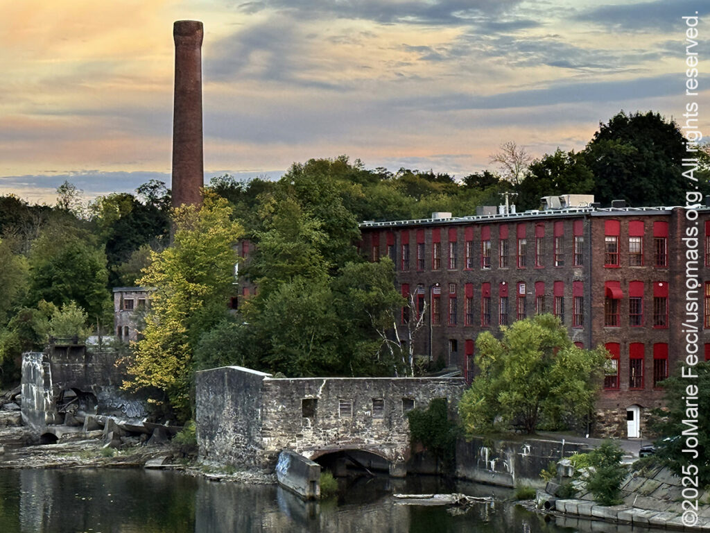
The Champlain Mill was built in 1912. Construction of the mill hallmarked the economic prosperity Winooski was experiencing. Along with the rest of the United States, Vermont’s mill towns were seeing a boom in industry following the First World War. New technology flourished, and American Woolen Company’s new mill was said to be “one of the world’s best equipped.” Over the next decade, that would prove true. Mill operations continued to expand, and American Woolen Company was determined to use the best technology to ensure maximum efficiency. In 1916, 78 new looms were added to the enterprise, bringing the number of operational looms up to 600. All five stories, including the clerestory were used at full capacity. The mill produced piece-dyed worsted fabric, silks, and yarns for serging, weaving, and knitting. By 1922, the American Woolen Company was the state’s largest employer and Winooski Falls incorporated itself as the City of Winooski.
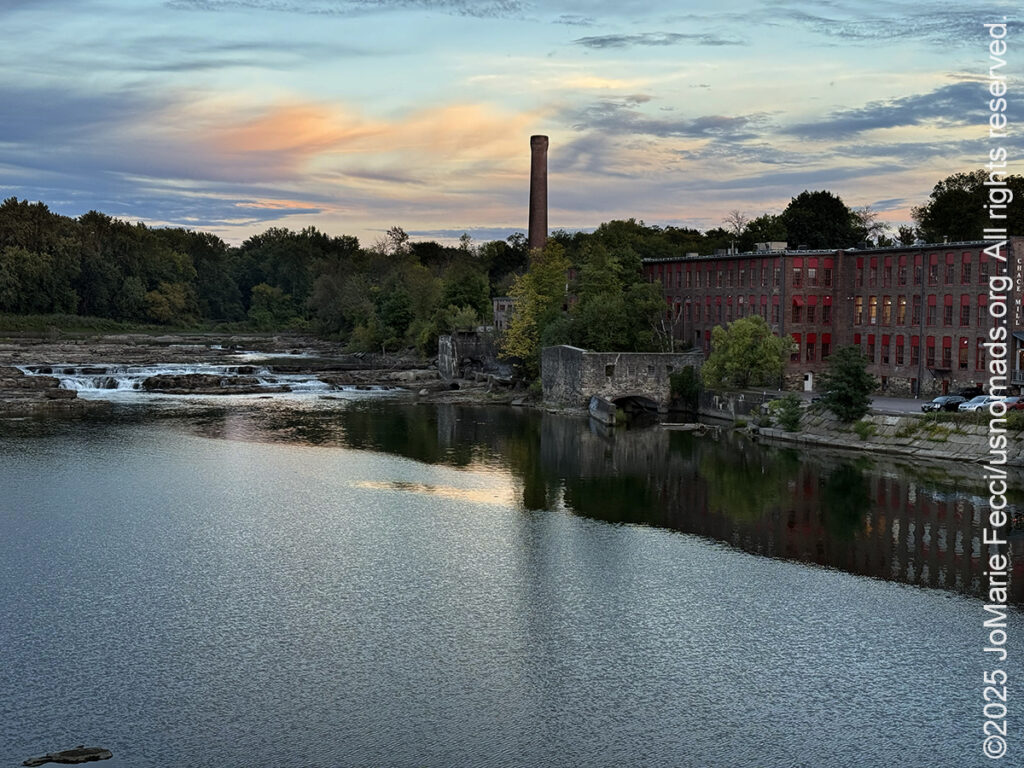
Winooski’s industry continued to thrive until a massive flood destroyed the dams in 1927. All the mills suffered heavy damage in the flood, and some would never recover. The flood damage was followed by the crash of the stock market and the Great Depression that gripped the country during the 1930s marked the beginning of the decline of Vermont’s textile industry. The last of the mills closed in 1954, but many of the buildings remained and have been transformed into the center of a revitalized historic downtown full of vibrant shops, restaurants and cultural institutions. A river-walk leads to some fabulous views and the industrial history of the town has been memorialized in the Heritage Winooski Mill Museum. It was created in 1998 when many former mill workers were still alive and able to share their stories. The museum aims to weave the city’s industrial and cultural past with what matters to Winooski’s diverse community today.
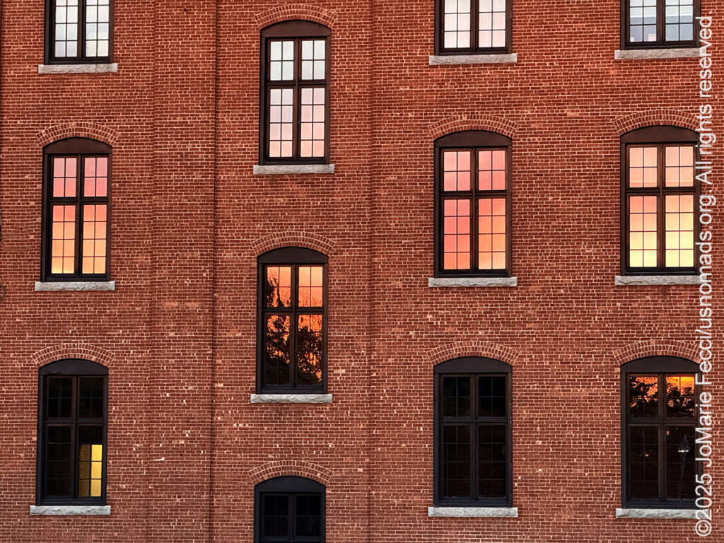
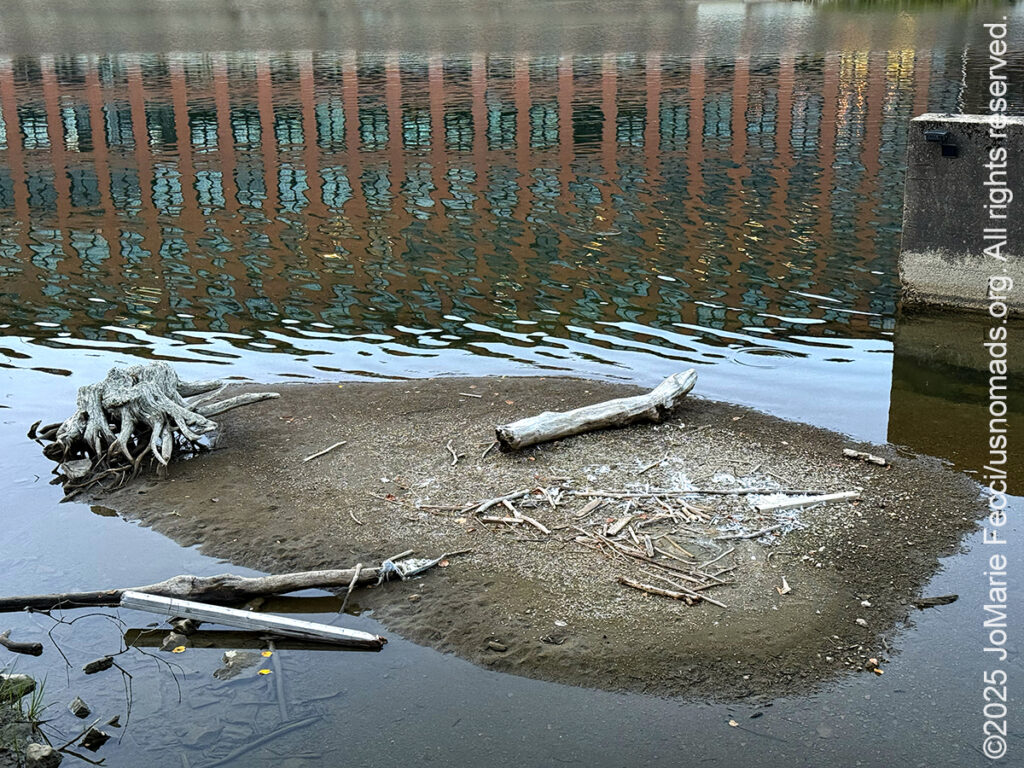
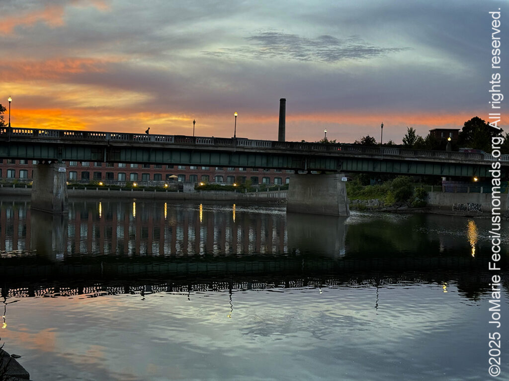
The old mill district is very walkable and the late afternoon light lent the historical buildings a dramatic light as I explored along the river bank. I followed the route of a “self-guided” walking tour put together by the museum that offers a historical interpretation of key sites. The old Chace Mill is now a restaurant, but the former steam engine house is still a ruin and the iconic chimney rises up behind it with the cascading falls in the background. Old and new, nature and man-made, all mixed together next to the eternal flow of the river. The sun set behind the clouds and the sky lit up in a dramatic display of vibrant red and charcoal grey clouds struggling in a clash of their own. The sky reflected in the tall glass windows of a renovated mill building creating a patchwork mosaic that contrasted with the orderly brick construction. It all combined to make it seem like the downtown had a special kind of energy all it’s own.
I headed over to Onion City Chicken & Oyster immerse myself in the local vibe and have an early-ish dinner. A popular neighborhood spot, “OCCO” is located in the historic Block Building at the top of the downtown Rotary. There is outdoor seating and the indoor dining room exudes a cozy and intimate atmosphere, with exposed brick walls and deco-style chandeliers the ambiance strikes the perfect balance between elegant and casual. Enjoyed an excellent dinner and another short walk along the river before calling it a night.

ABOUT THE JOURNEY
JoMarie Fecci, of USnomads.org, set off on a fun overlanding adventure exploring around the state of Vermont for a few weeks in September. Driving and camping out of her 2019 JL Rubicon, she was able to check out several different regions and enjoy some local cultural and historic sites while en route to “Beaver Camp” at the Bonnyvale Environmental Education Center in Brattleboro. The 2nd Annual “Beaver Camp” is a workshop event dedicated to resolving human-wildlife conflicts with workable solutions that allow the beavers to continue their important role as a keystone species restoring and conserving wetland ecosystems.
WHERE WE ARE
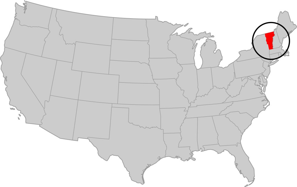
Vermont is part of the “New England” region of the United States. It borders Massachusetts to the south, New Hampshire to the east, New York to the west, and the Canadian province of Quebec to the north. The geography of the state is marked by the Green Mountains, which run north–south up the middle of the state, separating Lake Champlain and other valley terrain on the west from the Connecticut River Valley that defines much of its eastern border. A majority of its terrain is forested with hardwoods and conifers. The Algonquian-speaking Abenaki and Iroquoian-speaking Mohawk were active in the area at the time of European encounter, but the history of the indigenous peoples here goes back about 12,000 years. The first humans to inhabit what is now Vermont arrived as the glaciers of the last ice age receded. Small groups of hunter-gatherers followed herds of caribou, elk, and mastodon through the grasslands of the Champlain Valley. At that time much of region was mixed tundra. The oldest human artifacts are 11,000 year old projectile points found along the eastern shore of the saltwater Champlain Sea. This time is known as the Paleo-Indian period. By about 8,000 years ago, the Champlain Sea had become the freshwater Lake Champlain and the climate was more temperate, bringing increased diversity of flora and fauna. By about 4,300 years ago, the forests were as they are today. Large mammals underwent extinction or migrated north, and the human population became reliant on smaller game and plants. Most of the state’s territory was occupied by the Abenaki, south-western parts were inhabited by the Mohicans and south-eastern borderlands by the Pocumtuc and the Pennacook. In 1609, Samuel de Champlain led the first European expedition to Lake Champlain. He named the lake after himself and made the first known map of the area. The French maintained a military presence around Lake Champlain, since it was an important waterway, but they did very little colonization. In 1666, they built Fort Sainte Anne on Isle La Motte to defend Canada from the Iroquois. It was abandoned by 1670. The English also made unsuccessful attempts to colonize the area in the 1600s. In 1724, they built Fort Dummer near what is now Brattleboro, but it remained a small and isolated outpost, often under attack by the Abenaki. Vermont became the 14th state of the United States on March 4, 1791. From north to south, Vermont is 159 miles long. Its greatest width, from east to west, is 89 miles at the Canada–U.S. border; the narrowest width is 37 miles near the Massachusetts border. There are fifteen U.S. federal border crossings between Vermont and Canada. Several mountains have timberlines with delicate year-round alpine ecosystems. The state has warm, humid summers and cold, snowy winters. The topography and climate make sections of Vermont subject to large-scale flooding, and extreme rain and flooding events are expected to intensify with climate change.