
The adventure begins in the dark of night. I was up by 4:30am and out the door by 5:15 in order to make it to the Port Jefferson Ferry in time for the 6:00am departure. It was still dark as the ferry pulled away from the dock and set off across the Long Island Sound, making the first leg of this overland journey a “water crossing.” I am heading to Vermont to spend a few weeks exploring before joining the folks at the Bonnyvale Environmental Education Center for a unique workshop focused on beavers (more about that later on) and I’ve put together a somewhat ambitious route plan. Today will be a big drive day as I make my way from Long Island through Connecticut and Massachusetts and on into Vermont’s Green Mountains where I will set up my first “base camp” of the journey.
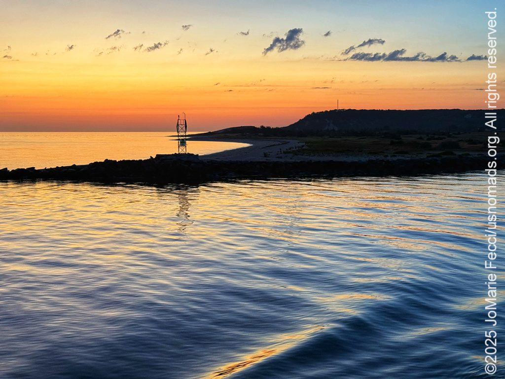
We are still within sight of the shoreline when the first hints of light appear on the horizon, and I went out on deck to watch the sunrise despite the damp chill in the air. It was a beautiful sunrise that turned both the sky and the sea golden for just a moment before the sun took her place in the blue field of the sky. The water was calm and the ferry sailed on. We reached Bridgeport a little over an hour after we had set out, and as we drove off the boat I was feeling inspired.
The highway driving through Connecticut and Massachusetts was uneventful, though I could see that some of the trees were getting ready to put on their fall colors. I didn’t stop until I reached the Vermont Welcome Center where I picked up a roadmap and took a short walk to stretch my legs — I was in Vermont, but I still had a lot of driving left to do before reaching camp.
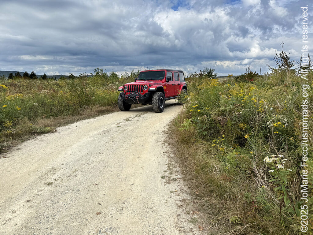
I am heading into the Green Mountain National Forest — the only federally managed forest in the state — and picking up the Kelley Stand Road, an unpaved Forest Road that travels over a high plateau, following and crossing over the Roaring Branch River numerous times. The road, which served several logging camps and early settlements during the nineteenth century, is named for the Kelley Stand, an “old-time” tavern or inn. The Kelley’s had built a home near the Roaring Branch River, which they expanded into an inn for travellers, adding porches to the first and second stories. The inn had 15 bedrooms, glass chandeliers, hand-made oak furniture, a fireplace, bar, ballroom, general store, and even a bowling alley. Rooms were appointed with lace doilies and quilts. By 1866 the inn had become a destination for events, not just a place to stay if you were in the lumber business. There were New Year’s Eve parties, trout dinners, and yearly commemorations of Bennington Battle Day. But with the decline of logging in the area beginning around 1910 signaled the demise of the inn. It was still in operation circa 1913, but there is nothing left of it now but the name of the road. It is an easy scenic drive and I took a few detours to check out some side trails. I was pleasantly surprised when the forest opened up to a beautiful view across a field of wildflowers along Grout Pond Road.
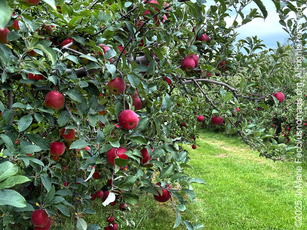
My first real “stop” of the day was at Mad Tom’s Orchard in East Dorset, where I took part in a Vermont autumn tradition — apple picking. This year the season started a little later than usual, and the crop was smaller than last year. With relatively few of the early ripening Zestars and Ginger Golds the Orchard held off opening until last weekend, so there were still a nice amount of apples when I arrived. There was also quite a large crowd of people picking from the trees that were ready. I grabbed a bag and went looking for some of the Ginger Golds. There were also some ripe Macintosh and Galas and I picked a nice assortment before checking out. I also picked up a small bag of their homemade cider donuts.
The donuts were an “impulse buy” but they came in handy when I was back on the road and didn’t have time to stop for lunch. I ate two of them while continuing the drive northbound towards camp.
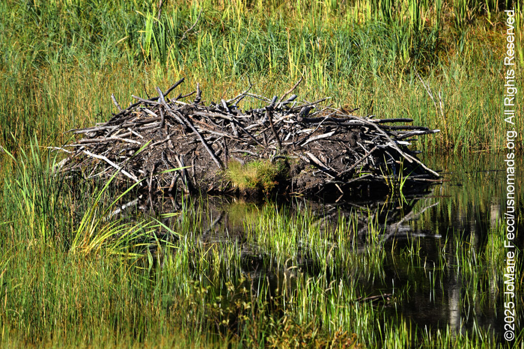
As the afternoon wore on I decided to take the Brandon Gap Scenic Route, following Vermont RT73 as it winds in and around the rural countryside. I stopped at the pull-out just east of the Brandon Gap mountain pass where there is an observation point with an overview of a beaver pond and a large wetland complex. I could see the beavers’ lodge clearly, but there was no sign of the beavers themselves — perhaps it was still too early in the afternoon. The site was quiet and there didn’t seem to be any wildlife activity going on at the moment. Looking up I could see the top of the 800-foot Great Cliff of Mount Horrid. This impressive rock wall is said to provide a home for nesting Peregrine falcons — though I didn’t see any of them either.
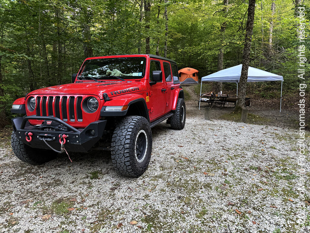
I made a note to myself to come back here closer to sunset in hopes of seeing the beavers, and then continued the rest of the way to the Chittenden Brook Campground. This National Forest campground is a small 17-site location without amenities and the long dirt access road cannot accommodate trailers over 18 feet, making it very welcoming for tent campers. The sites are nicely separated and quite large. I set up my “base camp” in three “sections” with the big Gazelle tent on top of a small hill where there was a nice level “tent pad”, then the easy-up covering a part of the picnic table by the fire pit, and finally the Jeep itself at the front of the site. As I began to get the fire started I felt that it was a really comfortable space and a great “hub” for exploring different areas of the forest.
Night fell soon after I got everything organized and I really didn’t see any “sunset” through the trees. The air was clear and it remained relatively warm which made for a perfect evening, though I was tired and went to sleep rather early after such a long day. Tomorrow will be time for exploring…
ABOUT THE JOURNEY
JoMarie Fecci, of USnomads.org, set off on a fun overlanding adventure exploring around the state of Vermont for a few weeks in September. Driving and camping out of her 2019 JL Rubicon, she was able to check out several different regions and enjoy some local cultural and historic sites while en route to “Beaver Camp” at the Bonnyvale Environmental Education Center in Brattleboro. The 2nd Annual “Beaver Camp” is a workshop event dedicated to resolving human-wildlife conflicts with workable solutions that allow the beavers to continue their important role as a keystone species restoring and conserving wetland ecosystems.
WHERE WE ARE
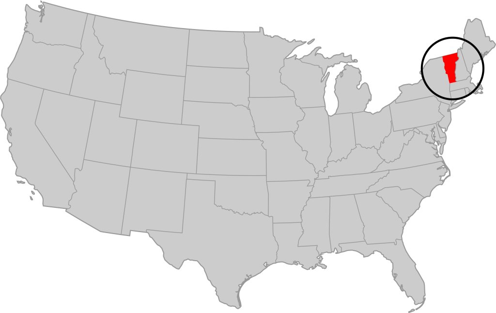
Vermont is part of the “New England” region of the United States. It borders Massachusetts to the south, New Hampshire to the east, New York to the west, and the Canadian province of Quebec to the north. The geography of the state is marked by the Green Mountains, which run north–south up the middle of the state, separating Lake Champlain and other valley terrain on the west from the Connecticut River Valley that defines much of its eastern border. A majority of its terrain is forested with hardwoods and conifers. The Algonquian-speaking Abenaki and Iroquoian-speaking Mohawk were active in the area at the time of European encounter, but the history of the indigenous peoples here goes back about 12,000 years. The first humans to inhabit what is now Vermont arrived as the glaciers of the last ice age receded. Small groups of hunter-gatherers followed herds of caribou, elk, and mastodon through the grasslands of the Champlain Valley. At that time much of region was mixed tundra. The oldest human artifacts are 11,000 year old projectile points found along the eastern shore of the saltwater Champlain Sea. This time is known as the Paleo-Indian period. By about 8,000 years ago, the Champlain Sea had become the freshwater Lake Champlain and the climate was more temperate, bringing increased diversity of flora and fauna. By about 4,300 years ago, the forests were as they are today. Large mammals underwent extinction or migrated north, and the human population became reliant on smaller game and plants. Most of the state’s territory was occupied by the Abenaki, south-western parts were inhabited by the Mohicans and south-eastern borderlands by the Pocumtuc and the Pennacook. In 1609, Samuel de Champlain led the first European expedition to Lake Champlain. He named the lake after himself and made the first known map of the area. The French maintained a military presence around Lake Champlain, since it was an important waterway, but they did very little colonization. In 1666, they built Fort Sainte Anne on Isle La Motte to defend Canada from the Iroquois. It was abandoned by 1670. The English also made unsuccessful attempts to colonize the area in the 1600s. In 1724, they built Fort Dummer near what is now Brattleboro, but it remained a small and isolated outpost, often under attack by the Abenaki. Vermont became the 14th state of the United States on March 4, 1791. From north to south, Vermont is 159 miles long. Its greatest width, from east to west, is 89 miles at the Canada–U.S. border; the narrowest width is 37 miles near the Massachusetts border. There are fifteen U.S. federal border crossings between Vermont and Canada. Several mountains have timberlines with delicate year-round alpine ecosystems. The state has warm, humid summers and cold, snowy winters. The topography and climate make sections of Vermont subject to large-scale flooding, and extreme rain and flooding events are expected to intensify with climate change.