
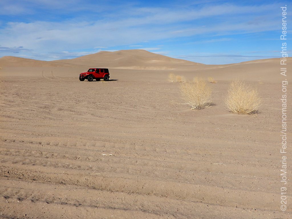
RIDGECREST, CA (30 December 2019) — Left Death Valley with a solid plan to go to the Trona Pinacles and set up camp there to celebrate New Years Eve in that surreal place. Things didn’t quite go as planned. I used the GPS to choose a route and then stopped a long the way first at Big Dune to scout that out a bit. I was the only one there. Then I had to get meat and fresh vegetables and more firewood so I went in search of a supermarket. Made a gas stop at the Alien Cafe first. Once I was stocked I followed the GPS which sent me via Shoshone.
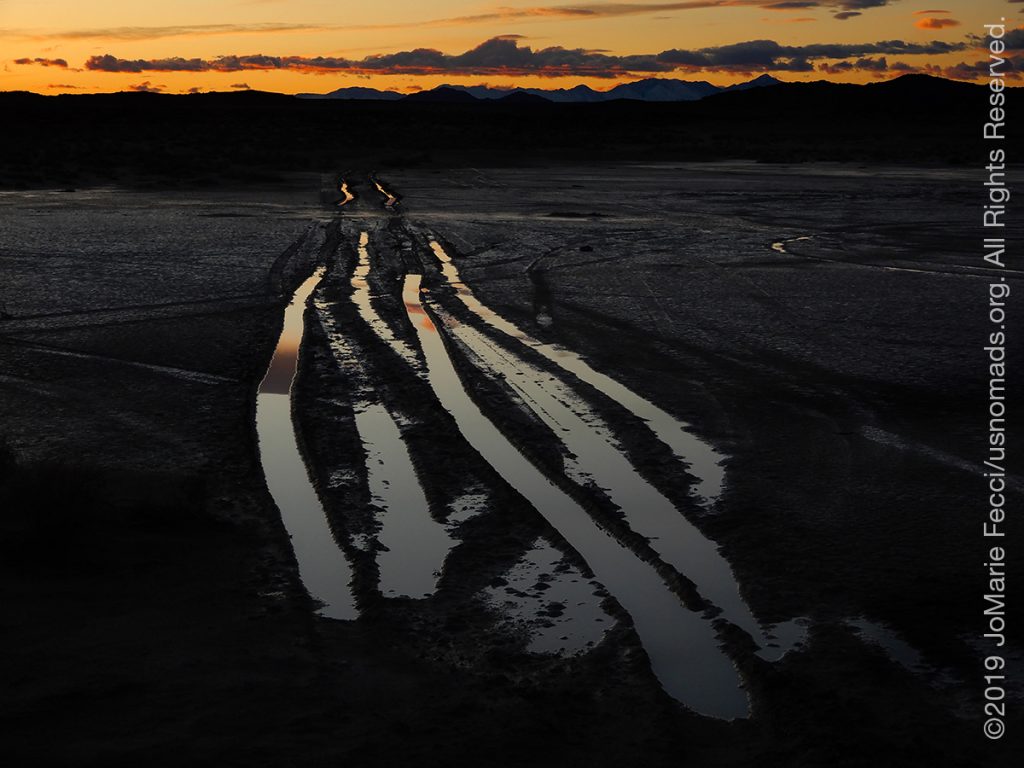
The weather once again cased a major change in plans. The place I planned to camp was turned into a mud bog by the storms. And I only finally arrived at sunset. So ended up plan-B-ing it in a hotel in Ridgecrest.
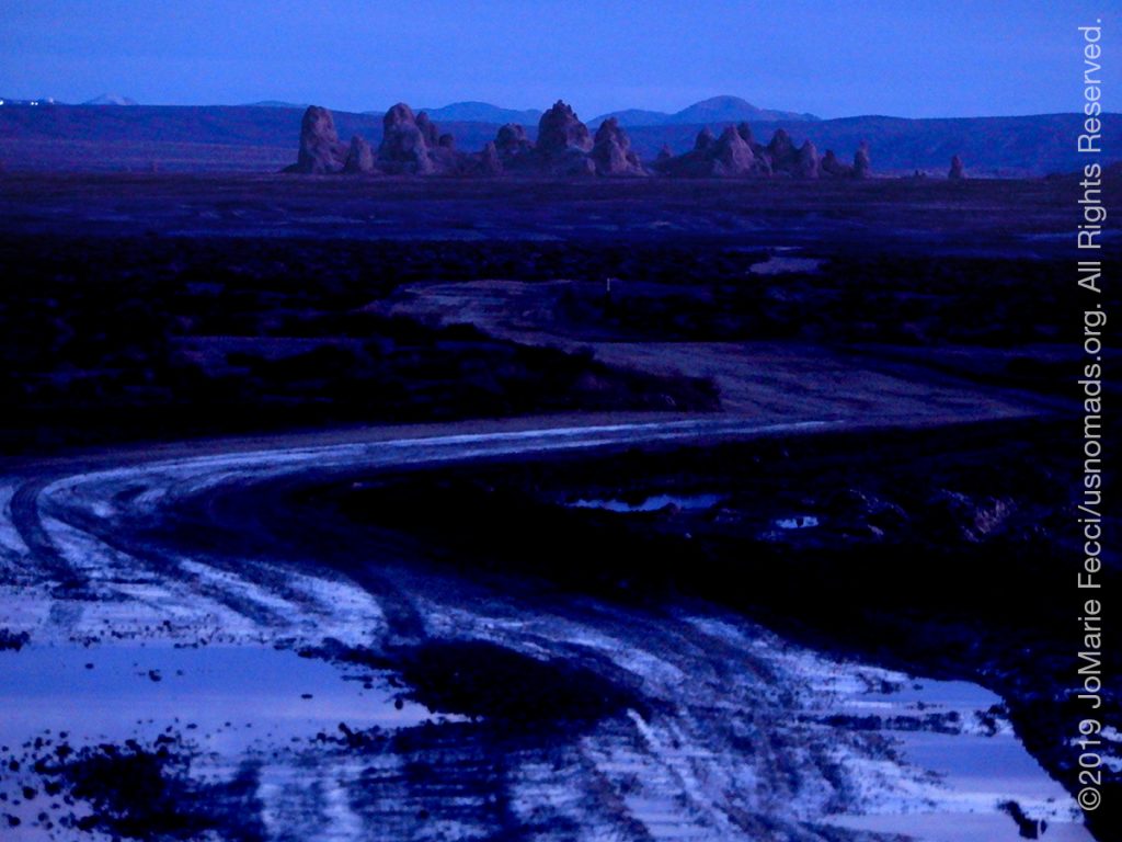
A major “learning” day about following GPS, too. I don’t rely on GPS when I am off-road in the backcountry at all but I do use it for major highway travel. And so when I plugged in my destination I assumed it would be “fine.” I was wrong. The GPS decided to send me on a huge loop south around that put me on a 68 mile washboarded dirt road late in the day. I had really wanted to get to Trona before sunset for photography, and so I decided to look at the paper maps and find a “quicker” route. Of course I found a better option, but I had lost a lot of time making that huge loop (well not really “lost” as I did make some great photo stops along the way), and I ended up arriving just AFTER sunset. The skies were still beautiful with colors as dusk began and I got out to photograph and realized that the earth all around was saturated and muddy. There would be no good place to put up the tent and set up camp. It was starting to get dark now and the only other campers I saw in the aera were in RVs. And the dashboard lit up with another weather alert for the area through 4a. I decided to turn back to the nearest town and another hotel. I was sad to be not camping tonite as it breaks my mentality of being outdoors all the time, but it was the smart thing to do.
ABOUT THE EXPEDITION
JoMarie Fecci, of USnomads, sets off on the first holiday roadtrip with the new Jeep, overlanding from New York to the deserts of the southwest. Once out in the desert, it will be time for some scouting and pre-running in preparation for an upcoming adventure. The primary goal of this journey is to get the Jeep pre-positioned in the west, and to assess terrain, logistical concerns and approximate timeframes for future travel.
WHERE WE ARE
![]()
There are four deserts that connect across the southwest of the United States — the Great Basin, Mojave, Sonoran and Chihuahuan. The Great Basin Desert is “high desert” which can get cold and see much snow in winter. This desert covers southeast Oregon, a small portion of northeast California, most of west Utah, part of southeast Idaho, and the majority of Nevada – all except the southernmost 150 miles which are within the Mojave Desert. All this land is characterized by long, thin, parallel mountain ridges running north-south, separated by wider valleys, often containing dry lake beds (playas) or salt basins. The few rivers run inwards, with no outlet to the ocean; their waters ultimately either sink below ground or evaporate. The Mojave Desert covers the southernmost 150 miles of Nevada, a tiny area of southwest Utah, lower elevation regions of northwest Arizona (bordering the Colorado River) and most of southeast California. The topography is generally similar to the Great Basin, with isolated mountains and wide, flat plains, but temperatures are hotter, vegetation sparser, and the hills are less numerous. The Sonoran Desert of southwest Arizona and the south-eastern tip of California has perhaps the most archetypal desert scenery in the Southwest, with vast flat plains and abundant cacti, especially the giant saguaro, which occurs most densely in Arizona towards the higher elevation reaches of the desert, between 1,500 and 3,500 feet. The Sonoran desert continues a long way south into Mexico, nearly 500 miles down the east side of the Gulf of California. The Chihuahuan Desert is the second largest in the US, and also extends a long way into Mexico. It covers the southern third of New Mexico, excluding several mountain ranges, and all of far west Texas, west of a line between Del Rio and Monahans. Elevations are generally higher than in the Sonoran Desert (2,000 to 6,000 feet), and precipitation is a little greater, with most rain falling during the summer thunderstorm season. Cacti are still quite numerous but are generally smaller than to the west; instead, the dominant plants are yucca and agave, though even so, as with many other desert regions, large areas have only the ubiquitous creosote bushes and mesquite trees. For more information and a list of interesting places to visit in each desert see the American Southwest website.