
Backcountry driving conditions can change rapidly due to weather events making a multi-day journey into remote areas a real challenge. In addition to preparing for the expected seasonal weather conditions, it is important to have contingency plans in case roads become impassable or extreme weather threatens survival.
Before setting out, become familiar with the typical temperature range for the period, as well as the historical lows and highs. Make sure to consider those record lows/highs when selecting appropriate gear. This is especially critical in “shoulder” seasons where weather can vary greatly. Sleeping bags should be rated for the lowest temperature, not the average. And always bring along one or two emergency survival blankets for each person.
Getting accurate weather information for remote wilderness locations is not as easy as pulling up your local weather on a site like weather.com. Terrain and elevations in the backcountry may be very different from the nearest town, so simply plugging in a nearby zip code will not necessarily get you relevant results. A better tool is this National Weather Service site which has a feature that lets you search by clicking on a large map then zooming in on a topo map or by entering GPS coordinates. You can also get a sense of the trajectory of major weather systems by accessing the current satellite radar imagery. In the United States weather patterns generally move west to east. Look west of your destination by 300-500 miles for a good idea at what’s coming in the next 24 hours.
Start tracking the weather prior to departure, and check the latest forecast again as you begin your journey. Be prepared with alternate routing and enough food, water and gas to “wait it out” if unexpected weather blocks you in place. Always check with ranger stations or visitor centers for the latest road conditions and a weather update. They will often have more precise forecasts for the specific areas of travel and will be familiar with local weather patterns and “sensitive” areas of the route that tend to become troublesome under certain conditions. Monitor the skies, look for “safe” ground, and have a plan before bad weather comes in.
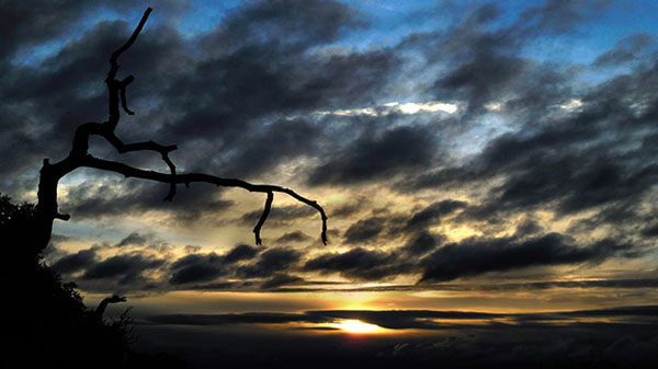
Once you are out in the wilderness, you should keep an eye on the sky. Changes in weather can usually be anticipated by observing the shapes and movements of the clouds.
Warm fronts progress from thin, high-level cirrus clouds to low, dense stratus clouds. A warm front moves at roughly half the speed of a cold front and rarely produces violent weather. However the precipitation associated with a warm from may continue longer. The cirrus clouds may precede the front by as much as 48 hours. These thin wispy clouds can resemble white brush strokes on a blue canvas high in the sky. Cirrocumulus clouds arrive next, often appearing as small puffs or rippled rows, followed by cirrostratus clouds, which tend to wallpaper large areas of blue sky with thin, bright sheets of clouds. Filled with ice crystals, cirrostratus clouds frequently cause a halo to form around the sun. Both cloud types float high in the sky. The precipitation finally arrives with altostratus (dense, smoky looking, mid-level) and nimbostratus (gray, thick, low-level) clouds bringing anything from a drizzle to a steady rain or snow.
Cold fronts involve cold air masses that wedge under warmer air pockets. A cold front can develop rapidly and move swiftly, causing temperatures to drop, wind directions to shift and barometric pressure to fall. Cumulus clouds are white, puffy, fair-weather clouds, but if they continue to build upward, rain may come late in the day. The Cumulonimbus clouds rise vertically and expand dramatically from those original white, puffy bases to soar high into the upper atmosphere. On other occasions their tops will flatten out into a menacing, anvil-like shape. These classic “thunderhead” clouds foretell potentially severe weather. Cumulonimbus clouds also form independent of cold fronts, blossoming in the afternoon hours of very warm days and producing late-afternoon thunderstorms.
[For more information and a great guide see How to Forecast the Weather with Clouds]