
In preparation for a longer upcoming trans-Saharan journey we conducted a scouting trip in Egypt and Sudan during March and April 2018. Working with small local teams and locally-sourced Toyota Land Cruisers in each region, we traversed a winding route skipping between towns and the desert along key points from Cairo to Khartoum. The Sudan segment of the scouting focused on the region of the ancient Nubian kingdom, in a loop northward from Khartoum, weaving back and forth across the Nile in search of some key archaeological sites. The primary goal of this mission was to assess terrain, security, driving conditions, logistical concerns and approximate timeframes for a future expedition.
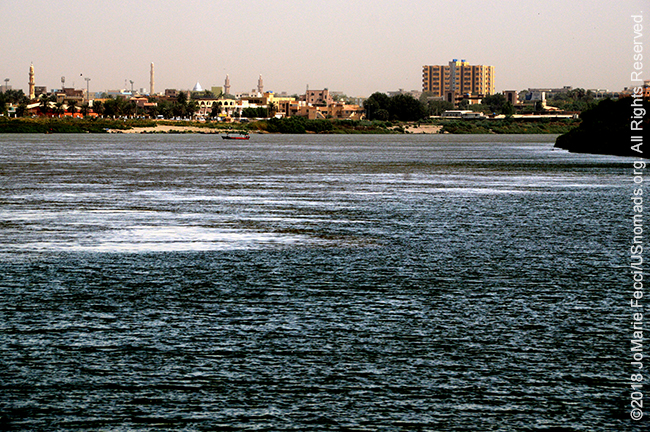
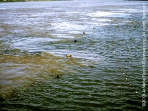
An exploration of a desert crossroads where ancient and modern civilizations mix, our journey in Sudan starts on the bank of the Nile in Khartoum. The Sudanese capital sits at the place where the White Nile and the Blue Nile converge to form a single river in an “S”-shaped curve that continues to zigzag through northern Sudan and into Egypt. Each of the two tributary rivers have their own characteristics. The Blue Nile, fast and narrow, comes from the east beginning in Ethiopia with a surging energy, while the White Nile comes from the south and is wide and lazy after passing through the swamps of the Sudd far from it’s source at Lake Victoria. The exact spot where the Niles meet, a pointy tip of unkempt land covered by tall-ish weeds, is known as Al-Mogran or “the confluence of the Nile.” From here it is possible to actually see the “line” where White and Blue waters meet and mingle before combining into the mighty river Nile, one of the “cradles of civilization.” Each Nile really does have a distinctive color due to the different silts they carry and there is a clear visual “seam”. The waters swirl in a mix of color as they flow into each other, pushing northward towards the distant Mediterranean.
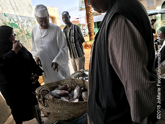
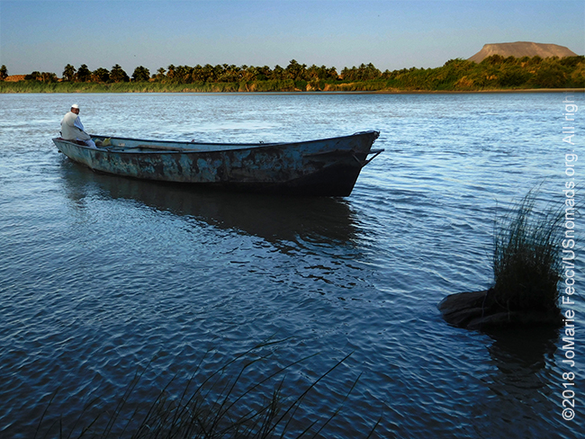
Above lies the modern city of Khartoum connected by bridges, while the the river’s world continues timeless below. Fishermen still ply the waters, bringing their catches to the nearby markets which supply local eateries as well as individual residents. The Nile remains central to life here, a counterbalance to the global influences of the vibrant linked-in modern hub that surrounds it. In fact the Nile “separates” the metropolitan area into three main sections: Khartoum, Khartoum North and Omdurman.
Khartoum, the administrative downtown with the main government buildings, university, and modern hotels, sits between the Blue and White Niles. Omdurman, with its big sprawling market, is the old traditional city center on the west bank. Khartoum Bahri or Khartoum North is the semi-industrial modern expansion city to the north. Bridges link the three cities into a greater metropolitan area buzzing with ambition beneath a quiet relaxed veneer.
The word “Khartoum” means “elephant’s trunk” in the local dialect, and is said to be a reference to the shape of the narrow strip of land between the Blue and White Niles. The city is relatively “young” in comparison to the ancient civilizations that spread across the Nile Valley beginning in pre-historic times. Khartoum was only founded in 1821 as an outpost for the Egyptian army after an Ottoman force conquered and unified the northern portion of Sudan. The location at the confluence of the Nile meant the settlement grew as a regional center of trade. By 1840, its population of 30,000 was living in an unplanned agglomeration of mud buildings interspersed with thatched huts. When the Egyptians attempted to extend their rule to the south, they brought in the British, which led to the pivotal events of Sudan’s modern historical narrative pitting the local population against the colonial powers.
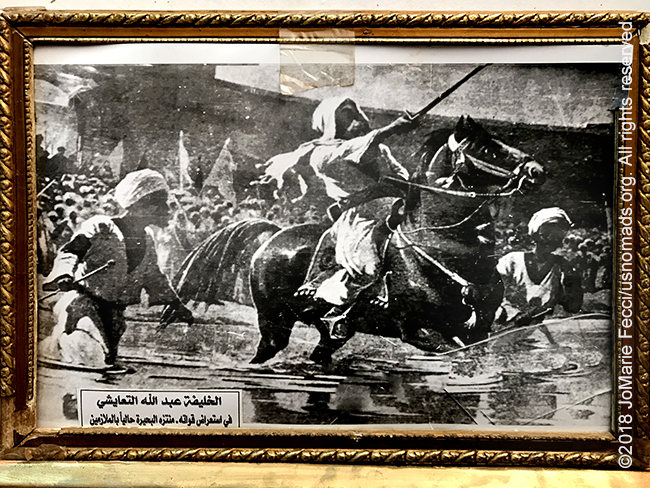
A revered Nubian religious leader of the Samaniyya order, Muhammad Ahmad, was proclaimed the Mahdi (the “guided one,” a long-awaited messianic redeemer of the Islamic faith) in 1881 during a period of widespread resentment among the Sudanese population towards the oppressive policies of the colonial rulers. The Mahdi began to unify the tribes in western and central Sudan, and his troops laid siege to Khartoum on March 13, 1884. The siege resulted in the massacre of British General Charles Gordon’s Anglo-Egyptian garrison and Khartoum fell to the Mahdists on January 26, 1885. The Mahdists moved the capital across the Nile to Omdurman, which became the scene of another bloody battle on September 2, 1898, during which British forces retook the city, proclaiming Sudan a condominium under British-Egyptian administration. The British moved the capital back to Khartoum, rebuilding the town with a new street layout in a pattern resembling the Union Jack and Sudan remained a de facto British colony until its independence in 1956.
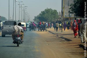
Khartoum became a horizontal city as waves of rural migrants settled along the barren edges of increasingly further outskirts. Refugees from neighboring war-torn countries and the internally displaced also moved into the expanding megalopolis. Major investments from China and the Gulf States led to a wave of high-end hotels and middle class suburban housing developments continuing the sprawl. Today Khartoum is a place where the 597 different cultural groups that make up the modern nation of Sudan meet and mix. Roughly two-thirds of Sudan’s population resides within 300–500 kilometers of Khartoum and the metropolitan area is home to several million people — a melting pot of tribes and nationalities. The city is continually growing and expanding, with a huge surge in construction of infrastructure and innovative building projects. Khartoum has a modern appearance, with a mixture of architectural styles that does not seem to dwell on the past.
Within the modern urban mix a few hints of historical styles remain. The most prominent being buildings that date to the beginning of the 20th century, when the British eliminated most traces of Ottoman architecture replacing them with buildings in the British colonial style. The British were perfectly aware of economic and political benefits derived from controlling the delta of the largest river in Africa, which had served as a trade route for thousands of years, but they were less interested in assimilating with the local people who inhabited the old capital at Umm-durman on the west bank of the Nile. The British built their modern city center in isolation with wide straight boulevards, massive brick walls and functionally decorative government buildings.
At independence, elegant, organized and multicultural, Khartoum became one of the most modern cities in Africa, a vanguard of a tropical architectural style notable for airy interiors shaded by broad protruding verandas. Villas and larger city buildings exhibited a certain type of geometry called “tropical modernism,” characterized by massive dimensions with minimalist window openings. Though these building interiors lacked daylight, the heat of the desert sun was blocked from penetrating these residential fortresses — clearly modelling a form created to meet local climatic conditions.
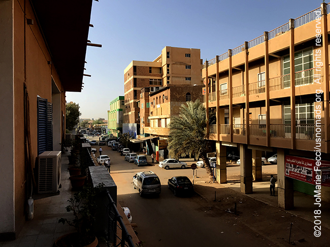
Today, after years of civil wars and sanctions, the city remains a hodgepodge of styles, where wealth and poverty exist side by side, and not far from the elegant buildings that grace the city center, much more humble structures are the rule. Though it actually has one of the higher economic growth rates in sub-Saharan Africa due in large part to its crude oil production, the incidence of poverty is high. According to a report from the Sudanese Central Bureau of Statistics, in 2009, Sudan was the third largest producer of crude oil in sub-Saharan Africa, behind Nigeria and Angola, but 46.5 percent of its population was living below the poverty line. In Khartoum the situation is aggravated by the fact that the city’s population has more than tripled in 20 years with no formal plan to accommodate the newcomers.
Extreme poverty exists here, but the first thing a visitor to Sudan learns is to put the ingrained stereotypes aside. Despite suffering years of civil wars and humanitarian crises, the Sudanese people are resilient and skilled at improvising solutions.
To get a Sudanese perspective on the nation’s history we made a few museum stops in Khartoum before heading into the desert. Forging national unity in a country with a population divided by ethnic, linguistic, and religious differences has been challenging, and the defining narrative of the anti-colonialist struggle is at the core of the Sudanese national identity. A visit to the Presidential Palace Museum offers a good starting point to understanding the timeline of key events. A remnant of the colonial architectural style, this fine red sandstone building, constructed in 1912, was once an Anglican cathedral. Today it houses a museum that celebrates the history of the Sudanese republic with a collection that includes some of the artifacts from the British colonial period as well as a number of items commemorating the defeat of the British, the transfer of power and the establishment of the modern Sudanese nation. Most interesting here is the section that details the Mahdi uprising with rare historical photographs that help bring the story of struggle alive. This museum also holds a collection of presidential items, including a very fun display of old presidential vehicles that is a must-see for car enthusiasts.
Delving deeper into the nation’s history, the Military Museum in Khartoum Bahri focuses on the role of the armed forces from independence through today. Using period photographs and displays of weaponry it tells a story of nation building in all its complexity, and we were fortunate to be shown around by a Sudanese army officer who gave interpretive information and anecdotes about the various items on display including an Italian bomb purported to be the one that fell on an unsuspecting donkey credited with saving the city of Khartoum. It was during World War II, when the Italian air force dropped the bomb on a crowded market area of the city, where a woman was selling milk with her donkey. The bomb fell on the donkey, and as it was designed to explode on impact with the ground, it didn’t explode. The poor donkey died from the direct hit, but all the people were saved. The event was a minor incident in WWII but was memorialized in a locally-famous song.

For a “short course” on the more ancient civilizations we moved on to the National Museum which houses the archaeological wealth of ancient Nubia as well as a complete set of Egyptian temples rescued from the area submerged during the creation of Lake Nasser. A walk through the largest and most comprehensive Nubian collection in the world helps flesh out the “timeline” and contexts for the key archaeological sites on our route. The artifacts on display include objects from the Paleolithic through to the Islamic period originating from every site of importance in the Sudan. The well-organized exhibits take us through the rise and fall of the kingdoms of Kerma, Kush and Meroe via stunning royal statues and perfectly preserved artifacts.
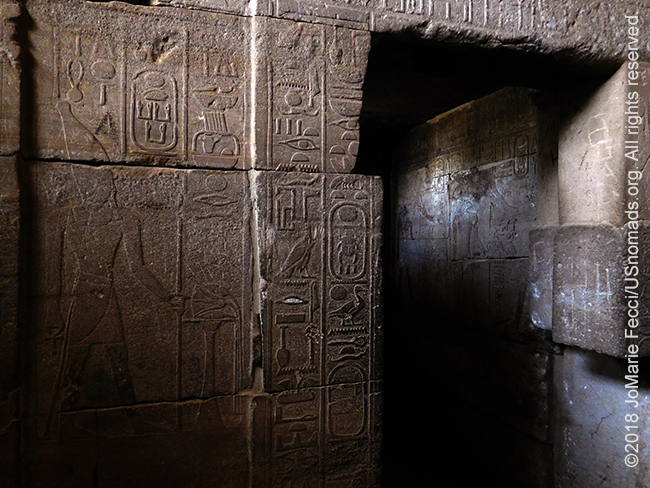
Outside the carefully re-assembled temples rescued from the flood waters of Lake Nasser are open to visitors. These temples would have been submerged and lost forever with the construction of the Aswan Dam, but were rescued by an international team of archaeologists who came together to work with their Sudanese colleagues in a massive operation to relocate the ruins. Under the umbrella of the UNESCO salvage campaign, the monuments were disassembled and floated down the Nile to Khartoum, where they were reassembled in the museum’s outdoor garden. The project, began in 1960, took 20 years to complete but was a spectacular success resulting in the excavation and recording of hundreds of sites, the recovery of thousands of objects, and the salvage and relocation of a number of important temples to higher ground.
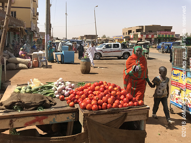
There are other worthwhile museums in Khartoum too, but with a limited amount of time to spend in the capital, we chose to explore the ambiance of the old city center in Omdurman. Omdurman’s market is the largest in Sudan with endless alleys and side streets lined with shops selling all varieties of goods. It is said you can find anything in Omdurman, if you have the time to look. According to some visitors, this is the place to go for muskets, broadswords and other relics of empire. Though there are souvenir stalls and plenty for tourists to buy, the souk is really the everyday shopping center for local Sudanese who come in search of everything from clothing to cookware to Chinese microwaves and plastic shoes. Omdurman has a different feel than downtown Khartoum or Khartoum North. It has retained something of its humble roots as a watering place for local pastoralists and waystation for travelers, even after it grew into a crowded market center and for some, a holy city.
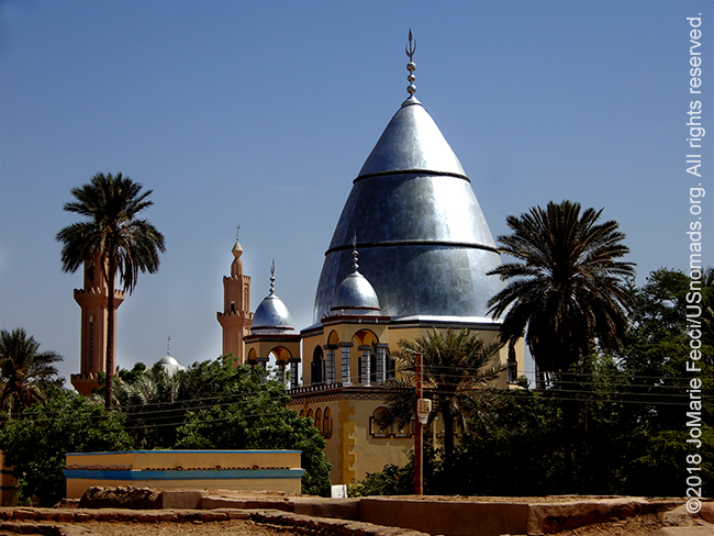
Its early history as well as the meaning of its name (“Mother of Durman”), remains obscure, but from the first written accounts it was associated with the Koranic school of a local holy man. Then, with the rise of the Mahdist movement, Omdurman became “the Mahdi’s city.” The spiritual center was the Mahdi’s tomb located just east of the prayer niche of the central mosque. Its dome loomed over the city making it Omdurman’s most visible feature from a distance — a beacon to approaching travelers.
Much of the ideology and organizational strength of the Mahdiyyah had its origins in Sufism which is widespread in Sudan. These Islamic religious brotherhoods or “tariqa” seek a closer personal relationship with God through special spiritual disciplines that include reciting prayers and passages of the Quran and repeating the names, or attributes, of God while performing physical movements according to the formula established by the founder of each particular order.
Each tariqa is founded by an individual sheikh with his own way of conducting a dhikr — as the ritual is called — but all share common principles and similar practices. The oldest and most widespread tariqa is the Qadiriyah founded by Abd al Qadir al Jilani in Baghdad in the twelfth century and introduced into Sudan in the sixteenth. The Qadiriyah’s principal rival and the largest tariqa in the western part of the country was the Tijaniyah, a sect begun by Ahmad at Tijani in Morocco, which eventually penetrated Sudan in about 1810. Another important tariqa in Sudan was established by the followers of Sayyid Ahmad ibn Idris, known as Al Fasi, who died in 1837. Although he lived in Arabia and never visited Sudan, his students spread into the Nile Valley establishing indigenous Sudanese orders, the Majdhubiyah, the Idrisiyah, the Ismailiyah, and the Khatmiyyah.
With time new orders, which were offshoots of older ones were established by sheiks who simply made alterations to the ways of their former tariqa. There are roughly a dozen different sufi orders in Sudan, with some found only here and others that are widespread in Africa and/or the Middle East. The sufi orders vary considerably in their practice and internal organization — some are tightly organized in hierarchical fashion; others allow their local branches considerable autonomy. Some are more or less involved in the internal politics of the country, while others are strictly ascetic and focus purely on the mystical side of their faith. At the heart of their rituals is the “dhikr” which often leads to an ecstatic state that practitioners believe brings them closer to God.
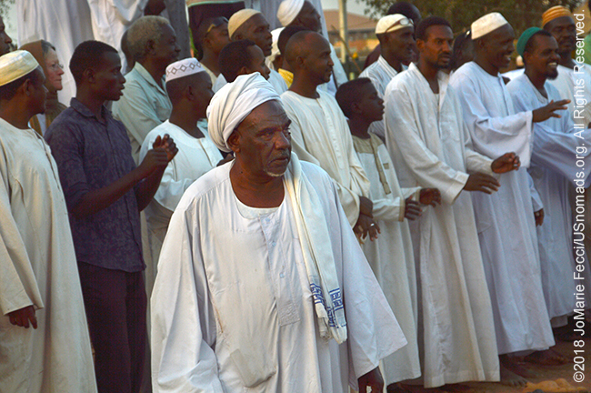
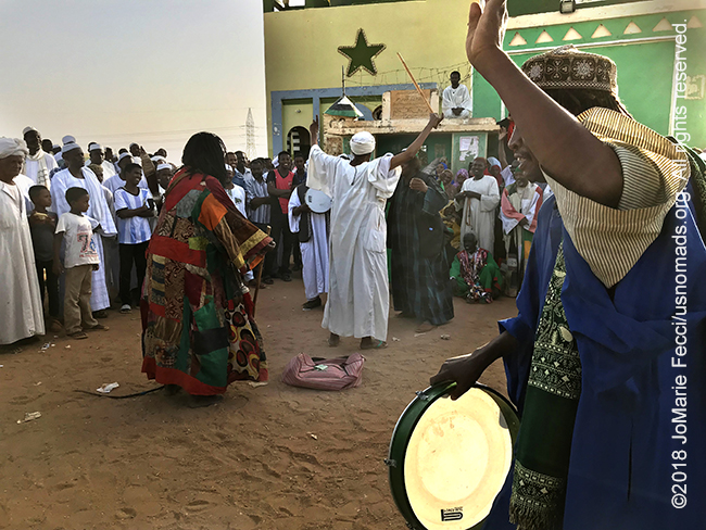
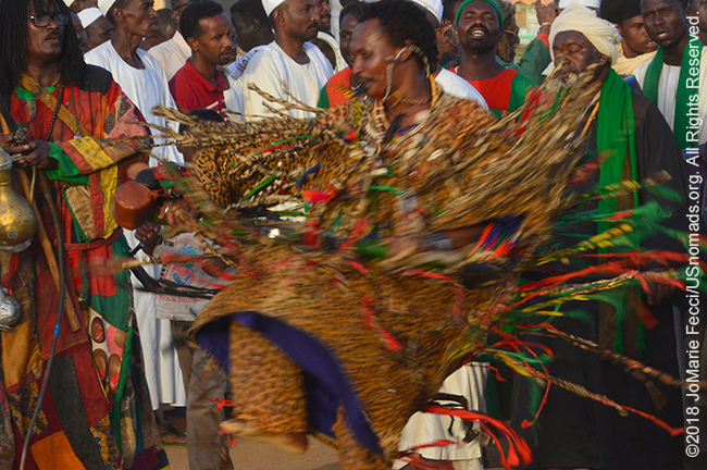
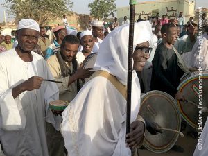
We attended a Friday afternoon dhikr in Omdurman at the tomb of Hamed al-Nil, where a large crowd gathers weekly for the Sufi ceremony of dance and prayer which is open to outsiders. The “dervishes” arrive from different directions amidst drumbeats and chanting as they make their way to the three-domed mosque dedicated to the 19th century religious leader Sheik Hamad El-Nil. The order of the ceremony is hard to understand as a visitor and at first glance it seems like street theatre, with people in colorful attire accompanied by drumming as they act out a scripted choreography complete with props evocative of the Mahdi era. However it soon becomes clear that this is something else. While there seems to be an overall ritual order, the worshipers individually dance or spin as the spirit moves them, and anyone joining the circle can enter and dance or just sway and chant on the edge.
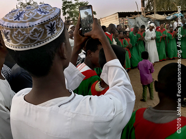
Many of the worshipers belong to the Quadriya Sufi Order and some wear green and red instead of the usual white robes. The circle begins as a small ring, but is enlarged as the group of followers grows, opening up to allow more people to join. Food is passed around to share and incense is burned in waves of smoke that is also shared around the circle while the chanting and swaying continues. Some groups come with their own drummers, and the circle gets even larger. Some carry staffs or are wearing wildly colorful garments. The rhythmic chant of “La Illaha Illallah” (there is no god but Allah) punctuated by drumbeats can seem hypnotic, and the swaying of bodies to the rhythm in the growing crowd creates an electric ambiance. From time to time one of the worshipers inside the circle spins in a colorful blur of outstretched arms, legs and fabric.
> CONTINUE: THE JOURNEY TO DONGOLA
< BACK: SUDAN DAILY BLOG | SUDAN REPORT HOME | AHEAD: TO DONGOLA >

WHERE WE ARE
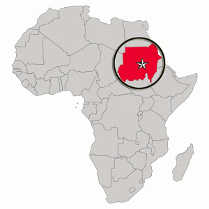
The Sudan in Northeast Africa is bordered by Egypt to the north, the Red Sea, Eritrea and Ethiopia to the east, South Sudan to the south, the Central African Republic to the southwest, Chad to the west and Libya to the northwest. The country has a total area of 1.861.484 square kilometres (718.722 square miles), making it the third largest in Africa. The terrain is generally flat plains, broken by several mountain ranges. In the west the Deriba Caldera (3,042 m or 9,980 ft), located in the Marrah Mountains, is the highest point in Sudan. In the east are the Red Sea Hills. The name Sudan derives from the Arabic “bilād as-sūdān” or “the lands of the Blacks.” The population of roughly 37 million people is made up of 597 different ethnic or tribal groups speaking over 400 different languages and dialects. Sudanese Arabs are by far the largest ethnic group, estimated to account for 70% of the population. They are almost entirely Muslims. The majority speak Sudanese Arabic, with some different Arabic dialects, while many Arabized and indigenous tribes like the Fur, Zaghawa, Borgo, Masalit and some Baggara ethnic groups, speak Chadian Arabic. The nation’s official languages are Arabic and English. Sudanese history goes back to Antiquity, when the Meroitic-speaking Kingdom of Kush controlled northern and central Sudan and, for nearly a century, Egypt.
TERRAIN DETAIL: KHARTOUM
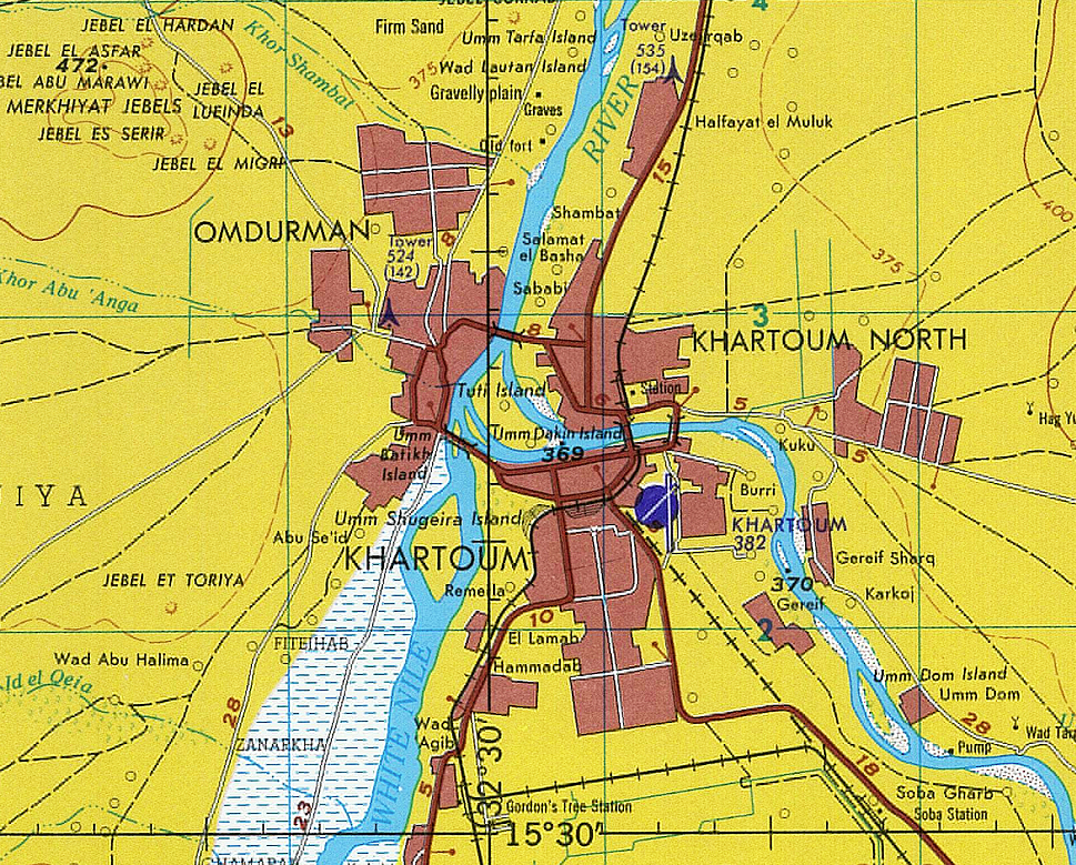
(click map to view larger image)
Divided by the two Rivers Nile, Khartoum is a tripartite metropolis located in the middle of the populated areas in Sudan, at almost the northeast center of the country between 15 and 16 degrees latitude north, and 31 and 32 degrees longitude east. The terrain is relatively flat, ranging in elevation from 385 m (1,263 ft), where the Nile flows northeast past Omdurman to Shendi, to 364 m (1,194 ft) over roughly 100 miles.
MAP RESOURCES
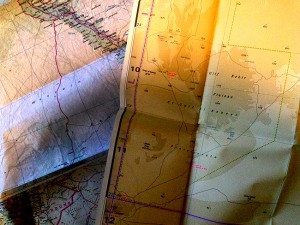
For general planning, there are a few country maps that are useful. The ITM Canada Sudan Travel Map is a 1:2,500,000 overview road map and this German map of Sudan/South Sudan is a similar option at a 1:1,800,000 scale. There is a Gizi Map of Sudan/South Sudan, which has slightly better road detail at 1:2,500,000. For detailed navigational planning we used 1:500,000 US tactical pilotage maps from the Perry-Castañeda Library Map Collection of the University of Texas at Austin. Note that these maps are “historical” and marked “not to be used for navigational purposes” but they make an excellent planning tool, as the basic topography does not change. For more on available maps for the Sahara generally, see the Sahara-Overland.com map page.
SECURITY: TRAVEL TO SUDAN
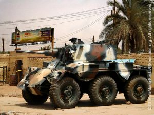
We had no security issues during our journey in the North of Sudan and felt quite safe at all times, but some western governments still maintain travel warnings for Sudan. The US State Department Travel Advisory for Sudan as of July 2018, suggests that travelers should “reconsider travel to Sudan due to terrorism and civil unrest.” More specifically the advisory calls out specific locations that “have increased risk,” with their highest “Level 4: Do Not Travel” warning for the regions of Darfur, Blue Nile and South Kordofan, where “Violent crime, such as kidnapping, armed robbery, home invasion, and carjacking, is particularly prevalent” and “Westerners are frequently targeted.” The advisory also notes that “tensions remain high between the government of Sudan and opposition forces and violence continues along the border between Chad and Sudan and areas that border South Sudan with armed opposition groups are active in Central Darfur and parts of Blue Nile and South Kordofan states.” There are no specific warnings related to the region North of Khartoum where our journey took place.
CLIMATE
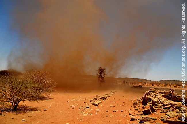
Although Sudan lies within the tropics, the climate ranges from arid in the north to tropical wet-and-dry in the far southwest. Temperatures do not vary greatly with the season at any location; the most significant climatic variables are rainfall and the length of the dry season. Variations in the length of the dry season depend on which of two air flows predominates: dry northern winds from the Sahara and the Arabian Peninsula or moist southwesterly winds from the Congo River basin and southeasterly winds from the Indian Ocean. From January to March, the country is under the influence of dry northeasterlies. There is minimal rainfall countrywide, except for a small area in northwestern Sudan where the winds have passed over the Mediterranean and bring occasional light rains. By early April, the moist southwesterlies reach southern Sudan, bringing heavy rains and thunderstorms. By July the moist air has reaches Khartoum, and in August it extends to its usual northern limits around Abu Hamad, although in some years the humid air may even reach the Egyptian border. The flow becomes weaker as it spreads north. In September, the dry northeasterlies begin to strengthen and to push south, and by the end of December they cover the entire country. Khartoum has a three-month rainy season (July–September) with an annual average rainfall of just 6.2 inches (157.5 mm). In some years, the arrival of the southwesterlies and their rain in central Sudan can be delayed, or they may not come at all. When that happens, drought and famine often follow. The decades of the 1970s, 1980s, and 1990s saw the southwesterlies frequently fail, with disastrous results for the Sudanese people and economy. Temperatures are the highest at the end of the dry season, when cloudless skies and dry air allow them to soar. In Khartoum, the hottest months are May and June, when average highs are 41º C, and temperatures can reach 48º C. The average maximum temperature is over 100°F (38°C) from February to November, with an average maximum of 94°F (34°C) during the remaining two months. Lows in Khartoum average 15º C in January and have dropped as low as 6º C after the passing of a cool front in winter. Violent sandstorms known as “haboob” can occur in central Sudan when the moist southwesterly flow first arrives (May through July). The moist, unstable air forms thunderstorms in the heat of the afternoon. The initial downflow of air from an approaching storm produces a huge yellow/red wall of sand and clay that can temporarily reduce visibility to zero; traffic comes to a standstill, and fine sand particles penetrate everywhere.
THE RIVER NILE
The mighty river Nile, which flows northward, is 4,258 miles long and is considered the longest river in the world (though some sources say the Amazon River is actually longer). The Nile is formed by the confluence of its two tributaries — the White and Blue Niles. The White Nile is considered to be the headwaters and primary stream of the Nile itself. The Blue Nile, however, is the source of most of the water and silt. The White Nile originates in equatorial regions, where rainfall occurs throughout the year, so it runs at a nearly constant rate. It is the longer of the two, rising in the Great Lakes region of central Africa, with the most distant source still undetermined but located in either Rwanda or Burundi. It flows north through Tanzania, Lake Victoria, Uganda and South Sudan. The Blue Nile flows out of the Ethiopian highlands starting at Lake Tana, where rainfall is more seasonal. The Blue Nile swells in the late summer and early autumn with rains from the summer monsoons. The flow at these times can be so great, causing the Nile to flow backward at the junction. Heavy monsoon rain brings floods in Khartoum. The Nile’s drainage basin covers eleven countries: Tanzania, Uganda, Rwanda, Burundi, the Democratic Republic of the Congo, Kenya, Ethiopia, Eritrea, South Sudan, Republic of the Sudan and Egypt. The course of the Nile in Sudan is distinctive. It flows over six groups of cataracts, from the sixth at Sabaloka just north of Khartoum northward to Abu Hamed. Due to the tectonic uplift of the Nubian Swell, the river is then diverted to flow for over 300 km south-west following the structure of the Central African Shear Zone embracing the Bayuda Desert. At Al Dabbah it resumes its northward course towards the first Cataract at Aswan forming the ‘S’-shaped Great Bend of the Nile.
A FEW NILE FUN FACTS
The Nile is Sudan’s dominant geographical feature and a life-line for almost 400 million people.
• Flow: The Nile stretches across half of Africa, flowing northwards from the tropical mountains and forests of the Equator to the temperate Mediterranean Sea. The water level in the river varies throughout the year, reaching its rushing heights in July and August.
• Fertility: The Blue Nile is the source of dark and rich alluvial silt, which provides the fertile earth that allows the Nile Valley in Sudan and Egypt to grow and prosper. In winter, the Blue Nile’s volume decreases considerably and the flow of the river is maintained by the slow flowing water of the White Nile.
• Source: The ultimate source of the White Nile was a mystery until the 1860s. The reason for the problems in tracing the source of the Nile is a massive swamp (the size of Belgium) known as “Sudd’. The name means barrier in Arabic. The White Nile loses over half of its water to evaporation in the Sudd, but is replenished by the Sobat river from western Ethiopia.
• Countries: The Nile flows through 11 countries in northeastern Africa: Rwanda, Burundi, Democratic Republic of the Congo (DRC), Tanzania, Kenya, Uganda, Ethiopia, Eritrea, South Sudan, Sudan, and Egypt, each with varying climates. Considering the basin area of the Nile, Sudan has the largest size (1.9 million km²).
• Water: Egypt and Sudan are almost completely dependent on the Nile system and consume the major share of the Nile water. Egypt claims it has a natural historical right to the Nile River and principles of its acquired rights have been a focal point of negotiations with other upstream states. There have been occasions when Egypt has threatened to go to war over Nile water.
• Dams: The Nile has been dammed in several places. Egypt Aswan High Dam is the most famous, creating the second largest artificial lake in the world. Sudan has also built several dams, while Ethiopia is struggling to build dam of its own and this is being strongly opposed by both Sudan and Egypt.
• Cataracts: One of the most important characteristics of the Nile River are its “Cataracts.” The Cataracts are sections where the river tumbles over rocks and they have long kept boats from going up and down the river from Equatorial Africa to Egypt. There are 6 Cataracts: 1 in Egypt and 5 in Sudan.
SUDAN’S TOPOGRAPHY
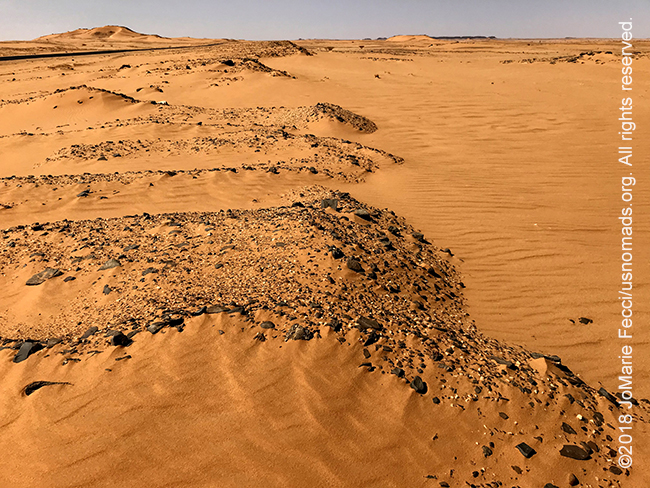
Sudan is a land of plateaus and plains. Low mountains are found behind the Red Sea coast, in the far south, and in the far west. The only interior highlands of consequence are the Nuba Mountains west of the White Nile. All significant streams flow into the White Nile or Blue Nile, which join at Khartoum to form the River Nile. Extensive swamps are found in the south, especially along the Bahr al-Ghazal and the Bahr al-Jabal, the principal southernmost tributaries of the White Nile. The area we are traveling in Northern Sudan, lies between the Egyptian border and Khartoum, and has two distinct parts, the desert and the Nile valley. To the east of the Nile lies the Nubian Desert and to the west is the Libyan Desert. They are similar: stony, with sandy dunes drifting over the landscape. There is virtually no rainfall in these deserts, and in the Nubian Desert there are no oases. In the west, there are a few small watering holes, such as Bir en Natrun. Here the water table reaches the surface to form wells that provide water for nomads, caravans, and administrative patrols, although insufficient to support an oasis and inadequate to provide for a settled population. Running through the desert is the Nile valley, with its alluvial strip of habitable land no more than two kilometers wide and productivity dependent on the annual flood. Western Sudan is a generic term describing the regions known as Darfur and Kordofan, which together comprise 850,000 square kilometers. The dominant feature throughout this immense area is the absence of perennial streams; thus, people and animals must remain within reach of permanent wells. Sudan’s third distinct region is the central clay plains that stretch eastward from the Nuba Mountains to the Ethiopian frontier. The central clay plains provide the backbone of Sudan’s economy because they are a productive region in which settlements cluster around available water. Northeast of the central clay plains lies eastern Sudan, which is divided between desert and semi-desert, and the coastal plain.
THE PEOPLE OF SUDAN
Sudan’s ethnic and linguistic diversity is among the most complex in the world. The population of Sudan is a combination of indigenous inhabitants of the Nile Valley, and descendants of migrants from the Arabian Peninsula. Today Arab culture predominates in Sudan though there are still numerous other non-Arabic groups, such as the Masalit, Zaghawa, Fulani, Northern Nubians, Nuba, and the Beja people. Also, the ethnic groups that are considered “Arab” include some of the African ethnic groups such as Nubians, Beja, Fur, Nuba, and Fallata. The use of the term “Arab” can be confusing, because it often indicates a “lifestyle choice” so that membership in tribal and subtribal units is generally by birth, but individuals decisions to live and behave a certain way may define how they are perceived. For example, when a sedentary Fur (“African”) becomes a cattle nomad, he is perceived as a Baqqara (“Arab”). A more useful distinction is, in fact, a term that originated in the nineteenth century distinguishing the awlad al-bahr (children of the river) from the awlad ar-rif (children of the countryside), reflecting the differences of lifestyle between those living in the more urban areas of the Nile Valley and those living outside that zone. The large majority of Sudanese (roughly 97%) are Muslim and most speak Sudanese Arabic though some of the “Arab” tribes speak different Arabic dialects (Najdi Arabic is spoken by Awadia and Fadnia and Bani Arak tribes; Hejazi Arabic is spoken by Bani Hassan, Al-Ashraf, Kinanah and Rashaida; Chadian Arabic is spoken by the Baggara and other Darfurians). With approximately 70 different languages native to Sudan the country has three out of the four language “super-stocks” spoken in Africa: Afro-Asiatic, Niger-Kordofanian, and NiloSaharan. In addition to arabic, Cushitic, another major branch of Afro-Asiatic, is represented by Bedawiye (with several dialects), spoken by the largely nomadic Beja. Chadic, a third branch, is represented by its most important single language, Hausa, a West African tongue used in Nigeria by the Hausa themselves and employed by many other West Africans in Sudan as a lingua franca. As with South Sudan, a number of Nilo-Saharan languages are also spoken in Sudan. Fur speakers inhabit the west (Darfur), with perhaps a million speakers. There are likewise various Nubian languages, with over 6 million speakers along the Nile in the north. The most linguistically diverse region in the country is the Nuba Hills area in Kordofan, inhabited by speakers of multiple language families, with Darfur and other border regions being second. The Niger–Congo family is represented by many of the Kordofanian languages, and Indo-European by Domari (Gypsy) and English. Historically, Old Nubian, Greek, and Coptic were the languages of Christian Nubia, while Meroitic was the language of the Kingdom of Kush, which conquered Egypt. Today the “official languages” according to the Sudanese constitution of 2005 are Arabic and English.
THE RESCUED TEMPLES
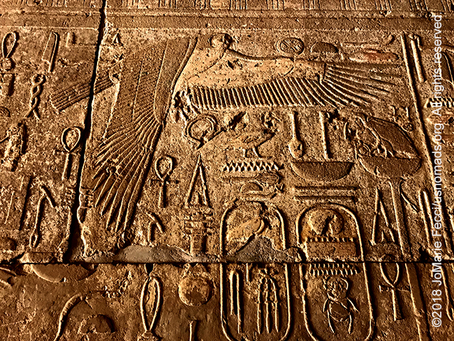
The decision to build the Aswan High Dam was made in 1954. This dam would lead to the creation of a huge artificial lake covering the Upper Nile Valley from Aswan in Egypt to the Dal Cataract in Sudan—a culturally extremely rich area, which has been known as Nubia since antiquity. The Egyptian and the Sudanese Governments requested that UNESCO assist in the protection and rescue of the endangered monuments and sites and in 1960, the Director-General of UNESCO launched an appeal to the Member States for an International Campaign to Save the Monuments of Nubia. The spectacularly successful campaign saved an important part of the cultural heritage of Nubia. In addition to the temples on display in Khartoum the operation saved several other important temples including those at Abu Simbel. In Sudan the temple of Ramses at Aksha, the fortified town of Buhen with two temples of the 18th Egyptian Dynasty and two temples of the same period in the fortresses of Semna East and West were threatened by final submersion under 50 or so meters of water. The salvage operation was as urgent as it was technically challenging. The monuments were dismantled, carved up and moved to new sites where they were then reassembled. The three temples in the Sudan National Museum are remarkably intact. The Temple of Kumma dates from 1473–1400BC during the reigns of Queen Hatshepsut and the pharaohs Tuthmosis III and Amenophis II. It was part of a series of fortresses built during the Middle Kingdom period to control the movement of goods and troops up and down the Nile. This particular temple was located at the Semna Cataract approximately 60km south of Wadi Halfa, which was then the frontier of Egyptian control. Roughly contemporary with the Temple of Kumma is the Buhen Temple, dedicated to the falcon god Horus. This is an inner temple divided into five rectangular rooms that would, in ancient times, have been surrounded by an outer courtyard with mud-brick walls. The temple remained in use as late as AD450, after which time it was partially incorporated into a church. The third temple is the Temple of Semna, built by the pharaohs of the Middle Kingdom as part of the fortifications at the Second Cataract, 60km south of Wadi Halfa. The temple was dedicated to the Nubian god Dedwen and the main building was constructed from stone, surrounded by a mud-brick wall. The temple remained in use at least until the 7th century BC.
SUFISM
Islamic life in Sudan is strongly influenced by Sufi beliefs, which creates a more “tolerant” social ambiance than in some other Islamic regimes. Sufism is an “inward dimension of Islam” or “Islamic mysticism” dating back to early Islamic history. The Sufis strive for “ihsan” or “perfection of worship” and generally oppose dry legalism, though they observe Islamic law. The Sufi practices originally grew in prominence as a reaction against the worldliness of the early Umayyad Caliphate (661–750) and came to span several continents. They are known for their asceticism and their practice of the dhikr. Sufis explain their practice as an aspect of Islam similar to sharia, “a science whose objective is the reparation of the heart and turning it away from all else but God”. Sufism is not a distinct sect, as is sometimes erroneously assumed, but a way of practicing the religious duties which opens the individuals spirit to the Divinity. By focusing on the more spiritual aspects of religion, Sufis strive to obtain direct experience of God. In the eleventh-century, Sufism, which had previously been a less “codified” trend in Islamic piety, began to be “ordered and crystallized” into orders which have continued until the present day. Because Sufism can accommodate local beliefs and customs, it has been an important factor in the spread of Islam in Africa and also played a role in resisting European imperialism. Although approaches to teaching vary among different Sufi orders, Sufism as a whole is primarily concerned with direct personal experience. The devotional practices of Sufis vary widely. The Dhikr is the remembrance of Allah commanded in the Qur’an for all Muslims through a specific devotional act, and in Sufism dhikr takes a wide range and various layers of meaning. Some orders follow a ritualized worship that can include recitation, singing, chanting, instrumental music, dance (most famously the “whirling dervishes” of the Mevlevi order), incense, meditation, ecstasy, and trance.
NOTE: This is the first in a series of segments highlighting details of a scouting trip in the Sudan, which looped northward from Khartoum and focused on the area of the ancient Nubian kingdoms. All text and photos are copyright JoMarie Fecci/USnomads unless otherwise noted. If you would like to use any imagery here, please contact us for permission. The trip was conducted in March and April 2018 by JoMarie Fecci of US Nomads with a local team. For more information about the specifics contact us.